00z EURO 48 Hrs... Shows modest TS moving over @St. Lucia. Heading WNW towards DR/Haiti again...
Appears 00z models are generally shifting more NE in the 3+ day range...
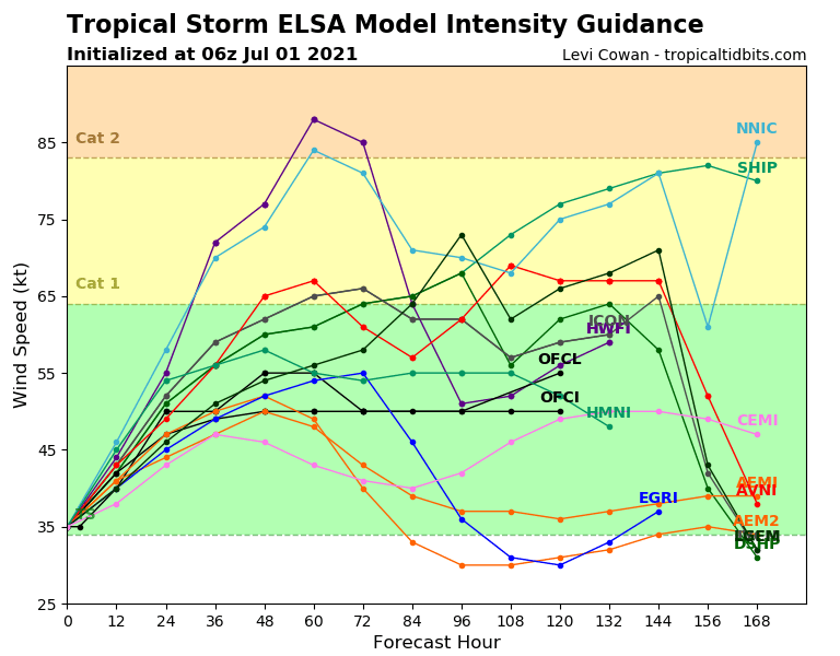
ATL: ELSA - Models
Moderator: S2k Moderators
-
Blown Away

- S2K Supporter

- Posts: 10253
- Joined: Wed May 26, 2004 6:17 am
Re: ATL: FIVE - Models
0 likes
Hurricane Eye Experience: David 79, Irene 99, Frances 04, Jeanne 04, Wilma 05… Hurricane Brush Experience: Andrew 92, Erin 95, Floyd 99, Matthew 16, Irma 17, Ian 22, Nicole 22…
-
Blown Away
- S2K Supporter
- Posts: 10253
- Joined: Wed May 26, 2004 6:17 am
Re: ATL: FIVE - Models
00z EURO 72 HRS... Landfall Hispaniola as strong TS/Cat 1 and exits into SE Bahamas as TS...
1 likes
Hurricane Eye Experience: David 79, Irene 99, Frances 04, Jeanne 04, Wilma 05… Hurricane Brush Experience: Andrew 92, Erin 95, Floyd 99, Matthew 16, Irma 17, Ian 22, Nicole 22…
-
AtlanticWind

- S2K Supporter
- Posts: 1898
- Age: 67
- Joined: Sun Aug 08, 2004 9:57 pm
- Location: Plantation,Fla
-
Blown Away
- S2K Supporter
- Posts: 10253
- Joined: Wed May 26, 2004 6:17 am
Re: ATL: FIVE - Models
00z HWRF 120 hrs... Spends a lot of time down spine of Cuba... Landfalls Key West moving N towards Everglades with winds at 106 mph... Big NE shift from 18z
1 likes
Hurricane Eye Experience: David 79, Irene 99, Frances 04, Jeanne 04, Wilma 05… Hurricane Brush Experience: Andrew 92, Erin 95, Floyd 99, Matthew 16, Irma 17, Ian 22, Nicole 22…
-
Blown Away
- S2K Supporter
- Posts: 10253
- Joined: Wed May 26, 2004 6:17 am
Re: ATL: FIVE - Models
00z Euro 96 Hrs... After Hispaniola landfall 05 moves through SE Bahamas and recurves well offshore from CONUS... Euro significantly faster forward speed than rest of models...
I suspect a moderate NE shift in 5am NHC track days 3-5...
I suspect a moderate NE shift in 5am NHC track days 3-5...
1 likes
Hurricane Eye Experience: David 79, Irene 99, Frances 04, Jeanne 04, Wilma 05… Hurricane Brush Experience: Andrew 92, Erin 95, Floyd 99, Matthew 16, Irma 17, Ian 22, Nicole 22…
-
AtlanticWind
- S2K Supporter
- Posts: 1898
- Age: 67
- Joined: Sun Aug 08, 2004 9:57 pm
- Location: Plantation,Fla
Re: ATL: FIVE - Models
You will rarely see the GFS and the EURO with that big a difference at only 96 hours.
2 likes
-
AxaltaRacing24
- Category 5

- Posts: 1774
- Age: 25
- Joined: Wed Jul 27, 2016 11:14 am
- Location: Jupiter, FL
Re: ATL: FIVE - Models
AtlanticWind wrote:You will rarely see the GFS and the EURO with that big a difference at only 96 hours.
and it’s even more uncertain if the euro will win that battle due to it just now even starting to acknowledge TD5.
1 likes
-
USTropics
- Professional-Met

- Posts: 2739
- Joined: Sun Aug 12, 2007 3:45 am
- Location: Florida State University
Re: ATL: FIVE - Models
To add even more confusion, 00z GFS ensembles shifted west, some significantly so. Here is the GFS ensemble trend from the past 3 runs:

00z ECMWF ensembles stay on the eastern envelope:

00z ECMWF ensembles stay on the eastern envelope:
2 likes

Re: ATL: FIVE - Models
It's (almost) official Tropical Storm Elsa has formed!
Full update in about 30 minutes from the NHC.
Obviously a storm that will have our attention this holiday weekend.
I'm not sure why there is such a discrepancy with the 2 major models....for the short term it appears the GFS has a better handle on the storm....hopefully we will have better inputs by this weekend and have much more certainty.
0 likes
-
Shell Mound
- Category 5
- Posts: 2432
- Age: 33
- Joined: Thu Sep 07, 2017 3:39 pm
- Location: St. Petersburg, FL → Scandinavia
Re: ATL: FIVE - Models
AxaltaRacing24 wrote:AtlanticWind wrote:You will rarely see the GFS and the EURO with that big a difference at only 96 hours.
and it’s even more uncertain if the euro will win that battle due to it just now even starting to acknowledge TD5.
Well, the past three cycles of the GEFS have trended significantly downward with the intensity through 72h (day three) and have also shifted southwestward.
The HWRF is going to bust miserably in terms of its forecast intensity, though it and the GFS did far better with genesis than the ECMWF has thus far.
Last edited by Shell Mound on Thu Jul 01, 2021 4:33 am, edited 1 time in total.
0 likes
CVW / MiamiensisWx / Shell Mound
The posts in this forum are NOT official forecasts and should not be used as such. They are just the opinion of the poster and may or may not be backed by sound meteorological data. They are NOT endorsed by any professional institution or STORM2K. For official information, please refer to products from the NHC and NWS.
-
AlphaToOmega
- Category 5
- Posts: 1448
- Joined: Sat Jun 26, 2021 10:51 am
- Location: Somewhere in Massachusetts


-
jlauderdal
- S2K Supporter
- Posts: 7240
- Joined: Wed May 19, 2004 5:46 am
- Location: NE Fort Lauderdale
- Contact:
Re: ATL: FIVE - Models
Shell Mound wrote:AxaltaRacing24 wrote:AtlanticWind wrote:You will rarely see the GFS and the EURO with that big a difference at only 96 hours.
and it’s even more uncertain if the euro will win that battle due to it just now even starting to acknowledge TD5.
Well, the past three cycles of the GEFS have trended significantly downward with the intensity through 72h (day three) and have also shifted southwestward.
The HWRF is going to bust miserably in terms of its forecast intensity, though it and the GFS did far better with genesis than the ECMWF has thus far.
THE HWRF busting on intensity is no surprise, if this system takes the westerly route at days 4 and 5 then Florida could certainly be looking at a hurricane, the western side of cuba hasn't shown much propensity to knock back systems...the models struggling with the ridge is also not a surprise but the euro being so far right is odd but its the euro and needs to be taken very seriously
3 likes
-
SFLcane

- S2K Supporter
- Posts: 10281
- Age: 48
- Joined: Sat Jun 05, 2010 1:44 pm
- Location: Lake Worth Florida
Re: ATL: ELSA - Models
Gfs trended westward no surprise it’s racing at 25 mph tough to gain any latitude. Would not surprise me if this stays in the Caribbean. With that forward speed good luck gaining much organization.
1 likes
-
eastcoastFL

- Category 5
- Posts: 3996
- Age: 44
- Joined: Thu Apr 12, 2007 12:29 pm
- Location: Palm City, FL
Re: ATL: ELSA - Models
Does anyone know what MB the euro initialized at? It’s Hard to tell on tropical tidbits but it looks like it’s a little north of the nhc position and at 8pm tonight it has a 1009mb system which doesn’t seem to add up since the NHC has it at 1006mb right and forecasts gradual strengthening during the day…
0 likes
Personal Forecast Disclaimer:
The posts in this forum are NOT official forecast and should not be used as such. They are just the opinion of the poster and may or may not be backed by sound meteorological data. They are NOT endorsed by any professional institution or storm2k.org. For official information, please refer to the NHC and NWS products.
The posts in this forum are NOT official forecast and should not be used as such. They are just the opinion of the poster and may or may not be backed by sound meteorological data. They are NOT endorsed by any professional institution or storm2k.org. For official information, please refer to the NHC and NWS products.
-
Blown Away
- S2K Supporter
- Posts: 10253
- Joined: Wed May 26, 2004 6:17 am
Re: ATL: ELSA - Models
SFLcane wrote:I think this one probably has Eastern Gulf of Mexico written on it.
Agree, but until the Euro and TVCN consensus stop showing a complete recurve off the CONUS I'm going with Fl Peninsula E to Bahamas...
1 likes
Hurricane Eye Experience: David 79, Irene 99, Frances 04, Jeanne 04, Wilma 05… Hurricane Brush Experience: Andrew 92, Erin 95, Floyd 99, Matthew 16, Irma 17, Ian 22, Nicole 22…

Re: ATL: ELSA - Models
Good morning I'm new here just wanted to say hi and introduce myself great site!!
6 likes
-
eastcoastFL
- Category 5
- Posts: 3996
- Age: 44
- Joined: Thu Apr 12, 2007 12:29 pm
- Location: Palm City, FL
Re: ATL: ELSA - Models
Blown Away wrote:SFLcane wrote:I think this one probably has Eastern Gulf of Mexico written on it.
Agree, but until the Euro and TVCN consensus stop showing a complete recurve off the CONUS I'm going with Fl Peninsula E to Bahamas...
That’s reasonable. Her forward speed over the next few days will be a big factor in that.
0 likes
Personal Forecast Disclaimer:
The posts in this forum are NOT official forecast and should not be used as such. They are just the opinion of the poster and may or may not be backed by sound meteorological data. They are NOT endorsed by any professional institution or storm2k.org. For official information, please refer to the NHC and NWS products.
The posts in this forum are NOT official forecast and should not be used as such. They are just the opinion of the poster and may or may not be backed by sound meteorological data. They are NOT endorsed by any professional institution or storm2k.org. For official information, please refer to the NHC and NWS products.
-
eastcoastFL
- Category 5
- Posts: 3996
- Age: 44
- Joined: Thu Apr 12, 2007 12:29 pm
- Location: Palm City, FL
Re: ATL: ELSA - Models
HWRF 2am tomorrow 995mb 60 kt and it gains a lot of latitude today.

0 likes
Personal Forecast Disclaimer:
The posts in this forum are NOT official forecast and should not be used as such. They are just the opinion of the poster and may or may not be backed by sound meteorological data. They are NOT endorsed by any professional institution or storm2k.org. For official information, please refer to the NHC and NWS products.
The posts in this forum are NOT official forecast and should not be used as such. They are just the opinion of the poster and may or may not be backed by sound meteorological data. They are NOT endorsed by any professional institution or storm2k.org. For official information, please refer to the NHC and NWS products.
Who is online
Users browsing this forum: No registered users and 29 guests