ATL: INVEST 90L - Discussion

Moderator: S2k Moderators

Message
Author
AlphaToOmega
Category 5
Category 5
Posts: 1448
Joined: Sat Jun 26, 2021 10:51 am
Location: Somewhere in Massachusetts

Re: ATL: INVEST 90L - Discussion

#101 Postby AlphaToOmega » Sat Jul 24, 2021 4:14 pm

Jr0d wrote:SFMR is back online but missed the stormy part of the system.

Even though there is no conventional around the low, it is still a closed low. The associated convection to the east of the center has at least depression winds, and it is close to the coast....I am a bit surprised there is no upgrade a 5pm...

While this likely will not do.much, just a flare up of convection could make this a tropical storm...and in my amateur opinion this will happen when it crosses the gulf stream. Even though a minimal tropical storm can be less intense than an afternoon thunderstorm, it still may bring storm conditions tomorrow night and Monday to Florida's east coast....so again I am a bit puzzled by no upgrade hence no watches.


I believe the NHC does not believe that the low has enough convection to be classified as a tropical cyclone. Any increase would be sufficient in my opinion. Plus, the NHC has the option to issue watches once develop chances go beyond 70%.
1 likes   

User avatar
NDG
S2K Supporter
S2K Supporter
Posts: 14947
Joined: Sun Jul 09, 2006 10:14 pm
Location: Orlando, FL

Re: ATL: INVEST 90L - Discussion

#102 Postby NDG » Sat Jul 24, 2021 4:41 pm

When you have just about a naked swirl with very limited convection well to the east & south along with the HWRF, GFS, Euro and all other global models not forecasting to strengthen I wouldn't expect the NHC to raise chances for development.
2 likes   

User avatar
Jr0d
S2K Supporter
S2K Supporter
Posts: 1177
Joined: Tue Aug 27, 2019 10:52 am
Location: Cayo Hueso

Re: ATL: INVEST 90L - Discussion

#103 Postby Jr0d » Sat Jul 24, 2021 4:41 pm

I figure they will go with 70% at 8pm....

While the system looks horrible, it could be considered a depression.

We had a line of storms associated with this that prompted a tornado warning for the upper keys, between Islamorada and Key Largo. Yet to confirm if one was on the ground...it just shows that even a ragged system like this can spawn severe weather and tornadoes.
2 likes   

User avatar
Kingarabian
S2K Supporter
S2K Supporter
Posts: 15462
Joined: Sat Aug 08, 2009 3:06 am
Location: Honolulu, Hawaii

Re: ATL: INVEST 90L - Discussion

#104 Postby Kingarabian » Sat Jul 24, 2021 4:45 pm

Jr0d wrote:I figure they will go with 70% at 8pm....

While the system looks horrible, it could be considered a depression.

We had a line of storms associated with this that prompted a tornado warning for the upper keys, between Islamorada and Key Largo. Yet to confirm if one was on the ground...it just shows that even a ragged system like this can spawn severe weather and tornadoes.

we had similar cases to 90L (exposed LLC's without consistent convection) this season where the NHC has been pretty hesitant. I'm expecting them to be conservative until 90L can push convection over the LLC.
3 likes   
RIP Kobe Bryant

User avatar
Jr0d
S2K Supporter
S2K Supporter
Posts: 1177
Joined: Tue Aug 27, 2019 10:52 am
Location: Cayo Hueso

Re: ATL: INVEST 90L - Discussion

#105 Postby Jr0d » Sat Jul 24, 2021 4:54 pm

Kingarabian wrote:we had similar cases to 90L (exposed LLC's without consistent convection) this season where the NHC has been pretty hesitant. I'm expecting them to be conservative until 90L can push convection over the LLC.


It certainly has not become anymore organized today, however the buoy 120 miles off Cape Canaveral is showing the pressure fall throughout the day, so despite the extremely ragged appearance the actual low may be deepening slightly.

I do expect some convection to fire tonight with di-max but doubtful if it will sustain throughout the day tomorrow.
0 likes   

User avatar
Nimbus
Category 5
Category 5
Posts: 4933
Joined: Mon Jul 19, 2004 10:54 am

Re: ATL: INVEST 90L - Discussion

#106 Postby Nimbus » Sat Jul 24, 2021 4:56 pm

Kingarabian wrote:The NHC will probably want the convection to build over that exposed center for an 'X' amount of time.


You can see cirrus clouds streaming south off New Jersey as the high pressure dome moves east.
The ULL to the southeast that could provide destructive shear is moving west but may fill or start to roll SW. And 90L is just now becoming a trackable circulation as it was too elongated earlier and didn't really have a clear center. If you are going to issue warnings you would Ideally like to have them appropriate so that the timing is correct within 6 hours or so.

I'd guess conditions could deteriorate enough south of Lake O that some kind of warning will eventually be needed.
1 likes   

AlphaToOmega
Category 5
Category 5
Posts: 1448
Joined: Sat Jun 26, 2021 10:51 am
Location: Somewhere in Massachusetts

Re: ATL: INVEST 90L - Discussion

#107 Postby AlphaToOmega » Sat Jul 24, 2021 5:15 pm

The ECMWF shows a 70% to 80% chance of Invest 90L forming. Based on that alone, I think the NHC will increase the percentage to 80%, which would be enough to issue Tropical Storm Warnings for Florida and Georgia.
1 likes   

User avatar
Jr0d
S2K Supporter
S2K Supporter
Posts: 1177
Joined: Tue Aug 27, 2019 10:52 am
Location: Cayo Hueso

Re: ATL: INVEST 90L - Discussion

#108 Postby Jr0d » Sat Jul 24, 2021 5:20 pm

AlphaToOmega wrote:The ECMWF shows a 70% to 80% chance of Invest 90L forming. Based on that alone, I think the NHC will increase the percentage to 80%, which would be enough to issue Tropical Storm Warnings for Florida and Georgia.


I don't think Georgia or even North Florida needs to be under a watch, but we will see. Maybe at the 11pm if some convection fires near the center they will upgrade.

Here is the link to buoy 41010, which is just west of the center.
https://www.ndbc.noaa.gov/station_page. ... tion=41010
0 likes   

Airboy
Category 1
Category 1
Posts: 435
Joined: Wed Jul 27, 2011 10:41 am

Re: ATL: INVEST 90L - Discussion

#109 Postby Airboy » Sat Jul 24, 2021 5:31 pm

Product: Air Force Vortex Message (URNT12 KNHC)
Transmitted: 24th day of the month at 22:22Z
Agency: United States Air Force
Aircraft: Lockheed WC-130J Hercules with reg. number AF97-5304
Mission Purpose: Investigate second suspect area (flight in the North Atlantic basin)
Mission Number: 1
Observation Number: 08

A. Time of Center Fix: 24th day of the month at 21:43:30Z
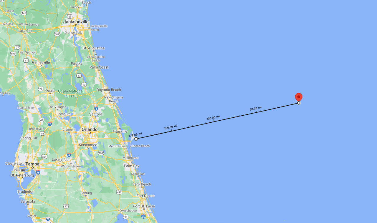
B. Center Fix Coordinates: 28.89N 77.51W
B. Center Fix Location: 197 statute miles (317 km) to the ENE (74°) from Melbourne, FL, USA.
C. Minimum Height at Standard Level: Not Available
D. Minimum Sea Level Pressure: 1012mb (29.89 inHg) - Extrapolated
E. Dropsonde Surface Wind at Center (Undecoded): NA
F. Eye Character: Not Available
G. Eye Shape: Not Available
H. Estimated (by SFMR or visually) Maximum Surface Wind Inbound: 24kts (27.6mph)
I. Location & Time of the Estimated Maximum Surface Wind Inbound: 61 nautical miles (70 statute miles) to the W (270°) of center fix at 21:23:00Z
J. Maximum Flight Level Wind Inbound: From 13° at 19kts (From the NNE at 21.9mph)
K. Location & Time of the Maximum Flight Level Wind Inbound: 63 nautical miles (72 statute miles) to the W (270°) of center fix at 21:22:30Z
L. Estimated (by SFMR or visually) Maximum Surface Wind Outbound: 25kts (28.8mph)
M. Location & Time of the Estimated Maximum Surface Wind Outbound: 44 nautical miles (51 statute miles) to the NW (308°) of center fix at 22:00:30Z
N. Maximum Flight Level Wind Outbound: From 38° at 24kts (From the NE at 27.6mph)
O. Location & Time of the Maximum Flight Level Wind Outbound: 56 nautical miles (64 statute miles) to the NW (307°) of center fix at 22:04:30Z
P. Maximum Flight Level Temp & Pressure Altitude Outside Eye: 25°C (77°F) at a pressure alt. of 153m (502ft)
Q. Maximum Flight Level Temp & Pressure Altitude Inside Eye: 25°C (77°F) at a pressure alt. of 155m (509ft)
R. Dewpoint Temp (collected at same location as temp inside eye): 23°C (73°F)
R. Sea Surface Temp (collected at same location as temp inside eye): Not Available
S. Fix Determined By: Penetration, Wind and Pressure
S. Fix Level: Other - Not surface, 1500ft, 925mb, 850mb, 700mb, 500mb, 400mb, 300mb or 200mb
T. Navigational Fix Accuracy: 0.02 nautical miles
T. Meteorological Accuracy: 10 nautical miles

Remarks Section - Remarks That Were Decoded...

Maximum Flight Level Wind: 35kts (~ 40.3mph) which was observed 57 nautical miles (66 statute miles) to the ESE (117°) from the flight level center at 20:10:00Z

Remarks Section - Additional Remarks...

SLP EXTRAP FROM NONSTANDARD LEVEL
FIX LEVEL 500 FT AGL
0 likes   
Personal Forecast Disclaimer:
The posts in this forum are NOT official forecast and should not be used as such. They are just the opinion of the poster and may or may not be backed by sound meteorological data. They are NOT endorsed by any professional institution or storm2k.org. For official information, please refer to the NHC and NWS products.

MarioProtVI
Category 2
Category 2
Posts: 675
Age: 23
Joined: Sun Sep 29, 2019 7:33 pm
Location: New Jersey

Re: ATL: INVEST 90L - Discussion

#110 Postby MarioProtVI » Sat Jul 24, 2021 5:31 pm

Apparently a VDM came through? Are they actually considering classifying it? When was the last time a VDM occurred for a system that did not get classified by NHC?
0 likes   

AlphaToOmega
Category 5
Category 5
Posts: 1448
Joined: Sat Jun 26, 2021 10:51 am
Location: Somewhere in Massachusetts

Re: ATL: INVEST 90L - Discussion

#111 Postby AlphaToOmega » Sat Jul 24, 2021 5:35 pm

35 kt * 0.9 = 31.5 kt
Any amount of intensification would give it gale-force winds.
2 likes   

User avatar
abajan
S2K Supporter
S2K Supporter
Posts: 4175
Joined: Sun Sep 07, 2003 5:10 am
Location: Barbados

Re: ATL: INVEST 90L - Discussion

#112 Postby abajan » Sat Jul 24, 2021 5:43 pm

Mark Sudduth's take on this:


Link: https://youtu.be/qQeaJ7gtElo
0 likes   

User avatar
Category5Kaiju
Category 5
Category 5
Posts: 3438
Age: 22
Joined: Thu Dec 24, 2020 12:45 pm
Location: Seattle

Re: ATL: INVEST 90L - Discussion

#113 Postby Category5Kaiju » Sat Jul 24, 2021 5:47 pm

Imho a TD or very weak and short-lived TS are not out of the possibilities; I mean sure it may not be likely, but I've seen weirder things happen in the tropics and as a result I'd rather be safe than sorry...
0 likes   
Unless explicitly stated, all information covered in my posts is based on my opinions and observations. Please refer to a professional meteorologist or an accredited weather research agency otherwise, especially if serious decisions must be made in the event of a potentially life-threatening tropical storm or hurricane.

User avatar
Jr0d
S2K Supporter
S2K Supporter
Posts: 1177
Joined: Tue Aug 27, 2019 10:52 am
Location: Cayo Hueso

Re: ATL: INVEST 90L - Discussion

#114 Postby Jr0d » Sat Jul 24, 2021 5:55 pm

Category5Kaiju wrote:Imho a TD or very weak and short-lived TS are not out of the possibilities; I mean sure it may not be likely, but I've seen weirder things happen in the tropics and as a result I'd rather be safe than sorry...


According to the NHC, this is more likely than not.

The 120.mile buoy off Cape Canaveral is now down to 1012.5mb....recon found 1012mb. The pressure is still slowly falling despite no convection.
0 likes   

User avatar
toad strangler
S2K Supporter
S2K Supporter
Posts: 4178
Joined: Sun Jul 28, 2013 3:09 pm
Location: Earth
Contact:

Re: ATL: INVEST 90L - Discussion

#115 Postby toad strangler » Sat Jul 24, 2021 6:05 pm

Sudduth very vigorously shut the door on 90L
2 likes   

psyclone
S2K Supporter
S2K Supporter
Posts: 4510
Joined: Wed Aug 24, 2005 9:04 pm
Location: palm harbor fl

Re: ATL: INVEST 90L - Discussion

#116 Postby psyclone » Sat Jul 24, 2021 6:20 pm

This "system" has actually yielded reduced convection in my area today. Tropical systems that bring fair weather are my kind of systems. We'll see if it can do anything later on but so far it's a nothing. we certainly don't need an upgrade or any sort of complacency building warnings/watches at this point. we get too much of that as it is.
0 likes   

User avatar
cycloneye
Admin
Admin
Posts: 139604
Age: 67
Joined: Thu Oct 10, 2002 10:54 am
Location: San Juan, Puerto Rico

Re: ATL: INVEST 90L - Discussion

#117 Postby cycloneye » Sat Jul 24, 2021 6:30 pm

Tropical Weather Outlook
NWS National Hurricane Center Miami FL
800 PM EDT Sat Jul 24 2021

For the North Atlantic...Caribbean Sea and the Gulf of Mexico:

1. Earlier this afternoon and evening, an Air Force Reserve Hurricane
Hunter aircraft investigated the low pressure system off the east
coast of Florida and found a well-defined center of circulation
about 185 miles east of Cape Canaveral. However, the system still
lacks organized shower and thunderstorm activity near its center
and therefore has not met the criteria to be designated as a
tropical depression. Environmental conditions are expected to
remain marginally conducive for additional development, and a
tropical depression could still form overnight or on Sunday while
the low moves generally westward at 5 to 10 mph toward the east
coast of Florida. Interests in Florida should continue to monitor
the progress of this system. Another Hurricane Hunter aircraft is
scheduled to investigate the system Sunday morning, if necessary.
* Formation chance through 48 hours...medium...50 percent.
* Formation chance through 5 days...medium...50 percent.

Forecaster Berg/Blake
0 likes   
Visit the Caribbean-Central America Weather Thread where you can find at first post web cams,radars
and observations from Caribbean basin members Click Here

psyclone
S2K Supporter
S2K Supporter
Posts: 4510
Joined: Wed Aug 24, 2005 9:04 pm
Location: palm harbor fl

Re: ATL: INVEST 90L - Discussion

#118 Postby psyclone » Sat Jul 24, 2021 6:32 pm

Down to 50%. Nice. Hopefully the start of a gradual step down. Still a coin toss though
0 likes   

AlphaToOmega
Category 5
Category 5
Posts: 1448
Joined: Sat Jun 26, 2021 10:51 am
Location: Somewhere in Massachusetts

Re: ATL: INVEST 90L - Discussion

#119 Postby AlphaToOmega » Sat Jul 24, 2021 6:46 pm

Any amount of convective improvement would yield a tropical cyclone. With diurnal minimum coming up, that might be difficult, but the ECMWF still has a 90%-100% chance of a tropical cyclone. Looking at satellite imagery, convection is trying to form near the center.
0 likes   

AlphaToOmega
Category 5
Category 5
Posts: 1448
Joined: Sat Jun 26, 2021 10:51 am
Location: Somewhere in Massachusetts

Re: ATL: INVEST 90L - Discussion

#120 Postby AlphaToOmega » Sat Jul 24, 2021 7:04 pm

Image

This is moving 5 to 10 mph towards Florida. A distance of 192 miles means it has 38 to 19 more hours over water. I say this has plenty of time to intensify.
0 likes   


Return to “2021”

Who is online

Users browsing this forum: No registered users and 8 guests