ATL: JOSEPHINE - Remnants - Discussion
Moderator: S2k Moderators
-
Aric Dunn
- Category 5

- Posts: 21238
- Age: 43
- Joined: Sun Sep 19, 2004 9:58 pm
- Location: Ready for the Chase.
- Contact:
Re: ATL: JOSEPHINE - Tropical Storm - Discussion
It does appear.. that if recon fors another pass it might find the center reforming to the NE a little. Hard to be for sure yet.
2 likes
Note: If I make a post that is brief. Please refer back to previous posts for the analysis or reasoning. I do not re-write/qoute what my initial post said each time.
If there is nothing before... then just ask
Space & Atmospheric Physicist, Embry-Riddle Aeronautical University,
I believe the sky is falling...
If there is nothing before... then just ask
Space & Atmospheric Physicist, Embry-Riddle Aeronautical University,
I believe the sky is falling...


Re: ATL: JOSEPHINE - Tropical Storm - Discussion
Big improvement now on VIS.
The CoC of the PVS must be a lot closer than I thought.

The CoC of the PVS must be a lot closer than I thought.
3 likes

Re: ATL: JOSEPHINE - Tropical Storm - Discussion
GCANE wrote:Looks like a very tight pressure gradient.
That could be one potential reason the ASCAT passes have been having trouble identifying the closed low
3 likes
Re: ATL: JOSEPHINE - Tropical Storm - Discussion
tiger_deF wrote:GCANE wrote:Looks like a very tight pressure gradient.
That could be one potential reason the ASCAT passes have been having trouble identifying the closed low
For sure
0 likes
Re: ATL: JOSEPHINE - Tropical Storm - Discussion
West-end of the dry slot is getting taken out.

2 likes

-
1900hurricane

- Category 5
- Posts: 6063
- Age: 34
- Joined: Fri Feb 06, 2015 12:04 pm
- Location: Houston, TX
- Contact:
Re: ATL: JOSEPHINE - Tropical Storm - Discussion
Easy to see the shear belt on WV imagery extending from Hispaniola towards Josephine. Here's a couple of upshear soundings too, which show the upcoming envioronment.


3 likes
Contract Meteorologist. TAMU & MSST. Fiercely authentic, one of a kind. We are all given free will, so choose a life meant to be lived. We are the Masters of our own Stories.
Opinions expressed are mine alone.
Follow me on Twitter at @1900hurricane : Read blogs at https://1900hurricane.wordpress.com/
Opinions expressed are mine alone.
Follow me on Twitter at @1900hurricane : Read blogs at https://1900hurricane.wordpress.com/
-
Aric Dunn
- Category 5
- Posts: 21238
- Age: 43
- Joined: Sun Sep 19, 2004 9:58 pm
- Location: Ready for the Chase.
- Contact:
Re: ATL: JOSEPHINE - Tropical Storm - Discussion
1900hurricane wrote:Easy to see the shear belt on WV imagery extending from Hispaniola towards Josephine. Here's a couple of upshear soundings too, which show the upcoming envioronment.
https://i.imgur.com/j3p8KPC.gif
https://i.imgur.com/BkCo6uB.gif
https://i.imgur.com/er9aphs.gif
Exactly why this will probably continue to survive a lot longer than what people have been thinking.
all the shear is above the mid levels. 300mb and up.
or who knows maybe it will just get lost in the Bermuda triangle.
7 likes
Note: If I make a post that is brief. Please refer back to previous posts for the analysis or reasoning. I do not re-write/qoute what my initial post said each time.
If there is nothing before... then just ask
Space & Atmospheric Physicist, Embry-Riddle Aeronautical University,
I believe the sky is falling...
If there is nothing before... then just ask
Space & Atmospheric Physicist, Embry-Riddle Aeronautical University,
I believe the sky is falling...

Re: ATL: JOSEPHINE - Tropical Storm - Discussion
Aric, are you still thinking this one has some parallels to Andrew?
If it survives the next couple od days or regenerates and misses the trough, who knows. If it an open wave, its more likely to miss the trough...at one point Andrew was essentially an open wave but they kept it classified based on high winds at flight level and a vigorous MLC if I remember the history correctly.
Several models have hinted at Josephine doing a loop, so completely missing the trough as a shallower system is not a crazy idea. Obviously tough to trust the models this year. I might need to start drawing my own weather maps to get a better idea what is likely to happen.
1 likes
-
Aric Dunn
- Category 5
- Posts: 21238
- Age: 43
- Joined: Sun Sep 19, 2004 9:58 pm
- Location: Ready for the Chase.
- Contact:
Re: ATL: JOSEPHINE - Tropical Storm - Discussion
Jr0d wrote:Aric, are you still thinking this one has some parallels to Andrew?
If it survives the next couple od days or regenerates and misses the trough, who knows. If it an open wave, its more likely to miss the trough...at one point Andrew was essentially an open wave but they kept it classified based on high winds at flight level and a vigorous MLC if I remember the history correctly.
Several models have hinted at Josephine doing a loop, so completely missing the trough as a shallower system is not a crazy idea. Obviously tough to trust the models this year. I might need to start drawing my own weather maps to get a better idea what is likely to happen.
I mean it really does have some parallels. especially that upper low to the north of it right now causing the shear. Andrew forced it/blew it apart which gave way to a huge upper high. as the ridge building in behind the mid atlantic low that pulled NE.
we literally have something very similar. the big difference is the eastern US trough is supposed to be re-inforced. then weaken.
of course, I dont think it will turn into an Andrew. but it sure does have some very similar features the last few days.
A lot of unknown variables right now.. will be an interesting thing to watch.
6 likes
Note: If I make a post that is brief. Please refer back to previous posts for the analysis or reasoning. I do not re-write/qoute what my initial post said each time.
If there is nothing before... then just ask
Space & Atmospheric Physicist, Embry-Riddle Aeronautical University,
I believe the sky is falling...
If there is nothing before... then just ask
Space & Atmospheric Physicist, Embry-Riddle Aeronautical University,
I believe the sky is falling...
Re: ATL: JOSEPHINE - Tropical Storm - Discussion
Utter obliteration of the dry slot.
If you loop UL WV on slider you can see the gravity waves as depicted in green, flow away from Jo.

If you loop UL WV on slider you can see the gravity waves as depicted in green, flow away from Jo.
6 likes
-
Hurricaneman

- Category 5
- Posts: 7404
- Age: 45
- Joined: Tue Aug 31, 2004 3:24 pm
- Location: central florida
Re: ATL: JOSEPHINE - Tropical Storm - Discussion
Aric Dunn wrote:Jr0d wrote:Aric, are you still thinking this one has some parallels to Andrew?
If it survives the next couple od days or regenerates and misses the trough, who knows. If it an open wave, its more likely to miss the trough...at one point Andrew was essentially an open wave but they kept it classified based on high winds at flight level and a vigorous MLC if I remember the history correctly.
Several models have hinted at Josephine doing a loop, so completely missing the trough as a shallower system is not a crazy idea. Obviously tough to trust the models this year. I might need to start drawing my own weather maps to get a better idea what is likely to happen.
I mean it really does have some parallels. especially that upper low to the north of it right now causing the shear. Andrew forced it/blew it apart which gave way to a huge upper high. as the ridge building in behind the mid atlantic low that pulled NE.
we literally have something very similar. the big difference is the eastern US trough is supposed to be re-inforced. then weaken.
of course, I dont think it will turn into an Andrew. but it sure does have some very similar features the last few days.
A lot of unknown variables right now.. will be an interesting thing to watch.
That’s why we always say until it’s passed your latitude you need to keep watching just in case of something unexpected
2 likes
Re: ATL: JOSEPHINE - Tropical Storm - Discussion
Much stronger ice signature in the CDO the last couple hours
2 likes

Re: ATL: JOSEPHINE - Tropical Storm - Discussion
Hurricaneman wrote:Aric Dunn wrote:Jr0d wrote:Aric, are you still thinking this one has some parallels to Andrew?
If it survives the next couple od days or regenerates and misses the trough, who knows. If it an open wave, its more likely to miss the trough...at one point Andrew was essentially an open wave but they kept it classified based on high winds at flight level and a vigorous MLC if I remember the history correctly.
Several models have hinted at Josephine doing a loop, so completely missing the trough as a shallower system is not a crazy idea. Obviously tough to trust the models this year. I might need to start drawing my own weather maps to get a better idea what is likely to happen.
I mean it really does have some parallels. especially that upper low to the north of it right now causing the shear. Andrew forced it/blew it apart which gave way to a huge upper high. as the ridge building in behind the mid atlantic low that pulled NE.
we literally have something very similar. the big difference is the eastern US trough is supposed to be re-inforced. then weaken.
of course, I dont think it will turn into an Andrew. but it sure does have some very similar features the last few days.
A lot of unknown variables right now.. will be an interesting thing to watch.
That’s why we always say until it’s passed your latitude you need to keep watching just in case of something unexpected
Or in the case of Betsy and Jeanne, wait until its passed your latitude then freak out when they move WSW
11 likes
Andrew (1992), Irene (1999), Frances (2004), Katrina (2005), Wilma (2005), Fay (2008), Irma (2017), Eta (2020), Ian (2022)
Re: ATL: JOSEPHINE - Tropical Storm - Discussion
It look like the earliest signs of banding are present on the NE side of the system
0 likes
Re: ATL: JOSEPHINE - Tropical Storm - Discussion
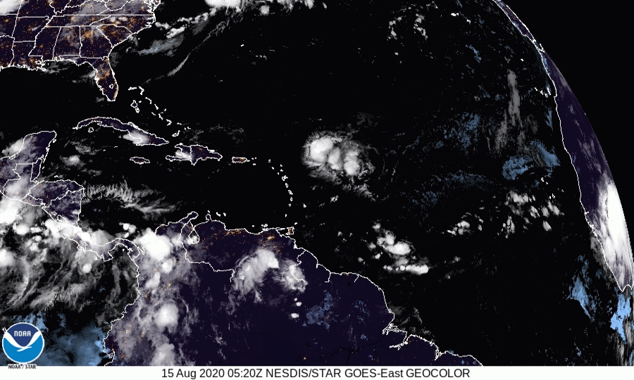
Early popups across some of the eastern islands.
Must be some very high CAPE air.
I am expecting the rest of the islands to fire off soon including PR.
That should nail the dry slot.
We'll see how Jo reorganizes then.

Must be some very high CAPE air.
I am expecting the rest of the islands to fire off soon including PR.
That should nail the dry slot.
We'll see how Jo reorganizes then.
4 likes
-
Aric Dunn
- Category 5
- Posts: 21238
- Age: 43
- Joined: Sun Sep 19, 2004 9:58 pm
- Location: Ready for the Chase.
- Contact:
Re: ATL: JOSEPHINE - Tropical Storm - Discussion
GCANE wrote:WTF???
No Recon anymore!!!????
No threat to land.
this also means it will likely be downgraded and called open before it actually is... since we have to go off ASCAT now. which has not been doing well with this system.
just wait for the claims... "see the models got it right" lol
1 likes
Note: If I make a post that is brief. Please refer back to previous posts for the analysis or reasoning. I do not re-write/qoute what my initial post said each time.
If there is nothing before... then just ask
Space & Atmospheric Physicist, Embry-Riddle Aeronautical University,
I believe the sky is falling...
If there is nothing before... then just ask
Space & Atmospheric Physicist, Embry-Riddle Aeronautical University,
I believe the sky is falling...
Who is online
Users browsing this forum: No registered users and 6 guests