#293 Postby Aric Dunn » Tue Jun 02, 2020 1:30 pm
bella_may wrote::P
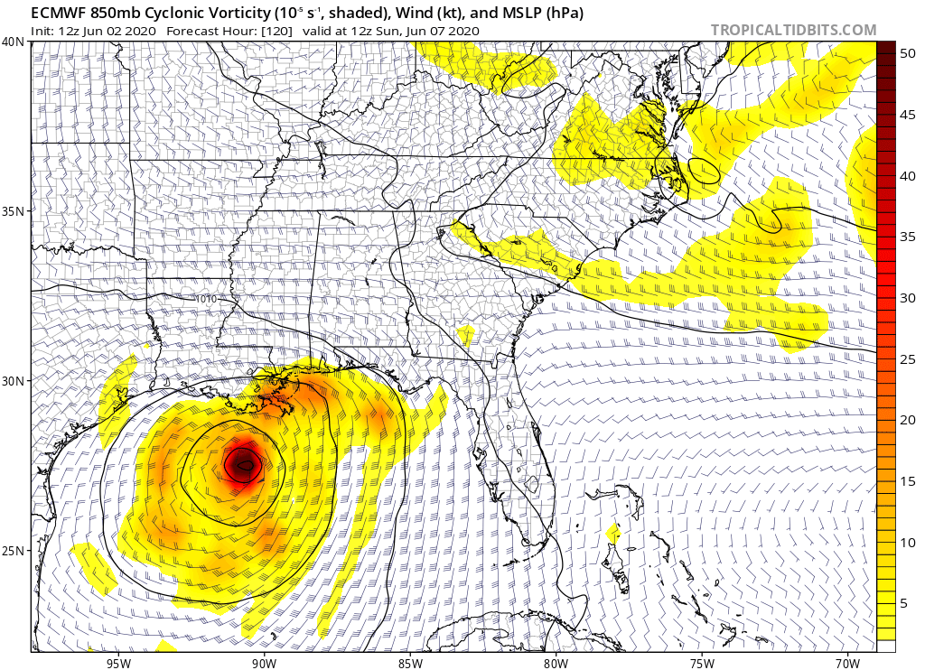
Aric Dunn wrote:well the 12z euro goes way too far west in the next 24 hours.. the motion is not what is happening now. so we can sit and wait for then run now. lol
Yeah once it moves away from land I’m guessing the models will consolidate much more
Yeah right now models are not really to helpful except for the general background environment and steering.
this 12z Euro still takes it inland for awhile disrupts the circ and turns it into a more broad circ. tighter than some runs but still less organized core.
0 likes
Note: If I make a post that is brief. Please refer back to previous posts for the analysis or reasoning. I do not re-write/qoute what my initial post said each time.
If there is nothing before... then just ask

Space & Atmospheric Physicist, Embry-Riddle Aeronautical University,
I believe the sky is falling...