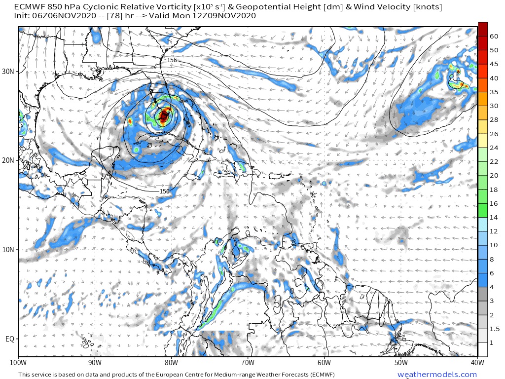
ObsessedMiami wrote:jhpigott wrote:TheProfessor wrote:Low level vorticity and the heaviest convection now align with each other, I have to imagine we should see this start to develop pretty quickly. I have to imagine that NHC will issue TS watches for the Keys and maybe SFL unless we see drastic changes with the 12z models. They may be a bit more proactive in this instance knowing that people are pretty distracted right now and may not be paying attention to the weather.
UGH. I'm in northeastern palm beach county near juno. Supposed to leave this afternoon for a weekend of camping just up the road at Jonathan Dickenson state park. Probably should rethink that
Based on the rain forecast alone from earlier in the week, I would have already cancelled!
No kidding. Looks like the updated Hydrologic Outlook has 7-10 inches of rain incoming. And given the saturated ground from October's rains, looks like a foregone conclusion we will at the very least (irrespective of the winds) see some extensive flooding here in SE FL