kevin wrote:GCANE wrote:Recon reports a pinhole eye.
Circular, closed 8nm wide
So that means the EWRC is over? In that case it might still have some time to strengthen if a landfall is delayed due to its slow movement.
Yes is over.
Moderator: S2k Moderators
kevin wrote:GCANE wrote:Recon reports a pinhole eye.
Circular, closed 8nm wide
So that means the EWRC is over? In that case it might still have some time to strengthen if a landfall is delayed due to its slow movement.

kevin wrote:GCANE wrote:Recon reports a pinhole eye.
Circular, closed 8nm wide
So that means the EWRC is over? In that case it might still have some time to strengthen if a landfall is delayed due to its slow movement.

wxman57 wrote:Significant weakening due to the ERC. Hurricanes often drop 1-2 categories during an ERC. No Cat 5 for Eta. Barely may be a Cat 3 now.

wxman57 wrote:kevin wrote:GCANE wrote:Recon reports a pinhole eye.
Circular, closed 8nm wide
So that means the EWRC is over? In that case it might still have some time to strengthen if a landfall is delayed due to its slow movement.
No, the eyewall replacement cycle is ongoing. That inner eye is deteriorating. Pressure gradient in the core will relax as the pinhole eye disappears. Winds probably 110 kts now. Landfall will occur mid-ERC.


Iceresistance wrote:Eta could explosively strengthen JUST before landfall, Charley 2004 did just that.


Ryxn wrote:aspen wrote:If Eta becomes a remnant low and dissipates over CA, and those remnants re-develop over the NW Caribbean, would it still be Eta or would it be named Theta?
Eta. If a low pressure separate from ex-Eta forms and develops, it would be Theta though this is looking less likely.

p1nheadlarry wrote:Ryxn wrote:aspen wrote:If Eta becomes a remnant low and dissipates over CA, and those remnants re-develop over the NW Caribbean, would it still be Eta or would it be named Theta?
Eta. If a low pressure separate from ex-Eta forms and develops, it would be Theta though this is looking less likely.
Then how did Ivan keep its name that time in 04


euro6208 wrote:My peak intensity is 135 knots. Besides the RAW T's and CI which peaked at over 8.0 and over 7.0 and winds found during flight level of 155 knots, i don't think that is enough of an upgrade.
Cold tops were very cold yes but the eye temps wasn't even that extraordinaire. 10C?
Dvorak was only a 6.5. I think the NHC wants to see consistent data to upgrade not just one observation. ADT isn't the only metric to measure how strong a system is.
Weather Dude wrote:euro6208 wrote:My peak intensity is 135 knots. Besides the RAW T's and CI which peaked at over 8.0 and over 7.0 and winds found during flight level of 155 knots, i don't think that is enough of an upgrade.
Cold tops were very cold yes but the eye temps wasn't even that extraordinaire. 10C?
Dvorak was only a 6.5. I think the NHC wants to see consistent data to upgrade not just one observation. ADT isn't the only metric to measure how strong a system is.
ADT was 6.9

Owasso wrote:https://i.postimg.cc/fWxdyswL/61495583.gif
Intense lightning.
SFLcane wrote:Another 2-3 days and SFL might be in the cone.

underthwx wrote:SFLcane wrote:Another 2-3 days and SFL might be in the cone.
Unfortunately...I won't be surprised.... definitely needs to be watched carefully for some time to come

SFLcane wrote:Another 2-3 days and SFL might be in the cone.

Jr0d wrote:SFLcane wrote:Another 2-3 days and SFL might be in the cone.
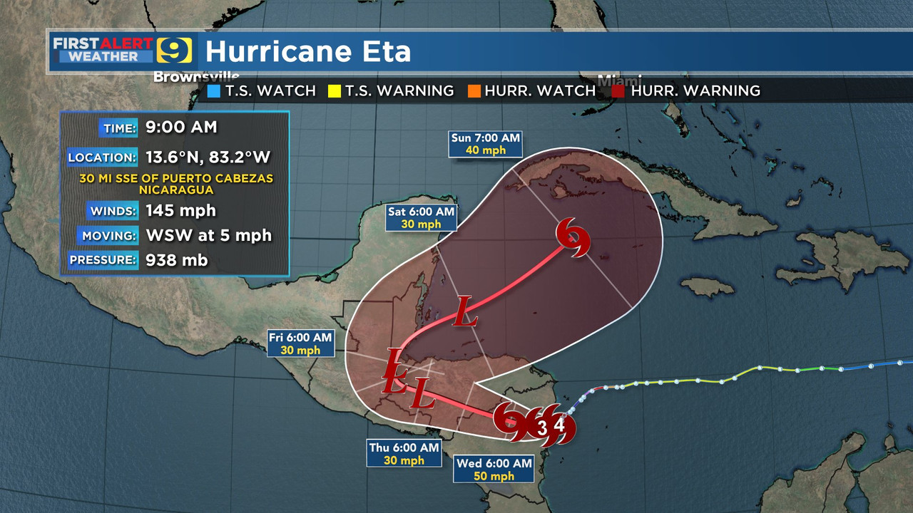
Doubtful, Eta will likely be downgraded to a remnant low by Thursday. If it regenerates that wont be to Friday or later. Maybe Florida will be in the cone, if advisories are re-initiated by this weekend.
Eta will soon be ripped apart by the mountains of Central America. Unfortunately this also means Nicaragua and Hondorus will see an incredible amount of rain that will to widespread flooding and landslides.
Users browsing this forum: No registered users and 7 guests