EPAC: GENEVIEVE - Post-Tropical

Moderator: S2k Moderators

Message
Author
User avatar
Yellow Evan
Professional-Met
Professional-Met
Posts: 15960
Age: 25
Joined: Fri Jul 15, 2011 12:48 pm
Location: Henderson, Nevada/Honolulu, HI
Contact:

Re: EPAC: GENEVIEVE - Hurricane

#141 Postby Yellow Evan » Mon Aug 17, 2020 5:47 pm

Kingarabian wrote:
Yellow Evan wrote::uarrow: I'll add the usual caveat that an ERC would be quite unusual for a Cat 1.

Think we seen it with Douglas as well, earlier this season. I think this just proves that Douglas and this were stronger than advertised at the time of the ERC process.


Douglas did not ERC as a Cat 1. As a Cat 4 and Cat 2, it did.
2 likes   

User avatar
DorkyMcDorkface
Category 2
Category 2
Posts: 743
Age: 26
Joined: Mon Sep 30, 2019 1:32 pm
Location: Mid-Atlantic

Re: EPAC: GENEVIEVE - Hurricane

#142 Postby DorkyMcDorkface » Mon Aug 17, 2020 5:50 pm

Looking much better. I'd say it's off to the races.
2 likes   
Floyd 1999 | Isabel 2003 | Hanna 2008 | Irene 2011 | Sandy 2012 | Isaias 2020

User avatar
Kingarabian
S2K Supporter
S2K Supporter
Posts: 15461
Joined: Sat Aug 08, 2009 3:06 am
Location: Honolulu, Hawaii

Re: EPAC: GENEVIEVE - Hurricane

#143 Postby Kingarabian » Mon Aug 17, 2020 6:03 pm

Has another hour and a half to warm the eye further to warrant a higher SAB fix. But it's clearly at least a 90k system at this point.

Image
3 likes   
RIP Kobe Bryant

User avatar
Kingarabian
S2K Supporter
S2K Supporter
Posts: 15461
Joined: Sat Aug 08, 2009 3:06 am
Location: Honolulu, Hawaii

Re: EPAC: GENEVIEVE - Hurricane

#144 Postby Kingarabian » Mon Aug 17, 2020 6:16 pm

UW - CIMSS
ADVANCED DVORAK TECHNIQUE
ADT-Version 9.0
Tropical Cyclone Intensity Algorithm

----- Current Analysis -----
Date : 17 AUG 2020 Time : 225020 UTC
Lat : 15:45:34 N Lon : 105:01:49 W


CI# /Pressure/ Vmax
4.7 / 974.6mb/ 82.2kt


Final T# Adj T# Raw T#
4.5 4.9 5.0

Center Temp : -48.8C Cloud Region Temp : -66.0C

Scene Type : EMBEDDED CENTER CLOUD REGION
0 likes   
RIP Kobe Bryant

User avatar
Highteeld
Category 5
Category 5
Posts: 2097
Age: 40
Joined: Tue Jan 30, 2018 9:10 pm
Location: Chicago

Re: EPAC: GENEVIEVE - Hurricane

#145 Postby Highteeld » Mon Aug 17, 2020 6:46 pm

Image
6 likes   
Very useful information on the Dvorak Technique --

https://severe.worldweather.wmo.int/TCF ... kBeven.pdf

User avatar
cycloneye
Admin
Admin
Posts: 139602
Age: 67
Joined: Thu Oct 10, 2002 10:54 am
Location: San Juan, Puerto Rico

Re: EPAC: GENEVIEVE - Hurricane

#146 Postby cycloneye » Mon Aug 17, 2020 6:53 pm

BULLETIN
Hurricane Genevieve Intermediate Advisory Number 6A
NWS National Hurricane Center Miami FL EP122020
700 PM CDT Mon Aug 17 2020

...GENEVIEVE RAPIDLY STRENGTHENS INTO A CATEGORY 2 HURRICANE...
...EXPECTED TO BECOME A MAJOR HURRICANE ON TUESDAY...


SUMMARY OF 700 PM CDT...0000 UTC...INFORMATION
----------------------------------------------
LOCATION...16.0N 105.3W
ABOUT 225 MI...360 KM SSW OF MANZANILLO MEXICO
ABOUT 500 MI...805 KM SE OF THE SOUTHERN TIP OF BAJA CALIFORNIA
MAXIMUM SUSTAINED WINDS...100 MPH...160 KM/H
PRESENT MOVEMENT...WNW OR 300 DEGREES AT 18 MPH...30 KM/H
MINIMUM CENTRAL PRESSURE...980 MB...28.94 INCHES


WATCHES AND WARNINGS
--------------------

CHANGES WITH THIS ADVISORY:

None.

SUMMARY OF WATCHES AND WARNINGS IN EFFECT:

A Tropical Storm Watch is in effect for...
* Southern Baja California peninsula from Los Barriles to Todos
Santos

A Tropical Storm Watch means that tropical storm conditions are
possible within the watch area, generally within 48 hours.


DISCUSSION AND OUTLOOK
----------------------
At 700 PM CDT (0000 UTC), the center of Hurricane Genevieve was
located near latitude 16.0 North, longitude 105.3 West. Genevieve is
moving toward the west-northwest near 18 mph (30 km/h), and this
motion is expected to continue through early Tuesday. A turn to the
northwest with a decrease in forward speed is forecast to occur by
Tuesday afternoon and continue through at least early Thursday. On
the forecast track, the center of Genevieve is expected to move
parallel to but well offshore the coast of southwestern Mexico
during the next day or so. The center of the hurricane is forecast
to pass near or southwest of the southern portion of the Baja
California peninsula on Wednesday night and Thursday.

Maximum sustained winds have increased to near 100 mph (160 km/h)
with higher gusts. Rapid strengthening is forecast to continue
during the next 24 to 36 hours, and Genevieve is expected to become
a major hurricane on Tuesday.

Hurricane-force winds extend outward up to 25 miles (35 km) from
the center and tropical-storm-force winds extend outward up to 140
miles (220 km).

The estimated minimum central pressure is 980 mb (28.94 inches).


HAZARDS AFFECTING LAND
----------------------
WIND: Tropical storm conditions are possible within the watch
area in the southern Baja California peninsula by Wednesday
afternoon.

SURF: Large swells produced by Genevieve are affecting portions of
the southern coast of Mexico and will spread northward along
the southwestern and west-central coast of Mexico to the Baja
California peninsula through Wednesday. These swells are likely to
cause life-threatening surf and rip current conditions. Please
consult products from your local weather office.


NEXT ADVISORY
-------------
Next complete advisory at 1000 PM CDT.

$$
Forecaster Brown
0 likes   
Visit the Caribbean-Central America Weather Thread where you can find at first post web cams,radars
and observations from Caribbean basin members Click Here

User avatar
aspen
Category 5
Category 5
Posts: 8061
Joined: Sat Oct 12, 2019 7:10 pm
Location: Connecticut, USA

Re: EPAC: GENEVIEVE - Hurricane

#147 Postby aspen » Mon Aug 17, 2020 7:08 pm

From 2pm Sunday to 8pm Monday, Genevieve has intensified from a 30 kt TD to an 85 kt Category 2 hurricane. Just wow.
6 likes   
Irene '11 Sandy '12 Hermine '16 5/15/2018 Derecho Fay '20 Isaias '20 Elsa '21 Henri '21 Ida '21

I am only a meteorology enthusiast who knows a decent amount about tropical cyclones. Look to the professional mets, the NHC, or your local weather office for the best information.

User avatar
Yellow Evan
Professional-Met
Professional-Met
Posts: 15960
Age: 25
Joined: Fri Jul 15, 2011 12:48 pm
Location: Henderson, Nevada/Honolulu, HI
Contact:

Re: EPAC: GENEVIEVE - Hurricane

#148 Postby Yellow Evan » Mon Aug 17, 2020 7:29 pm

17/2330 UTC 16.0N 105.2W T4.5/4.5 GENEVIEVE


Not sure why the NHC went 85 tbh.
2 likes   

User avatar
aspen
Category 5
Category 5
Posts: 8061
Joined: Sat Oct 12, 2019 7:10 pm
Location: Connecticut, USA

Re: EPAC: GENEVIEVE - Hurricane

#149 Postby aspen » Mon Aug 17, 2020 7:29 pm

Definitely looks like she’s undergoing an EWRC. There should still be enough time to bomb out into a major.
2 likes   
Irene '11 Sandy '12 Hermine '16 5/15/2018 Derecho Fay '20 Isaias '20 Elsa '21 Henri '21 Ida '21

I am only a meteorology enthusiast who knows a decent amount about tropical cyclones. Look to the professional mets, the NHC, or your local weather office for the best information.

User avatar
Yellow Evan
Professional-Met
Professional-Met
Posts: 15960
Age: 25
Joined: Fri Jul 15, 2011 12:48 pm
Location: Henderson, Nevada/Honolulu, HI
Contact:

Re: EPAC: GENEVIEVE - Hurricane

#150 Postby Yellow Evan » Mon Aug 17, 2020 7:33 pm

Image

Actually worthy of T5.0 now.
0 likes   

User avatar
aspen
Category 5
Category 5
Posts: 8061
Joined: Sat Oct 12, 2019 7:10 pm
Location: Connecticut, USA

Re: EPAC: GENEVIEVE - Hurricane

#151 Postby aspen » Mon Aug 17, 2020 7:42 pm

Yellow Evan wrote:https://i.imgur.com/r4NUHOM.png

Actually worthy of T5.0 now.

Definitely looks like an ongoing EWRC. Please don’t eat dry air...
0 likes   
Irene '11 Sandy '12 Hermine '16 5/15/2018 Derecho Fay '20 Isaias '20 Elsa '21 Henri '21 Ida '21

I am only a meteorology enthusiast who knows a decent amount about tropical cyclones. Look to the professional mets, the NHC, or your local weather office for the best information.

User avatar
Yellow Evan
Professional-Met
Professional-Met
Posts: 15960
Age: 25
Joined: Fri Jul 15, 2011 12:48 pm
Location: Henderson, Nevada/Honolulu, HI
Contact:

Re: EPAC: GENEVIEVE - Hurricane

#152 Postby Yellow Evan » Mon Aug 17, 2020 7:51 pm

Image

This is about to ERC, which is probably destroying its chances at going pinhole.
0 likes   

User avatar
gatorcane
S2K Supporter
S2K Supporter
Posts: 23499
Age: 46
Joined: Sun Mar 13, 2005 3:54 pm
Location: Boca Raton, FL

Re: EPAC: GENEVIEVE - Hurricane

#153 Postby gatorcane » Mon Aug 17, 2020 7:54 pm

Wow very impressive

Image
0 likes   

User avatar
Yellow Evan
Professional-Met
Professional-Met
Posts: 15960
Age: 25
Joined: Fri Jul 15, 2011 12:48 pm
Location: Henderson, Nevada/Honolulu, HI
Contact:

Re: EPAC: GENEVIEVE - Hurricane

#154 Postby Yellow Evan » Mon Aug 17, 2020 8:20 pm

* GFS version *
* EAST PACIFIC 2020 SHIPS INTENSITY FORECAST *
* IR SAT DATA AVAILABLE, OHC AVAILABLE *
* GENEVIEVE EP122020 08/18/20 00 UTC *

TIME (HR) 0 6 12 18 24 36 48 60 72 84 96 108 120 132 144 156 168
V (KT) NO LAND 85 95 104 112 119 125 122 114 103 90 75 65 55 45 36 25 N/A
V (KT) LAND 85 95 104 112 119 125 122 114 103 90 75 65 55 45 36 25 N/A
V (KT) LGEM 85 95 103 109 114 120 116 106 95 80 63 52 42 34 28 22 18
Storm Type TROP TROP TROP TROP TROP TROP TROP TROP TROP TROP TROP TROP TROP TROP TROP EXTP EXTP

SHEAR (KT) 4 3 2 4 4 3 3 3 8 9 7 11 11 18 21 28 42
SHEAR ADJ (KT) -2 -3 -5 -5 -5 -3 -2 3 3 7 8 3 9 0 6 -3 -2
SHEAR DIR 91 141 183 210 117 235 242 166 182 174 190 198 180 204 205 212 211
SST (C) 30.2 29.9 29.3 29.2 29.3 28.7 27.4 26.9 26.5 24.4 23.6 23.2 21.7 21.2 21.0 20.4 19.8
POT. INT. (KT) 169 166 158 156 157 151 137 132 128 106 98 95 79 72 69 64 60
200 MB T (C) -52.1 -52.5 -52.9 -52.3 -51.9 -52.1 -51.4 -51.2 -50.3 -50.3 -49.8 -49.9 -49.6 -49.6 -49.7 -50.1 -49.6
200 MB VXT (C) 0.3 0.4 0.5 0.5 0.5 0.8 0.6 0.8 0.8 0.9 1.3 1.5 1.1 1.3 1.1 0.8 0.6
TH_E DEV (C) 8 7 7 8 8 6 8 5 6 3 3 1 0 0 0 0 0
700-500 MB RH 80 78 78 75 76 73 67 63 56 57 55 54 49 47 40 38 32
MODEL VTX (KT) 24 23 23 26 27 27 27 29 28 27 23 21 19 17 15 11 8
850 MB ENV VOR 27 28 38 46 58 57 82 71 72 61 47 44 28 45 40 43 25
200 MB DIV 150 158 127 91 87 70 96 45 30 -6 1 16 13 16 11 32 13
700-850 TADV -9 -5 -1 0 0 0 0 -8 0 -4 -9 -1 -4 2 4 1 -9
LAND (KM) 328 328 358 376 398 303 207 223 211 291 312 371 529 616 579 554 537
LAT (DEG N) 16.0 16.8 17.6 18.2 18.8 20.2 21.4 22.4 23.7 24.7 25.4 26.6 28.3 xx.x xx.x xx.x xx.x
LONG(DEG W) 105.3 106.6 107.8 108.5 109.1 110.4 111.2 112.3 114.0 115.4 116.7 118.5 121.0 xxx.x xxx.x xxx.x xxx.x
STM SPEED (KT) 16 14 11 9 9 8 7 9 9 8 8 12 11 7 6 8 9
HEAT CONTENT 29 29 21 16 16 17 4 1 1 0 0 0 0 0 0 0 0

FORECAST TRACK FROM OFCI INITIAL HEADING/SPEED (DEG/KT):305/ 18 CX,CY: -14/ 10
T-12 MAX WIND: 65 PRESSURE OF STEERING LEVEL (MB): 470 (MEAN=587)
GOES IR BRIGHTNESS TEMP. STD DEV. 50-200 KM RAD: 5.3 (MEAN=14.5)
% GOES IR PIXELS WITH T < -20 C 50-200 KM RAD: 100.0 (MEAN=65.0)
PRELIM RI PROB (DV .GE. 35 KT IN 36 HR): 59.1

INDIVIDUAL CONTRIBUTIONS TO INTENSITY CHANGE
6 12 18 24 36 48 60 72 84 96 108 120 132 144 156 168
------------------------------------------------------------------------------
SAMPLE MEAN CHANGE 0. 0. 1. 1. 1. 2. 1. 1. 0. -0. -1. -2. -3. -4. -4. -5.
SST POTENTIAL 1. 2. 3. 4. 2. -2. -7. -11. -15. -19. -23. -27. -32. -36. -42. -48.
VERTICAL SHEAR MAG 0. 1. 1. 2. 4. 6. 8. 9. 10. 10. 10. 9. 7. 4. 1. -4.
VERTICAL SHEAR ADJ 0. 1. 1. 2. 3. 3. 2. 1. 0. 0. 0. 0. 0. 0. -0. -0.
VERTICAL SHEAR DIR 0. 0. -0. -0. -1. -1. -1. -1. -1. -0. -0. 0. 0. 1. 1. 1.
PERSISTENCE 5. 7. 7. 6. 4. 2. 1. -0. -0. -1. -1. -1. -1. -1. -1. -1.
200/250 MB TEMP. -0. -0. -0. -1. -1. -1. -1. -0. 1. 2. 3. 4. 5. 6. 7. 7.
THETA_E EXCESS 0. 0. 0. 1. 1. 1. 1. 1. 0. -1. -2. -3. -4. -5. -7. -8.
700-500 MB RH 0. 0. 0. 1. 1. 1. 1. 1. 1. 1. 1. 0. 0. 0. -0. -0.
MODEL VTX TENDENCY -0. -0. 1. 3. 2. 4. 7. 6. 4. -1. -3. -6. -8. -9. -12. -13.
850 MB ENV VORTICITY 0. 0. 0. 0. 0. -0. -0. -1. -1. -1. -1. -1. -1. -1. -1. -0.
200 MB DIVERGENCE 0. 1. 1. 2. 2. 2. 3. 4. 4. 3. 2. 2. 1. 0. 0. 0.
850-700 T ADVEC 0. 0. 0. 0. 0. 0. -0. 0. -0. -0. -0. -0. -0. -0. -0. -1.
ZONAL STORM MOTION 0. 0. 1. 1. 2. 3. 3. 3. 2. 2. 2. 2. 2. 1. 1. -0.
STEERING LEVEL PRES -0. -0. -1. -1. -1. -2. -2. -2. -2. -2. -2. -2. -2. -1. -1. -0.
DAYS FROM CLIM. PEAK 0. 0. 0. 0. 0. 0. 1. 1. 2. 2. 3. 3. 3. 4. 4. 5.
GOES PREDICTORS 1. 2. 3. 3. 3. 2. 3. 3. 2. 3. 3. 3. 3. 3. 2. 2.
OCEAN HEAT CONTENT -0. 0. 0. 0. 0. -0. -0. -0. -0. -0. -0. 0. 1. 1. 2. 4.
RI POTENTIAL 2. 4. 7. 11. 17. 16. 9. 3. -2. -5. -8. -10. -10. -10. -11. -10.
------------------------------------------------------------------------------
TOTAL CHANGE 10. 19. 27. 34. 40. 37. 29. 18. 5. -10. -20. -30. -40. -49. -60. -72.

CURRENT MAX WIND (KT): 85. LAT, LON: 16.0 105.3

** 2020 E. Pacific RI INDEX EP122020 GENEVIEVE 08/18/20 00 UTC **
(SHIPS-RII PREDICTOR TABLE for 30 KT OR MOREMAXIMUM WIND INCREASE IN NEXT 24-h)

Predictor Value RI Predictor Range Scaled Value(0-1) % Contribution
POT = MPI-VMAX (KT) : 76.4 40.5 to 149.3 0.33 6.9
12 HR PERSISTENCE (KT) : 20.0 -22.0 to 44.0 0.64 15.8
850-200 MB SHEAR (KT) : 3.4 19.6 to 1.4 0.89 17.2
D200 (10**7s-1) : 122.6 -33.0 to 160.6 0.80 16.1
MAXIMUM WIND (KT) : 85.0 22.5 to 132.0 0.63 9.4
STD DEV OF IR BR TEMP : 5.3 37.8 to 2.1 0.91 11.3
HEAT CONTENT (KJ/CM2) : 22.2 2.7 to 106.7 0.19 2.2
BL DRY-AIR FLUX (W/M2) : 141.4 800.8 to -82.5 0.75 -11.6
%area of TPW <45 mm upshear : 0.0 56.6 to 0.0 1.00 5.2
2nd PC OF IR BR TEMP : 0.2 2.2 to -1.9 0.49 0.7

SHIPS Prob RI for 20kt/ 12hr RI threshold= 79% is 12.6 times climatological mean ( 6.3%)
SHIPS Prob RI for 25kt/ 24hr RI threshold= 79% is 6.2 times climatological mean (12.6%)
SHIPS Prob RI for 30kt/ 24hr RI threshold= 73% is 8.5 times climatological mean ( 8.6%)
SHIPS Prob RI for 35kt/ 24hr RI threshold= 66% is 10.6 times climatological mean ( 6.2%)
SHIPS Prob RI for 40kt/ 24hr RI threshold= 54% is 12.8 times climatological mean ( 4.2%)
SHIPS Prob RI for 45kt/ 36hr RI threshold= 44% is 6.5 times climatological mean ( 6.7%)
SHIPS Prob RI for 55kt/ 48hr RI threshold= 23% is 3.8 times climatological mean ( 5.9%)
SHIPS Prob RI for 65kt/ 72hr RI threshold= 0% is 0.0 times climatological mean ( 4.7%)

Matrix of RI probabilities
------------------------------------------------------------------------------
RI (kt / h) | 20/12 | 25/24 | 30/24 | 35/24 | 40/24 | 45/36 | 55/48 |65/72
------------------------------------------------------------------------------
SHIPS-RII: 79.1% 78.7% 73.3% 65.6% 53.9% 43.8% 22.6% 0.0%
Logistic: 60.8% 63.2% 58.0% 51.2% 42.7% 43.8% 10.8% 0.3%
Bayesian: 63.3% 72.4% 83.7% 83.7% 30.3% 4.1% 0.0% 0.0%
Consensus: 67.7% 71.5% 71.7% 66.8% 42.3% 30.6% 11.1% 0.1%
DTOPS: 74.0% 84.0% 83.0% 74.0% 63.0% 22.0% 1.0% 0.0%

## ANNULAR HURRICANE INDEX (AHI) EP122020 GENEVIEVE 08/18/20 00 UTC ##
## STORM NOT ANNULAR, SCREENING STEP FAILED, NPASS=4 NFAIL=3 ##
## AHI= 0 (AHI OF 100 IS BEST FIT TO ANN. STRUC., 1 IS MARGINAL, 0 IS NOT ANNULAR) ##
0 likes   

supercane4867
Category 5
Category 5
Posts: 4966
Joined: Wed Nov 14, 2012 10:43 am

Re: EPAC: GENEVIEVE - Hurricane

#155 Postby supercane4867 » Mon Aug 17, 2020 8:31 pm

We should see a beautiful eye on visible by sunrise tomorrow.

Image
3 likes   

User avatar
Yellow Evan
Professional-Met
Professional-Met
Posts: 15960
Age: 25
Joined: Fri Jul 15, 2011 12:48 pm
Location: Henderson, Nevada/Honolulu, HI
Contact:

Re: EPAC: GENEVIEVE - Hurricane

#156 Postby Yellow Evan » Mon Aug 17, 2020 9:10 pm

1 likes   

User avatar
1900hurricane
Category 5
Category 5
Posts: 6044
Age: 33
Joined: Fri Feb 06, 2015 12:04 pm
Location: Houston, TX
Contact:

Re: EPAC: GENEVIEVE - Hurricane

#157 Postby 1900hurricane » Mon Aug 17, 2020 9:22 pm

Both SAB and TAFB had a FT of 3.0 24 hours ago. Now, SAB's FT is 4.5 and TAFB's is 5.0, a 1.5 and 2.0 T increase in 24 hours. That's pretty stout.
0 likes   
Contract Meteorologist. TAMU & MSST. Fiercely authentic, one of a kind. We are all given free will, so choose a life meant to be lived. We are the Masters of our own Stories.
Opinions expressed are mine alone.

Follow me on Twitter at @1900hurricane : Read blogs at https://1900hurricane.wordpress.com/

User avatar
cycloneye
Admin
Admin
Posts: 139602
Age: 67
Joined: Thu Oct 10, 2002 10:54 am
Location: San Juan, Puerto Rico

Re: EPAC: GENEVIEVE - Hurricane

#158 Postby cycloneye » Mon Aug 17, 2020 9:40 pm

Hurricane Genevieve Discussion Number 7
NWS National Hurricane Center Miami FL EP122020
900 PM MDT Mon Aug 17 2020

Genevieve's rapid intensification phase continues, having
strengthened 40 kt over the past 24 hours. The upper-level outflow
pattern has continued to expand, and outflow channels to the north
and south have become evident in water vapor imagery and UW-CIMSS
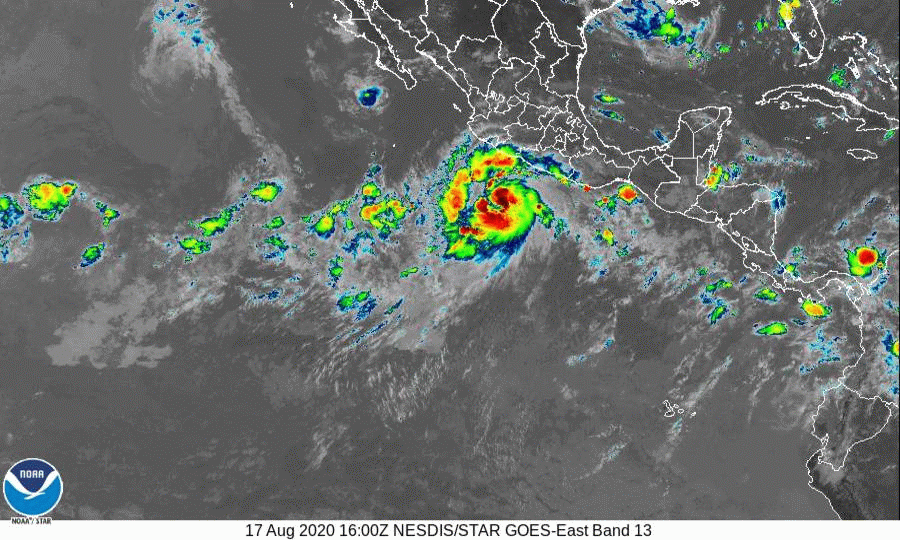
upper-level wind analyses. A 20-nmi-wide, cloud-filled eye has
appeared in infrared and visible satellite imagery during the past
few hours, indicating that Genevieve's wind field and vertical
structure has improved significantly since the previous advisory.
Subjective satellite intensity estimates are T5.0/90 kt from TAFB
and T4.5/77 kt from SAB, while objective estimates are T4.7/82 kt
from UW-CIMSS ADT and T5.1/92 kt from the NHC. An average of these
estimates supports an initial intensity of 85 kt.

Genevieve has remained a well-behaved hurricane and lies on the
previous advisory track, maintaining a motion of 300/15 kt. The
hurricane is expected to continue moving west-northwestward for the
next 12 hours or so while the cyclone skirts the southwestern
periphery of a broad deep-layer ridge. A slight motion shift toward
the northwest is forecast during the 24-48 hour period, bringing
Genevieve's outer wind field a little closer to Baja California Sur.
Thereafter, a motion back toward the west-northwest is forecast,
which will keep the center of the hurricane moving parallel to but
offshore the west coast of Baja California Sur. The new NHC forecast
track is essentially just an extension of the previous advisory
track, and lies down the middle of the tightly packed simple and
corrected-consensus models.

Genevieve is forecast to continue its rapid intensification phase
for the next 36 hours or so while the hurricane moves within an
extremely favorable environment characterized by low vertical wind
shear less than 5 kt, dual outflow channels, sea-surface
temperatures (SSTs) of 29-30C, and a very moist middle-troposphere.
By 48 hours, the hurricane will be moving over upper-ocean heat
content values of less than 5 units due to shallow warm ocean layer,
likely resulting in significant cold upwelling occurring. This
should initiate a gradual weakening trend, followed by rapid
weakening after 60 hours when Genevieve will be moving over sub-25
deg C water. By 120 hours, the hurricane is expected to degenerate
into a convection-free post-tropical cyclone over 21 deg C SSTs. The
NHC official intensity forecast remains near the the upper end of
the intensity guidance, and is similar to the previous advisory.

Key Messages:

1. There is an increasing risk of tropical-storm-force winds over
the southern portion of the Baja California peninsula beginning
Wednesday afternoon and continuing into Thursday as Genevieve passes
near or southwest of the southern tip of Baja California, and a
Tropical Storm Watch is in effect for a portion of this area.

2. Large swells generated by Genevieve are affecting portions of the
coast of southern Mexico and will spread northward along the coast
of Mexico to the Baja California peninsula by Wednesday.


FORECAST POSITIONS AND MAX WINDS

INIT 18/0300Z 16.5N 106.0W 85 KT 100 MPH
12H 18/1200Z 17.5N 107.5W 100 KT 115 MPH
24H 19/0000Z 18.9N 109.3W 115 KT 130 MPH
36H 19/1200Z 20.1N 110.5W 120 KT 140 MPH
48H 20/0000Z 21.2N 111.4W 115 KT 130 MPH
60H 20/1200Z 22.3N 112.5W 100 KT 115 MPH
72H 21/0000Z 23.3N 113.8W 85 KT 100 MPH
96H 22/0000Z 25.4N 117.0W 60 KT 70 MPH
120H 23/0000Z 27.9N 120.5W 40 KT 45 MPH...POST-TROPICAL

$$
Forecaster Stewart
0 likes   
Visit the Caribbean-Central America Weather Thread where you can find at first post web cams,radars
and observations from Caribbean basin members Click Here

User avatar
Highteeld
Category 5
Category 5
Posts: 2097
Age: 40
Joined: Tue Jan 30, 2018 9:10 pm
Location: Chicago

Re: EPAC: GENEVIEVE - Hurricane

#159 Postby Highteeld » Mon Aug 17, 2020 9:50 pm

Looking much more organized, tops colder

Image
2 likes   
Very useful information on the Dvorak Technique --

https://severe.worldweather.wmo.int/TCF ... kBeven.pdf

User avatar
toad strangler
S2K Supporter
S2K Supporter
Posts: 4178
Joined: Sun Jul 28, 2013 3:09 pm
Location: Earth
Contact:

Re: EPAC: GENEVIEVE - Hurricane

#160 Postby toad strangler » Mon Aug 17, 2020 10:03 pm

Last edited by toad strangler on Mon Aug 17, 2020 10:04 pm, edited 1 time in total.
3 likes   


Return to “2020”

Who is online

Users browsing this forum: No registered users and 2 guests