
From the 11:36am WPC Discussion:
... A cold front is expected to be off the Eastern Seaboard
on day 3 (Wed), with the trailing end of the front extending from
the Florida Panhandle/northern Peninsula to South Texas. Models
show consensus that this front should slow or occasionally stall
as a few waves of low pressure move along it through late in the
week, very slowly moving the front further south/east, with the
trailing portion of the boundary gradually washing out.
ATL: THREE - Remnants - Discussion
Moderator: S2k Moderators
Re: ATL: INVEST 94L - Discussion
3 likes
-
floridasun78
- Category 5

- Posts: 3755
- Joined: Sun May 17, 2009 10:16 pm
- Location: miami fl
Re: ATL: INVEST 94L - Discussion
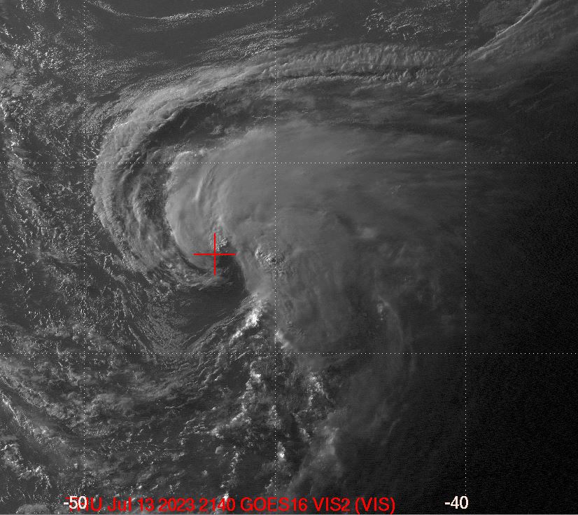
it look running out time almost over Bahamas all storms are east of center look shear and bit dry air
0 likes
-
AutoPenalti
- Category 5
- Posts: 4091
- Age: 29
- Joined: Mon Aug 17, 2015 4:16 pm
- Location: Ft. Lauderdale, Florida
Re: ATL: INVEST 94L - Discussion
Looks to be slowing down a bit, trying to wrap convection around the LLC.
1 likes
The posts in this forum are NOT official forecasts and should not be used as such. They are just the opinion of the poster and may or may not be backed by sound meteorological data. They are NOT endorsed by any professional institution or STORM2K. For official information, please refer to products from the NHC and NWS.
Model Runs Cheat Sheet:
GFS (5:30 AM/PM, 11:30 AM/PM)
HWRF, GFDL, UKMET, NAVGEM (6:30-8:00 AM/PM, 12:30-2:00 AM/PM)
ECMWF (1:45 AM/PM)
TCVN is a weighted averaged
-
Aric Dunn
- Category 5
- Posts: 21238
- Age: 43
- Joined: Sun Sep 19, 2004 9:58 pm
- Location: Ready for the Chase.
- Contact:
Re: ATL: INVEST 94L - Discussion
AutoPenalti wrote:Looks to be slowing down a bit, trying to wrap convection around the LLC.
looking at everything. at least what I can find. things are moistening up. IF there is enough convergence they eventually it will reach saturation and then off we go.. next 24 hours will tell all.
1 likes
Note: If I make a post that is brief. Please refer back to previous posts for the analysis or reasoning. I do not re-write/qoute what my initial post said each time.
If there is nothing before... then just ask
Space & Atmospheric Physicist, Embry-Riddle Aeronautical University,
I believe the sky is falling...
If there is nothing before... then just ask
Space & Atmospheric Physicist, Embry-Riddle Aeronautical University,
I believe the sky is falling...

Re: ATL: INVEST 94L
CyclonicFury wrote:This came out of nowhere. It doesn't appear to have any model support.
Well, at least one model (the one many like to ridicule) sniffed it out:
viewtopic.php?p=2749700#p2749700
4 likes
-
northjaxpro

- S2K Supporter

- Posts: 8900
- Joined: Mon Sep 27, 2010 11:21 am
- Location: Jacksonville, FL
Re: ATL: INVEST 94L - Discussion
Last edited by northjaxpro on Sun Jul 21, 2019 3:34 pm, edited 1 time in total.
2 likes
NEVER, EVER SAY NEVER in the tropics and weather in general, and most importantly, with life itself!!
________________________________________________________________________________________
Fay 2008 Beryl 2012 Debby 2012 Colin 2016 Hermine 2016 Julia 2016 Matthew 2016 Irma 2017 Dorian 2019
________________________________________________________________________________________
Fay 2008 Beryl 2012 Debby 2012 Colin 2016 Hermine 2016 Julia 2016 Matthew 2016 Irma 2017 Dorian 2019
-
Aric Dunn
- Category 5
- Posts: 21238
- Age: 43
- Joined: Sun Sep 19, 2004 9:58 pm
- Location: Ready for the Chase.
- Contact:
Re: ATL: INVEST 94L - Discussion
northjaxpro wrote::uarrow: Possibly. We will know more about this potentially slowing down in a few more hours..Convection could begin to fire up again as the LLC trverses over the Central Bahamas tonight. I think if we see this happen, then game.on folks!
yeah it is coming to the turning point, the edge of the ridge which extends into the eastern gulf at the moment. in the next 24 hrs so slowing down is inevitable.
0 likes
Note: If I make a post that is brief. Please refer back to previous posts for the analysis or reasoning. I do not re-write/qoute what my initial post said each time.
If there is nothing before... then just ask
Space & Atmospheric Physicist, Embry-Riddle Aeronautical University,
I believe the sky is falling...
If there is nothing before... then just ask
Space & Atmospheric Physicist, Embry-Riddle Aeronautical University,
I believe the sky is falling...
-
AutoPenalti
- Category 5
- Posts: 4091
- Age: 29
- Joined: Mon Aug 17, 2015 4:16 pm
- Location: Ft. Lauderdale, Florida
Re: ATL: INVEST 94L - Discussion
Convection trying to fire again, it’s been mainly skeletal throughout the day. Maybe as we approach DMAX we’ll see some popcorn convection.
0 likes
The posts in this forum are NOT official forecasts and should not be used as such. They are just the opinion of the poster and may or may not be backed by sound meteorological data. They are NOT endorsed by any professional institution or STORM2K. For official information, please refer to products from the NHC and NWS.
Model Runs Cheat Sheet:
GFS (5:30 AM/PM, 11:30 AM/PM)
HWRF, GFDL, UKMET, NAVGEM (6:30-8:00 AM/PM, 12:30-2:00 AM/PM)
ECMWF (1:45 AM/PM)
TCVN is a weighted averaged
-
wxman57

- Moderator-Pro Met

- Posts: 23178
- Age: 68
- Joined: Sat Jun 21, 2003 8:06 pm
- Location: Houston, TX (southwest)
Re: ATL: INVEST 94L - Discussion
No LLC. Not much of any wave axis, either. Development chances pretty low.
4 likes
-
Aric Dunn
- Category 5
- Posts: 21238
- Age: 43
- Joined: Sun Sep 19, 2004 9:58 pm
- Location: Ready for the Chase.
- Contact:
Re: ATL: INVEST 94L - Discussion
wxman57 wrote:No LLC. Not much of any wave axis, either. Development chances pretty low.
http://wxman57.com/images/94La.JPG
Your surface obs are far east of the very sharp wave axis and nearly closed circ. would not take much to close it off. once it slows down assuming the environment is indeed becoming more moist then seeing this try to make a run is quite possible.
from earlier of course. but the overall structure has maintained or slightly improved since.

6 likes
Note: If I make a post that is brief. Please refer back to previous posts for the analysis or reasoning. I do not re-write/qoute what my initial post said each time.
If there is nothing before... then just ask
Space & Atmospheric Physicist, Embry-Riddle Aeronautical University,
I believe the sky is falling...
If there is nothing before... then just ask
Space & Atmospheric Physicist, Embry-Riddle Aeronautical University,
I believe the sky is falling...
-
Hurricane Jed

- Category 2

- Posts: 546
- Age: 38
- Joined: Mon Jan 24, 2011 3:36 pm
- Location: Cen Tex
Re: ATL: INVEST 94L - Discussion
wxman57 wrote:No LLC. Not much of any wave axis, either. Development chances pretty low.
http://wxman57.com/images/94La.JPG
We can’t discount it either
1 likes
-
HURRICANELONNY
- Category 5
- Posts: 1392
- Joined: Wed May 07, 2003 6:48 am
- Location: HOLLYWOOD.FL
Re: ATL: INVEST 94L - Discussion
What makes me laugh. Is the local mets are using a cone like it's a storm. The path right through Florida. Ratings must be down. 
1 likes
hurricanelonny


Re: ATL: INVEST 94L - Discussion
Shear from the west keeps all the popcorn convection from building over the lowest surface pressure.
If the shear lightens up it might make depression status near south Florida but NHC hasn't given it much chance in the short term.
If the shear lightens up it might make depression status near south Florida but NHC hasn't given it much chance in the short term.
1 likes
-
Aric Dunn
- Category 5
- Posts: 21238
- Age: 43
- Joined: Sun Sep 19, 2004 9:58 pm
- Location: Ready for the Chase.
- Contact:
Re: ATL: INVEST 94L - Discussion
well at least it will be in radar range by morning...
1 likes
Note: If I make a post that is brief. Please refer back to previous posts for the analysis or reasoning. I do not re-write/qoute what my initial post said each time.
If there is nothing before... then just ask
Space & Atmospheric Physicist, Embry-Riddle Aeronautical University,
I believe the sky is falling...
If there is nothing before... then just ask
Space & Atmospheric Physicist, Embry-Riddle Aeronautical University,
I believe the sky is falling...
Re: ATL: INVEST 94L - Discussion
Not optimistic on this one. The NHC's 1 in five shot seems plenty generous.. but it is a reminder that August is coming.
0 likes
-
tolakram
- Admin

- Posts: 20189
- Age: 62
- Joined: Sun Aug 27, 2006 8:23 pm
- Location: Florence, KY (name is Mark)
Re: ATL: INVEST 94L - Discussion
0 likes
M a r k
- - - - -
Join us in chat: Storm2K Chatroom Invite. Android and IOS apps also available.
The posts in this forum are NOT official forecasts and should not be used as such. Posts are NOT endorsed by any professional institution or STORM2K.org. For official information and forecasts, please refer to NHC and NWS products.
-
cycloneye

- Admin
- Posts: 149843
- Age: 69
- Joined: Thu Oct 10, 2002 10:54 am
- Location: San Juan, Puerto Rico
Re: ATL: INVEST 94L - Discussion
Down to 10% in 5 days.
Tropical Weather Outlook
NWS National Hurricane Center Miami FL
800 PM EDT Sun Jul 21 2019
For the North Atlantic...Caribbean Sea and the Gulf of Mexico:
A trough of low pressure over the Central Bahamas is producing
disorganized showers and thunderstorms. Environmental
conditions are likely to be unfavorable for significant
development during the next couple of days while the trough moves
westward to west-northwestward at around 15 mph. Development is not
anticipated after that time due to strong upper-level winds.
* Formation chance through 48 hours...low...10 percent.
* Formation chance through 5 days...low...10 percent.
Forecaster Blake
1 likes
Visit the Caribbean-Central America Weather Thread where you can find at first post web cams,radars
and observations from Caribbean basin members Click Here
and observations from Caribbean basin members Click Here

Re: ATL: INVEST 94L - Discussion
I think 94L gets deactivated by tomorrow it looks like crap right now.
1 likes
-
floridasun78
- Category 5
- Posts: 3755
- Joined: Sun May 17, 2009 10:16 pm
- Location: miami fl
Re: ATL: INVEST 94L - Discussion
aric dunn too next invest this one done i know chance were very low dryair now shear going finish it only thing we may get here rainy day if dont die out
0 likes
Who is online
Users browsing this forum: No registered users and 32 guests