CrazyC83 wrote:Highteeld wrote:https://i.imgur.com/8NmetPO.png
I'm wondering if we will go sub-900 when Recon gets back? It looks to be only stronger now.
My guess is somewhere near 900mb. Winds could be slightly higher or stay the same
Moderator: S2k Moderators

CrazyC83 wrote:Highteeld wrote:https://i.imgur.com/8NmetPO.png
I'm wondering if we will go sub-900 when Recon gets back? It looks to be only stronger now.

BobHarlem wrote:From looking at long term radar loops, showing it bouncing around a little .. http://flhurricane.com/imageanimator.php?467
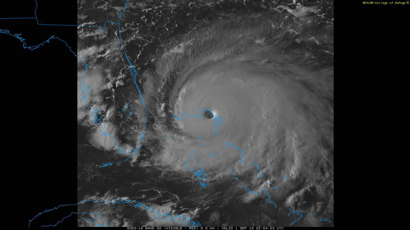
sikkar wrote:Just unbelievable IR presentation and symmetry for so long now. Those waters are pure high octane fuel.
GCANE wrote:UL HIgh now positioned over NE GOM
Some afternoon popups over west FL eroding this a bit.
Steering not as strong as compared 6 hrs ago.
Expect popups to rain out shortly.
Diurnal cooling should build the UL High back up overnight.
Not seeing the trough doing much with this.
https://i.imgur.com/JgHqZYz.png
https://i.imgur.com/Fu4fwXU.gif
https://i.imgur.com/xt4H539.png


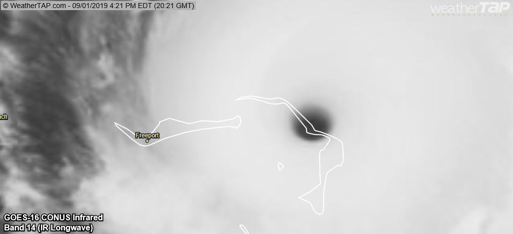
supercane4867 wrote:It better start turning NW or Freeport(population 50K) is going to be doomed
https://uploads.disquscdn.com/images/50d115e4d86084f4f0a4e34f487f2d931dd010989067134bcb6a4459f3100ef2.gif


Blown Away wrote:DestinHurricane wrote:If it wobbles WSW anytime soon then it could bounce off the south coast of Grand Bahama and cause it to go into or get closer to Florida. Just a thought.
https://i.imgur.com/EYBSQRb.gif
A hair S of due west motion is happening...

supercane4867 wrote:It better start turning NW or Freeport(population 50K) is going to be doomed
https://uploads.disquscdn.com/images/50d115e4d86084f4f0a4e34f487f2d931dd010989067134bcb6a4459f3100ef2.gif
Michele B wrote:mutley wrote:Just out of curiosity. Does anyone truly believe that Dorian is not going to make the turn, and go right into Florida's coast somewhere?
I’ll admit it. I’m skeptical.
Personally,’when I look at “trofs” and “ridges” I don’t see a big dip that looks like it’s going to pick this thing up.

KWT wrote:sikkar wrote:Just unbelievable IR presentation and symmetry for so long now. Those waters are pure high octane fuel.
Its crazy, because there have been some really outstanding looking hurricanes in the last few years, especially Irma and Michael, but this one maybe the best out of all of them, maybe tied with Irma.
I was going to go to bed as its 11.20pm here, but I think I will stay up for this first round of recon...

Users browsing this forum: No registered users and 21 guests


