

ATL: DORIAN - Models
Moderator: S2k Moderators
-
supercane4867
- Category 5

- Posts: 4966
- Joined: Wed Nov 14, 2012 10:43 am


Re: ATL: DORIAN - Models
12z HWRF the Cape landfall. HMON and HWRF now show same landfall near the Cape.
https://www.tropicaltidbits.com/analysis/models/?model=hwrf®ion=05L&pkg=ref&runtime=2019090112&fh=54
https://www.tropicaltidbits.com/analysis/models/?model=hwrf®ion=05L&pkg=ref&runtime=2019090112&fh=54
0 likes
-
TheStormExpert
Re: ATL: DORIAN - Models
supercane4867 wrote:HRRR still not turning Dorian northward 36hrs out
https://i.imgur.com/LQz1V0p.png
I’m pretty sure it was this model that had Matthew three years ago coming ashore in SE or E-Central FL.
3 likes

Re: ATL: DORIAN - Models
supercane4867 wrote:HRRR still not turning Dorian northward 36hrs out
https://i.imgur.com/LQz1V0p.png
I would not use HRRR for hurricane paths. It had Matthew barreling into South Florida at the same time that all the other models had it correctly going up near the coast.
2 likes
-
Hypercane_Kyle

- Category 5
- Posts: 3465
- Joined: Sat Mar 07, 2015 7:58 pm
- Location: Cape Canaveral, FL
Re: ATL: DORIAN - Models
Right over the two most historic launch pads in the world: Launch Complex 39A and B.
3 likes
My posts are my own personal opinion, defer to the National Hurricane Center (NHC) and other NOAA products for decision making during hurricane season.
Re: ATL: DORIAN - Models
THE HWRF nails New Smyrna in 63 hours then heads well west inland up to east of Lake City, FL midway to Jacksonville (30-35 nm west of Jax).
Pretty big shift west there folks.
Pretty big shift west there folks.
Last edited by BobHarlem on Sun Sep 01, 2019 12:35 pm, edited 2 times in total.
0 likes
-
tolakram
- Admin

- Posts: 20170
- Age: 62
- Joined: Sun Aug 27, 2006 8:23 pm
- Location: Florence, KY (name is Mark)
Re: ATL: DORIAN - Models
HMON and HWRF some of the worst for track, HMON takes the bad crown from NOGAPS. These are intensity models.

8 likes
M a r k
- - - - -
Join us in chat: Storm2K Chatroom Invite. Android and IOS apps also available.
The posts in this forum are NOT official forecasts and should not be used as such. Posts are NOT endorsed by any professional institution or STORM2K.org. For official information and forecasts, please refer to NHC and NWS products.

Re: ATL: DORIAN - Models
Just 30 hours ago it was off by a good 50 miles, when and where Dorian starts heading NNW will make a big difference, it will be now casting over the next 24-36 hours.

0 likes
Re: ATL: DORIAN - Models
BobHarlem wrote:THE HWRF nails New Smyrna in 63 hours then heads well west inland up to east of Lake City, FL midway to Jacksonville.
Pretty big shift west there folks.
Yes Bob big shift. Sensing a stronger ridge east of Dorian after the first short wave passes by?
0 likes
-
NCWeatherChic

- Tropical Storm

- Posts: 154
- Age: 54
- Joined: Wed Dec 03, 2003 2:49 pm
- Location: Benson, North Carolina
- Contact:
Re: ATL: DORIAN - Models
tolakram wrote:kevin wrote:Does anyone have a comparison between what models predicted f.e. 24 hours ago, versus where Dorian actually is right now?
On this page, the trends box: http://www.atmos.albany.edu/facstaff/tang/tcguidance/al052019/
Wow great post! This actually helps to put things in perspective.
Examples:
GFS
https://i.imgur.com/zoBLOmq.png
Euro
https://i.imgur.com/x6KwCdh.png
Canadian
https://i.imgur.com/a8zsS5e.png
UKMET
https://i.imgur.com/bkNOrlF.png
1 likes
Re: ATL: DORIAN - Models
12z GEFS: mean is the furthest east of at least the last 4 runs off FL and GA. Near most of SC not much change and maybe a tad closer upper SC/NC.
3 likes
Personal Forecast Disclaimer:
The posts in this forum are NOT official forecasts and should not be used as such. They are just the opinion of the poster and may or may not be backed by sound meteorological data. They are NOT endorsed by any professional institution or storm2k.org. For official information, please refer to the NHC and NWS products.
The posts in this forum are NOT official forecasts and should not be used as such. They are just the opinion of the poster and may or may not be backed by sound meteorological data. They are NOT endorsed by any professional institution or storm2k.org. For official information, please refer to the NHC and NWS products.
-
SEASON_CANCELED

- Category 3

- Posts: 887
- Joined: Mon Jul 06, 2009 5:17 am
- Location: 8 Bit Charlie Sheen
Re: ATL: DORIAN - Models
b0tzy29 wrote:This thing is still moving at 8mph due west... I'm not met but when is this thing supposed to slow down again?
https://media.giphy.com/media/lRjf9bkBOfBt3Jl4BQ/source.gif
Any minute now literally.
The northerly component i thought i saw was clearly not the case ...its still heading west
1 likes
i am a big stupid ugly moron with an ugly face and a big butt and my butt stinks and i like to kiss my own butt
-
ConvergenceZone
.gif)
- Category 5
- Posts: 5241
- Joined: Fri Jul 29, 2005 1:40 am
- Location: Northern California
Re: ATL: DORIAN - Models
Any predictions on the EURO that's about to run? I predict it stays about the same. Not shift east or west....
3 likes

Re: ATL: DORIAN - Models
ConvergenceZone wrote:Any predictions on the EURO that's about to run? I predict it stays about the same. Not shift east or west....
predictions sure to go wrong...
south at 24 hours, less of a stall, brushes Cape and slams into Charleston
1 likes
Just like Jon Snow..."I know nothing" except what I know, and most of what I know is gathered by the fine people of the NHC

Re: ATL: DORIAN - Models
tpinnola wrote:Understandably the focus should be on the Bahamas, Florida, Georgia, Carolinas, etc... but this would be a pretty big deal for us coastal New England folks.
https://i.ibb.co/yYp3sYq/Capture.png
I think you need to change the wording from "would" to "could"
0 likes
Personal Forecast Disclaimer:
The posts in this forum are NOT official forecast and should not be used as such. They are just the opinion of the poster and may or may not be backed by sound meteorological data. They are NOT endorsed by any professional institution or storm2k.org. For official information, please refer to the NHC and NWS products.
The posts in this forum are NOT official forecast and should not be used as such. They are just the opinion of the poster and may or may not be backed by sound meteorological data. They are NOT endorsed by any professional institution or storm2k.org. For official information, please refer to the NHC and NWS products.
Re: ATL: DORIAN - Models
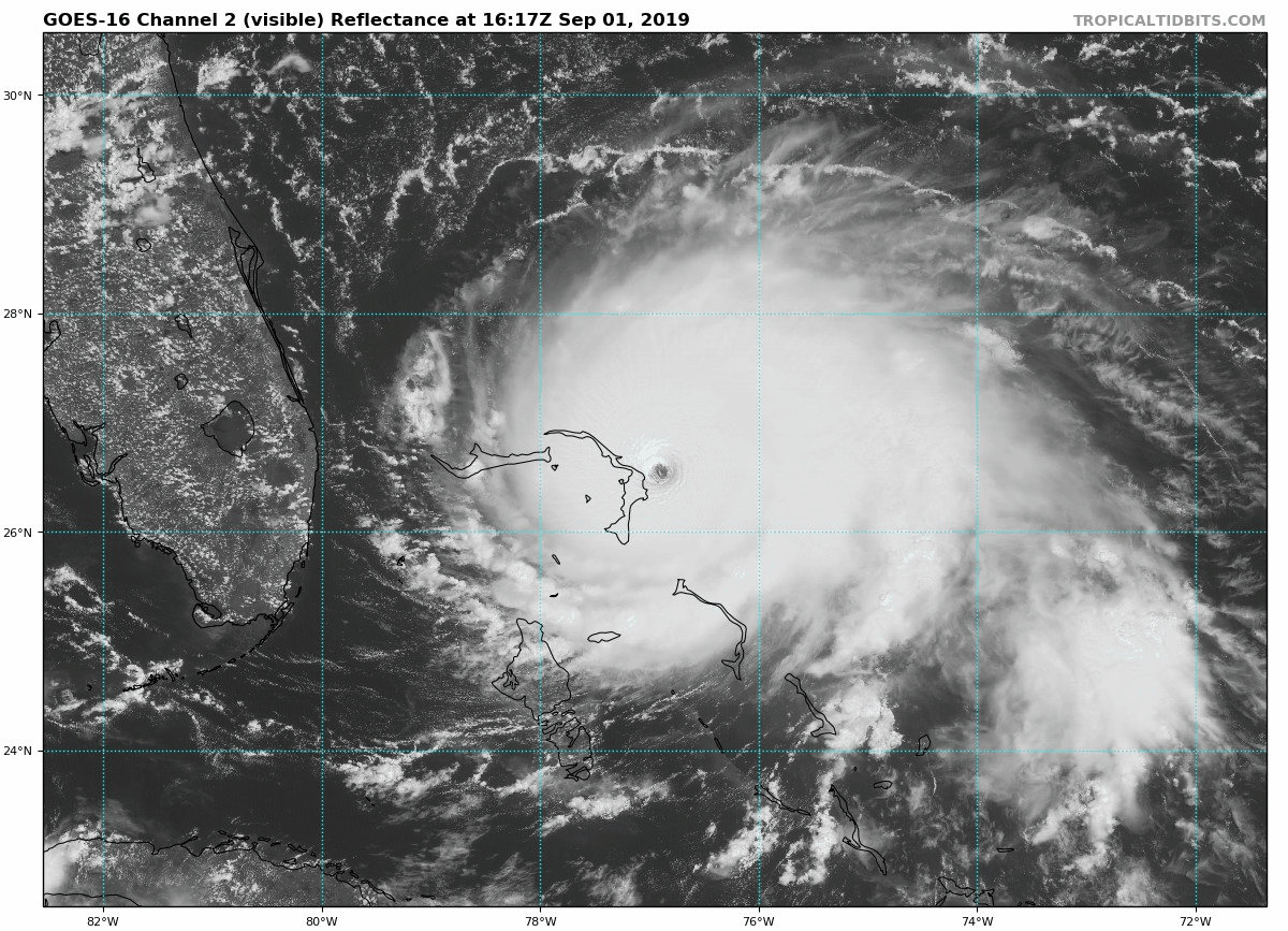
Looking at the 18Z position on the main 12Z dynamic model runs, the actual position (we're almost at 18Z now) is pretty much dead-on it appears to me. Any other opinions?
4 likes
Personal Forecast Disclaimer:
The posts in this forum are NOT official forecasts and should not be used as such. They are just the opinion of the poster and may or may not be backed by sound meteorological data. They are NOT endorsed by any professional institution or storm2k.org. For official information, please refer to the NHC and NWS products.
The posts in this forum are NOT official forecasts and should not be used as such. They are just the opinion of the poster and may or may not be backed by sound meteorological data. They are NOT endorsed by any professional institution or storm2k.org. For official information, please refer to the NHC and NWS products.
-
tolakram
- Admin
- Posts: 20170
- Age: 62
- Joined: Sun Aug 27, 2006 8:23 pm
- Location: Florence, KY (name is Mark)
Re: ATL: DORIAN - Models
Euro 12z init

0 likes
M a r k
- - - - -
Join us in chat: Storm2K Chatroom Invite. Android and IOS apps also available.
The posts in this forum are NOT official forecasts and should not be used as such. Posts are NOT endorsed by any professional institution or STORM2K.org. For official information and forecasts, please refer to NHC and NWS products.
- - - - -
Join us in chat: Storm2K Chatroom Invite. Android and IOS apps also available.
The posts in this forum are NOT official forecasts and should not be used as such. Posts are NOT endorsed by any professional institution or STORM2K.org. For official information and forecasts, please refer to NHC and NWS products.
-
Blown Away

- S2K Supporter

- Posts: 10253
- Joined: Wed May 26, 2004 6:17 am
Re: ATL: DORIAN - Models

12z Euro Initialized... High Pressure Trend...
6 likes
Hurricane Eye Experience: David 79, Irene 99, Frances 04, Jeanne 04, Wilma 05… Hurricane Brush Experience: Andrew 92, Erin 95, Floyd 99, Matthew 16, Irma 17, Ian 22, Nicole 22…
Who is online
Users browsing this forum: No registered users and 57 guests