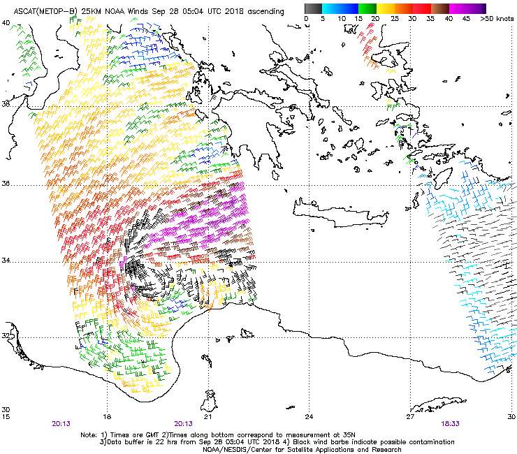
According to the new ESTOFEX Mesoscale discussion, this system is already very close to hurricane strength. 10-minute sustained winds of 55 kt equate to 63 kt 1-minute winds. Also note the forecast peak intensity has been increased to 986 mb/68 kt which would be near the upper end of Category 1.
Mesoscale Discussion
Valid: Fri 28 Sep 2018 09:00 to Fri 28 Sep 2018 21:00 UTC
Issued: Fri 28 Sep 2018 09:01
Forecaster: ESTOFEX
This is a Mesoscale Discussions issued for a cyclone that is primarily driven by convection, issued twice daily before 9, and 21 UTC until the cyclone dissipates or becomes extratropical. This Mesocale Discussion is not an official producat and does not substitute any warnings from National Meteorological Services. We welcome any feedback at
inflow@estofex.org.
System: 2018M02
At 28 SEP 0600UTC the storm centre was located near 34.8N and 18.7E
Estimated minimum pressure: 995 mb.
Maximum sustained winds: 28 m/s (55 kt, 100 km/h).
Maximum gusts: 35 m/s (70 kt, 125 km/h).
ANALYSIS
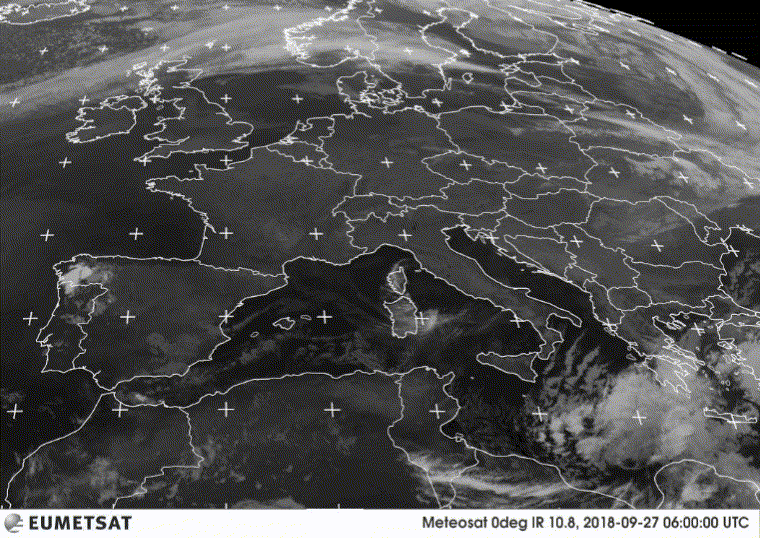
Overnight, the cyclone has organized and deepened, while drifting northward. Cloud bands are spiralling around the intensified vortex, although a tight inner circulation has not (yet) developed. A subjective Hebert-Poteat technique estimate yields T numbers between 3.0 and 3.5 at 06 UTC, supporting a minimum pressure of near 995 mb and maximum sustained winds near 28 m/s.
FORECAST
Models are in agreement that the cyclone should move only very slowly during the next 12 hours, before accelerating east-northeastward towards the Peloponnese, as an upper left trough approaches from the northwest. The greastest uncertainty in the forecast is the extent of interaction with the mountainous region of the Peloponnese: ICON and UKMO predicting the greatest interaction and strongest weakening, whereas ECMWF and ARPEGE continue feature a more southerly track with less influence on the inner core. The new track and intensity forecast are a blend of these different solutions. The track has been adjusted slightly to the south, and is quicker after 36 hours. The forecast takes the cyclone into Northwestern Anatolia on Sunday evening, upon which the cyclone will weaken rapidly.
The cyclone is predicted to intensify somewhat more prior to landfall the Peloponnese as suggsted by UKMO and ARPEGE, before moderate weakening occurs. As said, the intensity forecast after 36 hours is strongly dependent on the level of interaction with terrain and therefore rather uncertain.
The primary hazard of the cyclone is expected to be very heavy precipitation. Amounts of 200-300 mm can be expected on Saturday and Sunday across the Peloponnese, 125-250 mm over Attica, Eastern Central Greece (including Euboia) and the Cyclades, and 50–125 mm over southern Crete, Western Anatolia, the North Aegean Islands and Dodecanese Islands. In addition, isolated hurricane force winds and widespread hurricane force gusts will likely affect the southern Peloponnese coasts and the Cyclades.
Forecast:
FH DATE & TIME LOCATION PRESSURE WIND MAX.GUSTS
00 28SEP 0600 UTC 34.8N 18.7E 995 mb 28 m/s 35 m/s
12 28SEP 1800 UTC 35.2N 18.6E 991 mb 30 m/s 40 m/s
24 29SEP 0600 UTC 35.9N 20.8E 986 mb 35 m/s 45 m/s
36 29SEP 1800 UTC 36.7N 23.1E 992 mb 30 m/s 40 m/s NEAR COAST
48 30SEP 0600 UTC 37.7N 25.0E 997 mb 30 m/s 40 m/s
60 30SEP 1800 UTC 39.0N 26.7E 999 mb 25 m/s 30 m/s AT COAST
72 01OCT 0600 UTC 38.8N 27.2E 1002 mb 20 m/s 25 m/s INLAND


