ATL: BRET - Remnants - Discussion

Moderator: S2k Moderators

Message
Author
User avatar
Hammy
Category 5
Category 5
Posts: 5595
Age: 40
Joined: Fri May 25, 2012 5:25 pm
Contact:

Re: ATL: TWO - Potential Tropical Cyclone - Discussion

#481 Postby Hammy » Mon Jun 19, 2017 2:40 pm

RL3AO wrote:
Hammy wrote:I will say this is turning out to be terrible policy from a scientific standpoint--we're going to have storms that are actual tropical cyclones end up not going in the records now, rather than just following prior policy and declaring them sooner, and this is going to be the first.


No it's not. Warnings have been issued in a timely manner for locations that will be impacted by TS conditions tomorrow. In the only system, there would currently be no warnings until now at the earliest. I know you like to play the game where everything is wrong, but you are wrong about this.


I didn't say they should wait to issue warnings--I said that before they would declare a system earlier in order to have the warnings issued.
Last edited by Hammy on Mon Jun 19, 2017 2:48 pm, edited 1 time in total.
0 likes   
The above post is not official and should not be used as such. It is the opinion of the poster and may or may not be backed by sound meteorological data. It is not endorsed by any professional institution or storm2k.org. For official information, please refer to the NHC and NWS products.

Aric Dunn
Category 5
Category 5
Posts: 21228
Age: 41
Joined: Sun Sep 19, 2004 9:58 pm
Location: Ready for the Chase.
Contact:

Re: ATL: TWO - Potential Tropical Cyclone - Discussion

#482 Postby Aric Dunn » Mon Jun 19, 2017 2:42 pm

like I was saying they need to go farther north and west.. the are still a tad to far south..

center is much more defined .. that area to the south is like the doldrums.. lol
1 likes   
Note: If I make a post that is brief. Please refer back to previous posts for the analysis or reasoning. I do not re-write/qoute what my initial post said each time.
If there is nothing before... then just ask :)

Space & Atmospheric Physicist, Embry-Riddle Aeronautical University,
I believe the sky is falling...

RL3AO
Moderator-Pro Met
Moderator-Pro Met
Posts: 16308
Joined: Thu Jun 14, 2007 10:03 pm
Location: NC

Re: ATL: TWO - Potential Tropical Cyclone - Discussion

#483 Postby RL3AO » Mon Jun 19, 2017 2:43 pm

If you want to split this off into a new thread in talking tropics, then we can.

The new policy allows two things:
1) It allows watches and warnings to be issued in a timely manner
AND
2) It allows the NHC to wait until it is clearly a tropical cyclone to call it one

They no longer have to play the game of "upgrading it to start warnings even though it's not actually a storm yet".

I don't see how anyone can have any complaints about it.
6 likes   

User avatar
cainjamin
Tropical Storm
Tropical Storm
Posts: 165
Age: 33
Joined: Mon Apr 17, 2017 1:38 pm
Location: Nova Scotia, Canada

Re: ATL: TWO - Potential Tropical Cyclone - Discussion

#484 Postby cainjamin » Mon Jun 19, 2017 2:45 pm

Image

This last pass looks pretty good. Definitely looks like it's tightening up.
1 likes   
Noel '07, Kyle '08, Earl '10, Arthur '14, Dorian '19, Teddy '20, Lee '23

CrazyC83
Professional-Met
Professional-Met
Posts: 33399
Joined: Tue Mar 07, 2006 11:57 pm
Location: Deep South, for the first time!

Re: ATL: Potential Tropical Cyclone TWO - Recon

#485 Postby CrazyC83 » Mon Jun 19, 2017 2:46 pm

000
URNT15 KNHC 191928
AF300 0102A INVEST HDOB 33 20170619
191800 0852N 06011W 9772 00288 //// +211 //// 014010 011 032 003 05
191830 0854N 06011W 9770 00285 0097 +210 //// 028011 013 036 003 01
191900 0855N 06011W 9771 00279 0093 +210 //// 047013 017 051 031 05
191930 0857N 06011W 9763 00287 0095 +212 +212 059011 012 045 027 00
192000 0859N 06011W 9772 00281 0097 +213 +213 043010 011 037 020 00
192030 0901N 06011W 9772 00280 0097 +207 //// 032010 013 041 016 01
192100 0901N 06011W 9772 00280 0097 +215 //// 021009 013 030 006 01
192130 0904N 06011W 9767 00287 //// +215 //// 036009 009 026 001 01
192200 0906N 06011W 9771 00284 //// +217 //// 042010 011 024 000 01
192230 0908N 06011W 9771 00281 //// +214 //// 049013 016 024 000 01
192300 0910N 06011W 9770 00282 //// +216 //// 039015 016 020 002 05
192330 0912N 06011W 9774 00280 0092 +228 +214 041014 015 015 003 03
192400 0912N 06009W 9770 00285 0092 +225 +217 018014 015 020 001 03
192430 0912N 06007W 9770 00281 0089 +225 +218 011013 014 020 001 00
192500 0912N 06005W 9770 00277 0090 +221 +217 002014 014 019 001 00
192530 0912N 06003W 9771 00287 0097 +219 //// 353012 014 020 000 01
192600 0912N 06001W 9772 00286 //// +217 //// 354011 012 022 001 01
192630 0912N 05959W 9770 00286 //// +218 //// 355011 012 023 002 01
192700 0912N 05957W 9770 00285 0094 +221 +219 345011 012 023 001 03
192730 0912N 05955W 9772 00282 //// +220 //// 331012 012 023 000 05
$$
;
0 likes   

User avatar
Hammy
Category 5
Category 5
Posts: 5595
Age: 40
Joined: Fri May 25, 2012 5:25 pm
Contact:

Re: ATL: TWO - Potential Tropical Cyclone - Discussion

#486 Postby Hammy » Mon Jun 19, 2017 2:46 pm

RL3AO wrote:If you want to split this off into a new thread in talking tropics, then we can.

The new policy allows two things:
1) It allows watches and warnings to be issued in a timely manner
AND
2) It allows the NHC to wait until it is clearly a tropical cyclone to call it one

They no longer have to play the game of "upgrading it to start warnings even though it's not actually a storm yet".

I don't see how anyone can have any complaints about it.


That would probably work, I just needed to air my take on this (and this seemed the place to do it at the moment.)
0 likes   
The above post is not official and should not be used as such. It is the opinion of the poster and may or may not be backed by sound meteorological data. It is not endorsed by any professional institution or storm2k.org. For official information, please refer to the NHC and NWS products.

User avatar
SouthDadeFish
Professional-Met
Professional-Met
Posts: 2835
Joined: Thu Sep 23, 2010 2:54 pm
Location: Miami, FL
Contact:

Re: ATL: TWO - Potential Tropical Cyclone - Discussion

#487 Postby SouthDadeFish » Mon Jun 19, 2017 2:47 pm

Hammy wrote:I will say this is turning out to be terrible policy from a scientific standpoint--we're going to have storms that are actual tropical cyclones end up not going in the records now, rather than just following prior policy and declaring them sooner, and this is going to be the first. Just adds yet another inconsistency to the standards.


I don't think this is true. Even if the real-time declaration of a TC changes, the NHC frequently tweaks the genesis time and intensities of best track positions in post-season analysis. Ultimately, it is the finalized best track entries that are used by scientific studies. I don't see how the potential tropical cyclone designation idea changes the science at all. Instead, it acts to raise public awareness and helps get the proper watches and warnings issued.
Last edited by SouthDadeFish on Mon Jun 19, 2017 2:48 pm, edited 1 time in total.
5 likes   

User avatar
Hammy
Category 5
Category 5
Posts: 5595
Age: 40
Joined: Fri May 25, 2012 5:25 pm
Contact:

Re: ATL: TWO - Potential Tropical Cyclone - Discussion

#488 Postby Hammy » Mon Jun 19, 2017 2:48 pm

cainjamin wrote:Image

This last pass looks pretty good. Definitely looks like it's tightening up.


This is one of the strangest flight paths I've seen--it seems similar to the Global Hawk path.
0 likes   
The above post is not official and should not be used as such. It is the opinion of the poster and may or may not be backed by sound meteorological data. It is not endorsed by any professional institution or storm2k.org. For official information, please refer to the NHC and NWS products.

RL3AO
Moderator-Pro Met
Moderator-Pro Met
Posts: 16308
Joined: Thu Jun 14, 2007 10:03 pm
Location: NC

Re: ATL: TWO - Potential Tropical Cyclone - Discussion

#489 Postby RL3AO » Mon Jun 19, 2017 2:49 pm

Hammy wrote:That would probably work, I just needed to air my take on this (and this seemed the place to do it at the moment.)


Created.

viewtopic.php?f=31&t=118785
1 likes   

User avatar
cainjamin
Tropical Storm
Tropical Storm
Posts: 165
Age: 33
Joined: Mon Apr 17, 2017 1:38 pm
Location: Nova Scotia, Canada

Re: ATL: TWO - Potential Tropical Cyclone - Discussion

#490 Postby cainjamin » Mon Jun 19, 2017 2:49 pm

Hammy wrote:
cainjamin wrote:
This last pass looks pretty good. Definitely looks like it's tightening up.


This is one of the strangest flight paths I've seen--it seems similar to the Global Hawk path.


Yeah not sure why they're not going for the typical SE to NW passes. Good thing I'm not the one flying the plane :wink:
0 likes   
Noel '07, Kyle '08, Earl '10, Arthur '14, Dorian '19, Teddy '20, Lee '23

CrazyC83
Professional-Met
Professional-Met
Posts: 33399
Joined: Tue Mar 07, 2006 11:57 pm
Location: Deep South, for the first time!

Re: ATL: Potential Tropical Cyclone TWO - Recon

#491 Postby CrazyC83 » Mon Jun 19, 2017 2:51 pm

URNT15 KNHC 191948
AF300 0102A INVEST HDOB 35 20170619
193800 0912N 05915W 9774 00282 0097 +222 +217 138019 019 028 006 00
193830 0912N 05913W 9767 00292 0098 +220 +219 143017 018 024 002 01
193900 0912N 05911W 9768 00291 0099 +220 +214 147018 018 024 001 03
193930 0912N 05909W 9772 00287 0099 +219 +212 144018 019 027 000 00
194000 0912N 05908W 9771 00288 0100 +220 +209 147017 018 027 000 00
194030 0912N 05906W 9766 00294 0101 +220 +204 143017 018 023 001 00
194100 0911N 05904W 9770 00288 0099 +224 +209 149017 018 023 001 00
194130 0911N 05902W 9772 00288 0100 +225 +198 144018 019 024 000 00
194200 0911N 05900W 9770 00291 0101 +229 +181 145020 020 022 001 00
194230 0911N 05858W 9772 00288 0099 +229 +178 146020 020 021 001 00
194300 0911N 05857W 9782 00279 0099 +225 +189 149017 020 017 003 03
194330 0909N 05856W 9761 00297 0099 +225 +192 135014 015 020 000 00
194400 0908N 05856W 9773 00286 0100 +228 +184 130015 015 020 002 03
194430 0906N 05857W 9772 00288 0100 +225 +183 127015 015 021 001 00
194500 0904N 05857W 9769 00291 0101 +225 +192 128014 015 019 001 00
194530 0902N 05857W 9771 00291 0102 +222 +199 129015 016 020 002 03
194600 0900N 05858W 9772 00290 0102 +221 +207 128016 016 021 001 00
194630 0858N 05858W 9771 00292 0102 +220 +211 125016 017 021 002 00
194700 0857N 05858W 9772 00291 0103 +220 +213 115016 016 021 001 03
194730 0855N 05900W 9772 00291 0103 +220 +216 117018 019 /// /// 03
$$
;
0 likes   

Aric Dunn
Category 5
Category 5
Posts: 21228
Age: 41
Joined: Sun Sep 19, 2004 9:58 pm
Location: Ready for the Chase.
Contact:

Re: ATL: TWO - Potential Tropical Cyclone - Discussion

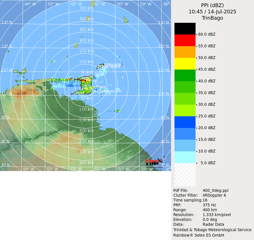
#492 Postby Aric Dunn » Mon Jun 19, 2017 2:52 pm

even though they slightly missed the center to the south on that .. its does match up with the middle circ been tracking all better then I thought.. its become better defined on radar too.

Image
Last edited by Aric Dunn on Mon Jun 19, 2017 2:54 pm, edited 1 time in total.
0 likes   
Note: If I make a post that is brief. Please refer back to previous posts for the analysis or reasoning. I do not re-write/qoute what my initial post said each time.
If there is nothing before... then just ask :)

Space & Atmospheric Physicist, Embry-Riddle Aeronautical University,
I believe the sky is falling...

User avatar
SouthDadeFish
Professional-Met
Professional-Met
Posts: 2835
Joined: Thu Sep 23, 2010 2:54 pm
Location: Miami, FL
Contact:

Re: ATL: TWO - Potential Tropical Cyclone - Discussion

#493 Postby SouthDadeFish » Mon Jun 19, 2017 2:54 pm

The current "lawn-mower" flight path is not uncommon in missions into TC invests. The alpha/figure-4 pattern is what is used for TCs that are already developed to help identify maximum wind radii. For the purposes of this aircraft reconnaissance mission, they are trying to identify if a closed circulation center exists near the surface. Thus, you see their low flight altitude in addition to a flight path focused near the presumed center of circulation. By continuously flying near the presumed center, the mission is better able to identify the organization of a possible surface center.
4 likes   

User avatar
Hammy
Category 5
Category 5
Posts: 5595
Age: 40
Joined: Fri May 25, 2012 5:25 pm
Contact:

Re: ATL: TWO - Potential Tropical Cyclone - Discussion

#494 Postby Hammy » Mon Jun 19, 2017 2:56 pm

I'm guessing they determined it's closed? It looks like they may be going back down to start a south-north pass.
0 likes   
The above post is not official and should not be used as such. It is the opinion of the poster and may or may not be backed by sound meteorological data. It is not endorsed by any professional institution or storm2k.org. For official information, please refer to the NHC and NWS products.

Aric Dunn
Category 5
Category 5
Posts: 21228
Age: 41
Joined: Sun Sep 19, 2004 9:58 pm
Location: Ready for the Chase.
Contact:

Re: ATL: TWO - Potential Tropical Cyclone - Discussion

#495 Postby Aric Dunn » Mon Jun 19, 2017 3:02 pm

There we go.. they shifted north :)
2 likes   
Note: If I make a post that is brief. Please refer back to previous posts for the analysis or reasoning. I do not re-write/qoute what my initial post said each time.
If there is nothing before... then just ask :)

Space & Atmospheric Physicist, Embry-Riddle Aeronautical University,
I believe the sky is falling...

CrazyC83
Professional-Met
Professional-Met
Posts: 33399
Joined: Tue Mar 07, 2006 11:57 pm
Location: Deep South, for the first time!

Re: ATL: Potential Tropical Cyclone TWO - Recon

#496 Postby CrazyC83 » Mon Jun 19, 2017 3:04 pm

URNT15 KNHC 191958
AF300 0102A INVEST HDOB 36 20170619
194800 0856N 05901W 9773 00287 0101 +220 +219 121022 024 /// /// 03
194830 0858N 05902W 9774 00287 0102 +220 +212 126024 025 018 002 00
194900 0900N 05902W 9771 00290 0101 +219 +211 129024 025 021 001 00
194930 0902N 05902W 9772 00290 0102 +219 +213 129023 023 020 001 00
195000 0904N 05902W 9771 00288 0099 +220 +211 133022 023 020 001 03
195030 0906N 05901W 9766 00291 0099 +221 +204 134022 022 020 002 00
195100 0908N 05901W 9770 00290 0099 +224 +200 134023 023 023 001 00
195130 0910N 05901W 9770 00288 0098 +229 +186 133023 024 020 001 00
195200 0912N 05900W 9772 00287 0098 +230 +179 133024 025 023 001 00
195230 0914N 05900W 9770 00290 0099 +228 +186 134024 025 021 001 00
195300 0916N 05900W 9770 00290 0099 +228 +183 130024 024 021 001 00
195330 0918N 05900W 9771 00288 0098 +230 +192 129023 024 021 001 03
195400 0920N 05859W 9772 00287 0097 +227 +200 128022 023 020 001 00
195430 0922N 05859W 9772 00286 0096 +225 +199 129019 021 021 003 03
195500 0924N 05859W 9770 00287 0098 +218 +209 131020 020 022 001 00
195530 0925N 05859W 9771 00286 0098 +213 +213 127022 023 026 000 01
195600 0927N 05858W 9770 00286 //// +215 //// 125022 023 026 002 01
195630 0929N 05858W 9774 00280 //// +215 //// 119022 023 020 003 05
195700 0930N 05900W 9767 00288 //// +215 //// 111020 023 027 002 01
195730 0930N 05902W 9773 00282 0096 +215 //// 111019 020 028 000 01
$$
0 likes   

Aric Dunn
Category 5
Category 5
Posts: 21228
Age: 41
Joined: Sun Sep 19, 2004 9:58 pm
Location: Ready for the Chase.
Contact:

Re: ATL: TWO - Potential Tropical Cyclone - Discussion

#497 Postby Aric Dunn » Mon Jun 19, 2017 3:05 pm

i'll go with 9.6n 59.8W a little wnw of my earlier numbers.
0 likes   
Note: If I make a post that is brief. Please refer back to previous posts for the analysis or reasoning. I do not re-write/qoute what my initial post said each time.
If there is nothing before... then just ask :)

Space & Atmospheric Physicist, Embry-Riddle Aeronautical University,
I believe the sky is falling...

Aric Dunn
Category 5
Category 5
Posts: 21228
Age: 41
Joined: Sun Sep 19, 2004 9:58 pm
Location: Ready for the Chase.
Contact:

Re: ATL: TWO - Potential Tropical Cyclone - Discussion

#498 Postby Aric Dunn » Mon Jun 19, 2017 3:17 pm

of course the set we need from recon is delayed.. lol
3 likes   
Note: If I make a post that is brief. Please refer back to previous posts for the analysis or reasoning. I do not re-write/qoute what my initial post said each time.
If there is nothing before... then just ask :)

Space & Atmospheric Physicist, Embry-Riddle Aeronautical University,
I believe the sky is falling...

AutoPenalti
Category 5
Category 5
Posts: 3950
Age: 27
Joined: Mon Aug 17, 2015 4:16 pm
Location: Ft. Lauderdale, Florida

Re: ATL: TWO - Potential Tropical Cyclone - Discussion

#499 Postby AutoPenalti » Mon Jun 19, 2017 3:21 pm

Aric Dunn wrote:of course the set we need from recon is delayed.. lol

Gotta love the HH, keeping us and the NHC in our toes. :lol:
1 likes   
The posts in this forum are NOT official forecasts and should not be used as such. They are just the opinion of the poster and may or may not be backed by sound meteorological data. They are NOT endorsed by any professional institution or STORM2K. For official information, please refer to products from the NHC and NWS.


Model Runs Cheat Sheet:
GFS (5:30 AM/PM, 11:30 AM/PM)
HWRF, GFDL, UKMET, NAVGEM (6:30-8:00 AM/PM, 12:30-2:00 AM/PM)
ECMWF (1:45 AM/PM)

TCVN
is a weighted averaged

User avatar
Gustywind
Category 5
Category 5
Posts: 12334
Joined: Mon Sep 03, 2007 7:29 am
Location: Baie-Mahault, GUADELOUPE

Re: ATL: TWO - Potential Tropical Cyclone - Discussion

#500 Postby Gustywind » Mon Jun 19, 2017 3:25 pm

Dvorak numbers sustains 2.0/2.0...

DATE/TIME LAT LON CLASSIFICATION STORM
19/1745 UTC 9.4N 58.8W T2.0/2.0 02L -- Atlantic
0 likes   


Return to “2017”

Who is online

Users browsing this forum: No registered users and 6 guests