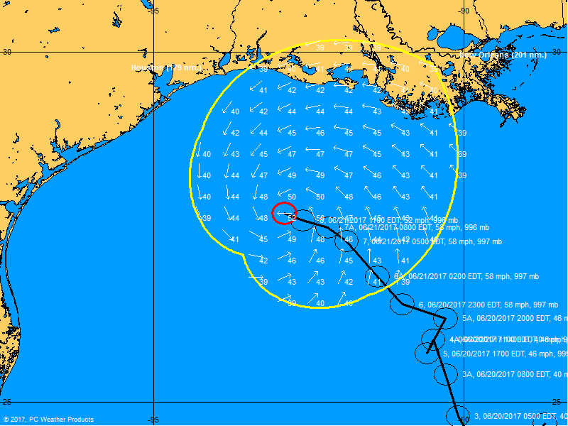
ATL: CINDY - Post-Tropical - Discussion

Moderator: S2k Moderators

Message
Author
User avatar
Steve
S2K Supporter
S2K Supporter
Posts: 9620
Joined: Sat Apr 05, 2003 11:41 pm
Location: Not a state-caster

Re: ATL: CINDY - Tropical Storm - Discussion

#1501 Postby Steve » Wed Jun 21, 2017 12:33 pm

cajungal wrote:Pretty much all the weather is towards the lake charles area. And then again towards Alabama/Florida panhandle. Still nothing in Thibodaux for the past 12 hours. Nothing even showing on radar for our area. Doesn't even feel like we are under a tropical storm warning. Just a normal day here.


Y'all are about to get the band that spawned the tornado warning here and the marine warning across all of lake ponchartrain (though most of it is slightly north in St Charles Parish). Nothing that's gonna flood you out but a decent band. It's also put much of Jefferson Parish under a flood warning though it looks like it will move thru Thibodaux in a few minutes. There's new stuff rotating in for the City of NO next half hour. No immediate warnings with that yet.

Edit to say it just spawned another tornado warning about 25 miles north of you just near Lake Borgne
Last edited by Steve on Wed Jun 21, 2017 1:06 pm, edited 2 times in total.
0 likes   

User avatar
cycloneye
Admin
Admin
Posts: 145273
Age: 68
Joined: Thu Oct 10, 2002 10:54 am
Location: San Juan, Puerto Rico

Re: ATL: CINDY - Tropical Storm - Discussion

#1502 Postby cycloneye » Wed Jun 21, 2017 12:34 pm

@MichaelRLowry
#Cindy, a tropical storm, produced a 6 ft storm #surge in Lake Borgne, some 250 miles from its center.


 https://twitter.com/MichaelRLowry/status/877579748519661568


3 likes   
Visit the Caribbean-Central America Weather Thread where you can find at first post web cams,radars
and observations from Caribbean basin members Click Here

CrazyC83
Professional-Met
Professional-Met
Posts: 34002
Joined: Tue Mar 07, 2006 11:57 pm
Location: Deep South, for the first time!

Re: ATL: CINDY - Recon

#1503 Postby CrazyC83 » Wed Jun 21, 2017 12:37 pm

URNT15 KNHC 211732
AF308 0403A CINDY HDOB 49 20170621
172130 2744N 09302W 8425 01473 9978 +186 +083 143004 006 011 002 03
172200 2744N 09302W 8425 01473 9978 +186 +083 143004 006 011 002 03
172230 2744N 09302W 8425 01473 9978 +186 +083 143004 006 011 002 03
172300 2744N 09302W 8425 01473 9978 +186 +083 143004 006 011 002 03
172330 2744N 09302W 8425 01473 9978 +186 +083 143004 006 011 002 03
172400 2744N 09302W 8425 01473 9978 +186 +085 139010 018 011 002 03
172430 2758N 09234W 8428 01474 9981 +184 +080 134018 018 /// /// 03
172500 2759N 09233W 8429 01471 9982 +184 +081 128020 020 009 001 00
172530 2800N 09231W 8430 01472 9981 +188 +081 128020 021 009 003 00
172600 2801N 09229W 8433 01468 9981 +186 +079 131020 021 011 003 00
172630 2802N 09227W 8425 01476 9980 +188 +085 133021 022 014 001 00
172700 2802N 09227W 8425 01476 9979 +190 +081 134022 023 012 002 00
172730 2802N 09227W 8425 01476 9979 +190 +081 134022 023 012 002 00
172800 2802N 09227W 8425 01476 9979 +190 +081 134022 023 012 002 00
172830 2802N 09227W 8425 01476 9979 +190 +081 134022 023 012 002 00
172900 2802N 09227W 8425 01476 9979 +190 +081 134022 023 012 002 00
172930 2802N 09227W 8425 01476 9979 +190 +081 134022 023 012 002 00
173000 2802N 09227W 8425 01476 9979 +190 +081 135022 023 012 002 00
173030 2809N 09214W 8429 01478 9988 +185 +086 141037 039 010 002 03
173100 2810N 09212W 8433 01474 9990 +182 +083 143040 040 /// /// 03
$$
;
0 likes   

CrazyC83
Professional-Met
Professional-Met
Posts: 34002
Joined: Tue Mar 07, 2006 11:57 pm
Location: Deep South, for the first time!

Re: ATL: CINDY - Recon

#1504 Postby CrazyC83 » Wed Jun 21, 2017 12:42 pm

URNT15 KNHC 211742
AF308 0403A CINDY HDOB 50 20170621
173130 2811N 09210W 8431 01479 9988 +188 +085 144040 040 /// /// 03
173200 2812N 09208W 8425 01485 9989 +190 +081 144040 040 /// /// 03
173230 2813N 09207W 8432 01480 9990 +190 +082 145040 041 /// /// 03
173300 2814N 09205W 8425 01488 9991 +190 +088 145039 039 /// /// 03
173330 2814N 09205W 8425 01488 9994 +186 +086 147040 041 /// /// 03
173400 2815N 09202W 8429 01487 9997 +186 +082 148041 041 032 000 00
173430 2816N 09200W 8429 01486 9998 +185 +082 150040 041 024 002 00
173500 2817N 09158W 8433 01485 0002 +183 +080 150040 041 026 000 00
173530 2818N 09156W 8426 01494 0006 +179 +082 150041 041 026 000 00
173600 2819N 09155W 8352 01571 0004 +179 +084 148040 041 027 002 00
173630 2820N 09153W 8343 01582 0006 +179 +082 149039 040 024 002 00
173700 2821N 09151W 8344 01580 0007 +178 +080 149038 039 027 001 00
173730 2822N 09149W 8346 01581 0009 +178 +079 151038 039 028 002 00
173800 2823N 09147W 8343 01586 0012 +176 +078 151039 039 028 002 00
173830 2824N 09146W 8343 01585 0015 +171 +079 155039 039 027 001 00
173900 2825N 09144W 8343 01587 0016 +172 +082 154040 040 027 003 00
173930 2825N 09142W 8342 01588 0018 +168 +082 154040 040 029 002 00
174000 2826N 09140W 8347 01584 0019 +170 +076 153039 041 030 002 00
174030 2827N 09138W 8343 01589 0020 +170 +075 155040 040 029 002 00
174100 2828N 09137W 8346 01587 0020 +170 +076 158041 042 029 003 00
$$
;

I think I caught the very end of the flight. It's a short hop back to base.
0 likes   

User avatar
cycloneye
Admin
Admin
Posts: 145273
Age: 68
Joined: Thu Oct 10, 2002 10:54 am
Location: San Juan, Puerto Rico

Re: ATL: CINDY - Tropical Storm - Discussion

#1505 Postby cycloneye » Wed Jun 21, 2017 1:00 pm

...CINDY MOVING NORTHWESTWARD TOWARD THE GULF COAST...
...HEAVY RAINFALL COULD PRODUCE LIFE-THREATENING FLASH FLOODING
ACROSS PORTIONS OF THE NORTHERN GULF COAST...


SUMMARY OF 100 PM CDT...1800 UTC...INFORMATION
----------------------------------------------
LOCATION...27.7N 92.9W
ABOUT 170 MI...270 KM SW OF MORGAN CITY LOUISIANA
ABOUT 160 MI...255 KM SE OF GALVESTON TEXAS
MAXIMUM SUSTAINED WINDS...50 MPH...85 KM/H
PRESENT MOVEMENT...NW OR 310 DEGREES AT 9 MPH...14 KM/H
MINIMUM CENTRAL PRESSURE...995 MB...29.38 INCHES
0 likes   
Visit the Caribbean-Central America Weather Thread where you can find at first post web cams,radars
and observations from Caribbean basin members Click Here

User avatar
chaser1
S2K Supporter
S2K Supporter
Posts: 5464
Age: 64
Joined: Sat Oct 15, 2005 5:59 pm
Location: Longwood, Fl

Re: ATL: CINDY - Tropical Storm - Discussion

#1506 Postby chaser1 » Wed Jun 21, 2017 1:10 pm

I"m not seeing any real "net motion" and Cindy appears to essentially be stationary. Its really hard to establish wobbles or minor changes in forward motion when dealing with such a broad and lessor defined center. Seems all models are really clustered on landfall occurring at about 20 hours. I do think the upper wind shear is less an inhibiting factor regarding last moment strengthening (or at least becoming better organized); as everyone else has already noted.... that diet of dry air that Cindy is ingesting is really giving the gal a serious case of indigestion lol It's one tap of rich tropical feed from the south just doesn't seem to be enough to overcome the dryer air its also pulling in. Though some models show Cindy deepening a few mb's prior to landfall, I doubt it'll result in any net change of strength. On the other hand, if just a slight bit of greater organization were to occur around its core than I suppose that could heighten chance's of strong squalls close to where the center makes landfall (and not exclusive to one primary north/south band well removed to the east).
2 likes   
Andy D

(For official information, please refer to the NHC and NWS products.)

User avatar
Steve
S2K Supporter
S2K Supporter
Posts: 9620
Joined: Sat Apr 05, 2003 11:41 pm
Location: Not a state-caster

Re: ATL: CINDY - Tropical Storm - Discussion

#1507 Postby Steve » Wed Jun 21, 2017 1:17 pm

chaser1 wrote:I"m not seeing any real "net motion" and Cindy appears to essentially be stationary. Its really hard to establish wobbles or minor changes in forward motion when dealing with such a broad and lessor defined center. Seems all models are really clustered on landfall occurring at about 20 hours. I do think the upper wind shear is less an inhibiting factor regarding last moment strengthening (or at least becoming better organized); as everyone else has already noted.... that diet of dry air that Cindy is ingesting is really giving the gal a serious case of indigestion lol It's one tap of rich tropical feed from the south just doesn't seem to be enough to overcome the dryer air its also pulling in. Though some models show Cindy deepening a few mb's prior to landfall, I doubt it'll result in any net change of strength. On the other hand, if just a slight bit of greater organization were to occur around its core than I suppose that could heighten chance's of strong squalls close to where the center makes landfall (and not exclusive to one primary north/south band well removed to the east).


I don't think it's stationary. I think it's moving NE at the moment. If you look at the Funktop which overlays I think cloud temperature over the IR, you can easily see what the center is. See if you agree. I agree with pretty much everything else though offshore things are lighting up and looking like if that can get ashore prior to 10:00pm, that Alabama, Mississippi and perhaps the North Shore (St. Tammany/Washington Parishes) could be in for a few more inches of rain.

http://www.ssd.noaa.gov/PS/TROP/floater ... imated.gif
0 likes   

BobHarlem
Category 5
Category 5
Posts: 2098
Joined: Thu Oct 20, 2005 6:11 pm

Re: ATL: CINDY - Tropical Storm - Discussion

#1508 Postby BobHarlem » Wed Jun 21, 2017 1:22 pm

Steve wrote:I don't think it's stationary. I think it's moving NE at the moment. If you look at the Funktop which overlays I think cloud temperature over the IR, you can easily see what the center is. See if you agree. I agree with pretty much everything else though offshore things are lighting up and looking like if that can get ashore prior to 10:00pm, that Alabama, Mississippi and perhaps the North Shore (St. Tammany/Washington Parishes) could be in for a few more inches of rain.

http://www.ssd.noaa.gov/PS/TROP/floater ... imated.gif


NHC 2PM Says NW @ 9mph, but it looks slower or more north than either NW or NE. Trying to watch the center of this storm is futile.
1 likes   

User avatar
bayoubebe
Category 1
Category 1
Posts: 313
Joined: Sun Jul 10, 2005 11:39 pm
Location: NOLA

Re: ATL: CINDY - Tropical Storm - Discussion

#1509 Postby bayoubebe » Wed Jun 21, 2017 1:24 pm

Parts of New Orleans and Jefferson Parish recently got pounded with rainfall. Clearview by Elmwood is flooded, and some surrounding areas. Be careful.
1 likes   

davidiowx
Category 1
Category 1
Posts: 390
Joined: Tue Sep 10, 2013 11:07 am
Location: Richmond, TX

Re: ATL: CINDY - Tropical Storm - Discussion

#1510 Postby davidiowx » Wed Jun 21, 2017 1:28 pm

Image
1 likes   

Stormcenter
S2K Supporter
S2K Supporter
Posts: 6683
Joined: Wed Sep 03, 2003 11:27 am
Location: Houston, TX

Re: ATL: CINDY - Tropical Storm - Discussion

#1511 Postby Stormcenter » Wed Jun 21, 2017 1:34 pm

0 likes   

sphelps8681
Category 2
Category 2
Posts: 785
Joined: Thu Aug 16, 2007 5:37 pm
Location: Somewhere over the rainbow

Re: ATL: CINDY - Tropical Storm - Discussion

#1512 Postby sphelps8681 » Wed Jun 21, 2017 1:37 pm

Friends of mine are needing to head toward New Orleans this evening. Is it major flooding or more of the on and off of storms and if that is the case make it possible for them to make it.
0 likes   

User avatar
chaser1
S2K Supporter
S2K Supporter
Posts: 5464
Age: 64
Joined: Sat Oct 15, 2005 5:59 pm
Location: Longwood, Fl

Re: ATL: CINDY - Tropical Storm - Discussion

#1513 Postby chaser1 » Wed Jun 21, 2017 1:46 pm

Steve wrote:
chaser1 wrote:I"m not seeing any real "net motion" and Cindy appears to essentially be stationary. Its really hard to establish wobbles or minor changes in forward motion when dealing with such a broad and lessor defined center. Seems all models are really clustered on landfall occurring at about 20 hours. I do think the upper wind shear is less an inhibiting factor regarding last moment strengthening (or at least becoming better organized); as everyone else has already noted.... that diet of dry air that Cindy is ingesting is really giving the gal a serious case of indigestion lol It's one tap of rich tropical feed from the south just doesn't seem to be enough to overcome the dryer air its also pulling in. Though some models show Cindy deepening a few mb's prior to landfall, I doubt it'll result in any net change of strength. On the other hand, if just a slight bit of greater organization were to occur around its core than I suppose that could heighten chance's of strong squalls close to where the center makes landfall (and not exclusive to one primary north/south band well removed to the east).


I don't think it's stationary. I think it's moving NE at the moment. If you look at the Funktop which overlays I think cloud temperature over the IR, you can easily see what the center is. See if you agree. I agree with pretty much everything else though offshore things are lighting up and looking like if that can get ashore prior to 10:00pm, that Alabama, Mississippi and perhaps the North Shore (St. Tammany/Washington Parishes) could be in for a few more inches of rain.

http://www.ssd.noaa.gov/PS/TROP/floater ... imated.gif


I see what you're seeing there Steve. You're right how that resolution seems to imply at least a more Northward (or even NNE) motion. Seems to me though that effect seems the result of some increased moisture in a low level band that is becoming slightly better evident to the north of the center. Still, if I try and focus on that point where what little convection continues to try and wrap around the northwest quadrant, then what motion I might be seeing appears nominal or maybe a NNW drift. Minimally convective cores are just one more reason these sub-tropical systems are such an annoyance for me to follow, but also why those of us so removed from the action (or ironically close to the center) have a hard time appreciating what impact that such a storm can have on other areas. Sucks to think that those areas that have already gotten a dumping of rain, may well see another 12-36 hours worth. Even after landfall, Cindy's circulation will broaden but it certainly wont stop pumping rich tropical moisture into the N. Gulf coast for at least another day or so.
0 likes   
Andy D

(For official information, please refer to the NHC and NWS products.)

User avatar
1900hurricane
Category 5
Category 5
Posts: 6059
Age: 34
Joined: Fri Feb 06, 2015 12:04 pm
Location: Houston, TX
Contact:

Re: ATL: CINDY - Tropical Storm - Discussion

#1514 Postby 1900hurricane » Wed Jun 21, 2017 1:52 pm

It has been difficult to follow the true center on satellite imagery with this one, but while recon was investigating, the center fixes did seem to show a more or less northwestward motion.

Image
0 likes   
Contract Meteorologist. TAMU & MSST. Fiercely authentic, one of a kind. We are all given free will, so choose a life meant to be lived. We are the Masters of our own Stories.
Opinions expressed are mine alone.

Follow me on Twitter at @1900hurricane : Read blogs at https://1900hurricane.wordpress.com/

User avatar
Steve
S2K Supporter
S2K Supporter
Posts: 9620
Joined: Sat Apr 05, 2003 11:41 pm
Location: Not a state-caster

Re: ATL: CINDY - Tropical Storm - Discussion

#1515 Postby Steve » Wed Jun 21, 2017 1:54 pm

For sure. I think the overall motion is a slow NW type drift. I think it just sort of looped there for a while which would agree with your no net motion above. Temporary spin probably as it should move pretty close on the coast within the next 24 hours. NAM did warn of a final loop just offshore in a couple of the runs yesterday, so who knows? Hopefully the folks in AL and FL don't take on too much more rain. A lot of those areas are near the base of various rivers and their watersheds.
0 likes   

User avatar
galvbay
Tropical Storm
Tropical Storm
Posts: 174
Joined: Mon Oct 14, 2002 8:29 pm
Location: Fort Anahuac, TX

Re: ATL: CINDY - Tropical Storm - Discussion

#1516 Postby galvbay » Wed Jun 21, 2017 1:55 pm

Hi all...Galvbay here. We live about a block off Galveston Bay on the North East Bay side....Smith Point, TX. Current condtions Bar. > 29.68 (29.71 @11:45 this morning). Winds NNE at 20mph gust to 27mph. No rain at this time but radar shows banding headed in from the NE. Stay safe. galvbay
1 likes   

snoop9928
Tropical Low
Tropical Low
Posts: 11
Joined: Sat Jun 23, 2012 10:26 pm

Re: ATL: CINDY - Tropical Storm - Discussion

#1517 Postby snoop9928 » Wed Jun 21, 2017 2:01 pm

Anyone know how far behind the winds and rain will lag? I'm supposed to fly out of Hobby (Houston) at 5:45 Thursday afternoon to Boston. Trying to see if that's realistic or if im here til Friday
0 likes   

User avatar
Steve
S2K Supporter
S2K Supporter
Posts: 9620
Joined: Sat Apr 05, 2003 11:41 pm
Location: Not a state-caster

Re: ATL: CINDY - Tropical Storm - Discussion

#1518 Postby Steve » Wed Jun 21, 2017 2:04 pm

sphelps8681 wrote:Friends of mine are needing to head toward New Orleans this evening. Is it major flooding or more of the on and off of storms and if that is the case make it possible for them to make it.


Shouldn't be an issue. It'll be a windy drive and probably some rain. But the streets here are fine. Lots of rain, but steady so it's drained off. Unless we get socked by something later this afternoon, they shouldn't have anything to worry about.
0 likes   

sphelps8681
Category 2
Category 2
Posts: 785
Joined: Thu Aug 16, 2007 5:37 pm
Location: Somewhere over the rainbow

Re: ATL: CINDY - Tropical Storm - Discussion

#1519 Postby sphelps8681 » Wed Jun 21, 2017 2:06 pm

Steve wrote:
sphelps8681 wrote:Friends of mine are needing to head toward New Orleans this evening. Is it major flooding or more of the on and off of storms and if that is the case make it possible for them to make it.


Shouldn't be an issue. It'll be a windy drive and probably some rain. But the streets here are fine. Lots of rain, but steady so it's drained off. Unless we get socked by something later this afternoon, they shouldn't have anything to worry about.


Thank you I will let them know.
0 likes   

Stormcenter
S2K Supporter
S2K Supporter
Posts: 6683
Joined: Wed Sep 03, 2003 11:27 am
Location: Houston, TX

Re: ATL: CINDY - Tropical Storm - Discussion

#1520 Postby Stormcenter » Wed Jun 21, 2017 2:18 pm

1 likes   


Return to “2017”

Who is online

Users browsing this forum: No registered users and 14 guests