ATL: BRET - Remnants - Discussion

Moderator: S2k Moderators

Message
Author
TheStormExpert

Re: ATL: INVEST 92L - Discussion

#141 Postby TheStormExpert » Sat Jun 17, 2017 12:50 pm

2pm TWO. Down to 60% from 70% for 5-day development chances.

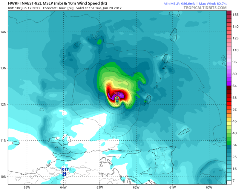
A tropical wave located about 1400 miles east-southeast of the
southern Windward Islands is producing scattered showers and
thunderstorms. This disturbance has changed little in organization
since yesterday. However, some development is expected during the
next two to three days before conditions become less favorable for
tropical cyclone formation. This system is forecast to move toward
the west or west-northwest at 15 to 20 mph over the tropical
Atlantic toward the Windward Islands and northeastern South America
during the next several days.
* Formation chance through 48 hours...medium...40 percent.
* Formation chance through 5 days...medium...60 percent.
Last edited by TheStormExpert on Sat Jun 17, 2017 12:52 pm, edited 1 time in total.
0 likes   

User avatar
cycloneye
Admin
Admin
Posts: 145271
Age: 68
Joined: Thu Oct 10, 2002 10:54 am
Location: San Juan, Puerto Rico

Re: ATL: INVEST 92L - Models

#142 Postby cycloneye » Sat Jun 17, 2017 12:51 pm

12z HWRF has a Hurricane entering Eastern Caribbean.

Image
0 likes   
Visit the Caribbean-Central America Weather Thread where you can find at first post web cams,radars
and observations from Caribbean basin members Click Here

hurricanes1234
Category 5
Category 5
Posts: 2907
Joined: Sat Jul 28, 2012 6:19 pm
Location: Trinidad and Tobago

Re: ATL: INVEST 92L - Discussion

#143 Postby hurricanes1234 » Sat Jun 17, 2017 12:52 pm

Down to 60% in five days. That's interesting ...
0 likes   
PLEASE NOTE: With the exception of information from weather agencies that I may copy and paste here, my posts will NEVER be official, since I am NOT a meteorologist. They are solely my amateur opinion, and may or may not be accurate. Therefore, please DO NOT use them as official details, particularly when making important decisions. Thank you.

TheStormExpert

Re: ATL: INVEST 92L - Discussion

#144 Postby TheStormExpert » Sat Jun 17, 2017 12:53 pm

hurricanes1234 wrote:Down to 60% in five days. That's interesting ...

My guess is the area right on it's tail is robbing it of energy.
0 likes   

RL3AO
Moderator-Pro Met
Moderator-Pro Met
Posts: 16308
Joined: Thu Jun 14, 2007 10:03 pm
Location: NC

Re: ATL: INVEST 92L - Discussion

#145 Postby RL3AO » Sat Jun 17, 2017 12:59 pm

There's plenty of energy available at 5 degrees of latitude. The whole idea of "robbing it of energy" doesn't really make sense. Other convection can add shear. It can shift areas of convergence and divergence. But it doesn't "remove energy". The ocean is plenty warm and it's removing not losing CAPE (potential energy) from other waves. It has likely disconnected from the monsoon trough now. It no longer has strong low-level convergence and it needs to make its own. I'm not sure how successful it will be in doing that.
4 likes   

TheStormExpert

ATL: INVEST 92L - Discussion

#146 Postby TheStormExpert » Sat Jun 17, 2017 1:02 pm

12z Euro develops this again.

Image
0 likes   

User avatar
Hammy
Category 5
Category 5
Posts: 5849
Age: 41
Joined: Fri May 25, 2012 5:25 pm
Contact:

ATL: INVEST 92L - Discussion

#147 Postby Hammy » Sat Jun 17, 2017 1:04 pm

TheStormExpert wrote:
hurricanes1234 wrote:Down to 60% in five days. That's interesting ...

My guess is the area right on it's tail is robbing it of energy.


It could be simply that it's developed slower than expected, and that the Euro still hasn't been 100% on board until the latest run. On the whole it looks better than yesterday as far as organization--the ITCZ that it's still attached to is being shoved south to the west, and shoved north to the east, rather than a straight east-west line going through it, though it still may not develop depending on the speed that this occurs.
0 likes   
The above post is not official and should not be used as such. It is the opinion of the poster and may or may not be backed by sound meteorological data. It is not endorsed by any professional institution or storm2k.org. For official information, please refer to the NHC and NWS products.

User avatar
Gustywind
Category 5
Category 5
Posts: 12334
Joined: Mon Sep 03, 2007 7:29 am
Location: Baie-Mahault, GUADELOUPE

Re: ATL: INVEST 92L - Discussion

#148 Postby Gustywind » Sat Jun 17, 2017 1:45 pm

Tropical Weather Discussion
NWS National Hurricane Center Miami FL
210 PM EDT Sat Jun 17 2017


...SPECIAL FEATURES...

A tropical wave is in the central Atlantic associated with a 1012
mb low centered near 06N40W.
Its axis extends from 10N39W to the
low to 01N39W, moving W at 20 kt within the last 24 hours. The
wave is in a region of favorable wind shear and is embedded in a
moderate moist environment at the lower levels according to CIRA
LPW imagery.
However, Saharan dry air is entering to its
environment, thus limiting the convection to scattered moderate
from 06N to 09N between 35W and 40W, isolated moderate showers
from 04N to 08N between 42W and 45W. Current convection is being
supported by upper level diffluence. This wave has a medium chance
of becoming a tropical cyclone during the next two days
. See the
latest NHC Tropical Weather Outlook under AWISP/WMO headers
MIATWOAT/ABNT20 KNHC for more details.
0 likes   

User avatar
cycloneye
Admin
Admin
Posts: 145271
Age: 68
Joined: Thu Oct 10, 2002 10:54 am
Location: San Juan, Puerto Rico

Re: ATL: INVEST 92L - Models

#149 Postby cycloneye » Sat Jun 17, 2017 2:09 pm

Image
Image
0 likes   
Visit the Caribbean-Central America Weather Thread where you can find at first post web cams,radars
and observations from Caribbean basin members Click Here

User avatar
cycloneye
Admin
Admin
Posts: 145271
Age: 68
Joined: Thu Oct 10, 2002 10:54 am
Location: San Juan, Puerto Rico

Re: ATL: INVEST 92L - Discussion

#150 Postby cycloneye » Sat Jun 17, 2017 2:10 pm

As of 18:00 UTC Jun 17, 2017:

Location: 5.8°N 41.2°W
Maximum Winds: 25 kt Gusts: N/A
Minimum Central Pressure: 1009 mb
Environmental Pressure: 1011 mb
Radius of Circulation: 150 NM
Radius of Maximum Wind: 80 NM
0 likes   
Visit the Caribbean-Central America Weather Thread where you can find at first post web cams,radars
and observations from Caribbean basin members Click Here

Dougiefresh
Tropical Depression
Tropical Depression
Posts: 55
Age: 35
Joined: Thu Jun 08, 2017 8:07 am
Location: Barbados

Re: ATL: INVEST 92L - Discussion

#151 Postby Dougiefresh » Sat Jun 17, 2017 2:44 pm

Ocean heat content in its path quickly ramps up. Maybe that's what the models are banking development on.
1 likes   

User avatar
Steve820
Tropical Storm
Tropical Storm
Posts: 188
Age: 25
Joined: Sat May 17, 2014 8:04 pm
Location: Southern California
Contact:

Re: ATL: INVEST 92L - Discussion

#152 Postby Steve820 » Sat Jun 17, 2017 3:41 pm

The NHC mentions how the environment will become less favorable after 3 days for this. This better develop quickly if it wants to be Cindy or Bret (depending on if this or 93L develop quicker).
0 likes   
Hurricanes are an amazing natural phenomena. While many are spiraling pits of evil that kill people or cause devastation, some are tame and stay clear of land.

I wish for you to :Bcool:

User avatar
Yellow Evan
Professional-Met
Professional-Met
Posts: 16143
Age: 27
Joined: Fri Jul 15, 2011 12:48 pm
Location: Henderson, Nevada/Honolulu, HI
Contact:

Re: ATL: INVEST 92L - Models

#153 Postby Yellow Evan » Sat Jun 17, 2017 4:05 pm

* ATLANTIC SHIPS INTENSITY FORECAST *
* IR SAT DATA AVAILABLE, OHC AVAILABLE *
* INVEST AL922017 06/17/17 18 UTC *

TIME (HR) 0 6 12 18 24 36 48 60 72 84 96 108 120
V (KT) NO LAND 25 25 26 29 32 39 47 50 53 51 52 52 54
V (KT) LAND 25 25 26 29 32 39 47 50 53 51 52 52 54
V (KT) LGEM 25 26 27 29 30 34 37 37 37 34 31 28 26
Storm Type TROP TROP TROP TROP TROP TROP TROP TROP TROP TROP TROP TROP TROP

SHEAR (KT) 2 1 0 3 5 8 10 19 17 25 25 19 9
SHEAR ADJ (KT) 1 3 10 9 7 3 1 6 7 8 0 -1 -1
SHEAR DIR 116 308 345 280 299 274 241 217 195 199 203 218 235
SST (C) 28.4 28.3 28.3 28.2 28.3 27.9 28.2 28.2 28.2 28.6 28.4 28.5 28.7
POT. INT. (KT) 145 144 144 143 145 139 143 143 142 148 145 146 149
ADJ. POT. INT. 159 158 160 160 161 153 155 153 147 151 145 145 145
200 MB T (C) -53.5 -53.6 -53.9 -54.1 -53.8 -54.2 -53.9 -54.2 -53.8 -54.1 -53.9 -53.6 -53.1
200 MB VXT (C) -0.1 -0.1 0.0 0.0 0.0 -0.1 -0.2 -0.1 -0.1 -0.2 -0.3 -0.4 -0.1
TH_E DEV (C) 7 7 6 6 7 8 10 9 10 9 10 10 11
700-500 MB RH 66 69 71 68 66 66 62 61 65 67 67 63 59
MODEL VTX (KT) 6 7 10 11 11 13 14 13 13 11 9 6 5
850 MB ENV VOR 43 42 37 30 47 26 15 -2 13 11 16 10 -20
200 MB DIV -10 7 49 55 47 48 55 95 83 45 0 11 -6
700-850 TADV 0 -2 -3 -5 -9 -6 0 12 8 10 2 0 1
LAND (KM) 1072 909 746 568 454 317 321 86 266 367 223 78 100
LAT (DEG N) 5.8 5.9 6.2 6.6 7.2 8.3 9.8 11.4 13.1 14.6 16.1 17.4 18.9
LONG(DEG W) 41.2 42.9 44.7 46.7 48.7 52.8 56.7 60.5 64.0 67.0 70.0 72.9 75.8
STM SPEED (KT) 17 18 19 20 21 21 20 20 17 16 16 16 15
HEAT CONTENT 41 45 53 44 38 33 40 18 19 32 57 37 37

FORECAST TRACK FROM TABM INITIAL HEADING/SPEED (DEG/KT):275/ 17 CX,CY: -16/ 1
T-12 MAX WIND: 25 PRESSURE OF STEERING LEVEL (MB): 573 (MEAN=618)
GOES IR BRIGHTNESS TEMP. STD DEV. 50-200 KM RAD: 10.2 (MEAN=14.5)
% GOES IR PIXELS WITH T < -20 C 50-200 KM RAD: 8.0 (MEAN=65.0)
PRELIM RI PROB (DV .GE. 55 KT IN 48 HR): 13.2

INDIVIDUAL CONTRIBUTIONS TO INTENSITY CHANGE
6 12 18 24 36 48 60 72 84 96 108 120
----------------------------------------------------------
SAMPLE MEAN CHANGE 1. 2. 3. 4. 6. 8. 9. 10. 11. 12. 13. 13.
SST POTENTIAL -0. -1. -1. 1. 5. 12. 19. 24. 28. 33. 36. 40.
VERTICAL SHEAR MAG 1. 3. 4. 6. 8. 9. 9. 8. 5. 3. 1. 1.
VERTICAL SHEAR ADJ -0. -1. -1. -2. -3. -3. -4. -5. -5. -5. -4. -3.
VERTICAL SHEAR DIR 0. 0. -0. -0. -1. -3. -5. -6. -7. -8. -10. -11.
PERSISTENCE -0. -1. -1. -1. -1. -1. -1. -1. -0. 0. 0. 1.
200/250 MB TEMP. -0. -1. -1. -1. -1. -1. -1. -1. -0. 0. 1. 1.
THETA_E EXCESS -0. -0. -0. -0. -0. -0. -0. -0. -0. -0. -0. 0.
700-500 MB RH -0. -0. -1. -1. -1. -2. -3. -4. -4. -5. -5. -4.
MODEL VTX TENDENCY 0. 1. 3. 3. 5. 7. 6. 6. 2. -1. -6. -8.
850 MB ENV VORTICITY 0. 0. 0. 0. 0. 0. -0. -0. -0. -0. -1. -1.
200 MB DIVERGENCE -0. -0. -0. -0. 0. 0. 0. 1. 1. 0. 0. -0.
850-700 T ADVEC 0. -0. -0. -0. -0. -1. -1. -0. -0. -0. -0. -0.
ZONAL STORM MOTION -0. 0. 1. 1. 2. 2. 2. 3. 3. 4. 5. 5.
STEERING LEVEL PRES 0. 0. 0. 0. 0. 0. 0. 0. 0. 0. 0. 0.
DAYS FROM CLIM. PEAK 0. 0. 0. 0. 0. 0. 1. 1. 1. 2. 2. 2.
GOES PREDICTORS -1. -2. -2. -3. -4. -6. -7. -7. -7. -6. -5. -5.
OCEAN HEAT CONTENT -0. -0. -0. -0. -0. -1. -1. -1. -1. -1. -1. -0.
----------------------------------------------------------
TOTAL CHANGE -0. 2. 4. 7. 14. 22. 25. 28. 26. 27. 27. 29.

CURRENT MAX WIND (KT): 25. LAT, LON: 5.8 41.2

** 2017 ATLANTIC RI INDEX AL922017 INVEST 06/17/17 18 UTC **
(SHIPS-RII PREDICTOR TABLE for 30 KT OR MORE MAXIMUM WIND INCREASE IN NEXT 24-h)

Predictor Value RI Predictor Range Scaled Value(0-1) % Contribution
12 HR PERSISTENCE (KT): 0.0 -49.5 to 33.0 0.60 6.5
850-200 MB SHEAR (KT) : 2.3 30.1 to 2.9 1.00 4.3
HEAT CONTENT (KJ/cm2) : 44.2 0.0 to 156.2 0.28 1.2
2nd PC OF IR BR TEMP : 0.3 2.4 to -3.0 0.40 1.8
STD DEV OF IR BR TEMP : 10.2 36.6 to 2.8 0.78 3.6
MAXIMUM WIND (kt) : 25.0 22.5 to 121.0 0.07 0.2
POT = MPI-VMAX (KT) : 134.7 28.4 to 139.6 0.96 2.9
D200 (10**7s-1) : 29.6 -29.7 to 181.5 0.28 0.4
BL DRY-AIR FLUX (w/m2): 70.4 961.4 to -67.1 0.87 0.0
% AREA WITH TPW <45 mm: 0.0 100.0 to 0.0 1.00 0.2

SHIPS Prob RI for 20kt/ 12hr RI threshold= 8% is 1.4 times sample mean ( 5.4%)
SHIPS Prob RI for 25kt/ 24hr RI threshold= 35% is 3.1 times sample mean (11.5%)
SHIPS Prob RI for 30kt/ 24hr RI threshold= 21% is 2.8 times sample mean ( 7.4%)
SHIPS Prob RI for 35kt/ 24hr RI threshold= 10% is 2.3 times sample mean ( 4.3%)
SHIPS Prob RI for 40kt/ 24hr RI threshold= 0% is 0.0 times sample mean ( 2.8%)
SHIPS Prob RI for 45kt/ 36hr RI threshold= 0% is 0.0 times sample mean ( 5.1%)
SHIPS Prob RI for 55kt/ 48hr RI threshold= 19% is 3.6 times sample mean ( 5.3%)
SHIPS Prob RI for 65kt/ 72hr RI threshold= 0% is 0.0 times sample mean ( 6.0%)

Matrix of RI probabilities
------------------------------------------------------------------------------
RI (kt / h) | 20/12 | 25/24 | 30/24 | 35/24 | 40/24 | 45/36 | 55/48 |65/72
------------------------------------------------------------------------------
SHIPS-RII: 7.5% 35.3% 20.9% 10.0% 0.0% 0.0% 18.8% 0.0%
Logistic: 4.5% 21.8% 11.6% 3.9% 3.2% 2.9% 5.8% 18.7%
Bayesian: 0.1% 0.4% 0.1% 0.0% 0.0% 0.0% 0.0% 0.1%
Consensus: 4.1% 19.2% 10.9% 4.6% 1.1% 1.0% 8.2% 6.2%

## ANNULAR HURRICANE INDEX (AHI) AL922017 INVEST 06/17/17 18 UTC ##
## STORM NOT ANNULAR, SCREENING STEP FAILED, NPASS=6 NFAIL=1 ##
## AHI= 0 (AHI OF 100 IS BEST FIT TO ANN. STRUC., 1 IS MARGINAL, 0 IS NOT ANNULAR) ##

** PROBLTY OF AT LEAST 1 SCNDRY EYEWL FORMTN EVENT AL922017 INVEST 06/17/2017 18 UTC **
TIME(HR) 0-12 12-24(0-24) 24-36(0-36) 36-48(0-48)
CLIMO(%) 0 0( 0) 0( 0) 0( 0) <-- PROB BASED ON INTENSITY ONLY
PROB(%) 0 0( 0) 0( 0) 0( 0) <-- FULL MODEL PROB (RAN NORMALLY)

** DSHIPS INTENSITY FORECAST ADJUSTED RELATIVE TO ONSET OF ERC WEAKENING PHASE **
TIME (HR) 0 6 12 18 24 36 48 60 72 84 96 108 120
>24HR AGO (DSHIPS) 25 25 26 29 32 39 47 50 53 51 52 52 54
18HR AGO 25 24 25 28 31 38 46 49 52 50 51 51 53
12HR AGO 25 22 21 24 27 34 42 45 48 46 47 47 49
6HR AGO 25 19 16 15 18 25 33 36 39 37 38 38 40
NOW CURRENT INTENSITY < 83 KT
IN 6HR INTENSITY IN 6HR < 83 KT
IN 12HR INTENSITY IN 12HR < 83 KT
0 likes   

AutoPenalti
Category 5
Category 5
Posts: 4030
Age: 29
Joined: Mon Aug 17, 2015 4:16 pm
Location: Ft. Lauderdale, Florida

Re: ATL: INVEST 92L - Discussion

#154 Postby AutoPenalti » Sat Jun 17, 2017 4:59 pm

Finally, the Euro is on board with 92L
0 likes   
The posts in this forum are NOT official forecasts and should not be used as such. They are just the opinion of the poster and may or may not be backed by sound meteorological data. They are NOT endorsed by any professional institution or STORM2K. For official information, please refer to products from the NHC and NWS.


Model Runs Cheat Sheet:
GFS (5:30 AM/PM, 11:30 AM/PM)
HWRF, GFDL, UKMET, NAVGEM (6:30-8:00 AM/PM, 12:30-2:00 AM/PM)
ECMWF (1:45 AM/PM)

TCVN
is a weighted averaged

User avatar
cycloneye
Admin
Admin
Posts: 145271
Age: 68
Joined: Thu Oct 10, 2002 10:54 am
Location: San Juan, Puerto Rico

Re: ATL: INVEST 92L - Discussion

#155 Postby cycloneye » Sat Jun 17, 2017 6:32 pm

8 PM TWO: 40%-60%.

A tropical wave located about 1300 miles east-southeast of the
southern Windward Islands is producing disorganized cloudiness and
showers. Some development of this system is possible during the
next few days before environmental conditions become less favorable
for tropical cyclone formation. This system is forecast to move
to the west or west-northwest at 15 to 20 mph toward the Windward
Islands and northeastern South America during the next several days.
* Formation chance through 48 hours...medium...40 percent.
* Formation chance through 5 days...medium...60 percent.
0 likes   
Visit the Caribbean-Central America Weather Thread where you can find at first post web cams,radars
and observations from Caribbean basin members Click Here

User avatar
NDG
S2K Supporter
S2K Supporter
Posts: 15446
Joined: Sun Jul 09, 2006 10:14 pm
Location: Orlando, FL

Re: ATL: INVEST 92L - Models

#156 Postby NDG » Sat Jun 17, 2017 6:42 pm

18z HWRF continues with its solution of 92L becoming a hurricane in the eastern Caribbean, 3 runs in a row now.

Image
0 likes   

User avatar
cycloneye
Admin
Admin
Posts: 145271
Age: 68
Joined: Thu Oct 10, 2002 10:54 am
Location: San Juan, Puerto Rico

Re: ATL: INVEST 92L - Models

#157 Postby cycloneye » Sat Jun 17, 2017 6:57 pm

999 mbss is the lowest pressure on the 18z operational GFS between Grenada and St Vincent.

Image
0 likes   
Visit the Caribbean-Central America Weather Thread where you can find at first post web cams,radars
and observations from Caribbean basin members Click Here

User avatar
cycloneye
Admin
Admin
Posts: 145271
Age: 68
Joined: Thu Oct 10, 2002 10:54 am
Location: San Juan, Puerto Rico

Re: ATL: INVEST 92L - Models

#158 Postby cycloneye » Sat Jun 17, 2017 7:12 pm

18z HWRF as a 987 mb Hurricane after it moves thru the Islands.

Image
0 likes   
Visit the Caribbean-Central America Weather Thread where you can find at first post web cams,radars
and observations from Caribbean basin members Click Here

User avatar
cycloneye
Admin
Admin
Posts: 145271
Age: 68
Joined: Thu Oct 10, 2002 10:54 am
Location: San Juan, Puerto Rico

Re: ATL: INVEST 92L - Discussion

#159 Postby cycloneye » Sat Jun 17, 2017 8:06 pm

00z Best Track.

As of 00:00 UTC Jun 18, 2017:

Location: 5.8°N 43.0°W
Maximum Winds: 25 kt Gusts: N/A
Minimum Central Pressure: 1009 mb
Environmental Pressure: 1011 mb
Radius of Circulation: 150 NM
Radius of Maximum Wind: 80 NM
0 likes   
Visit the Caribbean-Central America Weather Thread where you can find at first post web cams,radars
and observations from Caribbean basin members Click Here

User avatar
Hammy
Category 5
Category 5
Posts: 5849
Age: 41
Joined: Fri May 25, 2012 5:25 pm
Contact:

Re: ATL: INVEST 92L - Discussion

#160 Postby Hammy » Sat Jun 17, 2017 8:15 pm

Convection is deeper than this time yesterday, but I don't see nearly as much spin as earlier, and the west-to-east low level flow into the circulation seems like it's been replaced by more southerly inflow--it seems unlikely from here that anything closed will get going.
1 likes   
The above post is not official and should not be used as such. It is the opinion of the poster and may or may not be backed by sound meteorological data. It is not endorsed by any professional institution or storm2k.org. For official information, please refer to the NHC and NWS products.


Return to “2017”

Who is online

Users browsing this forum: No registered users and 15 guests