ozonepete wrote:psyclone wrote:ozonepete wrote:
Remember to wait until the music stops, psy. With this forecast to sit over the area for days somebody could get more than a "dousing". Floods are a much bigger killer than wind in TCs.
Just in case there's any ambiguity:
douse 1
also dowse (dous)
tr.v. doused, dous·ing, dous·es also dowsed or dows·ing or dows·es
1. To wet thoroughly; drench.
2. To put out (a light or fire); extinguish: doused the campfire with a bucket of water.
n.
A thorough drenching.
?? So the quoted definition of a dousing or dowsing doesn't imply flooding per se and it's not an NWS term. I'm worried that people in the low country aren't thinking of severe flooding. They need to be on their guard just in case. These slowly dying systems have caused some of the worst flooding in U.S. history. That's all.

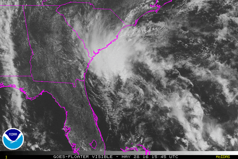
there are no flood watches from the NWS at this time. 2-4" isn't a big deal for this part of the country...happens in the Summer on a regular basis. Here's the relevant portion of the Hurricane local statement from the NWS Charleston:
THE RAIN COULD BECOME LOCALLY HEAVY AT TIMES THIS EVENING THROUGH
AT LEAST SUNDAY. STORM TOTAL RAINFALL OF 2 TO 4 INCHES IS EXPECTED
ACROSS SOUTHEAST SOUTH CAROLINA...WITH LOCALLY HIGHER AMOUNTS
POSSIBLE...ESPECIALLY ALONG THE COAST. THERE WILL BE A RISK FOR
MINOR FLOODING...MAINLY IN LOW LYING AND POORLY DRAINED AREAS NEAR
THE SOUTH CAROLINA COAST CLOSE TO THE TIMES OF HIGH TIDE.
HOWEVER...SIGNIFICANT FLASH FLOODING IS NOT EXPECTED AT THIS TIME.
RAINFALL TOTALS WILL BE HIGHLY DEPENDENT ON THE EXACT
TRACK...INTENSITY AND FORWARD SPEED OF THE TROPICAL SYSTEM.