You can see the very western extent (nose of the ridge) extends to the western edge of Cuba. If the trough in the GOM does not dig deeper to help erode that ridge further, it is possible the ridge may hold and keep Matthew moving a bit farther west just a bit longer
ATL: MATTHEW - Post-Tropical - Discussion
Moderator: S2k Moderators
- northjaxpro
- S2K Supporter
- Posts: 8900
- Joined: Mon Sep 27, 2010 11:21 am
- Location: Jacksonville, FL
Re: ATL: MATTHEW - Hurricane - Discussion
[quote="northjaxpro"]

You can see the very western extent (nose of the ridge) extends to the western edge of Cuba. If the trough in the GOM does not dig deeper to help erode that ridge further, it is possible the ridge may hold and keep Matthew moving a bit farther west just a bit longer
Last edited by northjaxpro on Sat Oct 01, 2016 8:42 am, edited 1 time in total.
0 likes
NEVER, EVER SAY NEVER in the tropics and weather in general, and most importantly, with life itself!!
________________________________________________________________________________________
Fay 2008 Beryl 2012 Debby 2012 Colin 2016 Hermine 2016 Julia 2016 Matthew 2016 Irma 2017 Dorian 2019
________________________________________________________________________________________
Fay 2008 Beryl 2012 Debby 2012 Colin 2016 Hermine 2016 Julia 2016 Matthew 2016 Irma 2017 Dorian 2019
- otterlyspicey
- Tropical Depression
- Posts: 55
- Age: 37
- Joined: Thu Oct 01, 2015 2:51 pm
- Location: Washington, DC
Re: ATL: MATTHEW - Hurricane - Discussion
I am still so bummed we didn't get to see Matthew at his incredible peak last night on daytime visible satellite. That would've been incredible! Guess we have to wait another nine years and hope it's daylight when cat 5 is reached.


1 likes
HURRICANE FLOYD HURRICANE IRENE HURRICANE SANDY
Re: ATL: MATTHEW - Hurricane - Discussion
Pressure have risen to 947 mb as per the latest center dropsonde. Expect continued weakening within the next day or so.
0 likes
Personal Forecast Disclaimer:
The posts in this forum are NOT official forecast and should not be used as such. They are just the opinion of the poster and may or may not be backed by sound meteorological data. They are NOT endorsed by any professional institution or storm2k.org. For official information, please refer to RSMC and NWS products.
Re: ATL: MATTHEW - Hurricane - Discussion
chris_fit wrote:wxman57 wrote:chris_fit wrote:Latest recon pass also shows what appears to be a S component to Matthew's Westerly movement.
You can't be sure that each vortex report caught the center of the eye, so it's difficult to determine storm movement over a short period of time using recon fixes. Satellite isn't indicating any south of west movement any longer.
Thank you sir. I was under the thought that why look at Satellite when we have recon out there - but you have a valid point.
Only 2 VDMs this mission.
0 likes
Re: ATL: MATTHEW - Hurricane - Discussion
northjaxpro wrote:northjaxpro wrote:Steering
[im bg]http://tropic.ssec.wisc.edu/real-time/atlantic/winds/wg8dlm5.GIF[/img]
You can see the very western extent (nose of the ridge) extends to the western edge of Cuba. If the trough in the GOM does not did deeper to help erode that ridge further, it is possible the ridge may hold and keep Matthew moving a bit farther west just a bit longer
Are most of the models expecting a weakening and retreat of that ridge?
0 likes
Re: ATL: MATTHEW - Hurricane - Discussion
otterlyspicey wrote:I am still so bummed we didn't get to see Matthew at his incredible peak last night on daytime visible satellite. That would've been incredible! Guess we have to wait another nine years and hope it's daylight when cat 5 is reached.![]()
It has a chance of restrengthening and becoming a Cat 5 again once the shear dies off, near Jamaica/Cuba. The waters are very warm around there, and the environment is even better than the one that enabled Matt to reach Cat 5 status last night.
2 likes
Igor 2010, Sandy 2012, Fay 2014, Gonzalo 2014, Joaquin 2015, Nicole 2016, Humberto 2019
I am only a tropical weather enthusiast. My predictions are not official and may or may not be backed by sound meteorological data. For official information, please refer to the NHC and NWS products.
- tarheelprogrammer
- S2K Supporter
- Posts: 1793
- Joined: Mon Mar 28, 2016 9:25 pm
- Location: Raleigh, NC area (Garner, NC)
Re: ATL: MATTHEW - Hurricane - Discussion
Feeling much better here in NC. US streak could possibly go to 11 years. Wow! I know things could change but our "luck" is incredible it seems. Everyone have a good day. Will be praying for Caribbean folks.
1 likes
My posts are not official forecasts. They are just my opinion and may or may not be backed by sound meteorological data. They are NOT endorsed by any professional institution or storm2k.org. For official information, please refer to the NHC and NWS products.
Re: ATL: MATTHEW - Hurricane - Discussion
There will be a US territory that will be hit by a Major Hurricane, GTMO, does it count? 

2 likes
-
- Tropical Depression
- Posts: 94
- Joined: Wed Aug 31, 2016 4:46 am
Re: ATL: MATTHEW - Hurricane - Discussion
Guantanamo Bay is held by perpetual lease and isn't technically part of the USA.
0 likes
-
- Admin
- Posts: 20020
- Age: 62
- Joined: Sun Aug 27, 2006 8:23 pm
- Location: Florence, KY (name is Mark)
Re: ATL: MATTHEW - Hurricane - Discussion
0 likes
M a r k
- - - - -
Join us in chat: Storm2K Chatroom Invite. Android and IOS apps also available.
The posts in this forum are NOT official forecasts and should not be used as such. Posts are NOT endorsed by any professional institution or STORM2K.org. For official information and forecasts, please refer to NHC and NWS products.
Re: ATL: MATTHEW - Hurricane - Discussion
Does that trough hanging out over you folks show any signs of movement west or north?
0 likes
- SouthFLTropics
- Category 5
- Posts: 4239
- Age: 50
- Joined: Thu Aug 14, 2003 8:04 am
- Location: Port St. Lucie, Florida
Re: ATL: MATTHEW - Hurricane - Discussion
It's going to be very important to watch the evolution of the feature ENE of the islands to see what, if any, impact it will have on the Bermuda High. Right now based on water vapor the high looks to be expanding west.
0 likes
Fourth Generation Florida Native
Personal Storm History: David 79, Andrew 92, Erin 95, Floyd 99, Irene 99, Frances 04, Jeanne 04, Wilma 05, Matthew 16, Irma 17, Ian 22, Nicole 22, Milton 24
-
- Admin
- Posts: 20020
- Age: 62
- Joined: Sun Aug 27, 2006 8:23 pm
- Location: Florence, KY (name is Mark)
Re: ATL: MATTHEW - Hurricane - Discussion
hipshot wrote:
Does that trough hanging out over you folks show any signs of movement west or north?
The cutoff low? It's been moving around east then west but not north yet. It's supposed to start clearing out north at the same time Matthew is expected to move north.
0 likes
M a r k
- - - - -
Join us in chat: Storm2K Chatroom Invite. Android and IOS apps also available.
The posts in this forum are NOT official forecasts and should not be used as such. Posts are NOT endorsed by any professional institution or STORM2K.org. For official information and forecasts, please refer to NHC and NWS products.
- - - - -
Join us in chat: Storm2K Chatroom Invite. Android and IOS apps also available.
The posts in this forum are NOT official forecasts and should not be used as such. Posts are NOT endorsed by any professional institution or STORM2K.org. For official information and forecasts, please refer to NHC and NWS products.
-
- Admin
- Posts: 20020
- Age: 62
- Joined: Sun Aug 27, 2006 8:23 pm
- Location: Florence, KY (name is Mark)
Re: ATL: MATTHEW - Hurricane - Discussion
Answering a post from the model thread on west motion.
The floater is tracking and it appears west is continuing but not as much of a north component as the tracker assumed.
http://rammb.cira.colostate.edu/ramsdis/online/loop.asp?data_folder=tropical/tropical_ge_1km_center_relative_vis_floater&width=640&height=480&number_of_images_to_display=12
The floater is tracking and it appears west is continuing but not as much of a north component as the tracker assumed.
http://rammb.cira.colostate.edu/ramsdis/online/loop.asp?data_folder=tropical/tropical_ge_1km_center_relative_vis_floater&width=640&height=480&number_of_images_to_display=12
0 likes
M a r k
- - - - -
Join us in chat: Storm2K Chatroom Invite. Android and IOS apps also available.
The posts in this forum are NOT official forecasts and should not be used as such. Posts are NOT endorsed by any professional institution or STORM2K.org. For official information and forecasts, please refer to NHC and NWS products.
- - - - -
Join us in chat: Storm2K Chatroom Invite. Android and IOS apps also available.
The posts in this forum are NOT official forecasts and should not be used as such. Posts are NOT endorsed by any professional institution or STORM2K.org. For official information and forecasts, please refer to NHC and NWS products.
Re: ATL: MATTHEW - Hurricane - Discussion
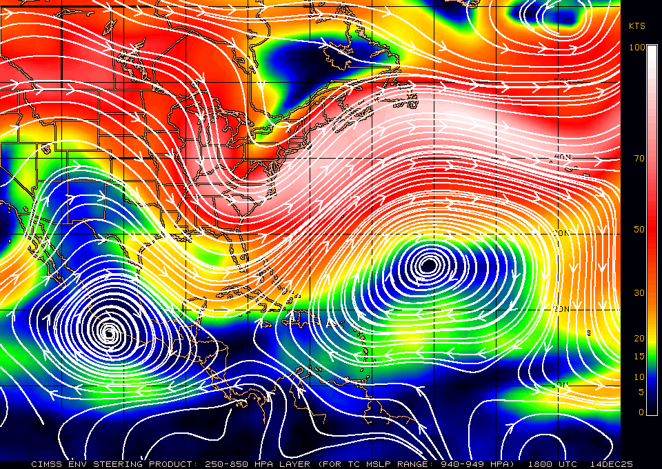
SouthFLTropics wrote:It's going to be very important to watch the evolution of the feature ENE of the islands to see what, if any, impact it will have on the Bermuda High. Right now based on water vapor the high looks to be expanding west.
Interesting. I know yesterday Matthew's outflow extended into the Atlantic (another example of its sheer power and strength) but is the low close enough to be sheared by the hurricane in the short-term?
0 likes
The posts or stuff said are NOT an official forecast. Please look to the NHC and NWS for official forecasts and products.
Floyd-1999, Frances-2004, Jeanne-2004, Fay-2008, Beryl-2012, Debby-2012, Colin-2016, Hermine-2016, Julia-2016, Matthew-2016, Irma-2017, Elsa-2021, Idalia-2023, Debby-2024, Helene-2024.
Go Gators! Go Jags!
Floyd-1999, Frances-2004, Jeanne-2004, Fay-2008, Beryl-2012, Debby-2012, Colin-2016, Hermine-2016, Julia-2016, Matthew-2016, Irma-2017, Elsa-2021, Idalia-2023, Debby-2024, Helene-2024.
Go Gators! Go Jags!
Re: ATL: MATTHEW - Hurricane - Discussion
It almost looks like that during the past couple of hours it went back to a more South than due West heading but it could be just a wobble.


0 likes
- 1900hurricane
- Category 5
- Posts: 6059
- Age: 34
- Joined: Fri Feb 06, 2015 12:04 pm
- Location: Houston, TX
- Contact:
Re: ATL: MATTHEW - Hurricane - Discussion
NDG wrote:[im g]http://i20.photobucket.com/albums/b245/ndgarcia/2014-06/MaracaiboMax_zpsit2sr2lx.gif[/img]
Looks like we may finally be getting some hints of an outer eyewall beginning to develop on radar.
0 likes
Contract Meteorologist. TAMU & MSST. Fiercely authentic, one of a kind. We are all given free will, so choose a life meant to be lived. We are the Masters of our own Stories.
Opinions expressed are mine alone.
Follow me on Twitter at @1900hurricane : Read blogs at https://1900hurricane.wordpress.com/
Opinions expressed are mine alone.
Follow me on Twitter at @1900hurricane : Read blogs at https://1900hurricane.wordpress.com/
Who is online
Users browsing this forum: No registered users and 3 guests