ATL: Ex INVEST 92L - Discussion

Moderator: S2k Moderators

Message
Author
User avatar
CourierPR
Category 5
Category 5
Posts: 1335
Age: 71
Joined: Tue Aug 31, 2004 7:53 pm
Location: Pompano Beach, Florida

Re: ATL: Tropical Wave in East Atlantic - Ex Invest 92L - Discussion

#141 Postby CourierPR » Thu Sep 01, 2016 4:48 am

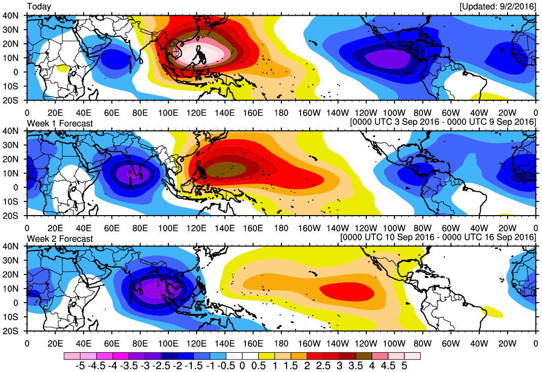
chaser1 wrote:Aside from the fact that the EURO once modeled this wave as a potential Cat. 8 (lol) and at times threatening nearly everyone outside of Maine and Alaska, it has a well definitely envelope and is popping some convection close to center. I'd expect it to take advantage of the warmer SST's as it approaches 55W or so. I don't believe this wave will simply fade away. But will it turn out to be Hermine's ugly brother? :froze:


I noticed the well-defined envelope, also. I'm with you in that I don't think we've seen the last of this system.
0 likes   

User avatar
Gustywind
Category 5
Category 5
Posts: 12334
Joined: Mon Sep 03, 2007 7:29 am
Location: Baie-Mahault, GUADELOUPE

Re: ATL: Tropical Wave in East Atlantic - Ex Invest 92L - Discussion

#142 Postby Gustywind » Thu Sep 01, 2016 6:27 am

The low pressure attached with has disapeared, no mention of it in the latest TWD...


Tropical Weather Discussion
NWS National Hurricane Center Miami FL
635 AM EDT THU SEP 1 2016

A tropical wave in the east Atlantic extends its axis from 21N34W
to 09N36W, moving west 15 to 20 kt over the past 24 hours. The
wave coincides with a well defined trough in global models at 700
mb. Isolated convection prevails from 12N-17N between 30W-36W.
0 likes   

User avatar
cycloneye
Admin
Admin
Posts: 145295
Age: 68
Joined: Thu Oct 10, 2002 10:54 am
Location: San Juan, Puerto Rico

Re: ATL: Tropical Wave in East Atlantic - Ex Invest 92L - Discussion

#143 Postby cycloneye » Thu Sep 01, 2016 7:01 am

A tropical wave over the eastern Atlantic ocean located about 700
miles west of the Cabo Verde Islands continues to produce only
limited shower activity. This wave is expected to be in an
environment of very dry air for the next few days, which should
prevent significant development during that time. Environmental
conditions could become a little more conducive for some development
when the wave is near the Lesser Antilles early next week.
* Formation chance through 48 hours...low...near 0 percent
* Formation chance through 5 days...low...20 percent
0 likes   
Visit the Caribbean-Central America Weather Thread where you can find at first post web cams,radars
and observations from Caribbean basin members Click Here

LarryWx
S2K Supporter
S2K Supporter
Posts: 6304
Joined: Sun Sep 07, 2003 2:04 pm
Location: GA

Re: ATL: Tropical Wave in East Atlantic - Ex Invest 92L - Discussion

#144 Postby LarryWx » Thu Sep 01, 2016 7:26 am

gatorcane wrote:
LarryWx wrote:The latest GEFS (18Z) once again has a good number of members form a sfc low near the Bahamas that later hits the CONUS. Just something to keep in mind.


I only see 2 ensembles members on the 18Z GFS. Are you sure you were not looking at the 12Z GEFS?


Oops, sorry, I just saw your post. I thought I was looking at the 18Z GEFS, but maybe I misinterpreted it. Regardless, more recent GEFS runs have shown little.
0 likes   
Personal Forecast Disclaimer:
The posts in this forum are NOT official forecasts and should not be used as such. They are just the opinion of the poster and may or may not be backed by sound meteorological data. They are NOT endorsed by any professional institution or storm2k.org. For official information, please refer to the NHC and NWS products.

User avatar
ConvergenceZone
Category 5
Category 5
Posts: 5194
Joined: Fri Jul 29, 2005 1:40 am
Location: Northern California

Re: ATL: Tropical Wave in East Atlantic - Ex Invest 92L - Discussion

#145 Postby ConvergenceZone » Thu Sep 01, 2016 9:25 am

I notice that the chance to develop in 5 days is dropping about 10% on every update. Down to only 20% of developing now. They will probably drop it completely the next couple of updates.
1 likes   

jlauderdal
S2K Supporter
S2K Supporter
Posts: 7182
Joined: Wed May 19, 2004 5:46 am
Location: NE Fort Lauderdale
Contact:

Re: ATL: Tropical Wave in East Atlantic - Ex Invest 92L - Discussion

#146 Postby jlauderdal » Thu Sep 01, 2016 10:02 am

ConvergenceZone wrote:I notice that the chance to develop in 5 days is dropping about 10% on every update. Down to only 20% of developing now. They will probably drop it completely the next couple of updates.


remember thats development in 5 days...dont write off energy moving across just because development in 5 days is unlikely
0 likes   

User avatar
centuryv58
Tropical Storm
Tropical Storm
Posts: 233
Age: 67
Joined: Sat Jul 30, 2016 1:24 pm
Location: Southeast Florida

Re: ATL: Tropical Wave in East Atlantic - Ex Invest 92L - Discussion

#147 Postby centuryv58 » Thu Sep 01, 2016 10:04 am

And to add to this mix...


Michael Ventrice
Verified account
‏@MJVentrice
I'm thinking the uptick in Atlantic tropical cyclone activity continues through mid-Sept under favorable MJO state
0 likes   

HURRICANELONNY
Category 5
Category 5
Posts: 1383
Joined: Wed May 07, 2003 6:48 am
Location: HOLLYWOOD.FL

Re: ATL: Tropical Wave in East Atlantic - Ex Invest 92L - Discussion

#148 Postby HURRICANELONNY » Thu Sep 01, 2016 11:46 am

Yup.Favorable MJO is progged to enter carribean in sept. Also the waves that take longer to develop have better chance of hitting land then those that develop out at sea. Plus the waves are looking pretty good coming off africa. Especially the one behind x92L. :eek:

http://tropic.ssec.wisc.edu/real-time/e ... njava.html
1 likes   
hurricanelonny

User avatar
Houstonia
S2K Supporter
S2K Supporter
Posts: 829
Age: 60
Joined: Fri Oct 11, 2002 9:45 am
Location: Sharpstown, Houston, Harris County, Southeast Texas.

Re: ATL: Tropical Wave in East Atlantic - Ex Invest 92L - Discussion

#149 Postby Houstonia » Thu Sep 01, 2016 11:55 am

It's back on the NHC map.

ZCZC MIATWOAT ALL
TTAA00 KNHC DDHHMM

TROPICAL WEATHER OUTLOOK
NWS NATIONAL HURRICANE CENTER MIAMI FL
800 AM EDT THU SEP 1 2016

For the North Atlantic...Caribbean Sea and the Gulf of Mexico:

The National Hurricane Center is issuing advisories on Hurricane
Gaston, located west of the Azores, and on Tropical Storm
Hermine, located over the central Gulf of Mexico. The National
Hurricane Center has issued the last advisory on former Tropical
Depression Eight, located east of the Mid-Atlantic states.

1. A tropical wave over the eastern Atlantic ocean located about 700
miles west of the Cabo Verde Islands continues to produce only
limited shower activity. This wave is expected to be in an
environment of very dry air for the next few days, which should
prevent significant development during that time. Environmental
conditions could become a little more conducive for some development
when the wave is near the Lesser Antilles early next week.
* Formation chance through 48 hours...low...near 0 percent
* Formation chance through 5 days...low...20 percent

Forecaster Blake
0 likes   

User avatar
cycloneye
Admin
Admin
Posts: 145295
Age: 68
Joined: Thu Oct 10, 2002 10:54 am
Location: San Juan, Puerto Rico

Re: ATL: Tropical Wave in East Atlantic - Ex Invest 92L - Discussion

#150 Postby cycloneye » Thu Sep 01, 2016 12:42 pm

2 PM TWO.Up to 10% in 2 days.

A tropical wave over the central tropical Atlantic Ocean located
about 800 miles west of the Cabo Verde Islands continues to produce
only limited shower activity. Any development of this system is
expected to be slow to occur for the next couple of days due to dry
air. Environmental conditions could become a little more conducive
for some development when the wave is near the Lesser Antilles early
next week.
* Formation chance through 48 hours...low...10 percent
* Formation chance through 5 days...low...20 percent
0 likes   
Visit the Caribbean-Central America Weather Thread where you can find at first post web cams,radars
and observations from Caribbean basin members Click Here

User avatar
Gustywind
Category 5
Category 5
Posts: 12334
Joined: Mon Sep 03, 2007 7:29 am
Location: Baie-Mahault, GUADELOUPE

Re: ATL: Tropical Wave in East Atlantic - Ex Invest 92L - Discussion

#151 Postby Gustywind » Thu Sep 01, 2016 12:54 pm

cycloneye wrote:2 PM TWO.Up to 10% in 2 days.

A tropical wave over the central tropical Atlantic Ocean located
about 800 miles west of the Cabo Verde Islands continues to produce
only limited shower activity. Any development of this system is
expected to be slow to occur for the next couple of days due to dry
air. Environmental conditions could become a little more conducive
for some development when the wave is near the Lesser Antilles early
next week.
* Formation chance through 48 hours...low...10 percent
* Formation chance through 5 days...low...20 percent

Very interresting %. Let's wait and see if this % continues to grow or not during the next 24H.
0 likes   

User avatar
Gustywind
Category 5
Category 5
Posts: 12334
Joined: Mon Sep 03, 2007 7:29 am
Location: Baie-Mahault, GUADELOUPE

Re: ATL: Tropical Wave in East Atlantic - Ex Invest 92L - Discussion - 2 PM TWO-10%-20%

#152 Postby Gustywind » Thu Sep 01, 2016 1:14 pm

Tropical Weather Discussion
NWS National Hurricane Center Miami FL
205 PM EDT THU SEP 01 2016

An Atlantic Ocean tropical wave is along 36W/37W, from 21N
southward, moving westward 15 to 20 knots. Upper level cyclonic
wind flow accompanies an inverted trough that is near the
tropical wave, between 30W and 43W. Convective precipitation:
isolated moderate from 11N to 18N between 32W and 47W.
0 likes   

User avatar
cycloneye
Admin
Admin
Posts: 145295
Age: 68
Joined: Thu Oct 10, 2002 10:54 am
Location: San Juan, Puerto Rico

Re: ATL: Tropical Wave in Central Atlantic - Ex Invest 92L - Discussion

#153 Postby cycloneye » Thu Sep 01, 2016 6:33 pm

A tropical wave over the central tropical Atlantic Ocean about
midway between the Cabo Verde Islands and the Lesser Antilles
continues to produce only limited shower activity. Environmental
conditions, particularly the presence of dry air, do not appear
favorable, and any development of this system through early next
week is expected to be slow to occur while it approaches the Lesser
Antilles and moves into the eastern Caribbean Sea.
* Formation chance through 48 hours...low...10 percent
* Formation chance through 5 days...low...20 percent
0 likes   
Visit the Caribbean-Central America Weather Thread where you can find at first post web cams,radars
and observations from Caribbean basin members Click Here

User avatar
Gustywind
Category 5
Category 5
Posts: 12334
Joined: Mon Sep 03, 2007 7:29 am
Location: Baie-Mahault, GUADELOUPE

Re: ATL: Tropical Wave in Central Atlantic - Ex Invest 92L - Discussion

#154 Postby Gustywind » Thu Sep 01, 2016 7:35 pm

Tropical Weather Discussion
NWS National Hurricane Center Miami FL
805 PM EDT THU SEP 01 2016


Tropical wave in the central Atlantic extends along 36W/37W from
9N-20N moving west near 20 kt over the past 24 hours. Wave
coincides with a well defined global model, 700 mb trough and is
embedded within a surge of deep moisture as seen on the Total
Precipitable Water imagery. Small clusters of isolated moderate
convection dot the area from 13N-17N between 39W-42W.
0 likes   

User avatar
ConvergenceZone
Category 5
Category 5
Posts: 5194
Joined: Fri Jul 29, 2005 1:40 am
Location: Northern California

Re: ATL: Tropical Wave in Central Atlantic - Ex Invest 92L - Discussion

#155 Postby ConvergenceZone » Thu Sep 01, 2016 9:05 pm

I'm surprised they keep the chances at only 20% 5 days out.......The conditions must be super hostile and unfavorable to keep the chances that low in September.
0 likes   

User avatar
cajungal
Category 5
Category 5
Posts: 2330
Age: 49
Joined: Sun Mar 14, 2004 9:34 pm
Location: Schriever, Louisiana (60 miles southwest of New Orleans)

Re: ATL: Tropical Wave in Central Atlantic - Ex Invest 92L - Discussion

#156 Postby cajungal » Thu Sep 01, 2016 9:14 pm

A lot of dry air. But you never know, conditions will prob be better by the Antilles. I would not totally write it off. And just can't believe they were showing this wave to be a monster just a few days ago.
0 likes   

User avatar
beoumont
Category 1
Category 1
Posts: 473
Joined: Sun Jul 10, 2011 4:13 pm
Location: East Central Florida
Contact:

Re: ATL: Tropical Wave in Central Atlantic - Ex Invest 92L - Discussion

#157 Postby beoumont » Fri Sep 02, 2016 1:01 am

That area looks pretty "impressive" considering it is embedded in half of the top layer of the Sahara Desert that has come across the Atlantic with, ahead of, and behind the wave.
1 likes   
List of 79 tropical cyclones intercepted by Richard Horodner:
http://www.canebeard.com/page/page/572246.htm

User avatar
abajan
S2K Supporter
S2K Supporter
Posts: 4230
Joined: Sun Sep 07, 2003 5:10 am
Location: Barbados

Re: ATL: Tropical Wave in Central Atlantic - Ex Invest 92L - Discussion

#158 Postby abajan » Fri Sep 02, 2016 4:54 am

Image

The system has dropped a few degrees of latitude since leaving Africa. The LOW is now heading for Martinique in the Windward Islands when earlier it looked like it was heading to Guadeloupe in the Leewards.
0 likes   

User avatar
ouragans
Category 1
Category 1
Posts: 490
Age: 53
Joined: Sun Jun 12, 2011 12:09 pm
Location: Abymes, Guadeloupe F.W.I
Contact:

Re: ATL: Tropical Wave in Central Atlantic - Ex Invest 92L - Discussion

#159 Postby ouragans » Fri Sep 02, 2016 5:27 am

Recon planned for tomorrow

2. SUCCEEDING DAY OUTLOOK: POSSIBLE LOW LEVEL INVEST
NEAR 14N 56W AT 03/1800Z.


It's in better shape this morning, but not enough to be more than a rainmaker for Eastern Caribbean
0 likes   
Personal forecast disclaimer
This post is a personal point of view, not an information. Please refer to official statements for life-threatening decisions.

David '79, Frederic '79, Hugo '89, Iris, Luis & Marilyn '95, Georges '98, Lenny '99, Dean '07, Irma '17, Maria '17, Fiona '22, Philippe '23, Tammy '23
16°13'33.3,"6N -61°36'39.5"W

User avatar
srainhoutx
S2K Supporter
S2K Supporter
Posts: 6919
Age: 67
Joined: Sun Jan 14, 2007 11:34 am
Location: Haywood County, NC
Contact:

Re: ATL: Tropical Wave in Central Atlantic - Ex Invest 92L - Discussion

#160 Postby srainhoutx » Fri Sep 02, 2016 6:01 am

Will need to watch this wave very carefully once it passes 50W and enters the Caribbean Sea early next week. Atmospheric conditions may become very favorable for tropical development as it nears the Western Caribbean in about 7 or so days. There is a very favorable MJO Pulse and a rather potent Convectively Couple Kelvin Wave that will be in place at that time. It appears conditions will be rather conducive for tropical development as it nears the Yucatan right around Peak Season.

Image

Image
1 likes   
Carla/Alicia/Jerry(In The Eye)/Michelle/Charley/Ivan/Dennis/Katrina/Rita/Wilma/Ike/Harvey

Member: National Weather Association
Wx Infinity Forums
http://wxinfinity.com/index.php

Facebook.com/WeatherInfinity
Twitter @WeatherInfinity


Return to “2016”

Who is online

Users browsing this forum: No registered users and 2 guests