ATL: ERIKA - Remnants - Discussion

Moderator: S2k Moderators

Message
Author
User avatar
Blown Away
S2K Supporter
S2K Supporter
Posts: 10148
Joined: Wed May 26, 2004 6:17 am

Re: ATL: ERIKA - Tropical Storm - Discussion

#1441 Postby Blown Away » Thu Aug 27, 2015 9:40 am

gatorcane wrote:
tolakram wrote:A center is now visible on this loop

http://wwwghcc.msfc.nasa.gov/cgi-bin/get-goes?satellite=GOES-E%20CONUS&lat=15&lon=-62&info=vis&zoom=1&width=1000&height=800&quality=90&type=Animation&palette=ir1.pal&numframes=5&mapcolor=gray

If we can follow it and it rotates west then SW, etc then we know (I think) there are multiple vortices rotating around a larger center. Right now it appears to me moving NW, which would keep Erika close to track if this is the center.


If that center is the same one I circled in my image above, looks pretty much W to me on the movement.

Image
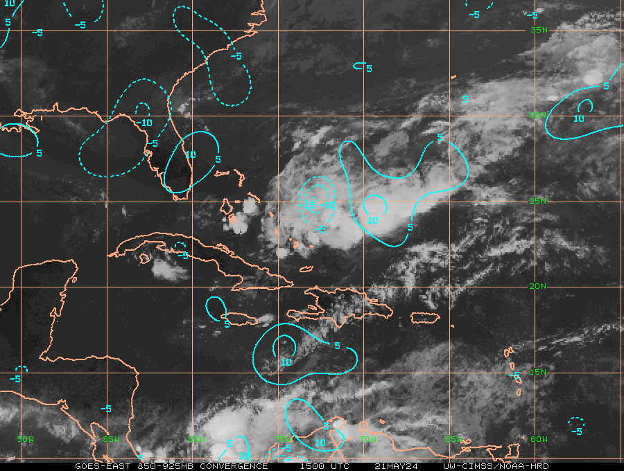
That's the center, it was relocated this morning to the south...

IMO, going to go over PR and skirt DR... Keeps circulation center weak and goes farther west... Track west shift at 11am is my prediction... See my disclaimer below... :D
http://www.ssd.noaa.gov/PS/TROP/floater ... short.html
Last edited by Blown Away on Thu Aug 27, 2015 9:42 am, edited 2 times in total.
0 likes   
Hurricane Eye Experience: David 79, Irene 99, Frances 04, Jeanne 04, Wilma 05... EYE COMING MY WAY IN 2024…
Hurricane Brush Experience: Andrew 92, Erin 95, Floyd 99, Matthew 16, Irma 17, Ian 22, Nicole 22…

BobHarlem
Category 5
Category 5
Posts: 2125
Joined: Thu Oct 20, 2005 6:11 pm

Re: ATL: ERIKA - Tropical Storm - Discussion

#1442 Postby BobHarlem » Thu Aug 27, 2015 9:40 am

Kohlecane wrote:anyone got a good radar link :wink:


I've been using http://flhurricane.com/imageanimator.php?175 it has a long run loop which makes it easier to see movement (but not this crazy center reformation)
0 likes   

shortwave
S2K Supporter
S2K Supporter
Posts: 156
Age: 53
Joined: Mon May 24, 2004 5:56 pm
Location: palm bay, fl.

Re:

#1443 Postby shortwave » Thu Aug 27, 2015 9:40 am

Aric Dunn wrote:either that or its opening up into a wave..


Given what recon is finding I'm thinking that may be occurring or will possibly occur around PR and DR. Either or it's poorly organized.
0 likes   
Personal Forecast Disclaimer:
The posts in this forum are NOT official forecast and should not be used as such. They are just the opinion of the poster and may or may not be backed by sound meteorological data. They are NOT endorsed by any professional institution or storm2k.org. For official information, please refer to the NHC and NWS products.

User avatar
msbee
S2K Supporter
S2K Supporter
Posts: 3027
Joined: Wed Jun 11, 2003 10:11 am
Location: St. Maarten

Re: ATL: ERIKA - Tropical Storm - Discussion

#1444 Postby msbee » Thu Aug 27, 2015 9:40 am

SouthFLTropics wrote:
janswizard wrote:Dominica is reporting close to 9 inches of rain from Erika. They are in a state of emergency. Looks like lots of rebuilding will have to be done.


Sad :cry: and once again shows that it doesn't take a hurricane to mess up peoples lives. Any tropical system can mean business.

SFT


especially in the islands, where structures are not as solid. and Dominic has man many rivers which easily overflow with so much rain
0 likes   
Too many hurricanes to remember

User avatar
gatorcane
S2K Supporter
S2K Supporter
Posts: 23691
Age: 47
Joined: Sun Mar 13, 2005 3:54 pm
Location: Boca Raton, FL

#1445 Postby gatorcane » Thu Aug 27, 2015 9:40 am

:uarrow: That is a pretty big shift south, you got to think the models will shift west. The guidance is mostly just to the NE of Puerto Rico, doesn't look like it will come close to verifying. Of course there is land interaction now at play too.
0 likes   

tolakram
Admin
Admin
Posts: 20012
Age: 62
Joined: Sun Aug 27, 2006 8:23 pm
Location: Florence, KY (name is Mark)

Re: ATL: ERIKA - Tropical Storm - Discussion

#1446 Postby tolakram » Thu Aug 27, 2015 9:42 am

It should be poorly organized, most of the models show multiple centers and/or poor definition. What is the unknown, in my opinion, is if reorganization will pull Erika significantly off track.
0 likes   
M a r k
- - - - -
Join us in chat: Storm2K Chatroom Invite. Android and IOS apps also available.

The posts in this forum are NOT official forecasts and should not be used as such. Posts are NOT endorsed by any professional institution or STORM2K.org. For official information and forecasts, please refer to NHC and NWS products.

User avatar
msbee
S2K Supporter
S2K Supporter
Posts: 3027
Joined: Wed Jun 11, 2003 10:11 am
Location: St. Maarten

Re: ATL: ERIKA - Tropical Storm - Discussion

#1447 Postby msbee » Thu Aug 27, 2015 9:42 am

txwatcher91 wrote:
Kohlecane wrote:anyone got a good radar link :wink:


Try this one.
http://www.barbadosweather.org/Composit ... 1440635457


this link also has radar

http://www.meteofrance.gp/previsions-me ... r/antilles
0 likes   
Too many hurricanes to remember

Aric Dunn
Category 5
Category 5
Posts: 21238
Age: 42
Joined: Sun Sep 19, 2004 9:58 pm
Location: Ready for the Chase.
Contact:

Re: ATL: ERIKA - Tropical Storm - Discussion

#1448 Postby Aric Dunn » Thu Aug 27, 2015 9:43 am

The fact that the center/vort is moving on a slight wsw vector leads me to believe there is multiple vorts in there somewhere or a reformation and that old center will die out... radar not showing much evidence of another center but the current one is rotating away from the convection.

Image
0 likes   
Note: If I make a post that is brief. Please refer back to previous posts for the analysis or reasoning. I do not re-write/qoute what my initial post said each time.
If there is nothing before... then just ask :)

Space & Atmospheric Physicist, Embry-Riddle Aeronautical University,
I believe the sky is falling...

User avatar
SouthFLTropics
Category 5
Category 5
Posts: 4236
Age: 50
Joined: Thu Aug 14, 2003 8:04 am
Location: Port St. Lucie, Florida

Re: ATL: ERIKA - Tropical Storm - Discussion

#1449 Postby SouthFLTropics » Thu Aug 27, 2015 9:43 am

If that is the center then she is over a full latitude south of the 18z forecast point!!! :spam:
0 likes   
Fourth Generation Florida Native

Personal Storm History: David 79, Andrew 92, Erin 95, Floyd 99, Irene 99, Frances 04, Jeanne 04, Wilma 05, Matthew 16, Irma 17, Ian 22, Nicole 22, Milton 24

User avatar
drezee
S2K Supporter
S2K Supporter
Posts: 3664
Joined: Mon Jun 09, 2003 12:49 pm
Location: FL

#1450 Postby drezee » Thu Aug 27, 2015 9:44 am

Based on recon, I almost feel like Erika has an elongated trough axis to the SW with an eddy "LLC" attached. She better get it right before the shear comes back. This is not a robust structure to tackle shear, let alone Hispaniola.
0 likes   

User avatar
tailgater
S2K Supporter
S2K Supporter
Posts: 3339
Joined: Sun Jul 11, 2004 9:13 pm
Location: St. Amant La.

Re: ATL: ERIKA - Tropical Storm - Discussion

#1451 Postby tailgater » Thu Aug 27, 2015 9:45 am

tailgater wrote:Look where the convergence is and 850 vorticty


Image

Image
0 likes   
The following post is NOT an official forecast and should not be used as such. It is just the opinion of the poster and may or may not be backed by sound meteorological data. It is NOT endorsed by any professional institution including storm2k.org For Official Information please refer to the NHC and NWS products.

User avatar
ConvergenceZone
Category 5
Category 5
Posts: 5194
Joined: Fri Jul 29, 2005 1:40 am
Location: Northern California

Re:

#1452 Postby ConvergenceZone » Thu Aug 27, 2015 9:45 am

Aric Dunn wrote:either that or its opening up into a wave..


That would be pretty crazy to go from a 50 mph storm right to a wave. Not that it couldn't happen though I suppose.
0 likes   

BucMan2
Tropical Storm
Tropical Storm
Posts: 108
Joined: Fri Aug 21, 2015 10:05 am

#1453 Postby BucMan2 » Thu Aug 27, 2015 9:46 am

what implications if any will this have on:
1. The Track ?
2. Intensity potential down the road?
0 likes   

Aric Dunn
Category 5
Category 5
Posts: 21238
Age: 42
Joined: Sun Sep 19, 2004 9:58 pm
Location: Ready for the Chase.
Contact:

Re: ATL: ERIKA - Tropical Storm - Discussion

#1454 Postby Aric Dunn » Thu Aug 27, 2015 9:47 am

being that its right over the radar.. watching the loops there might be another center/vort that developed (red circle) hard to be for sure but it would explain the current the motion of the present circ/vort. recon will be able to verify if they fly through this area.


Image
0 likes   
Note: If I make a post that is brief. Please refer back to previous posts for the analysis or reasoning. I do not re-write/qoute what my initial post said each time.
If there is nothing before... then just ask :)

Space & Atmospheric Physicist, Embry-Riddle Aeronautical University,
I believe the sky is falling...

User avatar
SouthFLTropics
Category 5
Category 5
Posts: 4236
Age: 50
Joined: Thu Aug 14, 2003 8:04 am
Location: Port St. Lucie, Florida

Re: ATL: ERIKA - Tropical Storm - Discussion

#1455 Postby SouthFLTropics » Thu Aug 27, 2015 9:48 am

I do not envy the forecaster on duty at the NHC right now...tough call on the 11:00AM forecast and discussion.

SFT
0 likes   
Fourth Generation Florida Native

Personal Storm History: David 79, Andrew 92, Erin 95, Floyd 99, Irene 99, Frances 04, Jeanne 04, Wilma 05, Matthew 16, Irma 17, Ian 22, Nicole 22, Milton 24

Aric Dunn
Category 5
Category 5
Posts: 21238
Age: 42
Joined: Sun Sep 19, 2004 9:58 pm
Location: Ready for the Chase.
Contact:

#1456 Postby Aric Dunn » Thu Aug 27, 2015 9:50 am

also the center/vort shows up very nicely on here..

http://weather.msfc.nasa.gov/GOES/goeseastconus.html
0 likes   
Note: If I make a post that is brief. Please refer back to previous posts for the analysis or reasoning. I do not re-write/qoute what my initial post said each time.
If there is nothing before... then just ask :)

Space & Atmospheric Physicist, Embry-Riddle Aeronautical University,
I believe the sky is falling...

Dean4Storms
S2K Supporter
S2K Supporter
Posts: 6358
Age: 62
Joined: Sun Aug 31, 2003 1:01 pm
Location: Miramar Bch. FL

Re: ATL: ERIKA - Tropical Storm - Discussion

#1457 Postby Dean4Storms » Thu Aug 27, 2015 9:51 am

redneck51 wrote:@Dean4Storms: Dominica -- NOT Dominican Republic

Image


Yes, Thanks! I caught that and edited my question to msbee.
0 likes   

User avatar
drezee
S2K Supporter
S2K Supporter
Posts: 3664
Joined: Mon Jun 09, 2003 12:49 pm
Location: FL

Re: ATL: ERIKA - Tropical Storm - Discussion

#1458 Postby drezee » Thu Aug 27, 2015 9:51 am

SouthFLTropics wrote:I do not envy the forecaster on duty at the NHC right now...tough call on the 11:00AM forecast and discussion.

SFT

I would punt until the 5pm advisory. I would do a midpoint adjustment on the track between the previous position. I would need to know how the 12z models feel about the center reformation...
0 likes   

BobHarlem
Category 5
Category 5
Posts: 2125
Joined: Thu Oct 20, 2005 6:11 pm

Re: ATL: ERIKA - Tropical Storm - Discussion

#1459 Postby BobHarlem » Thu Aug 27, 2015 9:53 am

drezee wrote:
SouthFLTropics wrote:I do not envy the forecaster on duty at the NHC right now...tough call on the 11:00AM forecast and discussion.

SFT

I would punt until the 5pm advisory. I would do a midpoint adjustment on the track between the previous position. I would need to know how the 12z models feel about the center reformation...


A situation like this is probably one ripe with internal disagreements, so punting is probably what they will do.
0 likes   

Dean4Storms
S2K Supporter
S2K Supporter
Posts: 6358
Age: 62
Joined: Sun Aug 31, 2003 1:01 pm
Location: Miramar Bch. FL

Re:

#1460 Postby Dean4Storms » Thu Aug 27, 2015 9:53 am

Aric Dunn wrote:also the center/vort shows up very nicely on here..

http://weather.msfc.nasa.gov/GOES/goeseastconus.html


Very disorganized and going to be a track shift westward, that isn't going north of PR!
0 likes   


Return to “2015”

Who is online

Users browsing this forum: No registered users and 3 guests