ATL: JOAQUIN - Post-Tropical - Discussion

Moderator: S2k Moderators

Message
Author
TheStormExpert

Re: Re:

#1161 Postby TheStormExpert » Wed Sep 30, 2015 5:44 pm

Alyono wrote:
wxman57 wrote:
green eyed girl wrote:Is anyone familiar with how storm surge and flooding affects Virginia Beach during a hurricane? My daughter and her family just moved there a few months ago since her husband is in the navy and we are familiar with hurricanes here in New Orleans, but not in Virginia Beach. They are preparing now just in case it does come their way, but I would like her to have an idea of what she could expect. Thank you!


I've run SLOSH (surge model) for a Cat 2 of average size striking near Hatteras from the SE and get a surge height of 6-8 feet in the Virginia Beach area. Could be a bit higher in bays/river inlets. Consider the heavy rain Thu/Fri combined with 10-15" from Joaquin and there will be flooding problems everywhere.


looking at the models, this may be significantly larger than average sized at landfall

Will it still be purely tropical at landfall?
0 likes   

TheStormExpert

#1162 Postby TheStormExpert » Wed Sep 30, 2015 5:50 pm

Last Saved Visible Loop of Joaquin before the sun sets.

Image
0 likes   

Aric Dunn
Category 5
Category 5
Posts: 21238
Age: 42
Joined: Sun Sep 19, 2004 9:58 pm
Location: Ready for the Chase.
Contact:

#1163 Postby Aric Dunn » Wed Sep 30, 2015 5:51 pm

Finally seeing the eye starting to clear out..


http://www.ssd.noaa.gov/PS/TROP/floater ... -long.html

IR also showing convection building up the west and nw side.. just in time for recon..
0 likes   
Note: If I make a post that is brief. Please refer back to previous posts for the analysis or reasoning. I do not re-write/qoute what my initial post said each time.
If there is nothing before... then just ask :)

Space & Atmospheric Physicist, Embry-Riddle Aeronautical University,
I believe the sky is falling...

User avatar
Yellow Evan
Professional-Met
Professional-Met
Posts: 16143
Age: 27
Joined: Fri Jul 15, 2011 12:48 pm
Location: Henderson, Nevada/Honolulu, HI
Contact:

#1164 Postby Yellow Evan » Wed Sep 30, 2015 5:52 pm

On BD, I'm not seeing any signs of an eye clearing though.
0 likes   

User avatar
wxman57
Moderator-Pro Met
Moderator-Pro Met
Posts: 22979
Age: 67
Joined: Sat Jun 21, 2003 8:06 pm
Location: Houston, TX (southwest)

Re: ATL: JOAQUIN - Hurricane - Discussion

#1165 Postby wxman57 » Wed Sep 30, 2015 5:52 pm

windnrain wrote:
wxman57 wrote:All models are shifting farther south for landfall - North Carolina vs. Virginia. All models, that is, except the Eurpoean which takes it north of Bermuda and near Ireland at day 10. NHC is still wondering if the EC is right, so they likely won't make any significant track shift this afternoon - splitting the difference between most of the models and the EC. That pretty much guarantees their track will be wrong, but not as wrong as if they indicated a U.S. landfall and the EC track was right.


I hate this. This will be statistically "more correct" but in reality, less correct. We have models and we have humans who are paid to understand weather and who studied it all their lives. I'd love to see humans begin to commit to solutions here... and the ones who consistently get it right, should be rewarded.


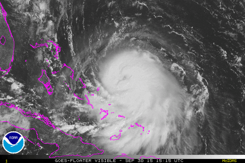
Note that the NHC's primary mission relates to public safety. It doesn't do the public any good to show a 5-day track striking the coast when they're not very confident it will impact that area and the landfall point (if any) will likely change, perhaps considerably. Think back to Erika earlier this season. Florida was in a panic when track confidence was still low. The NHC forecasters have seen the evidence shift more strongly into the east coast hit scenario over the past 2-3 model runs and they've decided to commit. I thought they might hold off until tomorrow since the ECMWF is so far east and a few more of the EC ensembles shifted east as well.

Private companies, like the one I work for, deal with businesses, not the general public. These businesses have specific hurricane response plans that require actions to be taken 5-7 days prior to possible (not guaranteed) impact. We don't have the luxury of waiting until we're sure of landfall before committing. Believe me, I got into the office yesterday morning and saw how the models were diverging and I wished I could just issue a 48-72 hour track vs. the 7-day track we've been producing for years. I worked on the track for over 3 hours and came up with an east coast hit after first taking it out to sea past Bermuda.
0 likes   

AutoPenalti
Category 5
Category 5
Posts: 4030
Age: 29
Joined: Mon Aug 17, 2015 4:16 pm
Location: Ft. Lauderdale, Florida

#1166 Postby AutoPenalti » Wed Sep 30, 2015 5:53 pm

Looks like it stalled out. Anyone can confirm this?
0 likes   
The posts in this forum are NOT official forecasts and should not be used as such. They are just the opinion of the poster and may or may not be backed by sound meteorological data. They are NOT endorsed by any professional institution or STORM2K. For official information, please refer to products from the NHC and NWS.


Model Runs Cheat Sheet:
GFS (5:30 AM/PM, 11:30 AM/PM)
HWRF, GFDL, UKMET, NAVGEM (6:30-8:00 AM/PM, 12:30-2:00 AM/PM)
ECMWF (1:45 AM/PM)

TCVN
is a weighted averaged

User avatar
wxman57
Moderator-Pro Met
Moderator-Pro Met
Posts: 22979
Age: 67
Joined: Sat Jun 21, 2003 8:06 pm
Location: Houston, TX (southwest)

Re: Re:

#1167 Postby wxman57 » Wed Sep 30, 2015 5:54 pm

Alyono wrote:
wxman57 wrote:
green eyed girl wrote:Is anyone familiar with how storm surge and flooding affects Virginia Beach during a hurricane? My daughter and her family just moved there a few months ago since her husband is in the navy and we are familiar with hurricanes here in New Orleans, but not in Virginia Beach. They are preparing now just in case it does come their way, but I would like her to have an idea of what she could expect. Thank you!


I've run SLOSH (surge model) for a Cat 2 of average size striking near Hatteras from the SE and get a surge height of 6-8 feet in the Virginia Beach area. Could be a bit higher in bays/river inlets. Consider the heavy rain Thu/Fri combined with 10-15" from Joaquin and there will be flooding problems everywhere.


looking at the models, this may be significantly larger than average sized at landfall


Larger in terms of the lower-end wind field (20-30 mph) but not the 50 kts or greater winds which produce the bulk of the surge. The larger lower-end wind field will result in more of a setup tide pre-landfall, perhaps 2-3 feet above normal along a large section of the East Coast on Saturday.
0 likes   

Aric Dunn
Category 5
Category 5
Posts: 21238
Age: 42
Joined: Sun Sep 19, 2004 9:58 pm
Location: Ready for the Chase.
Contact:

Re:

#1168 Postby Aric Dunn » Wed Sep 30, 2015 5:55 pm

AutoPenalti wrote:Looks like it stalled out. Anyone can confirm this?


mentioned earlier that it has really slowed just crawling..

the eye is starting to show for sure though..
0 likes   
Note: If I make a post that is brief. Please refer back to previous posts for the analysis or reasoning. I do not re-write/qoute what my initial post said each time.
If there is nothing before... then just ask :)

Space & Atmospheric Physicist, Embry-Riddle Aeronautical University,
I believe the sky is falling...

User avatar
wxman57
Moderator-Pro Met
Moderator-Pro Met
Posts: 22979
Age: 67
Joined: Sat Jun 21, 2003 8:06 pm
Location: Houston, TX (southwest)

Re: Re:

#1169 Postby wxman57 » Wed Sep 30, 2015 5:56 pm

TheStormExpert wrote:Will it still be purely tropical at landfall?


Looks like that will be the case. However, the gradient between high pressure to the north and the center of Joaquin will produce a large area of 25-35 mph winds well north of landfall, through Long Island and possibly up to Cape Cod.
0 likes   

User avatar
hurricanedude
Military Member
Military Member
Posts: 1856
Joined: Tue Oct 08, 2002 9:54 am
Location: Virginia Beach, Virginia
Contact:

Re: ATL: JOAQUIN - Hurricane - Discussion

#1170 Postby hurricanedude » Wed Sep 30, 2015 5:59 pm

OK WXMAN57...whats your take on Va Beach as of now....could we see gusts to Cane force?
0 likes   

User avatar
Bocadude85
Category 5
Category 5
Posts: 2991
Age: 38
Joined: Mon Apr 18, 2005 2:20 pm
Location: Honolulu,Hi

Re:

#1171 Postby Bocadude85 » Wed Sep 30, 2015 6:03 pm

AutoPenalti wrote:Looks like it stalled out. Anyone can confirm this?


Still looks to be moving SW to me. Looks to be ready to go south of 24 north here in the next hour or so.
0 likes   

Aric Dunn
Category 5
Category 5
Posts: 21238
Age: 42
Joined: Sun Sep 19, 2004 9:58 pm
Location: Ready for the Chase.
Contact:

Re: ATL: JOAQUIN - Hurricane - Discussion

#1172 Postby Aric Dunn » Wed Sep 30, 2015 6:03 pm

Hello.... there newly born eye.. lol

Image
0 likes   
Note: If I make a post that is brief. Please refer back to previous posts for the analysis or reasoning. I do not re-write/qoute what my initial post said each time.
If there is nothing before... then just ask :)

Space & Atmospheric Physicist, Embry-Riddle Aeronautical University,
I believe the sky is falling...

User avatar
MGC
S2K Supporter
S2K Supporter
Posts: 5899
Joined: Sun Mar 23, 2003 9:05 pm
Location: Pass Christian MS, or what is left.

Re: ATL: JOAQUIN - Hurricane - Discussion

#1173 Postby MGC » Wed Sep 30, 2015 6:03 pm

Hey 57, What kind of surge will occur in the Chesapeake Bay? Is that 6-8 feet valid for the Atlantic facing beaches?.....MGC
0 likes   

CrazyC83
Professional-Met
Professional-Met
Posts: 34002
Joined: Tue Mar 07, 2006 11:57 pm
Location: Deep South, for the first time!

#1174 Postby CrazyC83 » Wed Sep 30, 2015 6:04 pm

000
URNT15 KNHC 302301
AF309 0511A JOAQUIN HDOB 21 20150930
225200 2614N 07539W 3758 08045 0423 -168 -351 100031 032 006 000 00
225230 2613N 07537W 3758 08043 0422 -165 -357 101033 034 007 000 00
225300 2612N 07535W 3758 08043 0421 -167 -361 099031 033 008 000 00
225330 2611N 07534W 3757 08044 0421 -174 -362 094029 029 010 000 00
225400 2610N 07532W 3759 08042 0421 -175 -358 093028 029 009 000 00
225430 2609N 07530W 3780 08006 0422 -173 -351 088027 028 008 000 00
225500 2608N 07527W 3907 07766 0415 -158 -333 075023 026 007 000 00
225530 2607N 07525W 4066 07466 0397 -136 -285 047019 022 008 000 00
225600 2606N 07523W 4238 07150 0376 -116 -233 038020 020 008 000 00
225630 2604N 07521W 4409 06845 0354 -094 -190 035021 021 009 002 00
225700 2603N 07519W 4582 06541 0329 -072 -181 042022 024 009 000 00
225730 2602N 07517W 4750 06258 0309 -058 -166 044025 025 006 000 00
225800 2601N 07515W 4923 05977 0290 -048 -140 043027 027 008 001 00
225830 2600N 07513W 5110 05684 0271 -035 -081 039026 027 006 000 00
225900 2559N 07511W 5294 05403 0252 -017 -067 041027 028 006 000 00
225930 2558N 07509W 5480 05125 0234 +005 -076 045027 027 008 000 00
230000 2557N 07507W 5675 04843 0006 +024 -044 043027 028 011 000 00
230030 2556N 07505W 5865 04564 9999 +039 -029 045028 029 013 003 00
230100 2555N 07503W 6072 04282 0000 +051 +005 045026 028 017 001 00
230130 2554N 07502W 6279 04007 0003 +067 +021 032023 025 011 001 00
$$
;

Descending.
0 likes   

User avatar
Hammy
Category 5
Category 5
Posts: 5849
Age: 41
Joined: Fri May 25, 2012 5:25 pm
Contact:

#1175 Postby Hammy » Wed Sep 30, 2015 6:07 pm

Going on satellite appearance I'm expecting little to no change in intensity when the plane arrives. The deepest convection is still struggling to wrap around the western side and it probably won't be able to strengthen until it does.
0 likes   
The above post is not official and should not be used as such. It is the opinion of the poster and may or may not be backed by sound meteorological data. It is not endorsed by any professional institution or storm2k.org. For official information, please refer to the NHC and NWS products.

Aric Dunn
Category 5
Category 5
Posts: 21238
Age: 42
Joined: Sun Sep 19, 2004 9:58 pm
Location: Ready for the Chase.
Contact:

Re:

#1176 Postby Aric Dunn » Wed Sep 30, 2015 6:08 pm

Hammy wrote:Going on satellite appearance I'm expecting little to no change in intensity when the plane arrives. The deepest convection is still struggling to wrap around the western side and it probably won't be able to strengthen until it does.


ill go with 90pmh...
0 likes   
Note: If I make a post that is brief. Please refer back to previous posts for the analysis or reasoning. I do not re-write/qoute what my initial post said each time.
If there is nothing before... then just ask :)

Space & Atmospheric Physicist, Embry-Riddle Aeronautical University,
I believe the sky is falling...

CrazyC83
Professional-Met
Professional-Met
Posts: 34002
Joined: Tue Mar 07, 2006 11:57 pm
Location: Deep South, for the first time!

#1177 Postby CrazyC83 » Wed Sep 30, 2015 6:13 pm

000
URNT15 KNHC 302311
AF309 0511A JOAQUIN HDOB 22 20150930
230200 2553N 07500W 6474 03754 0001 +084 +032 040024 025 011 000 00
230230 2552N 07458W 6676 03499 0005 +095 +050 037024 025 009 000 00
230300 2551N 07456W 6902 03220 0007 +107 +059 029025 025 009 000 00
230330 2550N 07455W 6963 03133 0004 +109 +061 027024 025 011 000 00
230400 2549N 07453W 6967 03128 0004 +108 +067 031023 024 014 000 00
230430 2548N 07451W 6967 03126 9999 +109 +064 029026 027 014 000 00
230500 2548N 07450W 6966 03126 0000 +106 +065 029026 026 014 000 00
230530 2547N 07448W 6967 03124 0000 +109 +062 027026 026 014 000 00
230600 2546N 07446W 6967 03124 0000 +105 +069 029026 026 016 000 00
230630 2545N 07445W 6967 03123 0000 +107 +074 031026 026 014 001 00
230700 2543N 07443W 6966 03123 9997 +105 +073 031024 026 017 000 00
230730 2542N 07442W 6967 03120 9994 +107 +069 034025 025 019 000 00
230800 2541N 07440W 6967 03119 9992 +110 +057 039025 025 020 000 00
230830 2539N 07439W 6969 03118 9991 +110 +052 042026 027 021 000 00
230900 2538N 07437W 6967 03119 9990 +110 +053 039025 026 023 000 00
230930 2537N 07436W 6966 03119 9994 +110 +056 035026 026 023 000 00
231000 2535N 07435W 6967 03117 9993 +110 +059 033026 026 025 000 00
231030 2534N 07433W 6966 03119 9986 +112 +067 037028 029 025 000 00
231100 2533N 07432W 6963 03119 9985 +111 +063 039028 029 027 000 00
231130 2532N 07430W 6966 03117 9985 +113 +052 041029 029 025 000 00
$$
;
0 likes   

TimeZone

#1178 Postby TimeZone » Wed Sep 30, 2015 6:14 pm

Still as one sided as ever. Western side looking rather sad this evening. Starting to doubt this thing ever becomes a major. Dry air causing problems by the looks of it. Certainly not going to win any beauty contests. :lol:
0 likes   

CrazyC83
Professional-Met
Professional-Met
Posts: 34002
Joined: Tue Mar 07, 2006 11:57 pm
Location: Deep South, for the first time!

Re:

#1179 Postby CrazyC83 » Wed Sep 30, 2015 6:17 pm

TimeZone wrote:Still as one sided as ever. Western side looking rather sad this evening. Starting to doubt this thing ever becomes a major. Dry air causing problems by the looks of it. Certainly not going to win any beauty contests. :lol:


It doesn't take a major hurricane to cause major problems though.
0 likes   

User avatar
Yellow Evan
Professional-Met
Professional-Met
Posts: 16143
Age: 27
Joined: Fri Jul 15, 2011 12:48 pm
Location: Henderson, Nevada/Honolulu, HI
Contact:

#1180 Postby Yellow Evan » Wed Sep 30, 2015 6:20 pm

I remain confident this will become a major.

This is quite typical of a high-end Cat 1/low-end Cat 2. TC's usually intensify steadily, then plateau and look ugly before the eye clears. We're at the ugly stage.
0 likes   


Return to “2015”

Who is online

Users browsing this forum: No registered users and 9 guests