

Sunset
Moderator: S2k Moderators
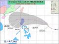

euro6208 wrote:2013NOV07 093000 7.8 870.7 +4.3 164.0 7.8 8.0 8.0 NO LIMIT OFF OFF 17.96 -83.77 EYE 26 IR 95.9 10.02 -129.76 COMBO MTSAT1 16.7
Unbelievable...i am really excited for haiyan!
Filipinas50 wrote:euro6208 wrote:2013NOV07 093000 7.8 870.7 +4.3 164.0 7.8 8.0 8.0 NO LIMIT OFF OFF 17.96 -83.77 EYE 26 IR 95.9 10.02 -129.76 COMBO MTSAT1 16.7
Unbelievable...i am really excited for haiyan!
Excited? There are 100's or even 1,000's of lives are at risk from this monster storm ...


Alyono wrote:The satellite appearance is perfect
If we had recon, winds of 175 KT may be justifiable as they were with Megi


euro6208 wrote:Fellow storm2k member, Typhoon Hunter, is currently doing recon for haiyang in central/southern leyte...
this is what he has to say...James Reynolds @typhoonfury 34m
Storm so severe we're making adjustments to our plan, found more solid building, nervous to say the least #YolandaPH #Haiyan
cycloneye wrote:Let's see if this cam continues to work in the next few hours.
Web Cam with audio in Boracay


euro6208 wrote:Fellow storm2k member, Typhoon Hunter, is currently doing recon for haiyang in central/southern leyte...
this is what he has to say...
James Reynolds @typhoonfury 34m
Storm so severe we're making adjustments to our plan, found more solid building, nervous to say the least #YolandaPH #Haiyan
https://twitter.com/typhoonfury
Users browsing this forum: No registered users and 64 guests
