
I would not get too hung up on these small eddys. They will likely dissipate. The center that should become dominate is where the strong convection is starting to wrap around the MCL. The storm looks to be slowly intensifying as it slowly moves......MGC
The above is the opinion of MGC and not an official forecast.
ATL: ARTHUR - Post-Tropical - Discussion
Moderator: S2k Moderators
-
ConvergenceZone
.gif)
- Category 5

- Posts: 5241
- Joined: Fri Jul 29, 2005 1:40 am
- Location: Northern California
Re: ATL: ARTHUR - Tropical Storm - Discussion
Any bets on wind speed on the next update in about 40 minutes? Same wind speed? An Increase?
0 likes
-
Evil Jeremy

- S2K Supporter

- Posts: 5463
- Age: 32
- Joined: Mon Apr 10, 2006 2:10 pm
- Location: Los Angeles, CA
Re: ATL: ARTHUR - Tropical Storm - Discussion
ConvergenceZone wrote:Any bets on wind speed on the next update in about 40 minutes? Same wind speed? An Increase?
I'm sure NHC will hold on intensity until they get recon in there overnight.
0 likes
Frances 04 / Jeanne 04 / Katrina 05 / Wilma 05 / Fay 08 / Debby 12 / Andrea 13 / Colin 16 / Hermine 16 / Matthew 16 / Irma 17

-
Aric Dunn
- Category 5
- Posts: 21238
- Age: 43
- Joined: Sun Sep 19, 2004 9:58 pm
- Location: Ready for the Chase.
- Contact:
Re:
Alyono wrote:I have a question. How are there not warnings out for the Bahamas when they are reporting winds near TS intensity?
its up to the government of each country to decide on watches and warnings.
0 likes
Note: If I make a post that is brief. Please refer back to previous posts for the analysis or reasoning. I do not re-write/qoute what my initial post said each time.
If there is nothing before... then just ask
Space & Atmospheric Physicist, Embry-Riddle Aeronautical University,
I believe the sky is falling...
If there is nothing before... then just ask
Space & Atmospheric Physicist, Embry-Riddle Aeronautical University,
I believe the sky is falling...
-
hurricanes1234
- Category 5
- Posts: 2908
- Joined: Sat Jul 28, 2012 6:19 pm
- Location: Trinidad and Tobago
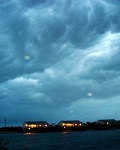
Growing convection despite the fact that it's diurnal minimum now...

( This file is not viewable on all devices.)
(
0 likes
PLEASE NOTE: With the exception of information from weather agencies that I may copy and paste here, my posts will NEVER be official, since I am NOT a meteorologist. They are solely my amateur opinion, and may or may not be accurate. Therefore, please DO NOT use them as official details, particularly when making important decisions. Thank you.
-
'CaneFreak

- Category 5
- Posts: 1487
- Joined: Mon Jun 05, 2006 10:50 am
- Location: New Bern, NC
Re:
I bet they include them in the warning at the new advisory.
Alyono wrote:I have a question. How are there not warnings out for the Bahamas when they are reporting winds near TS intensity?
0 likes
-
Bocadude85

- Category 5
- Posts: 2991
- Age: 39
- Joined: Mon Apr 18, 2005 2:20 pm
- Location: Honolulu,Hi
Re: Re:
'CaneFreak wrote:I bet they include them in the warning at the new advisory.Alyono wrote:I have a question. How are there not warnings out for the Bahamas when they are reporting winds near TS intensity?
I do not see why they would include them in the warning now as the system is pulling away. The 5pm advisory said Grand Bahama Island was reporting sustained winds at 39mph gusting to 51mph
0 likes
-
MaineWeatherNut
- Tropical Storm

- Posts: 225
- Joined: Sun Sep 01, 2013 5:06 pm
Re: Re:
TheStormExpert wrote:'CaneFreak wrote:I bet they include them in the warning at the new advisory.Alyono wrote:I have a question. How are there not warnings out for the Bahamas when they are reporting winds near TS intensity?
Depends if and where the center relocates.
I doubt the center will be doing any more relocations. This one appears to be the final Center of Circulation with a banding eyewall feature developing where the convection is wrapping around... Very clear on Radar.
0 likes
The content of this post does NOT constitute official forecast and should not be used as such. They are the opinion of the poster and may or may not be backed by sound meteorological data. They are NOT endorsed by any professional institution or Storm2K. For official information, please refer to the local meteorological centers of respective areas.
-
AJC3

- Admin

- Posts: 4156
- Age: 62
- Joined: Tue Aug 31, 2004 7:04 pm
- Location: Ballston Spa, New York
- Contact:
Re: ATL: ARTHUR - Tropical Storm - Discussion
hurricanefloyd5 wrote:Tropical storm conditions possible. Showers likely and possibly a thunderstorm before 11pm, then scattered showers and thunderstorms after 11pm. Some of the storms could produce heavy rain. Mostly cloudy, with a low around 77. Strong and damaging winds. Chance of precipitation is 60%.
Wednesday Tropical storm conditions possible. Showers and thunderstorms likely. Mostly cloudy, with a high near 93. Strong and damaging winds. Chance of precipitation is 70%.
This is for the micco area out of the NWS in Melbourne FL
There is a problem with the national point and click forecasts. It shouldn't have that verbiage in it, given the forecast conditions. We've been trying to get the powers that be to fix it. No luck yet, obviously. That should disappear at the top of the next hour, hopefully.
0 likes
-
AJC3
- Admin
- Posts: 4156
- Age: 62
- Joined: Tue Aug 31, 2004 7:04 pm
- Location: Ballston Spa, New York
- Contact:
Re: ATL: ARTHUR - Tropical Storm - Discussion
AJC3 wrote:hurricanefloyd5 wrote:Tropical storm conditions possible. Showers likely and possibly a thunderstorm before 11pm, then scattered showers and thunderstorms after 11pm. Some of the storms could produce heavy rain. Mostly cloudy, with a low around 77. Strong and damaging winds. Chance of precipitation is 60%.
Wednesday Tropical storm conditions possible. Showers and thunderstorms likely. Mostly cloudy, with a high near 93. Strong and damaging winds. Chance of precipitation is 70%.
This is for the micco area out of the NWS in Melbourne FL
There is a problem with the national point and click forecasts. It shouldn't have that verbiage in it, given the forecast conditions. We've been trying to get the powers that be to fix it. No luck yet, obviously. That should disappear at the top of the next hour, hopefully.
And it looks like it did....

0 likes
-
cycloneye

- Admin
- Posts: 149575
- Age: 69
- Joined: Thu Oct 10, 2002 10:54 am
- Location: San Juan, Puerto Rico
Re: ATL: ARTHUR - Tropical Storm - Discussion
No change in intensity.
SUMMARY OF 800 PM EDT...0000 UTC...INFORMATION
----------------------------------------------
LOCATION...27.8N 79.3W
ABOUT 90 MI...145 KM ESE OF CAPE CANAVERAL FLORIDA
ABOUT 95 MI...155 KM NNW OF FREEPORT GRAND BAHAMA ISLAND
MAXIMUM SUSTAINED WINDS...50 MPH...85 KM/H
PRESENT MOVEMENT...STATIONARY
MINIMUM CENTRAL PRESSURE...1003 MB...29.62 INCHES
0 likes
Visit the Caribbean-Central America Weather Thread where you can find at first post web cams,radars
and observations from Caribbean basin members Click Here
and observations from Caribbean basin members Click Here
-
Aric Dunn
- Category 5
- Posts: 21238
- Age: 43
- Joined: Sun Sep 19, 2004 9:58 pm
- Location: Ready for the Chase.
- Contact:
nice expanding CDO..
0 likes
Note: If I make a post that is brief. Please refer back to previous posts for the analysis or reasoning. I do not re-write/qoute what my initial post said each time.
If there is nothing before... then just ask
Space & Atmospheric Physicist, Embry-Riddle Aeronautical University,
I believe the sky is falling...
If there is nothing before... then just ask
Space & Atmospheric Physicist, Embry-Riddle Aeronautical University,
I believe the sky is falling...
-
TheAustinMan

- Category 5
- Posts: 1060
- Joined: Mon Jul 08, 2013 4:26 pm
- Location: Central TX / United States
Per the intermediate advisory -- "...WINDS TO TROPICAL STORM FORCE ARE
OCCURRING INTERMITTENTLY ON THE WESTERN END OF GRAND BAHAMA
ISLAND...AND ARE LIKELY TO CONTINUE THERE THIS EVENING."
Also, present movement is listed as stationary.
OCCURRING INTERMITTENTLY ON THE WESTERN END OF GRAND BAHAMA
ISLAND...AND ARE LIKELY TO CONTINUE THERE THIS EVENING."
Also, present movement is listed as stationary.
0 likes
Treat my opinions with a grain of salt. For official information see your local weather service.
“It's tough to make predictions, especially about the future.”
“It's tough to make predictions, especially about the future.”


Re: ATL: ARTHUR - Tropical Storm - Discussion
AJC3 wrote:hurricanefloyd5 wrote:Tropical storm conditions possible. Showers likely and possibly a thunderstorm before 11pm, then scattered showers and thunderstorms after 11pm. Some of the storms could produce heavy rain. Mostly cloudy, with a low around 77. Strong and damaging winds. Chance of precipitation is 60%.
Wednesday Tropical storm conditions possible. Showers and thunderstorms likely. Mostly cloudy, with a high near 93. Strong and damaging winds. Chance of precipitation is 70%.
This is for the micco area out of the NWS in Melbourne FL
There is a problem with the national point and click forecasts. It shouldn't have that verbiage in it, given the forecast conditions. We've been trying to get the powers that be to fix it. No luck yet, obviously. That should disappear at the top of the next hour, hopefully.
I know the nws has been (slowly) working on different wording; our local wfo is one of the testers on the proposed wording for severe storms and winter storms. But I'm unsure why the line "strong and damaging winds" is not appropriate in this instance? Are these conditions very unlikely in this area or...? Not debating the merits of your statement, just curious as to reasoning.
0 likes
- Disclaimer: Posts herein are my amateur opinion only and should not be used for making important decisions. Defer to the NHC, NWS, and local authorities for official guidance.

Re: Re:
Aric Dunn wrote:Alyono wrote:I have a question. How are there not warnings out for the Bahamas when they are reporting winds near TS intensity?
its up to the government of each country to decide on watches and warnings.
I'm pretty sure the Bahamas basically lets the NHC issue their watches/warnings for them. And if they do not officially cede control, they very heavily rely on their advice.
0 likes
Re: ATL: ARTHUR - Tropical Storm - Discussion
ConvergenceZone wrote:Any bets on wind speed on the next update in about 40 minutes? Same wind speed? An Increase?
I believe is the Bahamian Gov't that would had had to up the warnings not the NHC.
Is past 5 pm so they shut down everything until 8 AM tomorrow, j/k
0 likes
Re: ATL: ARTHUR - Tropical Storm - Discussion
Looks like we are finally getting the core to develop (the one to rule them all) http://radar.weather.gov/radar.php?prod ... b&loop=yes a bit offshore than thought.
0 likes
Who is online
Users browsing this forum: No registered users and 66 guests