
ATL: Ex NINE
Moderator: S2k Moderators
-
TropicalAnalystwx13

- Category 5

- Posts: 2109
- Age: 28
- Joined: Tue Jul 19, 2011 8:20 pm
- Location: Wilmington, NC
- Contact:
-
cycloneye

- Admin

- Posts: 149291
- Age: 69
- Joined: Thu Oct 10, 2002 10:54 am
- Location: San Juan, Puerto Rico
Re: ATL: INVEST 94L - Discussion
00z Best Track coincides with the 50 miles east of Nicaragua/Honduras border TWO position.
AL, 94, 2014102700, , BEST, 0, 153N, 823W, 30, 1007, LO
AL, 94, 2014102700, , BEST, 0, 153N, 823W, 30, 1007, LO
0 likes
Visit the Caribbean-Central America Weather Thread where you can find at first post web cams,radars
and observations from Caribbean basin members Click Here
and observations from Caribbean basin members Click Here
-
cycloneye
- Admin
- Posts: 149291
- Age: 69
- Joined: Thu Oct 10, 2002 10:54 am
- Location: San Juan, Puerto Rico
Re: ATL: INVEST 94L - Discussion
Text of 00z Best Track.
At 0000 UTC, 27 October 2014, LOW INVEST (AL94) was located in the North Atlantic basin at 15.3°N and 82.3°W. The current intensity was 30 kt and the center was moving at 4 kt at a bearing of 245 degrees. The minimum central pressure was 1007 mb.
At 0000 UTC, 27 October 2014, LOW INVEST (AL94) was located in the North Atlantic basin at 15.3°N and 82.3°W. The current intensity was 30 kt and the center was moving at 4 kt at a bearing of 245 degrees. The minimum central pressure was 1007 mb.
0 likes
Visit the Caribbean-Central America Weather Thread where you can find at first post web cams,radars
and observations from Caribbean basin members Click Here
and observations from Caribbean basin members Click Here
-
floridasun78
- Category 5
- Posts: 3755
- Joined: Sun May 17, 2009 10:16 pm
- Location: miami fl
-
ozonepete
- Professional-Met

- Posts: 4743
- Joined: Mon Sep 07, 2009 3:23 pm
- Location: From Ozone Park, NYC / Now in Brooklyn, NY
Re: ATL: INVEST 94L - Discussion
I sure hope the people in eastern Honduras and Nicaragua are getting good warnings from their local offices. They could have big flooding and mudslide issues no matter what this system does.
0 likes
-
cycloneye
- Admin
- Posts: 149291
- Age: 69
- Joined: Thu Oct 10, 2002 10:54 am
- Location: San Juan, Puerto Rico
Re: ATL: INVEST 94L - Discussion
The 00z surface analysis moves it WSW inland.

0 likes
Visit the Caribbean-Central America Weather Thread where you can find at first post web cams,radars
and observations from Caribbean basin members Click Here
and observations from Caribbean basin members Click Here
-
ozonepete
- Professional-Met
- Posts: 4743
- Joined: Mon Sep 07, 2009 3:23 pm
- Location: From Ozone Park, NYC / Now in Brooklyn, NY
Re: ATL: INVEST 94L - Discussion
Btw, sure looks like a TD already.
0 likes
-
ozonepete
- Professional-Met
- Posts: 4743
- Joined: Mon Sep 07, 2009 3:23 pm
- Location: From Ozone Park, NYC / Now in Brooklyn, NY
Re: ATL: INVEST 94L - Discussion
spiral wrote:ozonepete wrote::uarrow: Unless it drifts south or southeastward. That's why I'm thinking it still needs to be watched.
Btw, sure looks like a TD already.
Agree 100%
And from the satellite loops the movement looks S or SSW very slowly, if at all, not west or southwest. That would keep the center offshore.
0 likes

-
wyq614

- Category 3

- Posts: 827
- Age: 37
- Joined: Sun Dec 02, 2007 12:32 am
- Location: Beijing, China (Hometown: Qingdao, China, 36.06N 120.43E)
- Contact:
TROPICAL WEATHER OUTLOOK
NWS NATIONAL HURRICANE CENTER MIAMI FL
200 AM EDT MON OCT 27 2014
For the North Atlantic...Caribbean Sea and the Gulf of Mexico:
1. A small low pressure system, the remnants of Tropical Depression
Nine, is located over the western Caribbean Sea near Cabo Gracias
a Dios, Nicaragua. Although showers and thunderstorms associated
with this system have increased and become more concentrated during
the past 12 hours, surface pressures are not falling. The low is
expected to move west-southwestward or southwestward over land later
today, which should inhibit any significant development.
* Formation chance through 48 hours...low...10 percent.
* Formation chance through 5 days...low...10 percent.
Forecaster Kimberlain
0 likes
-
cycloneye
- Admin
- Posts: 149291
- Age: 69
- Joined: Thu Oct 10, 2002 10:54 am
- Location: San Juan, Puerto Rico
Re: ATL: INVEST 94L - Discussion
TROPICAL WEATHER OUTLOOK
NWS NATIONAL HURRICANE CENTER MIAMI FL
800 AM EDT MON OCT 27 2014
For the North Atlantic...Caribbean Sea and the Gulf of Mexico:
A small low pressure system, the remnants of Tropical Depression
Nine, is producing a concentrated area of showers and thunderstorms
along the coasts of northern Nicaragua and eastern Honduras.
Although this system is showing signs of development, the low is
forecast to move southwestward inland over Nicaragua later today.
Regardless of development, heavy rains and gusty winds are possible
over portions of northeastern Nicaragua and eastern Honduras during
the day.
* Formation chance through 48 hours...medium...30 percent.
* Formation chance through 5 days...medium...30 percent.
$$
Forecaster Berg
0 likes
Visit the Caribbean-Central America Weather Thread where you can find at first post web cams,radars
and observations from Caribbean basin members Click Here
and observations from Caribbean basin members Click Here
-
cycloneye
- Admin
- Posts: 149291
- Age: 69
- Joined: Thu Oct 10, 2002 10:54 am
- Location: San Juan, Puerto Rico
Re: ATL: INVEST 94L - Discussion
TS HANNA!
SPECIAL TROPICAL WEATHER OUTLOOK
NWS NATIONAL HURRICANE CENTER MIAMI FL
835 AM EDT MON OCT 27 2014
For the North Atlantic...Caribbean Sea and the Gulf of Mexico:
Special outlook to describe increased organization of low pressure
system over the northwestern Caribbean Sea.
Updated: The small low pressure system, the remnants of Tropical
Depression Nine, is producing a concentrated area of thunderstorms
along and just east of the coasts of northern Nicaragua and eastern
Honduras. This system has continued to become better organized, and
satellite-derived wind data overnight indicates that this system has
tropical-storm-force winds on the west side of the circulation. As a
result, the low is being upgraded to Tropical Storm Hanna, and a
Special Advisory will be issued by 900 am EDT...1300 UTC. Tropical
storm warnings will likely be required for portions of northeastern
Nicaragua and eastern Honduras.
* Formation chance through 48 hours...high...100 percent.
* Formation chance through 5 days...high...100 percent.
$$
Forecaster Stewart/Berg
0 likes
Visit the Caribbean-Central America Weather Thread where you can find at first post web cams,radars
and observations from Caribbean basin members Click Here
and observations from Caribbean basin members Click Here

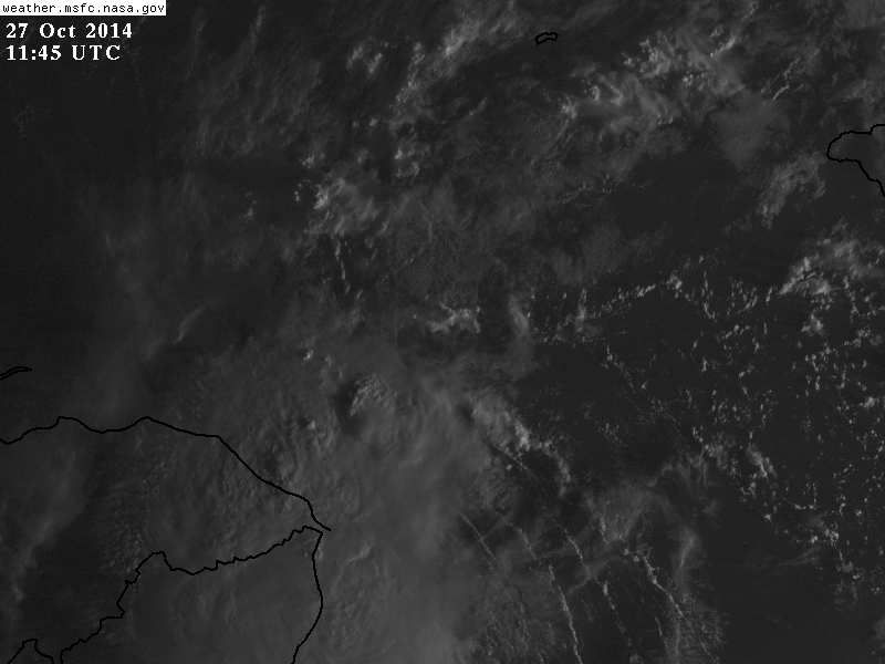
Re: ATL: INVEST 94L - Discussion
Convection persisted during the night near the LLC. This is already a TD this morning, but whatever, is about to move inland.
Look at the nice SE inflow it has in the eastern quadrant.
Edit: I see that this is now Hanna, I guess the NHC slept through the night, lol.
Seriously, the problem is that there is very little reporting stations in that part of the world that report during the night.
Look at the nice SE inflow it has in the eastern quadrant.
Edit: I see that this is now Hanna, I guess the NHC slept through the night, lol.
Seriously, the problem is that there is very little reporting stations in that part of the world that report during the night.
Last edited by NDG on Mon Oct 27, 2014 7:40 am, edited 2 times in total.
0 likes
-
tolakram
- Admin
- Posts: 20179
- Age: 62
- Joined: Sun Aug 27, 2006 8:23 pm
- Location: Florence, KY (name is Mark)
Re: ATL: INVEST 94L - Discussion
10/10 to 30/30. Hmmm.
Live visible loop
http://wwwghcc.msfc.nasa.gov/cgi-bin/get-goes?satellite=GOES-E%20CONUS&lat=15&lon=-83&info=vis&zoom=1&width=1000&height=800&quality=95&type=Animation&palette=ir1.pal&numframes=5&mapcolor=yellow
Live visible loop
http://wwwghcc.msfc.nasa.gov/cgi-bin/get-goes?satellite=GOES-E%20CONUS&lat=15&lon=-83&info=vis&zoom=1&width=1000&height=800&quality=95&type=Animation&palette=ir1.pal&numframes=5&mapcolor=yellow
0 likes
M a r k
- - - - -
Join us in chat: Storm2K Chatroom Invite. Android and IOS apps also available.
The posts in this forum are NOT official forecasts and should not be used as such. Posts are NOT endorsed by any professional institution or STORM2K.org. For official information and forecasts, please refer to NHC and NWS products.
Re: ATL: INVEST 94L - Discussion
tolakram wrote:10/10 to 30/30. Hmmm.
Live visible loop
http://wwwghcc.msfc.nasa.gov/cgi-bin/get-goes?satellite=GOES-E%20CONUS&lat=15&lon=-83&info=vis&zoom=1&width=1000&height=800&quality=95&type=Animation&palette=ir1.pal&numframes=5&mapcolor=yellow
To Tropical Storm Hanna
0 likes
-
cycloneye
- Admin
- Posts: 149291
- Age: 69
- Joined: Thu Oct 10, 2002 10:54 am
- Location: San Juan, Puerto Rico
Re: ATL: HANNA - Discussion (Upgraded to TS Hanna at 9 AM)
I am sure they will look at this system on post season analysis.
0 likes
Visit the Caribbean-Central America Weather Thread where you can find at first post web cams,radars
and observations from Caribbean basin members Click Here
and observations from Caribbean basin members Click Here
-
terstorm1012

- S2K Supporter

- Posts: 1314
- Age: 44
- Joined: Fri Sep 10, 2004 5:36 pm
- Location: Millersburg, PA
Re: ATL: HANNA - Discussion (Upgraded to TS Hanna at 9 AM)
cycloneye wrote:I am sure they will look at this system on post season analysis.
I am sure they are going to come to the conclusion that it was a TD as early as last night, very clearly it has had a fairly vigorous little circulation.
0 likes
-
TropicalAnalystwx13
- Category 5
- Posts: 2109
- Age: 28
- Joined: Tue Jul 19, 2011 8:20 pm
- Location: Wilmington, NC
- Contact:
-
cycloneye
- Admin
- Posts: 149291
- Age: 69
- Joined: Thu Oct 10, 2002 10:54 am
- Location: San Juan, Puerto Rico
Re: ATL: HANNA - Discussion (Upgraded to TS Hanna at 9 AM)
12z Best Track:
At 1200 UTC, 27 October 2014, TROPICAL STORM HANNA (AL09) was located in the North Atlantic basin at 14.6°N and 82.9°W. The current intensity was 35 kt and the center was moving at 6 kt at a bearing of 240 degrees. The minimum central pressure was 1005 mb.
At 1200 UTC, 27 October 2014, TROPICAL STORM HANNA (AL09) was located in the North Atlantic basin at 14.6°N and 82.9°W. The current intensity was 35 kt and the center was moving at 6 kt at a bearing of 240 degrees. The minimum central pressure was 1005 mb.
0 likes
Visit the Caribbean-Central America Weather Thread where you can find at first post web cams,radars
and observations from Caribbean basin members Click Here
and observations from Caribbean basin members Click Here
Who is online
Users browsing this forum: No registered users and 25 guests