
Here is a high resolution water vapor loop showing the ULL to the east pushing a finger of dry air into 92L.
http://www.ssd.noaa.gov/goes/east/natl/loop-wv.html
That probably won't last all the way across the gulf although WXman57 said an early forecast kept the ULL tracking with 92l for several days.
ATL: INVEST 92L - Discussion
Moderator: S2k Moderators
Re: ATL: INVEST 92L - Discussion
0 likes
-
bamajammer4eva
- Category 4

- Posts: 907
- Joined: Sun Apr 18, 2010 3:21 am
- Location: Ozark, AL
Shower activity associated with the broad area of low pressure
centered over southern Florida just west of Lake Okeechobee
remains poorly organized. By tonight or early Saturday, the low is
expected to be over the southeastern Gulf of Mexico where
upper-level winds are forecast to become even less favorable
for tropical cyclone formation. Nevertheless, this weather system
will continue to be closely monitored, and an Air Force Plane will
check the low on Saturday, if necessary. Locally heavy rains
associated with the low will continue over portions of southern
Florida and the Florida Keys today and Saturday.
* Formation chance through 48 hours...low...20 percent.
* Formation chance through 5 days...medium...30 percent.
http://www.nhc.noaa.gov/text/refresh/MI ... WOAT.shtml
0 likes
-
jlauderdal
- S2K Supporter

- Posts: 7240
- Joined: Wed May 19, 2004 5:46 am
- Location: NE Fort Lauderdale
- Contact:
Re: ATL: INVEST 92L - Discussion
Portastorm wrote:jlauderdal wrote:Landfall Update
WEAK SFC LOW MOVED ONSHORE EARLY THIS MORNING WITH A
1012.3 MB SFC PRESSURE READING AT WEST PALM BEACH AT 5 AM.
Next time a 1012 low hits south florida I will be much better prepared; learned the hard way on 92L
I shouldn't encourage this because I'm a moderator but ... how did your lawn furniture hold up?
strained my back picking up the two twigs that blew in
thanks for keeping us Floridians in your prayers everyone, it took all the positive vibes to survive landfall this morning
 ...92L will go in down as the famous Palm Beach storm of 2014
nice we can joke around about a system but the US is so overdue and I know overdue doesnt mean jack in weather but lets face it..someone is going to get it sooner rather than later
0 likes
-
jlauderdal
- S2K Supporter
- Posts: 7240
- Joined: Wed May 19, 2004 5:46 am
- Location: NE Fort Lauderdale
- Contact:
Re:
panamatropicwatch wrote:If your in Punta Gorda it might come right over you.
brings back haunting memories of hurricane Charley
0 likes
-
Stormcenter
- S2K Supporter
- Posts: 6689
- Joined: Wed Sep 03, 2003 11:27 am
- Location: Houston, TX
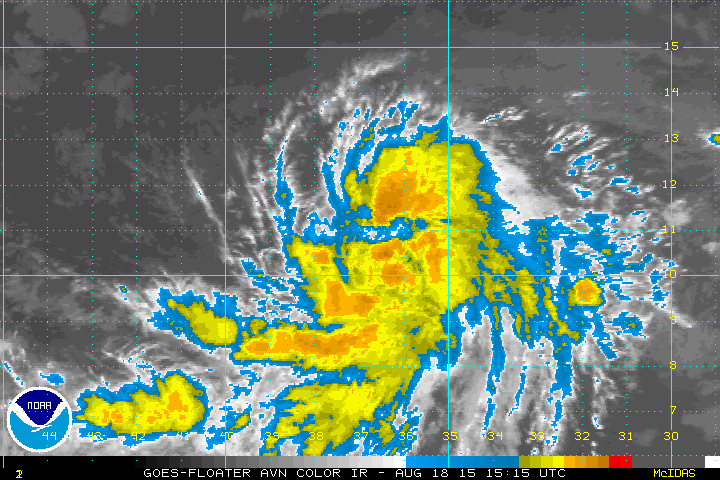
Looking better organized as it approaches the GOM. IMO
http://www.nrlmry.navy.mil/nexsat-bin/n ... PE=Instant
http://www.nrlmry.navy.mil/nexsat-bin/n ... PE=Instant
0 likes


After looking at the vorticity maps, it appears vorticity is better aligned on the southern end of the disturbance. Who knows what will happens once it enters the GOM. Will the original circulation build convection again and be dominant? Or will a new circulation/old one be pulled south where there is more convection? I guess time will tell..,
0 likes
The following post is NOT an official forecast and should not be used as such. It is just the opinion of the poster and may or may not be backed by sound meteorological data. It is NOT endorsed by storm2k.org.
-
PauleinHouston
- Tropical Storm

- Posts: 102
- Joined: Mon Aug 13, 2007 10:23 am
- Location: League City, TX
- Contact:
Re: ATL: INVEST 92L - Discussion
While not a big fan of Weather Underground, this is an interesting page showing where 92L is currently. Looks not far from crossing into the Gulf waters...
http://www.wunderground.com/wundermap/?lat=26.87729&lon=-80.90246&zoom=8&type=lightmap&units=english&eyedropper=0&hur=0&rad=1&rad.num=1&rad.spd=50&rad.opa=55&rad.type=00Q&rad.type2=&rad.smo=1&rad.noc=1&rad.stm=0&sat=0&cams=0&undefined=0
http://www.wunderground.com/wundermap/?lat=26.87729&lon=-80.90246&zoom=8&type=lightmap&units=english&eyedropper=0&hur=0&rad=1&rad.num=1&rad.spd=50&rad.opa=55&rad.type=00Q&rad.type2=&rad.smo=1&rad.noc=1&rad.stm=0&sat=0&cams=0&undefined=0
0 likes
The posts in this forum are NOT official forecasts and should not be used as such. They are just the opinion of this amateur poster and may or may not be backed by sound meteorological data. They are NOT endorsed by any professional institution or storm2k.org. For official information, please refer to NWS products.


Re:
baytownwx wrote:After looking at the vorticity maps, it appears vorticity is better aligned on the southern end of the disturbance. Who knows what will happens once it enters the GOM. Will the original circulation build convection again and be dominant? Or will a new circulation/old one be pulled south where there is more convection? I guess time will tell..,
I don't think the vorticity maps (such as the CIMMS Wisconsin map) are terrifically accurate when it comes to the exact placement of a vorticity maximum. I'm not certain at what resolution they are plotted.
0 likes

Re: ATL: INVEST 92L - Discussion
Okay, well - while I'm a firm believer in there's no definitive answer to where a system will go until it makes landfall, I just really need to know what this system is going to do and where it will end up and what it will be when it gets there. I'm tired of watching. I'm tired of waiting. I'm tired of speculating.
If someone could just tell me those things with absolution, I would appreciate it ever so much.
Thanks.
Yes, this post is a joke.
Sort of.
Ahem.
If someone could just tell me those things with absolution, I would appreciate it ever so much.
Thanks.
Yes, this post is a joke.
Sort of.
Ahem.
0 likes
-
TheStormExpert
Re:
bamajammer4eva wrote:Shower activity associated with the broad area of low pressure
centered over southern Florida just west of Lake Okeechobee
remains poorly organized. By tonight or early Saturday, the low is
expected to be over the southeastern Gulf of Mexico where
upper-level winds are forecast to become even less favorable
for tropical cyclone formation. Nevertheless, this weather system
will continue to be closely monitored, and an Air Force Plane will
check the low on Saturday, if necessary. Locally heavy rains
associated with the low will continue over portions of southern
Florida and the Florida Keys today and Saturday.
* Formation chance through 48 hours...low...20 percent.
* Formation chance through 5 days...medium...30 percent.
http://www.nhc.noaa.gov/text/refresh/MI ... WOAT.shtml
So conditions are now expected to be unfavorable in the Gulf? Geez! It must be really hard to come across ideal conditions in the Atlantic these days.
0 likes

Re:
Stormcenter wrote:Looking better organized as it approaches the GOM. IMO
http://www.nrlmry.navy.mil/nexsat-bin/n ... PE=Instant
Yeah I think the center's actually tightened up today crossing land. Let's see what happens in the SE GOM. it needs to rebuild core covection which will take a while.
0 likes
-
TheStormExpert
Re: Re:
ronjon wrote:Stormcenter wrote:Looking better organized as it approaches the GOM. IMO
http://www.nrlmry.navy.mil/nexsat-bin/n ... PE=Instant
Yeah I think the center's actually tightened up today crossing land. Let's see what happens in the SE GOM. it needs to rebuild core covection which will take a while.
The NHC begs to differ! "Shower activity associated with the broad area of low pressure centered over southern Florida just west of Lake Okeechobee
remains poorly organized."
0 likes
Re: ATL: INVEST 92L - Discussion
A small area of low pressure over South Florida (Invest 92L) is bringing heavy rains to South Florida and the waters of the Florida Straits, but Miami radar and satellite loops show that this activity is less organized than on Thursday. Strong upper level winds out of the north-northeast are creating a high 20 - 25 knots of wind shear, and the atmosphere is moderately dry to the north, interfering with development. While the circulation center of 92L is over land, development into a tropical depression is unlikely, but once the current westward 5 - 10 mph motion of 92L carries it over the Gulf of Mexico on Saturday, development odds will increase. Ocean temperatures are a very warm 30°C (86°F) over the Eastern Gulf, but the presence of dry air and high wind shear of 15 - 25 knots should keep any development slow. As of Friday morning, rainfall amounts from 92L were mostly below 1" over South Florida, but the disturbance will be capable of dumping additional rains of 1 - 3" over the area through Saturday. Heavy rains from 92L will begin affecting Texas and the Mexican coast south of the Texas border on Monday, with the center of 92L likely to move ashore over Texas on Monday evening or Tuesday morning. None of the three reliable computer models for predicting tropical cyclone genesis develop 92L over the Gulf of Mexico. In their 8 am EDT Friday Tropical Weather Outlook, NHC gave the system 2-day and 5-day odds of development odds of 20% and 40%, respectively. I put these odds higher, at 30% and 50%, respectively. The Hurricane Hunters are on call to investigate 92L on Saturday afternoon.
J. Masters' Blog
0 likes
-
tropicwatch

- Category 5

- Posts: 3426
- Age: 62
- Joined: Sat Jun 02, 2007 10:01 am
- Location: The Villages, Florida
- Contact:
The wind shear doesn't look to be too unreasonable yet.

0 likes
Tropicwatch
Agnes 72', Eloise 75, Elena 85', Kate 85', Charley 86', Florence 88', Beryl 94', Dean 95', Erin 95', Opal 95', Earl 98', Georges 98', Ivan 2004', Arlene 2005', Dennis 2005', Ida 2009' Debby 2012' Irma 2017' Michael 2018'
Agnes 72', Eloise 75, Elena 85', Kate 85', Charley 86', Florence 88', Beryl 94', Dean 95', Erin 95', Opal 95', Earl 98', Georges 98', Ivan 2004', Arlene 2005', Dennis 2005', Ida 2009' Debby 2012' Irma 2017' Michael 2018'
-
tropicwatch
- Category 5
- Posts: 3426
- Age: 62
- Joined: Sat Jun 02, 2007 10:01 am
- Location: The Villages, Florida
- Contact:
I believe the COC is close to Ft. Myers now.
http://www.wunderground.com/wundermap/?lat=30.15654945&lon=-85.64855957&zoom=8&pin=Panama%20City%2c%20FL&rad=1&wxsn=0&svr=0&cams=0&sat=0&riv=0&mm=0&hur=0
http://www.wunderground.com/wundermap/?lat=30.15654945&lon=-85.64855957&zoom=8&pin=Panama%20City%2c%20FL&rad=1&wxsn=0&svr=0&cams=0&sat=0&riv=0&mm=0&hur=0
0 likes
Tropicwatch
Agnes 72', Eloise 75, Elena 85', Kate 85', Charley 86', Florence 88', Beryl 94', Dean 95', Erin 95', Opal 95', Earl 98', Georges 98', Ivan 2004', Arlene 2005', Dennis 2005', Ida 2009' Debby 2012' Irma 2017' Michael 2018'
Agnes 72', Eloise 75, Elena 85', Kate 85', Charley 86', Florence 88', Beryl 94', Dean 95', Erin 95', Opal 95', Earl 98', Georges 98', Ivan 2004', Arlene 2005', Dennis 2005', Ida 2009' Debby 2012' Irma 2017' Michael 2018'
-
TheStormExpert
-
tropicwatch
- Category 5
- Posts: 3426
- Age: 62
- Joined: Sat Jun 02, 2007 10:01 am
- Location: The Villages, Florida
- Contact:
It appears that the convection is building closer to the COC and starting to wrap around.
0 likes
Tropicwatch
Agnes 72', Eloise 75, Elena 85', Kate 85', Charley 86', Florence 88', Beryl 94', Dean 95', Erin 95', Opal 95', Earl 98', Georges 98', Ivan 2004', Arlene 2005', Dennis 2005', Ida 2009' Debby 2012' Irma 2017' Michael 2018'
Agnes 72', Eloise 75, Elena 85', Kate 85', Charley 86', Florence 88', Beryl 94', Dean 95', Erin 95', Opal 95', Earl 98', Georges 98', Ivan 2004', Arlene 2005', Dennis 2005', Ida 2009' Debby 2012' Irma 2017' Michael 2018'
Re: ATL: INVEST 92L - Discussion
Thundering and gusty here. As soon as that band hit the Gulf it flared right up.
0 likes
-
bamajammer4eva
- Category 4
- Posts: 907
- Joined: Sun Apr 18, 2010 3:21 am
- Location: Ozark, AL
-
jlauderdal
- S2K Supporter
- Posts: 7240
- Joined: Wed May 19, 2004 5:46 am
- Location: NE Fort Lauderdale
- Contact:
Re: ATL: INVEST 92L - Discussion
Sanibel wrote:Thundering and gusty here. As soon as that band hit the Gulf it flared right up.
nobody south of orlando was spared by its wrath
center is intact, maybe it finds better conditions to the west then it did in our area but even that doesnt seem likely
0 likes
Who is online
Users browsing this forum: No registered users and 4 guests