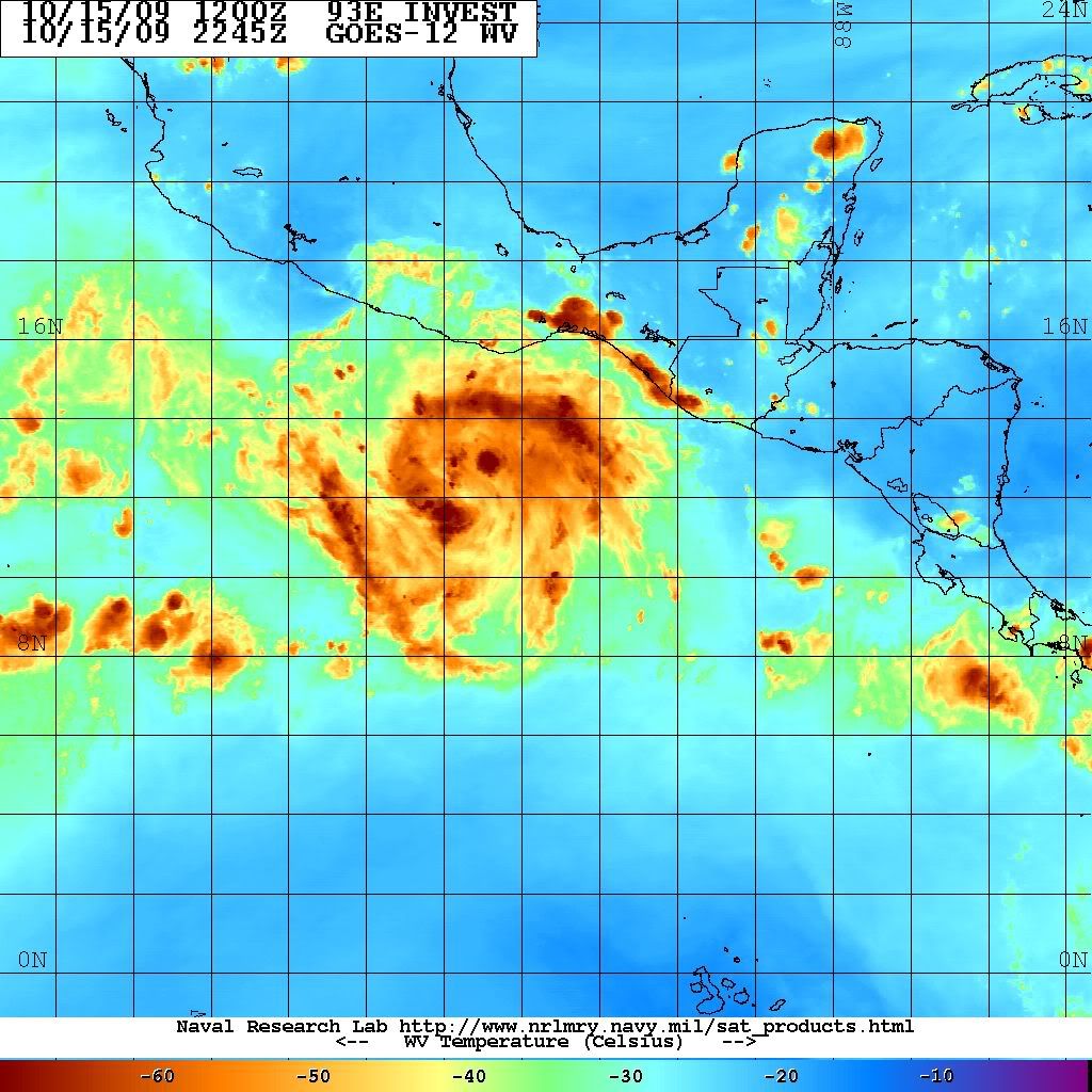
supercane4867 wrote:You know when NHC calls for a major hurricane in the first advisory then it must be a Cat.5
http://www.nhc.noaa.gov/archive/2009/ep ... .001.shtml
Dora 11 was forecast to be 105 knts on advisory 1. Reached 135 knts.
Moderator: S2k Moderators


supercane4867 wrote:You know when NHC calls for a major hurricane in the first advisory then it must be a Cat.5
http://www.nhc.noaa.gov/archive/2009/ep ... .001.shtml

Yellow Evan wrote:supercane4867 wrote:You know when NHC calls for a major hurricane in the first advisory then it must be a Cat.5
http://www.nhc.noaa.gov/archive/2009/ep ... .001.shtml
Dora 11 was forecast to be 105 knts on advisory 1. Reached 135 knts.


supercane4867 wrote:Yellow Evan wrote:supercane4867 wrote:You know when NHC calls for a major hurricane in the first advisory then it must be a Cat.5
http://www.nhc.noaa.gov/archive/2009/ep ... .001.shtml
Dora 11 was forecast to be 105 knts on advisory 1. Reached 135 knts.
It's still arguably Cat.5 though.
BTW ships indicates a 56% chance of 30kt intensification during the next 24 hours. Rick was 60%
Ntxw wrote:What we'd give to have recon go into this. Sadly it won't. We need to get some unmanned drones to do the job!
Well on it's way now
Yellow Evan wrote:if RI continues overnight, we could have a Cat 2 by this time tomorrow. The posts in this forum are NOT official forecast and should not be used as such. They are just the opinion of the poster and may or may not be backed by sound meteorological data. They are NOT endorsed by any professional institution or storm2k.org. For official information, please refer to the NHC and NWS products.
Ntxw wrote:Yellow Evan wrote:if RI continues overnight, we could have a Cat 2 by this time tomorrow. The posts in this forum are NOT official forecast and should not be used as such. They are just the opinion of the poster and may or may not be backed by sound meteorological data. They are NOT endorsed by any professional institution or storm2k.org. For official information, please refer to the NHC and NWS products.
I agree, this thing is going to get it's act together very quick just based on presentation. I'm getting Rick vibes, though I haven't followed the EPAC much until this year but I do remember following that storm.


cycloneye wrote:Does anyone has a image of RICK at the peak?


supercane4867 wrote:cycloneye wrote:Does anyone has a image of RICK at the peak?
The perfect storm
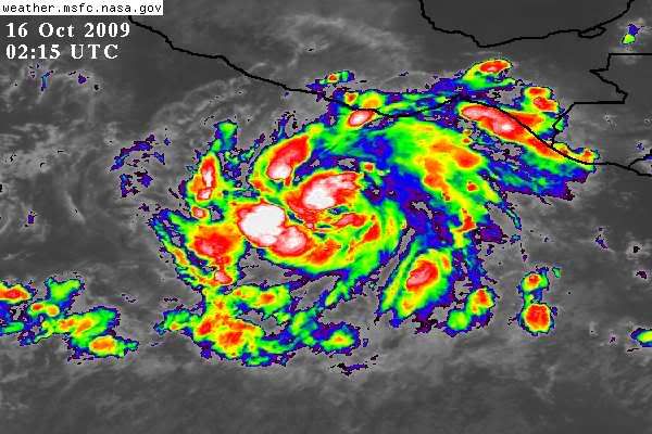

Yellow Evan wrote:Here were some early on photos of Rick 09
Not a whole lot different from 13E.
Kingarabian wrote:Does anyone have a hold of Rick's microwave images at its peak?


Users browsing this forum: No registered users and 13 guests


