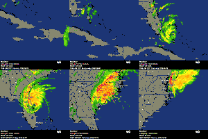
ATL: BERYL - Post-Tropical

Moderator: S2k Moderators

Message
Author
lebron23
Category 1
Category 1
Posts: 389
Age: 32
Joined: Sat May 24, 2008 11:58 am
Contact:

Re: ATL: INVEST 94L

#281 Postby lebron23 » Fri May 25, 2012 10:03 am

wxman57 wrote:Looks like several rotations on the satellite loop. Makes a big difference which center takes over. Could form a good bit farther north of where the models have been projecting if that northern center off the NC coast takes over.


After looking at many different sat. loops I agree with you.
0 likes   

User avatar
bg1
Category 1
Category 1
Posts: 409
Joined: Fri May 13, 2011 11:14 am
Location: near Santee, SC

Re: ATL: INVEST 94L

#282 Postby bg1 » Fri May 25, 2012 10:07 am

Not sure to put this in the models thread or this thread.

Everyone seems to be talking about a possible landfall in Florida. What are the models saying after that? Will it cross into the Gulf or cross back off the East Coast? Will it still have the atmosphere to strengthen?
0 likes   

lebron23
Category 1
Category 1
Posts: 389
Age: 32
Joined: Sat May 24, 2008 11:58 am
Contact:

Re: ATL: INVEST 94L

#283 Postby lebron23 » Fri May 25, 2012 10:08 am

bg1 wrote:Not sure to put this in the models thread or this thread.

Everyone seems to be talking about a possible landfall in Florida. What are the models saying after that? Will it cross into the Gulf or cross back off the East Coast? Will it still have the atmosphere to strengthen?


It's expected to cross back off the East Coast. No gulf worries with this one.
0 likes   

User avatar
wxman57
Moderator-Pro Met
Moderator-Pro Met
Posts: 22978
Age: 67
Joined: Sat Jun 21, 2003 8:06 pm
Location: Houston, TX (southwest)

Re: ATL: INVEST 94L

#284 Postby wxman57 » Fri May 25, 2012 10:16 am

bg1 wrote:Not sure to put this in the models thread or this thread.

Everyone seems to be talking about a possible landfall in Florida. What are the models saying after that? Will it cross into the Gulf or cross back off the East Coast? Will it still have the atmosphere to strengthen?


Looks like it may stall just inland Sunday night and be picked up by an approaching cold front by Tuesday and driven back to the NNE-NE, but probably as just a rain system not a TC.
0 likes   

ozonepete
Professional-Met
Professional-Met
Posts: 4743
Joined: Mon Sep 07, 2009 3:23 pm
Location: From Ozone Park, NYC / Now in Brooklyn, NY

Re: ATL: INVEST 94L

#285 Postby ozonepete » Fri May 25, 2012 10:19 am

I was thinking earlier this morning that the one by N.C. would be the one to develop but no longer.

Looking at the latest satellite loops it looks to me like the N.C. swirl has gotten elongated and is almost dissipated/absorbed now. The other one that Aric pointed out at 29.5 75.5 looks to be holding together pretty well and has already moved ENE of that location at a pretty good clip.
0 likes   

User avatar
NDG
S2K Supporter
S2K Supporter
Posts: 15446
Joined: Sun Jul 09, 2006 10:14 pm
Location: Orlando, FL

Re: ATL: INVEST 94L

#286 Postby NDG » Fri May 25, 2012 10:22 am

lebron23 wrote:
wxman57 wrote:Looks like several rotations on the satellite loop. Makes a big difference which center takes over. Could form a good bit farther north of where the models have been projecting if that northern center off the NC coast takes over.


After looking at many different sat. loops I agree with you.


But surface pressures are currently higher on the northern vorticity off of the NC coast than where the vorticity closer to 30N.
0 likes   

User avatar
northjaxpro
S2K Supporter
S2K Supporter
Posts: 8900
Joined: Mon Sep 27, 2010 11:21 am
Location: Jacksonville, FL

Re: ATL: INVEST 94L

#287 Postby northjaxpro » Fri May 25, 2012 10:27 am

NDG wrote:
lebron23 wrote:
wxman57 wrote:Looks like several rotations on the satellite loop. Makes a big difference which center takes over. Could form a good bit farther north of where the models have been projecting if that northern center off the NC coast takes over.


After looking at many different sat. loops I agree with you.


But surface pressures are currently higher on the northern vorticity off of the NC coast than where the vorticity closer to 30N.


I agree. The vort Aric has pointed out looks to be one I believe will become the dominant one. We'll find out very soon.
0 likes   
NEVER, EVER SAY NEVER in the tropics and weather in general, and most importantly, with life itself!!

________________________________________________________________________________________

Fay 2008 Beryl 2012 Debby 2012 Colin 2016 Hermine 2016 Julia 2016 Matthew 2016 Irma 2017 Dorian 2019

lebron23
Category 1
Category 1
Posts: 389
Age: 32
Joined: Sat May 24, 2008 11:58 am
Contact:

Re: ATL: INVEST 94L

#288 Postby lebron23 » Fri May 25, 2012 10:29 am

Am I the only one that thinks 94L was better organized yesterday..?
0 likes   

User avatar
northjaxpro
S2K Supporter
S2K Supporter
Posts: 8900
Joined: Mon Sep 27, 2010 11:21 am
Location: Jacksonville, FL

#289 Postby northjaxpro » Fri May 25, 2012 10:30 am

Also, NHC has scheduled REcon to fly out tomorrow afternoon to 94L

NOUS42 KNHC 251445
WEATHER RECONNAISSANCE FLIGHTS
CARCAH, NATIONAL HURRICANE CENTER, MIAMI, FL.
1045 AM EDT FRI 25 MAY 2012
SUBJECT: TROPICAL CYCLONE PLAN OF THE DAY (TCPOD)
VALID 26/1100Z TO 27/1100Z MAY 2012
TCPOD NUMBER.....12-007

I. ATLANTIC REQUIREMENTS
1. SUSPECT AREA
FLIGHT ONE -- TEAL 70 FLIGHT TWO -- TEAL 71
A. 26/1800Z A. 27/1200Z
B. AFXXX 01XXA INVEST B. AFXXX 0202A CYCLONE
C. 26/1515Z C. 27/0915Z
D. 33.0N 77.0W D. 30.8N 79.5W
E. 26/1730Z TO 26/2130Z E. 27/1130Z TO 27/1630Z
F. SFC TO 10,000 FT F. SFC TO 10,000 FT

2. OUTLOOK FOR SUCCEEDING DAY: POSSIBLE 28/0000Z FIX
NEAR 30.8N 81.0W IF SYSTEM DEVELOPS.
0 likes   
NEVER, EVER SAY NEVER in the tropics and weather in general, and most importantly, with life itself!!

________________________________________________________________________________________

Fay 2008 Beryl 2012 Debby 2012 Colin 2016 Hermine 2016 Julia 2016 Matthew 2016 Irma 2017 Dorian 2019

Aric Dunn
Category 5
Category 5
Posts: 21238
Age: 42
Joined: Sun Sep 19, 2004 9:58 pm
Location: Ready for the Chase.
Contact:

Re: ATL: INVEST 94L

#290 Postby Aric Dunn » Fri May 25, 2012 10:30 am

Shear is dropping pretty quick. especially on the south end. near the carolinas still 60 kts.

Image
0 likes   
Note: If I make a post that is brief. Please refer back to previous posts for the analysis or reasoning. I do not re-write/qoute what my initial post said each time.
If there is nothing before... then just ask :)

Space & Atmospheric Physicist, Embry-Riddle Aeronautical University,
I believe the sky is falling...

User avatar
NDG
S2K Supporter
S2K Supporter
Posts: 15446
Joined: Sun Jul 09, 2006 10:14 pm
Location: Orlando, FL

Re: ATL: INVEST 94L

#291 Postby NDG » Fri May 25, 2012 10:38 am

lebron23 wrote:Am I the only one that thinks 94L was better organized yesterday..?


I agree with you too, but it was a quick one, as soon it starter gaining height it was torn apart by the shear.
Today will be transitioning and start looking more like cyclone (not tropical), it will start getting subtropical/tropical charecteristics as it starts retrograding westward over the gulfstream tomorrow and Sunday.
0 likes   

User avatar
Bocadude85
Category 5
Category 5
Posts: 2991
Age: 38
Joined: Mon Apr 18, 2005 2:20 pm
Location: Honolulu,Hi

Re: ATL: INVEST 94L

#292 Postby Bocadude85 » Fri May 25, 2012 10:42 am

If the low near 29.5 N is the low that does eventually develop how much effect would that have on the track? Are we talking about a track as far south a Daytona Beach possibly?
0 likes   

User avatar
thundercam96
Tropical Storm
Tropical Storm
Posts: 129
Joined: Thu Aug 18, 2011 3:01 pm
Location: Boston, MA

Re: ATL: INVEST 94L

#293 Postby thundercam96 » Fri May 25, 2012 10:49 am

Some Models Have A St. Augustine-New Smyrna Beach Landfall

-Daytona Beach
0 likes   
Fay '08 / Mathew 16'

Personal Forecast Disclaimer: I am not a certified meteorologist, therefore, what is posted on this forum under my header should not be treated as an official forecast. Please refer to the NWS/NHC products for forecast information.

User avatar
Hurricane Andrew
S2K Supporter
S2K Supporter
Posts: 1891
Age: 26
Joined: Sun May 23, 2010 2:53 pm
Location: KS

#294 Postby Hurricane Andrew » Fri May 25, 2012 10:51 am

Jax, that is showing 2 flights for tommorow to 94L?
0 likes   

The Enthusiast
NREMT-AEMT, WX nerd

Irene '11, Sandy '12, Irma '17 (SAR)

"Hard to think we were born to live this way..." -Wage War

User avatar
Hurricane Andrew
S2K Supporter
S2K Supporter
Posts: 1891
Age: 26
Joined: Sun May 23, 2010 2:53 pm
Location: KS

ATL: BERYL - Recon

#295 Postby Hurricane Andrew » Fri May 25, 2012 10:54 am

Code: Select all

NOUS42 KNHC 251445
WEATHER RECONNAISSANCE FLIGHTS
CARCAH, NATIONAL HURRICANE CENTER, MIAMI, FL.
1045 AM EDT FRI 25 MAY 2012
SUBJECT: TROPICAL CYCLONE PLAN OF THE DAY (TCPOD)
         VALID 26/1100Z TO 27/1100Z MAY 2012
         TCPOD NUMBER.....12-007

I.  ATLANTIC REQUIREMENTS
    1. SUSPECT AREA
       FLIGHT ONE -- TEAL 70         FLIGHT TWO -- TEAL 71
       A. 26/1800Z                   A. 27/1200Z
       B. AFXXX 01XXA INVEST         B. AFXXX 0202A CYCLONE
       C. 26/1515Z                   C. 27/0915Z
       D. 33.0N 77.0W                D. 30.8N 79.5W
       E. 26/1730Z TO 26/2130Z       E. 27/1130Z TO 27/1630Z
       F. SFC TO 10,000 FT           F. SFC TO 10,000 FT

    2. OUTLOOK FOR SUCCEEDING DAY: POSSIBLE 28/0000Z FIX
       NEAR 30.8N 81.0W IF SYSTEM DEVELOPS.


http://www.nhc.noaa.gov/text/MIAREPRPD.shtml
0 likes   

The Enthusiast
NREMT-AEMT, WX nerd

Irene '11, Sandy '12, Irma '17 (SAR)

"Hard to think we were born to live this way..." -Wage War

User avatar
northjaxpro
S2K Supporter
S2K Supporter
Posts: 8900
Joined: Mon Sep 27, 2010 11:21 am
Location: Jacksonville, FL

Re:

#296 Postby northjaxpro » Fri May 25, 2012 10:58 am

Hurricane Andrew wrote:Jax, that is showing 2 flights for tommorow to 94L?


Yes, one is planned at 18Z tomorrow, and another scheduled for Sunday morning at 12Z.
0 likes   
NEVER, EVER SAY NEVER in the tropics and weather in general, and most importantly, with life itself!!

________________________________________________________________________________________

Fay 2008 Beryl 2012 Debby 2012 Colin 2016 Hermine 2016 Julia 2016 Matthew 2016 Irma 2017 Dorian 2019

User avatar
Tampa Bay Hurricane
Category 5
Category 5
Posts: 5597
Age: 37
Joined: Fri Jul 22, 2005 7:54 pm
Location: St. Petersburg, FL

Re: ATL: INVEST 94L

#297 Postby Tampa Bay Hurricane » Fri May 25, 2012 10:59 am

The low continues to move northward more than I anticipated. The only way this could strike Florida is if once the shear abates a new low center can successfully fire off convection further south. I know I am going against the models in saying this but I think it's moving too far north too fast.
Disclaimer: not an official forecast
0 likes   

lebron23
Category 1
Category 1
Posts: 389
Age: 32
Joined: Sat May 24, 2008 11:58 am
Contact:

#298 Postby lebron23 » Fri May 25, 2012 11:03 am

The models will swing both ways, as we learned from the past few years.
0 likes   

crimi481
Category 2
Category 2
Posts: 602
Joined: Thu Sep 09, 2004 4:47 pm

Re: ATL: INVEST 94L

#299 Postby crimi481 » Fri May 25, 2012 11:14 am

This is one strange system. Almost looks like the southern portion of this long Tail - may be where a Low spins up

http://weather.hawaii.edu/satellite/sti ... verlay=off

http://weather.hawaii.edu/satellite/sti ... verlay=off
0 likes   

User avatar
Hurricane Andrew
S2K Supporter
S2K Supporter
Posts: 1891
Age: 26
Joined: Sun May 23, 2010 2:53 pm
Location: KS

#300 Postby Hurricane Andrew » Fri May 25, 2012 11:14 am

Did tropical atlantic just crash for anyone else?
0 likes   

The Enthusiast
NREMT-AEMT, WX nerd

Irene '11, Sandy '12, Irma '17 (SAR)

"Hard to think we were born to live this way..." -Wage War


Return to “2012”

Who is online

Users browsing this forum: No registered users and 2 guests