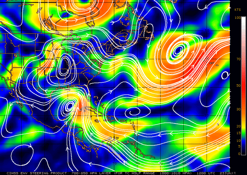
boca wrote:Could that shortwave in the plains actually sharpen the trough along the east coast?
The shortwave is advecting a lot of vorticity that does indeed deepen the trough over the East Coast. In fact, the GFS has the trough deepening to a point where it becomes unstable and a cut-off low forms over the New England area.