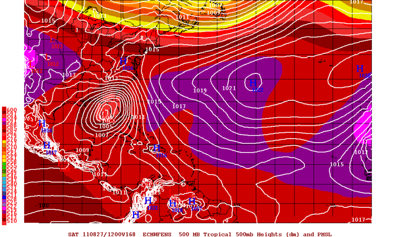
THE NEW 12Z GFS FOLLOWS ITS 00Z CONTINUITY REASONABLY WELL THRU
DAY 5 ON ALL THE MAIN FEATURES.
WE SEE BIGGER CHANGES FOR DAYS 6-7 AS TIMING/AMPLITUDE DIFFERENCES
CROP UP ACROSS CANADA. THESE CHANGES WOULD REMOVE THE POLAR
WESTERLIES ACROSS SRN CANADA EVEN FARTHER AWAY FROM HAVING ANY
INFLUENCE ON THE TRACK OF THE TROPICAL SYS THREATENING THE SERN
CONUS. IN FACT ALL THE 12Z DETERMINISTIC MODELS KEEP THE POLAR
WESTERLIES FAR ENOUGH N ACROSS SRN CANADA THAT AFTER A PINCH OF
ENERGY DROPS S INTO THE OH VLY THE FIRST PART OF THE MEDIUM RANGE
PERIOD...THERE SHOULD BE MINIMAL...IF ANY...INTERACTION OF ANY SE
CONUS TROPICAL SYS LATE NEXT WEEK WITH THE POLAR WESTERLIES.