ROCK wrote:hes curving out at 50-55W...on this run....
That's why I think the odds are about %50 %50 for recurve right now. It all depends on how strong that weakeness is....
Moderator: S2k Moderators

ROCK wrote:hes curving out at 50-55W...on this run....


PTrackerLA wrote:Can't wait to see the 12z Euro now, the 00z was quite alarming.


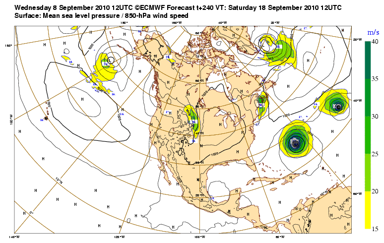
SFLcane wrote:What else is new...everything recurves this season especially something forming that far east.


gatorcane wrote:Models are screaming recurve yet again which seems the best forecast at this point.
Not the year for Cape Verde Systems getting to the U.S it seems or even Cape Verde systems making into the Caribbean for that matter. We will need to watch the WCAR later in the season or some systems that get going in the Caribbean or near the Bahamas.

wxman57 wrote:Some fascinating climo. I plotted all September storms passing within 65nm of Igor's point of formation from 1851-2009. There were 13 such storms. Here's the breakdown:
3 dissipated shortly after being designated
5 recurved well out to sea
5 struck the U.S.!! (2 of those hit the NE Caribbean)
Of the 5 that made landfall, there was:
1. The 1928 Okeechobee hurricane, which was also the only Cat 5 to hit PR
2. The Great 1938 New England Hurricane
3. The 1947 Hurricane that hit SE Florida as a major then New Orleans as a Cat 1
4. 1985's Gloria that struck the NE Caribbean then Long Island.
5. 1989's Hugo that devastated SC/NC
Those are some big names in the past. "I" storms often seem to be quite strong hurricanes that cause a lot of problems. Will this be Igor's first and only time the name is used? We'll see!


Code: Select all
WHXX01 KWBC 081853
CHGHUR
TROPICAL CYCLONE GUIDANCE MESSAGE
NWS TPC/NATIONAL HURRICANE CENTER MIAMI FL
1853 UTC WED SEP 8 2010

DISCLAIMER...NUMERICAL MODELS ARE SUBJECT TO LARGE ERRORS.
PLEASE REFER TO NHC OFFICIAL FORECASTS FOR TROPICAL CYCLONE
AND SUBTROPICAL CYCLONE INFORMATION.

ATLANTIC OBJECTIVE AIDS FOR

TROPICAL CYCLONE IGOR (AL112010) 20100908 1800 UTC

        ...00 HRS...   ...12 HRS...   ...24 HRS. ..   ...36 HRS...
        100908  1800   100909  0600   100909  1800   100910  0600

         LAT    LON     LAT    LON     LAT    LON     LAT    LON
BAMS    13.8N  23.7W   14.0N  24.9W   14.4N  26.6W   15.4N  28.5W
BAMD    13.8N  23.7W   14.0N  25.9W   14.4N  28.1W   15.0N  30.3W
BAMM    13.8N  23.7W   14.2N  25.2W   14.9N  27.1W   16.0N  29.3W
LBAR    13.8N  23.7W   14.1N  25.5W   15.0N  27.9W   16.0N  30.9W
SHIP        40KTS          46KTS          54KTS          61KTS
DSHP        40KTS          46KTS          54KTS          61KTS

        ...48 HRS...   ...72 HRS...   ...96 HRS. ..   ..120 HRS...
        100910  1800   100911  1800   100912  1800   100913  1800

         LAT    LON     LAT    LON     LAT    LON     LAT    LON
BAMS    16.8N  31.0W   19.3N  37.2W   21.4N  44.8W   20.7N  52.1W
BAMD    15.7N  32.7W   17.3N  37.9W   19.6N  42.4W   22.3N  46.0W
BAMM    17.2N  32.1W   18.8N  38.7W   20.1N  45.3W   19.4N  50.5W
LBAR    17.1N  34.1W   18.1N  40.8W   18.6N  45.5W   19.0N  49.0W
SHIP        67KTS          77KTS          83KTS          84KTS
DSHP        67KTS          77KTS          83KTS          84KTS

         ...INITIAL CONDITIONS...
LATCUR =  13.8N LONCUR =  23.7W DIRCUR = 270DEG SPDCUR =   5KT
LATM12 =  13.9N LONM12 =  22.6W DIRM12 = 262DEG SPDM12 =   7KT
LATM24 =  14.0N LONM24 =  21.1W
WNDCUR =   40KT RMAXWD =   30NM WNDM12 =   30KT
CENPRS = 1005MB OUTPRS = 1010MB OUTRAD =  180NM SDEPTH =   S
RD34NE =    0NM RD34SE =   45NM RD34SW =   45NM RD34NW =  30NM

Users browsing this forum: No registered users and 76 guests