ATL: Ex COLIN - Discussion

Moderator: S2k Moderators

Message
Author
User avatar
KWT
Category 5
Category 5
Posts: 31415
Joined: Tue Aug 17, 2004 11:02 am
Location: UK!!!

Re: ATL : INVEST 91L - DISCUSSION

#461 Postby KWT » Mon Aug 02, 2010 8:01 am

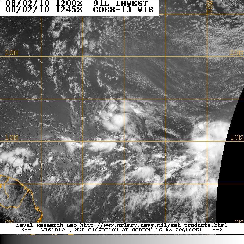
Recurve wrote:On visible this morning in the last frame, just starting to see arms curving toward the convection at what I guess is the center. Might go straight to named storm. Seems to be moving along faster in the east to west flow too. I get about 11 knot movement from the best track positions.


Put this one in the Gulf and you'll have TD4 by now I'd feel pretty confident...

Still no real need to rush with this one given how far it is out, probably will go from an invest to a TD then upto a TS very quickly after that IMO.

The islands need to watch very closely still, thus not really gaining any real latitude.
0 likes   
Personal Forecast Disclaimer:
The posts in this forum are NOT official forecast and should not be used as such. They are just the opinion of the poster and may or may not be backed by sound meteorological data. They are NOT endorsed by any professional institution or storm2k.org. For official information, please refer to the NHC and NWS products

User avatar
Gustywind
Category 5
Category 5
Posts: 12334
Joined: Mon Sep 03, 2007 7:29 am
Location: Baie-Mahault, GUADELOUPE

#462 Postby Gustywind » Mon Aug 02, 2010 8:04 am

Latest position given the non official site of StormPulse http://www.stormpulse.com/
8am: 11,5 N 43,5W
0 likes   

User avatar
ronjon
Category 5
Category 5
Posts: 4822
Joined: Fri Aug 19, 2005 5:17 pm
Location: Hernando Beach, FL

Re: ATL : INVEST 91L - DISCUSSION

#463 Postby ronjon » Mon Aug 02, 2010 8:06 am

Yes I would say its depression status by now looking at its SAT presentation and pressure. Didn't I say last night it wouldn't form until 40W? Movement looks to have sped up now too - 300 deg heading not bad. The next benchmark will be 15N-50W - if it stays south of that position it won't be good for the islands of the LA.

http://www.ssd.noaa.gov/goes/flt/t1/loop-vis.html
0 likes   

User avatar
cycloneye
Admin
Admin
Posts: 145323
Age: 68
Joined: Thu Oct 10, 2002 10:54 am
Location: San Juan, Puerto Rico

Re: ATL : INVEST 91L - DISCUSSION

#464 Postby cycloneye » Mon Aug 02, 2010 8:09 am

Nothing yet from the atcf site about upgrade as no renumber update has occured yet.

ftp://ftp.tpc.ncep.noaa.gov/atcf/tcweb/
0 likes   
Visit the Caribbean-Central America Weather Thread where you can find at first post web cams,radars
and observations from Caribbean basin members Click Here

User avatar
KWT
Category 5
Category 5
Posts: 31415
Joined: Tue Aug 17, 2004 11:02 am
Location: UK!!!

#465 Postby KWT » Mon Aug 02, 2010 8:11 am

It'll be good to compare this to where Bill went in the next 24hrs or so...one thing I wil lsay is the heading is not 300 degrees, the development of the centers moving northwards as the system moves just north of west is what causes the illusion of 300 degrees, I'd guess the last 2-3hrs to be about 280.

edit, I just don't know what the NHC are holding back on... :?:
0 likes   
Personal Forecast Disclaimer:
The posts in this forum are NOT official forecast and should not be used as such. They are just the opinion of the poster and may or may not be backed by sound meteorological data. They are NOT endorsed by any professional institution or storm2k.org. For official information, please refer to the NHC and NWS products

User avatar
HURAKAN
Professional-Met
Professional-Met
Posts: 46086
Age: 38
Joined: Thu May 20, 2004 4:34 pm
Location: Key West, FL
Contact:

#466 Postby HURAKAN » Mon Aug 02, 2010 8:18 am

Image

Latest
0 likes   

User avatar
Hurricane Andrew
S2K Supporter
S2K Supporter
Posts: 1891
Age: 26
Joined: Sun May 23, 2010 2:53 pm
Location: KS

Re: Re:

#467 Postby Hurricane Andrew » Mon Aug 02, 2010 8:20 am

x-y-no wrote:
Hurricane Andrew wrote:WHat is the herbert box?


Hebert Box:

http://en.wikipedia.org/wiki/Hebert_Box

Thanks you.
0 likes   

The Enthusiast
NREMT-AEMT, WX nerd

Irene '11, Sandy '12, Irma '17 (SAR)

"Hard to think we were born to live this way..." -Wage War

User avatar
KWT
Category 5
Category 5
Posts: 31415
Joined: Tue Aug 17, 2004 11:02 am
Location: UK!!!

#468 Postby KWT » Mon Aug 02, 2010 8:20 am

Thats looking very good Hurakan, just a little on the small side with regards to deep convection...but the central convection looks solid.
0 likes   
Personal Forecast Disclaimer:
The posts in this forum are NOT official forecast and should not be used as such. They are just the opinion of the poster and may or may not be backed by sound meteorological data. They are NOT endorsed by any professional institution or storm2k.org. For official information, please refer to the NHC and NWS products

User avatar
x-y-no
Category 5
Category 5
Posts: 8359
Age: 65
Joined: Wed Aug 11, 2004 12:14 pm
Location: Fort Lauderdale, FL

#469 Postby x-y-no » Mon Aug 02, 2010 8:24 am

I'm pretty sure I see some slight west winds at the low level ... sure looks like a TD to me.

I expect we'll have the upgrade at 11am.
0 likes   

User avatar
KWT
Category 5
Category 5
Posts: 31415
Joined: Tue Aug 17, 2004 11:02 am
Location: UK!!!

#470 Postby KWT » Mon Aug 02, 2010 8:29 am

I sure hope so x-y-no because it seems like the NHC are waiting for it to be almost a TS at the moment! :P
0 likes   
Personal Forecast Disclaimer:
The posts in this forum are NOT official forecast and should not be used as such. They are just the opinion of the poster and may or may not be backed by sound meteorological data. They are NOT endorsed by any professional institution or storm2k.org. For official information, please refer to the NHC and NWS products

User avatar
Hurricane Andrew
S2K Supporter
S2K Supporter
Posts: 1891
Age: 26
Joined: Sun May 23, 2010 2:53 pm
Location: KS

Re:

#471 Postby Hurricane Andrew » Mon Aug 02, 2010 8:29 am

HURAKAN wrote:Image

Latest

That is TS worthy.
0 likes   

The Enthusiast
NREMT-AEMT, WX nerd

Irene '11, Sandy '12, Irma '17 (SAR)

"Hard to think we were born to live this way..." -Wage War

User avatar
Blown Away
S2K Supporter
S2K Supporter
Posts: 10145
Joined: Wed May 26, 2004 6:17 am

Re:

#472 Postby Blown Away » Mon Aug 02, 2010 8:30 am

CROWNWEATHER
Issued: Monday, August 2, 2010 635 am EDT/535 am CDT
For Information On Invest 91-L with Maps, Images and Graphics, Go To: http://www.crownweather.com/?page_id=325


Right or wrong I love when credible folks are willing to put there thoughts out there for everybody to see and criticize when they are wrong. Everybody should know to refer to the NHC for the offical forecast. They have an interesting view and I agree with the short term w/ the models trending west back towards the NE Caribbean.
0 likes   
Hurricane Eye Experience: David 79, Irene 99, Frances 04, Jeanne 04, Wilma 05... EYE COMING MY WAY IN 2024…
Hurricane Brush Experience: Andrew 92, Erin 95, Floyd 99, Matthew 16, Irma 17, Ian 22, Nicole 22…

User avatar
cycloneye
Admin
Admin
Posts: 145323
Age: 68
Joined: Thu Oct 10, 2002 10:54 am
Location: San Juan, Puerto Rico

Re: ATL : INVEST 91L - DISCUSSION

#473 Postby cycloneye » Mon Aug 02, 2010 8:32 am

Maybe they skip TD status when they upgrade? :)
0 likes   
Visit the Caribbean-Central America Weather Thread where you can find at first post web cams,radars
and observations from Caribbean basin members Click Here

User avatar
Gustywind
Category 5
Category 5
Posts: 12334
Joined: Mon Sep 03, 2007 7:29 am
Location: Baie-Mahault, GUADELOUPE

#474 Postby Gustywind » Mon Aug 02, 2010 8:32 am

:uarrow:
:eek: :roll:
0 likes   

cwachal

#475 Postby cwachal » Mon Aug 02, 2010 8:33 am

no the NHC is too conservative to do that... unless you see an eye form they will not go to TS... it is not a threat to land right now
0 likes   

User avatar
srainhoutx
S2K Supporter
S2K Supporter
Posts: 6919
Age: 67
Joined: Sun Jan 14, 2007 11:34 am
Location: Haywood County, NC
Contact:

Re: ATL : INVEST 91L - DISCUSSION

#476 Postby srainhoutx » Mon Aug 02, 2010 8:34 am

Latest 2km Visible...

Image
0 likes   
Carla/Alicia/Jerry(In The Eye)/Michelle/Charley/Ivan/Dennis/Katrina/Rita/Wilma/Ike/Harvey

Member: National Weather Association
Wx Infinity Forums
http://wxinfinity.com/index.php

Facebook.com/WeatherInfinity
Twitter @WeatherInfinity

Vortmax1
Category 1
Category 1
Posts: 360
Joined: Wed Jul 07, 2010 11:35 pm
Location: Port Salerno, FL
Contact:

#477 Postby Vortmax1 » Mon Aug 02, 2010 8:35 am

I can certainly see West winds in there this morning. The low clouds on the West side scooting under the CDO. It looks like at least a TD to me...albeit a small one but TD nonetheless. I've seen smaller systems go straight to TS status before...nothing unusual about that either.
0 likes   

User avatar
Gustywind
Category 5
Category 5
Posts: 12334
Joined: Mon Sep 03, 2007 7:29 am
Location: Baie-Mahault, GUADELOUPE

#478 Postby Gustywind » Mon Aug 02, 2010 8:36 am

Image
0 likes   

jlauderdal
S2K Supporter
S2K Supporter
Posts: 7183
Joined: Wed May 19, 2004 5:46 am
Location: NE Fort Lauderdale
Contact:

Re:

#479 Postby jlauderdal » Mon Aug 02, 2010 8:39 am

Gustywind wrote:000
AXNT20 KNHC 021124
TWDAT

TROPICAL WEATHER DISCUSSION
NWS TPC/NATIONAL HURRICANE CENTER MIAMI FL
805 AM EDT MON AUG 02 2010

TROPICAL WEATHER DISCUSSION FOR NORTH AMERICA...CENTRAL
AMERICA...GULF OF MEXICO...CARIBBEAN SEA...NORTHERN SECTIONS OF
SOUTH AMERICA...AND ATLANTIC OCEAN TO THE AFRICAN COAST FROM THE
EQUATOR TO 32N. THE FOLLOWING INFORMATION IS BASED ON SATELLITE
IMAGERY...METEOROLOGICAL ANALYSIS...WEATHER OBSERVATIONS...AND
RADAR.

BASED ON 0600 UTC SURFACE ANALYSIS AND SATELLITE IMAGERY THROUGH
1015 UTC.

...SPECIAL FEATURES...

TROPICAL WAVE EXTENDS FROM 23N40W TO 13N39W WITH A 1007 MB LOW
NEAR 11N38W. WAVE IS EMBEDDED WITHIN A BROAD HIGH AMPLITUDE
MOISTURE MAXIMUM AS OBSERVED ON THE TOTAL PRECIPITABLE WATER
IMAGERY AND BROAD HIGH AMPLITUDE CYCLONIC LOW LEVEL CURVATURE
OBSERVED ON SATELLITE IMAGERY. SCATTERED MODERATE/STRONG
CONVECTION IS NW OF THE LOW CENTER FROM 11N-14N BETWEEN 38W-42W.
THIS BROAD AREA OF LOW PRESSURE REMAINS FAIRLY WELL ORGANIZED...
HOWEVER SATELLITE MICROWAVE IMAGERY INDICATES THAT THE LOW DOES
NOT YET HAVE A WELL-DEFINED SURFACE CENTER OF CIRCULATION.
NONETHELESS...CONDITIONS APPEAR FAVORABLE FOR DEVELOPMENT AND A
TROPICAL DEPRESSION COULD FORM AT ANY TIME DURING THE NEXT DAY
OR SO AS THIS SYSTEM MOVES WEST-NORTHWESTWARD AT 10-15 KT. THERE
IS A HIGH CHANCE OF TROPICAL CYCLONE FORMATION DURING THE NEXT
48 HOURS
.

i see the red font has appeared again, we had some last night too, we have done a good job getting rid of the CAPS now lets work on the colored fonts
0 likes   

jlauderdal
S2K Supporter
S2K Supporter
Posts: 7183
Joined: Wed May 19, 2004 5:46 am
Location: NE Fort Lauderdale
Contact:

Re:

#480 Postby jlauderdal » Mon Aug 02, 2010 8:40 am

cwachal wrote:no the NHC is too conservative to do that... unless you see an eye form they will not go to TS... it is not a threat to land right now


land has nothing to do with it, if it meets their TS criteria than they declare it if it doesn't than no TS
0 likes   


Return to “2010”

Who is online

Users browsing this forum: No registered users and 5 guests