
dexterlabio wrote:
so that means a major now?
A growing major...
Moderator: S2k Moderators
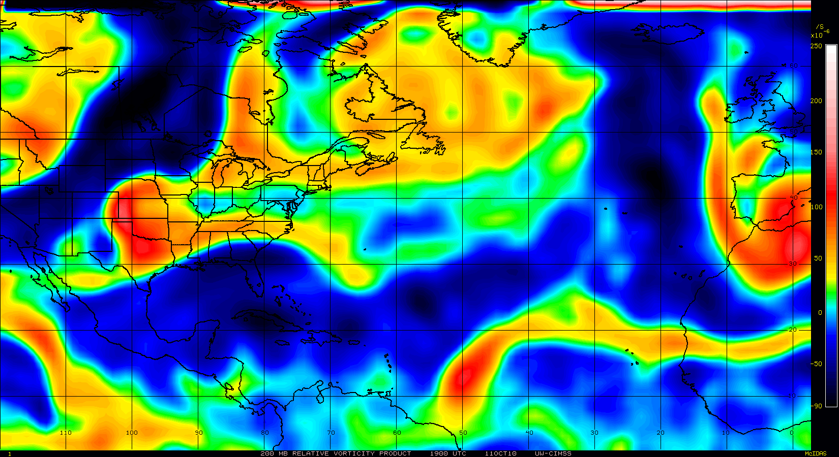
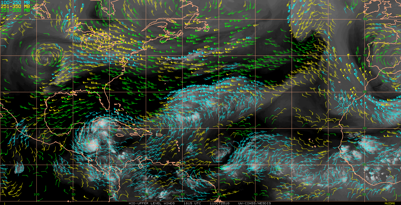


GCANE wrote:UL Trough centered at 32N 60W is developing an enhanced poleward outflow channel.
GCANE wrote:UL Trough centered at 32N 60W is developing an enhanced poleward outflow channel.
Equatorward outflow channel is well established.
Ventilation is nearly ideal.
http://cimss.ssec.wisc.edu/tropic2/pred ... r200-0.GIF
http://cimss.ssec.wisc.edu/tropic2/pred ... gEuw-0.GIF


terrapintransit wrote:so that means a major now?
[/quote]terrapintransit wrote:GCANE wrote:UL Trough centered at 32N 60W is developing an enhanced poleward outflow channel.
Equatorward outflow channel is well established.
Ventilation is nearly ideal.
What exactly does this mean...more of a NW turn soon?
terrapintransit wrote:GCANE wrote:
What exactly does this mean...more of a NW turn soon?


fox13weather wrote:Remember, as intense as "Earl" might be heading up the east coast, even if the center stays just 100 miles east of land then the impacts to land will be minimal. The impacts on the west side of a storm are always over exaggerated.

fox13weather wrote:Remember, as intense as "Earl" might be heading up the east coast, even if the center stays just 100 miles east of land then the impacts to land will be minimal. The impacts on the west side of a storm are always over exaggerated.
SkeetoBite wrote:

fox13weather wrote:Remember, as intense as "Earl" might be heading up the east coast, even if the center stays just 100 miles east of land then the impacts to land will be minimal. The impacts on the west side of a storm are always over exaggerated.
Users browsing this forum: No registered users and 20 guests


