ATL: Ex Tropical Storm EARL - Discussion

Moderator: S2k Moderators

Message
Author
User avatar
HURAKAN
Professional-Met
Professional-Met
Posts: 46086
Age: 38
Joined: Thu May 20, 2004 4:34 pm
Location: Key West, FL
Contact:

Re: ATL: Hurricane EARL - Discussion

#1801 Postby HURAKAN » Mon Aug 30, 2010 6:04 am

msbee wrote:not sure what to expect on st maarten
so far so good
will it get worse?


Image

Should be passing to your north
0 likes   

User avatar
cycloneye
Admin
Admin
Posts: 145584
Age: 68
Joined: Thu Oct 10, 2002 10:54 am
Location: San Juan, Puerto Rico

Re: ATL: Hurricane EARL - Discussion

#1802 Postby cycloneye » Mon Aug 30, 2010 6:05 am

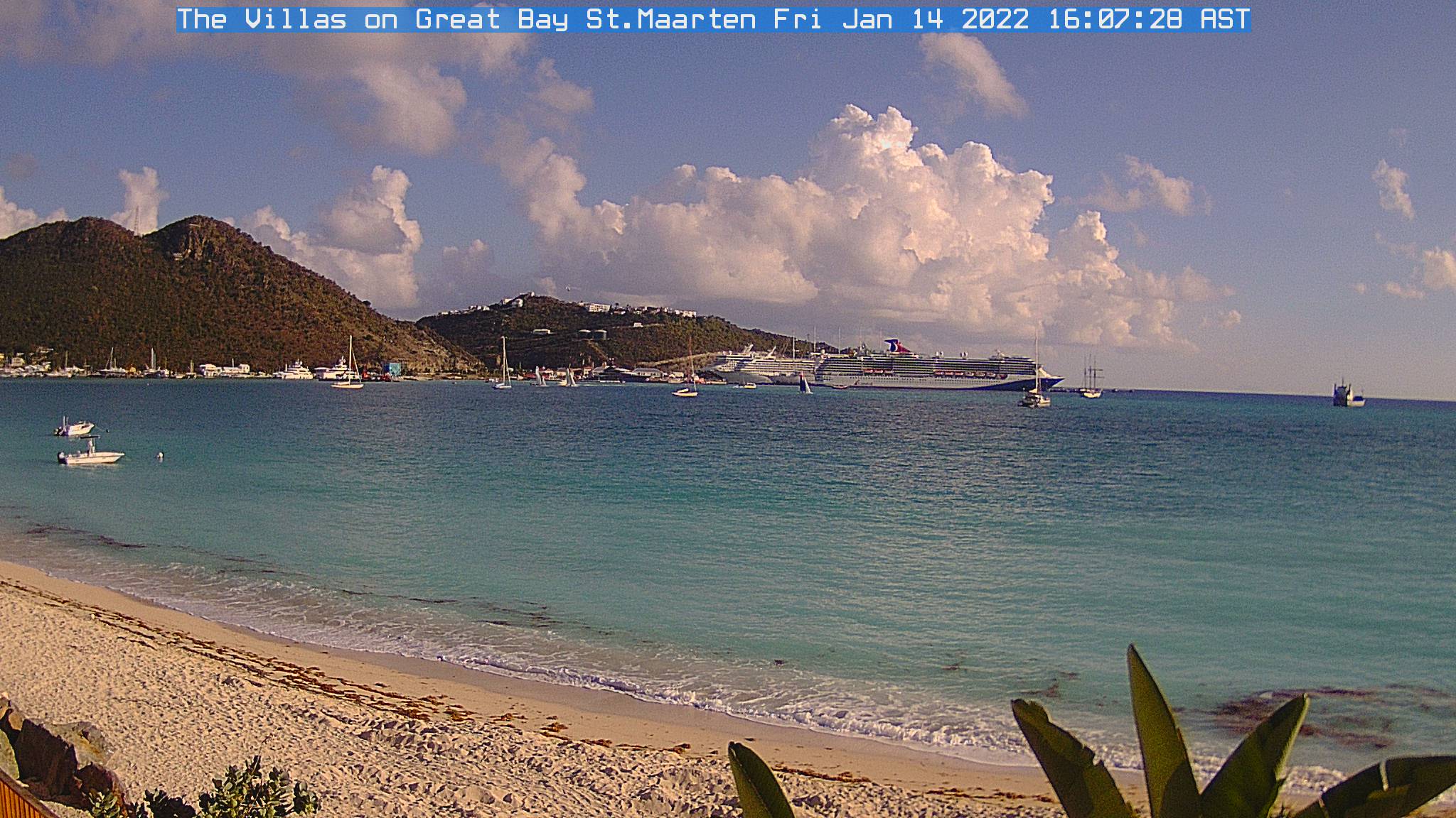
Web Cam in ST Maarten.

Image
0 likes   
Visit the Caribbean-Central America Weather Thread where you can find at first post web cams,radars
and observations from Caribbean basin members Click Here

plasticup

#1803 Postby plasticup » Mon Aug 30, 2010 6:11 am

Great bay is on the southern coast and faces slightly west, so it isn't likely to show the full strength of the storm.
0 likes   

O Town
S2K Supporter
S2K Supporter
Posts: 5205
Age: 52
Joined: Wed Sep 07, 2005 9:37 pm
Location: Orlando, Florida 28°35'35"N 81°22'55"W

Re:

#1804 Postby O Town » Mon Aug 30, 2010 6:15 am

plasticup wrote:Great bay is on the southern coast and faces slightly west, so it isn't likely to show the full strength of the storm.

So do you have a link to a cam on the east side??
0 likes   

#ORLANDOSTRONG

User avatar
Nimbus
Category 5
Category 5
Posts: 5306
Joined: Mon Jul 19, 2004 10:54 am

#1805 Postby Nimbus » Mon Aug 30, 2010 6:16 am

The highest winds for St Maarten will probably occur when the winds just start to shift around from the SW then it will be over. Aparantly they still have power.
0 likes   

User avatar
tailgater
S2K Supporter
S2K Supporter
Posts: 3339
Joined: Sun Jul 11, 2004 9:13 pm
Location: St. Amant La.

Re: ATL: Hurricane EARL - Discussion

#1806 Postby tailgater » Mon Aug 30, 2010 6:18 am

Best of luck getting through this one Islanders.
I obvious don't know ahything about steering currents because the last directuon I would think Earl is going is to the NW, N NNE or due west but NW? someone help ne out here.
Image
Last edited by tailgater on Mon Aug 30, 2010 6:20 am, edited 1 time in total.
0 likes   
The following post is NOT an official forecast and should not be used as such. It is just the opinion of the poster and may or may not be backed by sound meteorological data. It is NOT endorsed by any professional institution including storm2k.org For Official Information please refer to the NHC and NWS products.

User avatar
Gustywind
Category 5
Category 5
Posts: 12334
Joined: Mon Sep 03, 2007 7:29 am
Location: Baie-Mahault, GUADELOUPE

#1807 Postby Gustywind » Mon Aug 30, 2010 6:19 am

Image
0 likes   

User avatar
HURAKAN
Professional-Met
Professional-Met
Posts: 46086
Age: 38
Joined: Thu May 20, 2004 4:34 pm
Location: Key West, FL
Contact:

Re: ATL: Hurricane EARL - Discussion

#1808 Postby HURAKAN » Mon Aug 30, 2010 6:19 am

Pelican Resort Club Webcam - St. Maarten

Image
0 likes   

User avatar
Nimbus
Category 5
Category 5
Posts: 5306
Joined: Mon Jul 19, 2004 10:54 am

#1809 Postby Nimbus » Mon Aug 30, 2010 6:20 am

That was the high I saw building yesterday must be forecast to move or weaken quickly.
0 likes   

Dean4Storms
S2K Supporter
S2K Supporter
Posts: 6358
Age: 62
Joined: Sun Aug 31, 2003 1:01 pm
Location: Miramar Bch. FL

#1810 Postby Dean4Storms » Mon Aug 30, 2010 6:25 am

Looks like the East Coast could see a close call on this one if not a landfall!!!
0 likes   

User avatar
cycloneye
Admin
Admin
Posts: 145584
Age: 68
Joined: Thu Oct 10, 2002 10:54 am
Location: San Juan, Puerto Rico

Re: ATL: Hurricane EARL - Discussion

#1811 Postby cycloneye » Mon Aug 30, 2010 6:28 am

Thank Sandy for posting that cam. Is added to the Caribbean thread at the U.S & Caribbean Weather forum (At first post) where there are many more if anyone wants to see them.

Here is a cam from ST John's bay.

Image
0 likes   
Visit the Caribbean-Central America Weather Thread where you can find at first post web cams,radars
and observations from Caribbean basin members Click Here

Dean4Storms
S2K Supporter
S2K Supporter
Posts: 6358
Age: 62
Joined: Sun Aug 31, 2003 1:01 pm
Location: Miramar Bch. FL

Re: ATL: Hurricane EARL - Discussion

#1812 Postby Dean4Storms » Mon Aug 30, 2010 6:28 am

tailgater wrote:Best of luck getting through this one Islanders.
I obvious don't know anything about steering currents because the last direction I would think Earl is going is to the NW, N NNE or due west but NW? someone help me out here.
http://cimss.ssec.wisc.edu/tropic2/real ... c/dlm4.GIF

That ridge over the eastern US is expected to weaken and shift SW as the week wears on and a trough in the Great Lakes will eventually swing off the eastern seaboard and turn Earl more NE.
0 likes   

User avatar
ColinDelia
S2K Supporter
S2K Supporter
Posts: 918
Joined: Mon Aug 29, 2005 5:52 am
Location: The Beach, FL

Re: ATL: Hurricane EARL - Discussion

#1813 Postby ColinDelia » Mon Aug 30, 2010 6:31 am

Gonna be some dangerous conditions up the US east coast. Rip currents and rough surf. This was in a coastal flood statement here in Melbourne, FL

" DOZENS OF RESCUES ALONG WITH ONE SURF RELATED FATALITY WERE REPORTED ON SATURDAY IN VERY HAZARDOUS OCEAN CONDITIONS."
0 likes   

User avatar
GCANE
S2K Supporter
S2K Supporter
Posts: 11501
Joined: Mon Oct 22, 2007 8:03 am

Re: ATL: Hurricane EARL - Discussion

#1814 Postby GCANE » Mon Aug 30, 2010 6:31 am

Rain rate imagery showed a hot-tower firing in a south quad feeder band at 5:35Z 17N 62W.

Looking at IR, it seems to have helped in CDO building.

Core is in great shape.

Only, thing is MIMIC-TPW shows in-feed may be getting choked off a bit.

In fact, it looks like a small boundary-layer dry-slot is in the SE quad.

Intensification for the short term may come from more localized WISHE.


http://cimss.ssec.wisc.edu/tropic/real- ... t72hrs.gif

http://cimss.ssec.wisc.edu/tropic/real- ... t72hrs.gif


Image


Image

Image
0 likes   

User avatar
wxman57
Moderator-Pro Met
Moderator-Pro Met
Posts: 22984
Age: 67
Joined: Sat Jun 21, 2003 8:06 pm
Location: Houston, TX (southwest)

Re: ATL: Hurricane EARL - Discussion

#1815 Postby wxman57 » Mon Aug 30, 2010 6:42 am

There's a long St. Martin radar loop here:
http://einstein.atmos.colostate.edu/~mc ... aarten.gif

I downloaded it and edited the timing of the images to make it loop more smoothly on my PC. Earl took a quite significant NW jog in the past hour or two. This appears to be taking the southern eyewall north of St. Martin.
0 likes   

pcolaman
Category 1
Category 1
Posts: 380
Age: 61
Joined: Sun Aug 29, 2010 9:33 am
Location: Pensacola Fla

Re: ATL: Hurricane EARL - Discussion

#1816 Postby pcolaman » Mon Aug 30, 2010 6:48 am

http://radar.weather.gov/radar.php?rid= ... 1&loop=yes
Long range out of Puerto looks more to the west than wnw
0 likes   

Dean4Storms
S2K Supporter
S2K Supporter
Posts: 6358
Age: 62
Joined: Sun Aug 31, 2003 1:01 pm
Location: Miramar Bch. FL

Re: ATL: Hurricane EARL - Discussion

#1817 Postby Dean4Storms » Mon Aug 30, 2010 6:49 am

wxman57 wrote:There's a long St. Martin radar loop here:
http://einstein.atmos.colostate.edu/~mc ... aarten.gif

I downloaded it and edited the timing of the images to make it loop more smoothly on my PC. Earl took a quite significant NW jog in the past hour or two. This appears to be taking the southern eyewall north of St. Martin.


Thanks for that one!! Does it look to have slowed as well to you or am I seeing things?
0 likes   

User avatar
HURAKAN
Professional-Met
Professional-Met
Posts: 46086
Age: 38
Joined: Thu May 20, 2004 4:34 pm
Location: Key West, FL
Contact:

#1818 Postby HURAKAN » Mon Aug 30, 2010 6:50 am

LOCATION...18.4N 62.9W
ABOUT 25 MI...40 KM NNE OF ST. MARTIN
ABOUT 140 MI...220 KM E OF ST. THOMAS
MAXIMUM SUSTAINED WINDS...110 MPH...175 KM/HR
PRESENT MOVEMENT...WNW OR 285 DEGREES AT 14 MPH...22 KM/HR
MINIMUM CENTRAL PRESSURE...965 MB...28.50 INCHES
0 likes   

pcolaman
Category 1
Category 1
Posts: 380
Age: 61
Joined: Sun Aug 29, 2010 9:33 am
Location: Pensacola Fla

Re: ATL: Hurricane EARL - Discussion

#1819 Postby pcolaman » Mon Aug 30, 2010 6:51 am

Dean4Storms wrote:
wxman57 wrote:There's a long St. Martin radar loop here:
http://einstein.atmos.colostate.edu/~mc ... aarten.gif

I downloaded it and edited the timing of the images to make it loop more smoothly on my PC. Earl took a quite significant NW jog in the past hour or two. This appears to be taking the southern eyewall north of St. Martin.


Thanks for that one!! Does it look to have slowed as well to you or am I seeing things?

looks about the same to me ,Mabey alittle slower
0 likes   

Aric Dunn
Category 5
Category 5
Posts: 21238
Age: 42
Joined: Sun Sep 19, 2004 9:58 pm
Location: Ready for the Chase.
Contact:

#1820 Postby Aric Dunn » Mon Aug 30, 2010 6:57 am

the track forecast just keeps getting shifting ...
0 likes   


Return to “2010”

Who is online

Users browsing this forum: No registered users and 8 guests