ATL: MATTHEW - Ex-Tropical Storm - Discussion
Moderator: S2k Moderators
-
wxman57

- Moderator-Pro Met

- Posts: 23175
- Age: 68
- Joined: Sat Jun 21, 2003 8:06 pm
- Location: Houston, TX (southwest)
Re: ATL: INVEST 95L - Discussion
No LLC according to obs across the A-B-C islands, just easterly winds there. It's hard to develop when the low-level flow is accelerating, as it often does in the eastern Caribbean. Low-level convergence will occur in the western Caribbean when it slows down late tomorrow or Friday. Question is, does it stall for a few days inland or offshore before being picked up by an approaching trof/front around next Wednesday?
0 likes
Re: ATL: INVEST 95L - Discussion
wxman57 wrote:No LLC according to obs across the A-B-C islands, just easterly winds there. It's hard to develop when the low-level flow is accelerating, as it often does in the eastern Caribbean. Low-level convergence will occur in the western Caribbean when it slows down late tomorrow or Friday. Question is, does it stall for a few days inland or offshore before being picked up by an approaching trof/front around next Wednesday?
and thats the bigger question IMO 57...Those small details will be HUGE in terms of intensity
0 likes


-
SFLcane

- S2K Supporter

- Posts: 10281
- Age: 48
- Joined: Sat Jun 05, 2010 1:44 pm
- Location: Lake Worth Florida
Re: ATL: INVEST 95L - Discussion
wxman57 wrote:No LLC according to obs across the A-B-C islands, just easterly winds there. It's hard to develop when the low-level flow is accelerating, as it often does in the eastern Caribbean. Low-level convergence will occur in the western Caribbean when it slows down late tomorrow or Friday. Question is, does it stall for a few days inland or offshore before being picked up by an approaching trof/front around next Wednesday?
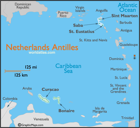
TPC just stated an LLC has formed this morning...according to surface obs, sateliite images, and radar data.
SURFACE OBSERVATIONS...SATELLITE IMAGES...AND RADAR DATA FROM
CURACAO INDICATE THAT AN AREA OF LOW PRESSURE HAS FORMED OVER THE
SOUTH-CENTRAL CARIBBEAN SEA.
0 likes
-
jlauderdal
- S2K Supporter
- Posts: 7240
- Joined: Wed May 19, 2004 5:46 am
- Location: NE Fort Lauderdale
- Contact:
Re:
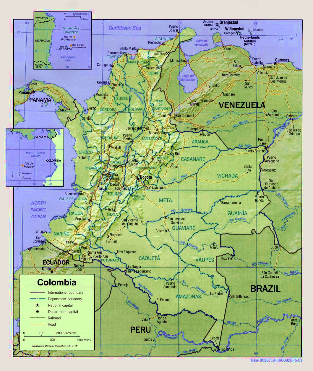
Frank2 wrote:...it also appears that it'll make "landfall", so to speak, over the La Guajira province/peninusla, so the low has formed a bit south of what some thought yesterday, and that's critical per it's future movement:
http://upload.wikimedia.org/wikipedia/c ... 2001-2.png
we need a poll, how many landfalls does the "center" make
i would say 4
0 likes
LOL, and I mean LOL - it's deja vu all over again for me!!!
Years ago, when Lixion Avila was not yet with NOAA (we was involved with UM at that time), one day he was at our office looking at the obs, and I asked him what he was doing, and he said he was looking for an ob with a west wind...
Some things NEVER change!!!
LOL
Ah - only 9:15 ET and my day is already made!!!
Once again, proof that the TWO is also based on who's writing it...
Frank
0 likes
-
Blown Away

- S2K Supporter
- Posts: 10253
- Joined: Wed May 26, 2004 6:17 am
Re: Re:
jlauderdal wrote:Frank2 wrote:...it also appears that it'll make "landfall", so to speak, over the La Guajira province/peninusla, so the low has formed a bit south of what some thought yesterday, and that's critical per it's future movement:
http://upload.wikimedia.org/wikipedia/c ... 2001-2.png
we need a poll, how many landfalls does the "center" make
i would say 4
Honduras/Cuba/SFL/Bahamas - 4 here!
Just like Wilma, the question will be does the center stall over land or water before being picked up by the trough! It's close but most of the model consensus says stall over water very near the coast.
0 likes
Hurricane Eye Experience: David 79, Irene 99, Frances 04, Jeanne 04, Wilma 05… Hurricane Brush Experience: Andrew 92, Erin 95, Floyd 99, Matthew 16, Irma 17, Ian 22, Nicole 22…


-
x-y-no

- Category 5

- Posts: 8359
- Age: 65
- Joined: Wed Aug 11, 2004 12:14 pm
- Location: Fort Lauderdale, FL
Re: ATL: INVEST 95L - Discussion
SFLcane wrote:TPC just stated an LLC has formed this morning...according to surface obs, sateliite images, and radar data.
SURFACE OBSERVATIONS...SATELLITE IMAGES...AND RADAR DATA FROM
CURACAO INDICATE THAT AN AREA OF LOW PRESSURE HAS FORMED OVER THE
SOUTH-CENTRAL CARIBBEAN SEA.
Ummm ... "an area of low pressure" does not equal an LLC. It can just as well be an open wave.
0 likes
-
wxman57
- Moderator-Pro Met
- Posts: 23175
- Age: 68
- Joined: Sat Jun 21, 2003 8:06 pm
- Location: Houston, TX (southwest)
Re: ATL: INVEST 95L - Discussion
Aruba is located just south of the disturbance. It's reporting ESE winds at 10 kts. Bonaire and Curacao are well SE of the disturbance reporting light and somewhat variable winds, indicative of a land/sea breeze. There may be a weak area of low pressure, but no clear LLC this morning. Give it another 24-48 hours.
Crosshairs mark an extrapolation of 12Z NHC position. Hard to say that surface obs indicate a circulation.

Crosshairs mark an extrapolation of 12Z NHC position. Hard to say that surface obs indicate a circulation.
0 likes
-
Bocadude85

- Category 5
- Posts: 2991
- Age: 39
- Joined: Mon Apr 18, 2005 2:20 pm
- Location: Honolulu,Hi
Re: ATL: INVEST 95L - Discussion
I would not be surprised if 95L makes landfall in Honduras and dissipates inland before the front has a chance to pick it up.
0 likes

Of course Frank the thing is those winds could very easily be caused by the system itself, esp as it is a strong wave which has been producing 35-45mph gusts at times on its NE flank.
75-80W seems like the more likely region for development, will be interesting to see how long it spends overland, obviously the longer it spends the flabbier it'll be when it does eventually emerge and probably the weaker it'll be when it does try to make its escape.
75-80W seems like the more likely region for development, will be interesting to see how long it spends overland, obviously the longer it spends the flabbier it'll be when it does eventually emerge and probably the weaker it'll be when it does try to make its escape.
0 likes
Personal Forecast Disclaimer:
The posts in this forum are NOT official forecast and should not be used as such. They are just the opinion of the poster and may or may not be backed by sound meteorological data. They are NOT endorsed by any professional institution or storm2k.org. For official information, please refer to the NHC and NWS products
The posts in this forum are NOT official forecast and should not be used as such. They are just the opinion of the poster and may or may not be backed by sound meteorological data. They are NOT endorsed by any professional institution or storm2k.org. For official information, please refer to the NHC and NWS products
-
lonelymike
- S2K Supporter
- Posts: 634
- Joined: Sat Jul 26, 2008 10:12 am
- Location: walton county fla
Re: ATL: INVEST 95L - Discussion
The tropical wind models don't seem too impressed with 95-L. I wonder if this is because of the time it spends over land?
0 likes
GO SEMINOLES
Land interaction will be quite important as to this ones strength, if it spends a while overland then obviously the chances of it being a powerful hurricane are reduced quite alot but if it manages to curve up quickly enough before landfall then obviously the opposite happens!
Its a real complex set-up but either way I think its quite probable this one ends up curving into Florida in the end, exactly where is hard to call though!
Its a real complex set-up but either way I think its quite probable this one ends up curving into Florida in the end, exactly where is hard to call though!
0 likes
Personal Forecast Disclaimer:
The posts in this forum are NOT official forecast and should not be used as such. They are just the opinion of the poster and may or may not be backed by sound meteorological data. They are NOT endorsed by any professional institution or storm2k.org. For official information, please refer to the NHC and NWS products
The posts in this forum are NOT official forecast and should not be used as such. They are just the opinion of the poster and may or may not be backed by sound meteorological data. They are NOT endorsed by any professional institution or storm2k.org. For official information, please refer to the NHC and NWS products
-
lonelymike
- S2K Supporter
- Posts: 634
- Joined: Sat Jul 26, 2008 10:12 am
- Location: walton county fla
Re: ATL: INVEST 95L - Discussion
HPC thoughts this morning:
"DOWN SOUTH...THE DETERMINISTIC AND ENSEMBLE GUIDANCE CONTINUE TO
ADVERTISE A SYSTEM LIFTING OUT OF THE WESTERN CARIBBEAN /INVEST
95L/ TO THE NORTH ACROSS EITHER THE YUCATAN CHANNEL OR WESTERN
CUBA BY MID NEXT WEEK. THE 00Z CANADIAN WAS BY FAR THE
STRONGEST/LARGEST WITH THIS SYSTEM...AND WAS DISCOUNTED.
CONSIDERING THE TRENDS ACROSS THE MIDWEST/EAST...IT APPEARS THAT
THIS SYSTEM WOULD BE HEADED NORTH TO NORTHEAST INTO THE SOUTHEAST
GULF OF MEXICO/WESTERN FLORIDA STRAITS TOWARDS THE NORTHEAST GULF
COAST/FLORIDA IN 7-10 DAYS. THE DETAILS WILL BE COORDINATED WITH
NHC AT 16Z. STAY TUNED."
0 likes
GO SEMINOLES
-
wzrgirl1

- S2K Supporter
- Posts: 1360
- Joined: Sat Sep 04, 2004 6:44 am
- Location: Pembroke Pines, Florida
Re:
Frank2 wrote:Right, but the thing to remember is that we are 6 weeks earlier than Wilma, so the screaming easteriles are still present down there...
Actually Frank Hurricane Wilma formed on Oct. 15...and hit us on the 24th...that makes it only about 3-4 weeks earlier....that can make a big difference as far as track.
0 likes
Who is online
Users browsing this forum: No registered users and 178 guests