What does SAL stnd for by the way.
Shear and Landmass? LOL
ATL : INVEST 92L - DISCUSSION
Moderator: S2k Moderators
-
Hurricane Andrew

- S2K Supporter

- Posts: 1891
- Age: 27
- Joined: Sun May 23, 2010 2:53 pm
- Location: KS
-
cycloneye

- Admin

- Posts: 149733
- Age: 69
- Joined: Thu Oct 10, 2002 10:54 am
- Location: San Juan, Puerto Rico
Re:
Hurricane Andrew wrote:What does SAL stnd for by the way.
Shear and Landmass? LOL
Saharan Air Layer
0 likes
Visit the Caribbean-Central America Weather Thread where you can find at first post web cams,radars
and observations from Caribbean basin members Click Here
and observations from Caribbean basin members Click Here


-
Hurricane Andrew
- S2K Supporter
- Posts: 1891
- Age: 27
- Joined: Sun May 23, 2010 2:53 pm
- Location: KS
Re: Re:
cycloneye wrote:Hurricane Andrew wrote:What does SAL stnd for by the way.
Shear and Landmass? LOL
Saharan Air Layer
Oh. Thanks.
It seems the Invest has 60 Hours for RAPID strengthening the Weakening.
0 likes
The Enthusiast
NREMT-AEMT, WX nerd
Irene '11, Sandy '12, Irma '17 (SAR)
"Hard to think we were born to live this way..." -Wage War
-
lonelymike
- S2K Supporter
- Posts: 634
- Joined: Sat Jul 26, 2008 10:12 am
- Location: walton county fla
Re: ATL : INVEST 92L
cycloneye wrote:No visit yet by planes as is still far from land.
WEATHER RECONNAISSANCE FLIGHTS
CARCAH, NATIONAL HURRICANE CENTER, MIAMI, FL.
1030 AM EDT SUN 13 JUNE 2010
SUBJECT: TROPICAL CYCLONE PLAN OF THE DAY (TCPOD)
VALID 14/1100Z TO 15/1100Z JUNE 2010
TCPOD NUMBER.....10-013
I. ATLANTIC REQUIREMENTS
1. NEGATIVE RECONNAISSANCE REQUIREMENTS.
2. SUCCEEDING DAY OUTLOOK.....NEGATIVE.
Why would there need to be? All the excitement over a bunch of clouds.
0 likes
GO SEMINOLES
-
Gustywind

- Category 5

- Posts: 12334
- Joined: Mon Sep 03, 2007 7:29 am
- Location: Baie-Mahault, GUADELOUPE
92L: History in the making
 http://www.wunderground.com/blog/Weathe ... trynum=380
Posted by: Weather456, 09:43 GMT le 13 juin 2010
In utter shock, the tropical wave that I was tracking over Africa last week and expected to develop in the Caribbean has defy all known fact of Atlantic Tropical Climatology and is now nearing depression status in the Eastern Atlantic. Satellite images taken of the Atlantic shows a rather disturbing scene at the start of what is expected to be "one hell of a season."
Satellite imagery showed a bone chilling image of an organizing cyclone near 8N-33W moving west-northwest near 10-15 knots. Banding continues to increase around a possible but broad closed low-level circulation and I suspect that we may have Tropical Depression 1 before the day’s end and Alex by Monday. There is still some vertical shear affecting the system from the east but that is likely due to the upper anticyclone superimposition over the low. Further analysis of the circulation revealed it continues to get stronger as it nears 10N. Environmental conditions are favourable for continued development with very warm sea surface temperatures, upper anticyclonic outflow, deep moisture field and low vertical shear. Much of the intensity guidances keep shear very low as 92L heads west, reaching moderate to strong tropical storm intensity by 2-4 days. Intensity begins to drop afterwards due to increasing shear as the system nears the Caribbean in about 5-7 days. I suspect that gradual intensification may lead to a moderate tropical storm in about 2-3 based with the consensus of the intensity models and the environmental conditions such as the availability of ocean heat content. I suspect if the system stays below 15-20N, that intensification will occur until reaching the SE Caribbean where high levels of shear may weaken the system.
Track guidance favours a west-northwest motion over the next couple of days with a bit more northerly component as it nears 50W. However, I think some of the models are a bit north for my fancy. For one, there is a large mid-latitude trough passing through near 50W and as it does so should give way to ridging. This should favour a more west-northwest track than northwest track bringing the system near the islands in about 5 days. Folks in the Lesser Antilles should monitor the progress of this system.
Now there is an upper trough guarding the western Tropical Atlantic but because it is located in the upper levels, it should have little effect on steering since the low-mid level flow is westerly. This is the TUTT and has more say over intensity than track of tropical cyclones. In addition, this trough served to weaken the steering flow below it and systems tend to move west-northwest to northwest in the absent of steering due to the beta effect. My current thinking is a track towards the west-northwest, following the southern models.
The significance of 92L is great as there has been no recorded cyclones this far east in June. This would become the only cyclone to develop in the Eastern Atlantic in June and if it does become a hurricane, it would shattered the record for earliest CV Hurricane by 2008's Bertha.
Early seasonal development like this does not bode well for the season ahead.
0 likes
-
Blown Away

- S2K Supporter
- Posts: 10253
- Joined: Wed May 26, 2004 6:17 am
Re: ATL : INVEST 92L
Convection seems to popping a little N of the best track I wonder if 92L is trying to reorganize a little N and get out of the ITCZ?
0 likes
Hurricane Eye Experience: David 79, Irene 99, Frances 04, Jeanne 04, Wilma 05… Hurricane Brush Experience: Andrew 92, Erin 95, Floyd 99, Matthew 16, Irma 17, Ian 22, Nicole 22…
-
Hurricane Andrew
- S2K Supporter
- Posts: 1891
- Age: 27
- Joined: Sun May 23, 2010 2:53 pm
- Location: KS
Re: ATL : INVEST 92L

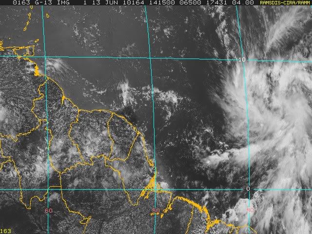
Latest RBG
0 likes
The Enthusiast
NREMT-AEMT, WX nerd
Irene '11, Sandy '12, Irma '17 (SAR)
"Hard to think we were born to live this way..." -Wage War
-
cycloneye
- Admin
- Posts: 149733
- Age: 69
- Joined: Thu Oct 10, 2002 10:54 am
- Location: San Juan, Puerto Rico
Re: ATL : INVEST 92L
Looks like a TD or very close to it seeing this loop but is only my take.

0 likes
Visit the Caribbean-Central America Weather Thread where you can find at first post web cams,radars
and observations from Caribbean basin members Click Here
and observations from Caribbean basin members Click Here


-
Hurricane Andrew
- S2K Supporter
- Posts: 1891
- Age: 27
- Joined: Sun May 23, 2010 2:53 pm
- Location: KS
Re: ATL : INVEST 92L

latest
0 likes
The Enthusiast
NREMT-AEMT, WX nerd
Irene '11, Sandy '12, Irma '17 (SAR)
"Hard to think we were born to live this way..." -Wage War

Re: ATL : INVEST 92L
lonelymike wrote:
Why would there need to be? All the excitement over a bunch of clouds.
A bunch of clouds that has a good circulation, good outflow, banding features, is under a moderate to low shear environment and warm SST, it's just a typical tropical wave...isn't it?
0 likes
-
Hurricane Andrew
- S2K Supporter
- Posts: 1891
- Age: 27
- Joined: Sun May 23, 2010 2:53 pm
- Location: KS
Re: ATL : INVEST 92L
Macrocane wrote:lonelymike wrote:
Why would there need to be? All the excitement over a bunch of clouds.
A bunch of clouds that has a good circulation, good outflow, banding features, is under a moderate to low shear environment and warm SST, it's just a typical tropical wave...isn't it?
Yup...just a typical wave...YEAH RIGHT!
0 likes
The Enthusiast
NREMT-AEMT, WX nerd
Irene '11, Sandy '12, Irma '17 (SAR)
"Hard to think we were born to live this way..." -Wage War

Notice that 92L is only moving 10-15 knots westward, a sign from this year's weaker than normal easterlies across the tropical Atlantic, usually tropical systems and or disturbances this time of the year usally in years that have a strong Azores ridge are flying westward at least at 15-20 knots westward, if not faster.
0 likes
-
cycloneye
- Admin
- Posts: 149733
- Age: 69
- Joined: Thu Oct 10, 2002 10:54 am
- Location: San Juan, Puerto Rico
Re: ATL : INVEST 92L
Circulation quite evident.

0 likes
Visit the Caribbean-Central America Weather Thread where you can find at first post web cams,radars
and observations from Caribbean basin members Click Here
and observations from Caribbean basin members Click Here

Cycloneye, I'd personally raise the chances of development as high as 50% right now myself, its got a really good circulation and I wouldn't be at all surprised if we have a tightening LLC down there. For now though its probably still quite broad.
Of course being where it is, the NHC will be conservative in calling this one and it may have to get close to TS status before they pull the trigger, thats been the case for many E/C Atlantic systems in recent years.
Of course being where it is, the NHC will be conservative in calling this one and it may have to get close to TS status before they pull the trigger, thats been the case for many E/C Atlantic systems in recent years.
Last edited by KWT on Sun Jun 13, 2010 10:03 am, edited 1 time in total.
0 likes
Personal Forecast Disclaimer:
The posts in this forum are NOT official forecast and should not be used as such. They are just the opinion of the poster and may or may not be backed by sound meteorological data. They are NOT endorsed by any professional institution or storm2k.org. For official information, please refer to the NHC and NWS products
The posts in this forum are NOT official forecast and should not be used as such. They are just the opinion of the poster and may or may not be backed by sound meteorological data. They are NOT endorsed by any professional institution or storm2k.org. For official information, please refer to the NHC and NWS products

Re: ATL : INVEST 92L
Weak easterlies I hate that. Can't believe we are actually watching something near 36W 6N start to spin up in June. Maybe its just a sharp wave apex and in 72 hours it will get blown apart but 72 hours under the present conditions will probably result in at least TD1 even if the NHC drags their feat.
0 likes
-
srainhoutx

- S2K Supporter
- Posts: 6919
- Age: 68
- Joined: Sun Jan 14, 2007 11:34 am
- Location: Haywood County, NC
- Contact:
Re: ATL : INVEST 92L
I suspect that we will see TD #1 in the next 24-36 hours if things progress as they have so far IMHO. Stay safe Eastern Caribbean neighbors.
0 likes
Carla/Alicia/Jerry(In The Eye)/Michelle/Charley/Ivan/Dennis/Katrina/Rita/Wilma/Ike/Harvey
Member: National Weather Association
Wx Infinity Forums
http://wxinfinity.com/index.php
Facebook.com/WeatherInfinity
Twitter @WeatherInfinity
Member: National Weather Association
Wx Infinity Forums
http://wxinfinity.com/index.php
Facebook.com/WeatherInfinity
Twitter @WeatherInfinity
-
x-y-no

- Category 5
- Posts: 8359
- Age: 65
- Joined: Wed Aug 11, 2004 12:14 pm
- Location: Fort Lauderdale, FL
Re:
NDG wrote:Notice that 92L is only moving 10-15 knots westward, a sign from this year's weaker than normal easterlies across the tropical Atlantic, usually tropical systems and or disturbances this time of the year usally in years that have a strong Azores ridge are flying westward at least at 15-20 knots westward, if not faster.
Good point, as that improves the prospects of development. If that pattern holds later in the season, we're going to have a lot of CV storms.
0 likes
Who is online
Users browsing this forum: No registered users and 46 guests