ATL: Ex Tropical Storm EARL - Discussion

Moderator: S2k Moderators

Message
Author
Aric Dunn
Category 5
Category 5
Posts: 21238
Age: 42
Joined: Sun Sep 19, 2004 9:58 pm
Location: Ready for the Chase.
Contact:

Re:

#1541 Postby Aric Dunn » Sun Aug 29, 2010 7:27 pm

Nimbus wrote:Well since 5PM Codrington Barbuda upped their maximum wind estimate to hurricane force winds increasing to 60 to 80 mph. We should see at least a gust to Hurricane strength which will put an end to the debate of whether the islands get hurricane force winds.


yeah from the looks of this continued west motion for the last couple hours.. barbuda may make into the southern part of the eye if the motion keeps up...

Image
0 likes   

User avatar
CronkPSU
S2K Supporter
S2K Supporter
Posts: 2014
Joined: Sun Aug 07, 2005 10:44 pm
Location: Avalon Park, FL

Re: ATL: Hurricane EARL - Discussion

#1542 Postby CronkPSU » Sun Aug 29, 2010 7:27 pm

so at what longitude should i start worrying about this if I live in Central Florida...or worry about it for my friends in the Carolinas or the Northeast?
0 likes   

supercane
S2K Supporter
S2K Supporter
Posts: 2858
Joined: Wed Sep 16, 2009 8:27 pm

#1543 Postby supercane » Sun Aug 29, 2010 7:28 pm

0 likes   

Aric Dunn
Category 5
Category 5
Posts: 21238
Age: 42
Joined: Sun Sep 19, 2004 9:58 pm
Location: Ready for the Chase.
Contact:

Re: ATL: Hurricane EARL - Discussion

#1544 Postby Aric Dunn » Sun Aug 29, 2010 7:29 pm

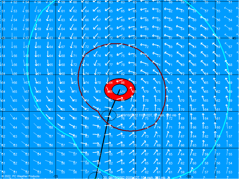
TampaFl wrote:Hurricane Earl 8:00pm postion & wind field. Map courtesy http://www.BoatUS.com

Image


Track shows the west motion and the south side is still strong and likely to get stronger before it gets to barbuda..
0 likes   

User avatar
artist
Category 5
Category 5
Posts: 9792
Joined: Mon Jun 06, 2005 3:26 pm
Location: West Palm

Re: ATL: Hurricane EARL - Discussion

#1545 Postby artist » Sun Aug 29, 2010 7:30 pm

Aric Dunn wrote:here is the next image.. the eye is contracting... and convection wrapping around gave that wobble but still seems about 275 or 280..

so when is this wnw turn scheduled to happen? This could be big for the northern islands if it was to have alrady happened.
0 likes   

Aric Dunn
Category 5
Category 5
Posts: 21238
Age: 42
Joined: Sun Sep 19, 2004 9:58 pm
Location: Ready for the Chase.
Contact:

Re:

#1546 Postby Aric Dunn » Sun Aug 29, 2010 7:30 pm

supercane wrote:Latest radar from St Maarten:
[img]http://a.imageshack.us/img521/5563/earl2010083000earlstmar.png


here is the loop for that.. clearly a showing at least a short term west motion..

http://www.weather.an/radar/cappisxm.html
0 likes   

User avatar
TwisterFanatic
Category 5
Category 5
Posts: 1041
Joined: Mon Jun 28, 2010 12:43 pm
Location: Sallisaw, Oklahoma

Re:

#1547 Postby TwisterFanatic » Sun Aug 29, 2010 7:31 pm


It will interesting to see how close it gets to PR before making its northern turn. I hope it makes it turn soon so PR will be out of the strongest winds.
0 likes   
Personal Forecast Disclaimer:
The posts in this forum are NOT official forecast and should not be used as such. They are just the opinion of the poster and may or may not be backed by sound meteorological data. They are NOT endorsed by any professional institution or storm2k.org. For official information, please refer to the NHC and NWS products.

TheShrimper
Category 2
Category 2
Posts: 516
Joined: Sun Aug 01, 2004 5:05 pm

Re: ATL: Hurricane EARL - Discussion

#1548 Postby TheShrimper » Sun Aug 29, 2010 7:32 pm

Watch and see if your dog stands on his head while drinking a Budweiser, much like my bassett hound did 8 hours before Charley flexed his muscles. If that is the case, batten down the hatches my friend.
0 likes   

User avatar
bvigal
S2K Supporter
S2K Supporter
Posts: 2276
Joined: Sun Jul 24, 2005 8:49 am
Location: British Virgin Islands
Contact:

Re: Re:

#1549 Postby bvigal » Sun Aug 29, 2010 7:32 pm

jinftl wrote:Exactly, and the slight motion north of due west (say 275-285 deg) has allowed the storm to gain a full degree (1.0 deg) of latitude in the last 18 hours:

At 2am sunday, the latitude was 16.7N
At 8pm sunday, the latitude is 17.7N

How significant has this just north-of-west motion been? The center of the storm was south in latitude of every island in the hurricane warning earlier this morning. Now, the center is north of every main island in the hurricane warning except for the following:

St Martin (18.05N)
Tortola (18.45N)
Anguilla (18.2N)

The eye is now north of the latitude of the following:

Antigua (17.12N)
Barbuda (17.63N) - it will be close enough to be in the eye wall
Montserrat (16.74N)
St. Kitts (17.3N)
Nevis (17.14N)
Saba (17.63N)
St. Eusatius (17.48N)


The significance of that is experiencing sustained tropical storm force winds vs. being in the eyepath or on the stronger north side (in terms of wind radii) of a strengthening hurricane. Huge implication in terms of damage potential As of 5pm, the wind radii of hurricane force winds shows that being north of the eye is where the worst winds will be, and where those damaging winds extend further north:

ESTIMATED MINIMUM CENTRAL PRESSURE 978 MB
MAX SUSTAINED WINDS 75 KT WITH GUSTS TO 90 KT.
64 KT....... 40NE 25SE 0SW 20NW.
50 KT....... 75NE 70SE 30SW 60NW.
34 KT.......150NE 120SE 90SW 120NW.


quote="Aric Dunn" quote="jinftl"Since he is gaining a bit of latitude with each advisory, I agree with you. Behaving as forecast....no sharp nw turn was forecast for the next 36 hours or so...rather, a slow, 2-steps-forward-1-wobble-back west to wnw motion is taking shape.

Wobble Watch 2010 is in full effect - when you have a thread confirming a wnw motion followed by a thread stating that the motion is due west...we are in wobble watch mode! The storm coming into radar range will help clarify that....


Dean4Storms wrote:It's pretty evident that Earl is beginning to stair step around the SW edge of the ridge

your missing the difference in this case.. when out in the middle of the ocean wobble watching is pointless.. but right now very important...


Wait a minute! This track has been forecast for 2 days. It has never said the eye would be over the islands, but that it would pass to the north. The SE quadrant will extend winds further than the southwest. The hurricane warning is for a chance that a place will experience hurricane conditions, it makes sense to me the order and level of which these have been issued.
0 likes   

Aric Dunn
Category 5
Category 5
Posts: 21238
Age: 42
Joined: Sun Sep 19, 2004 9:58 pm
Location: Ready for the Chase.
Contact:

Re: ATL: Hurricane EARL - Discussion

#1550 Postby Aric Dunn » Sun Aug 29, 2010 7:33 pm

CronkPSU wrote:so at what longitude should i start worrying about this if I live in Central Florida...or worry about it for my friends in the Carolinas or the Northeast?


here in central florida we are at about 28n ... and start worrying about Florida if earl decides not too turn NW as is forecast..
0 likes   

User avatar
cycloneye
Admin
Admin
Posts: 145489
Age: 68
Joined: Thu Oct 10, 2002 10:54 am
Location: San Juan, Puerto Rico

Re: Re:

#1551 Postby cycloneye » Sun Aug 29, 2010 7:33 pm

TwisterFanatic wrote:


It will interesting to see how close it gets to PR before making its northern turn. I hope it makes it turn soon so PR will be out of the strongest winds.


To clear PR,the eye has to be above 18.5N.
0 likes   
Visit the Caribbean-Central America Weather Thread where you can find at first post web cams,radars
and observations from Caribbean basin members Click Here

User avatar
wxman57
Moderator-Pro Met
Moderator-Pro Met
Posts: 22981
Age: 67
Joined: Sat Jun 21, 2003 8:06 pm
Location: Houston, TX (southwest)

Re: ATL: Hurricane EARL - Discussion

#1552 Postby wxman57 » Sun Aug 29, 2010 7:34 pm

artist wrote:
Aric Dunn wrote:here is the next image.. the eye is contracting... and convection wrapping around gave that wobble but still seems about 275 or 280..

so when is this wnw turn scheduled to happen? This could be big for the northern islands if it was to have already happened.


It's already moving WNW (285 deg).
0 likes   

User avatar
Gustywind
Category 5
Category 5
Posts: 12334
Joined: Mon Sep 03, 2007 7:29 am
Location: Baie-Mahault, GUADELOUPE

#1553 Postby Gustywind » Sun Aug 29, 2010 7:35 pm

Image
0 likes   

User avatar
cycloneye
Admin
Admin
Posts: 145489
Age: 68
Joined: Thu Oct 10, 2002 10:54 am
Location: San Juan, Puerto Rico

Re: ATL: Hurricane EARL - Discussion

#1554 Postby cycloneye » Sun Aug 29, 2010 7:38 pm

00z Best Track

AL, 07, 2010083000, , BEST, 0, 177N, 604W, 75, 972

0 likes   
Visit the Caribbean-Central America Weather Thread where you can find at first post web cams,radars
and observations from Caribbean basin members Click Here

CapeCod1995
Tropical Low
Tropical Low
Posts: 24
Joined: Sun Aug 29, 2010 8:10 am

Re: ATL: Hurricane EARL - Discussion

#1555 Postby CapeCod1995 » Sun Aug 29, 2010 7:39 pm

I live on Cape Cod and I'm within the projected path...should I be worried about a hurricane?
0 likes   

User avatar
Gustywind
Category 5
Category 5
Posts: 12334
Joined: Mon Sep 03, 2007 7:29 am
Location: Baie-Mahault, GUADELOUPE

#1556 Postby Gustywind » Sun Aug 29, 2010 7:39 pm

Image
0 likes   

Dean4Storms
S2K Supporter
S2K Supporter
Posts: 6358
Age: 62
Joined: Sun Aug 31, 2003 1:01 pm
Location: Miramar Bch. FL

Re: ATL: Hurricane EARL - Discussion

#1557 Postby Dean4Storms » Sun Aug 29, 2010 7:39 pm

wxman57 wrote:
artist wrote:
Aric Dunn wrote:here is the next image.. the eye is contracting... and convection wrapping around gave that wobble but still seems about 275 or 280..

so when is this wnw turn scheduled to happen? This could be big for the northern islands if it was to have already happened.


It's already moving WNW (285 deg).


What he said. Folks don't get caught up in the wobbles, you must look at the overall motion going back a good few hours!
0 likes   

Aric Dunn
Category 5
Category 5
Posts: 21238
Age: 42
Joined: Sun Sep 19, 2004 9:58 pm
Location: Ready for the Chase.
Contact:

Re: ATL: Hurricane EARL - Discussion

#1558 Postby Aric Dunn » Sun Aug 29, 2010 7:40 pm

wxman57 wrote:
artist wrote:
Aric Dunn wrote:here is the next image.. the eye is contracting... and convection wrapping around gave that wobble but still seems about 275 or 280..

so when is this wnw turn scheduled to happen? This could be big for the northern islands if it was to have already happened.


It's already moving WNW (285 deg).


not according to the recon fixes.. the last hour or 2 has been more 275/280... but overall 6 hour motion is likely 285..
0 likes   

Dean4Storms
S2K Supporter
S2K Supporter
Posts: 6358
Age: 62
Joined: Sun Aug 31, 2003 1:01 pm
Location: Miramar Bch. FL

Re: ATL: Hurricane EARL - Discussion

#1559 Postby Dean4Storms » Sun Aug 29, 2010 7:41 pm

CapeCod1995 wrote:I live on Cape Cod and I'm within the projected path...should I be worried about a hurricane?


I would prepare to the extent you can and hope for the best. Stay up to date on the official forecasts from the NHC and your local NWS!!
0 likes   

User avatar
Normandy
Category 5
Category 5
Posts: 2293
Joined: Sun Oct 10, 2004 12:31 am
Location: Houston, TX

Re: ATL: Hurricane EARL - Discussion

#1560 Postby Normandy » Sun Aug 29, 2010 7:41 pm

Wobbles are crucial for these islands. Because of the west wobble barbuda is facing the southern eyewall.
0 likes   


Return to “2010”

Who is online

Users browsing this forum: No registered users and 3 guests