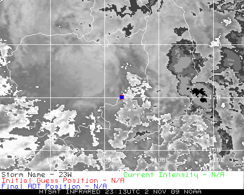
WPAC : TROPICAL DEPRESSION MIRINAE (23W)

Moderator: S2k Moderators

Message
Author
User avatar
HURAKAN
Professional-Met
Professional-Met
Posts: 46086
Age: 38
Joined: Thu May 20, 2004 4:34 pm
Location: Key West, FL
Contact:

#981 Postby HURAKAN » Thu Oct 29, 2009 4:55 am

Image

JMA's track
0 likes   

ricmood

#982 Postby ricmood » Thu Oct 29, 2009 5:28 am

I think, according to JMA, it just gained lat.
JTWC reported it at 15.8 earlier
0 likes   

User avatar
HURAKAN
Professional-Met
Professional-Met
Posts: 46086
Age: 38
Joined: Thu May 20, 2004 4:34 pm
Location: Key West, FL
Contact:

#983 Postby HURAKAN » Thu Oct 29, 2009 5:36 am

Image

Internally this system is struggling. Good news for the Philippines
0 likes   

User avatar
HURAKAN
Professional-Met
Professional-Met
Posts: 46086
Age: 38
Joined: Thu May 20, 2004 4:34 pm
Location: Key West, FL
Contact:

#984 Postby HURAKAN » Thu Oct 29, 2009 5:37 am

Image

If there's any good news is that this system won't be the monster feared before. Still, the rains could prove deadly and Ketsana showed what a tropical storm can do.
0 likes   

oaba09
S2K Supporter
S2K Supporter
Posts: 1496
Age: 38
Joined: Thu Oct 01, 2009 10:02 am
Location: Valenzuela, Philippines
Contact:

Re:

#985 Postby oaba09 » Thu Oct 29, 2009 5:46 am

ricmood wrote:I think, according to JMA, it just gained lat.
JTWC reported it at 15.8 earlier


It's at 16.1 right now
0 likes   

ricmood

Re:

#986 Postby ricmood » Thu Oct 29, 2009 5:49 am

HURAKAN wrote:Image

If there's any good news is that this system won't be the monster feared before. Still, the rains could prove deadly and Ketsana showed what a tropical storm can do.


How about the wind?
0 likes   

User avatar
StormingB81
S2K Supporter
S2K Supporter
Posts: 5676
Age: 43
Joined: Thu Aug 27, 2009 1:45 am
Location: Rockledge, Florida

#987 Postby StormingB81 » Thu Oct 29, 2009 5:54 am

The little cluster i said ealier looks like it is better then this one...
0 likes   

oaba09
S2K Supporter
S2K Supporter
Posts: 1496
Age: 38
Joined: Thu Oct 01, 2009 10:02 am
Location: Valenzuela, Philippines
Contact:

#988 Postby oaba09 » Thu Oct 29, 2009 5:56 am

It's seems to be moving westwards at this moment.......
0 likes   

User avatar
drdavisjr
Category 1
Category 1
Posts: 428
Age: 57
Joined: Mon Oct 12, 2009 7:07 am
Location: Marilao, Bulacan, Philippines
Contact:

#989 Postby drdavisjr » Thu Oct 29, 2009 5:58 am

http://cimss.ssec.wisc.edu/tropic/real- ... splay.html

According to MIMIC, winds are 90 knots
0 likes   

User avatar
StormingB81
S2K Supporter
S2K Supporter
Posts: 5676
Age: 43
Joined: Thu Aug 27, 2009 1:45 am
Location: Rockledge, Florida

#990 Postby StormingB81 » Thu Oct 29, 2009 6:04 am

If that cluster that left the storm develops into anything has that ever happend before?
0 likes   

User avatar
cycloneye
Admin
Admin
Posts: 145322
Age: 68
Joined: Thu Oct 10, 2002 10:54 am
Location: San Juan, Puerto Rico

Re: WPAC : TYPHOON MIRINAE (23W) PAGASA=TYPHOON SANTI

#991 Postby cycloneye » Thu Oct 29, 2009 6:05 am

If there's any good news is that this system won't be the monster feared before. Still, the rains could prove deadly and Ketsana showed what a tropical storm can do.


Also,it is moving at a fairly good clip not slowly as other past storms and that will mitigate some of the effects.But still it will be a big deal in terms of flooding,landslides and wind damage.
0 likes   
Visit the Caribbean-Central America Weather Thread where you can find at first post web cams,radars
and observations from Caribbean basin members Click Here

ricmood

Re: WPAC : TYPHOON MIRINAE (23W) PAGASA=TYPHOON SANTI

#992 Postby ricmood » Thu Oct 29, 2009 6:07 am

cycloneye wrote:
If there's any good news is that this system won't be the monster feared before. Still, the rains could prove deadly and Ketsana showed what a tropical storm can do.


Also,it is moving at a fairly good clip not slowly as other past storms and that will mitigate some of the effects.But still it will be a big deal in terms of flooding,landslides and wind damage.


It's like pulling a bandage. Quick and painful.
0 likes   

User avatar
ManilaTC
WesternPacificWeather.com
Posts: 593
Age: 47
Joined: Mon Oct 26, 2009 5:13 am
Location: Mandaluyong City, Philippines
Contact:

Re: WPAC : TYPHOON MIRINAE (23W) PAGASA=TYPHOON SANTI

#993 Postby ManilaTC » Thu Oct 29, 2009 6:15 am

Image

Here is my forecast track, its unofficial...

Based from PAGASA, JTWC, JMA, KMA, CWB Beijing and Taiwan.
0 likes   
The above post is NOT official and should not be used as such. It is my opinion and may or may not be backed by sound meteorological data. It is not endorsed by any professional institution or storm2k.org. Please refer to your official national weather agency.

WEB http://goo.gl/JDiKXB | FB https://goo.gl/N5sIle | @ManilaTC

dexterlabio
Category 5
Category 5
Posts: 3468
Joined: Sat Oct 24, 2009 11:50 pm

#994 Postby dexterlabio » Thu Oct 29, 2009 6:16 am

i'm pretty sure that this won't be a major typhoon (cat3 above). however, a typhoon is still a typhoon. winds of 100kph can already be destructive and destroy properties.

well, it seem to move westward again after the sudden gain in latitude. i saw the local weather report, saying that signal#3 might be raised tomorrow evening here in metro manila. signal#1 might be raised later tonight.
0 likes   
Personal Forecast Disclaimer:
The posts in this forum are NOT official forecast and should not be used as such. They are just the opinion of the poster and may or may not be backed by sound meteorological data. They are NOT endorsed by any professional institution or storm2k.org. For official information, please refer to the NHC and NWS products.

oaba09
S2K Supporter
S2K Supporter
Posts: 1496
Age: 38
Joined: Thu Oct 01, 2009 10:02 am
Location: Valenzuela, Philippines
Contact:

Re:

#995 Postby oaba09 » Thu Oct 29, 2009 6:23 am

dexterlabio wrote:i'm pretty sure that this won't be a major typhoon (cat3 above). however, a typhoon is still a typhoon. winds of 100kph can already be destructive and destroy properties.

well, it seem to move westward again after the sudden gain in latitude. i saw the local weather report, saying that signal#3 might be raised tomorrow evening here in metro manila. signal#1 might be raised later tonight.


yeah...it seems to be moving westwards.....I'm still expecting a wsw track after a few hours....
0 likes   

User avatar
drdavisjr
Category 1
Category 1
Posts: 428
Age: 57
Joined: Mon Oct 12, 2009 7:07 am
Location: Marilao, Bulacan, Philippines
Contact:

#996 Postby drdavisjr » Thu Oct 29, 2009 6:53 am

Right now I am not trusting my eyes on the lat/long points. Right now I am watching that ridge to the north and how the core interacts with it.

It does seem to be tracking the southern line, and that line, my friends, leads (at this moment) straight to Metro Manila.

Personal Forecast Disclaimer:
The posts in this forum are NOT official forecast and should not be used as such. They are just the opinion of the poster and may or may not be backed by sound meteorological data. They are NOT endorsed by any professional institution or storm2k.org. For official information, please refer to the NHC and NWS products.
0 likes   

User avatar
HURAKAN
Professional-Met
Professional-Met
Posts: 46086
Age: 38
Joined: Thu May 20, 2004 4:34 pm
Location: Key West, FL
Contact:

Re: Re:

#997 Postby HURAKAN » Thu Oct 29, 2009 6:57 am

ricmood wrote:How about the wind?


Those in the path of the core of the typhoon will have to deal with the winds, which should cause some damage. But like we know, the rain is the main problem.
0 likes   

oaba09
S2K Supporter
S2K Supporter
Posts: 1496
Age: 38
Joined: Thu Oct 01, 2009 10:02 am
Location: Valenzuela, Philippines
Contact:

Re:

#998 Postby oaba09 » Thu Oct 29, 2009 6:58 am

drdavisjr wrote:Right now I am not trusting my eyes on the lat/long points. Right now I am watching that ridge to the north and how the core interacts with it.

It does seem to be tracking the southern line, and that line, my friends, leads (at this moment) straight to Metro Manila.

Personal Forecast Disclaimer:
The posts in this forum are NOT official forecast and should not be used as such. They are just the opinion of the poster and may or may not be backed by sound meteorological data. They are NOT endorsed by any professional institution or storm2k.org. For official information, please refer to the NHC and NWS products.


It's important to watch the next few hours of mirinae because what happens next will pretty much determine mirinae's landfall area.....
0 likes   

User avatar
drdavisjr
Category 1
Category 1
Posts: 428
Age: 57
Joined: Mon Oct 12, 2009 7:07 am
Location: Marilao, Bulacan, Philippines
Contact:

#999 Postby drdavisjr » Thu Oct 29, 2009 6:59 am

Image
0 likes   

dexterlabio
Category 5
Category 5
Posts: 3468
Joined: Sat Oct 24, 2009 11:50 pm

Re:

#1000 Postby dexterlabio » Thu Oct 29, 2009 6:59 am

drdavisjr wrote:Right now I am not trusting my eyes on the lat/long points. Right now I am watching that ridge to the north and how the core interacts with it.

It does seem to be tracking the southern line, and that line, my friends, leads (at this moment) straight to Metro Manila.

Personal Forecast Disclaimer:
The posts in this forum are NOT official forecast and should not be used as such. They are just the opinion of the poster and may or may not be backed by sound meteorological data. They are NOT endorsed by any professional institution or storm2k.org. For official information, please refer to the NHC and NWS products.


i kinda agree with you. i am not trusting the sat animation in wunderground, but the core of the storm, as i observe, seems to be diving a bit as it moves westward.
0 likes   
Personal Forecast Disclaimer:
The posts in this forum are NOT official forecast and should not be used as such. They are just the opinion of the poster and may or may not be backed by sound meteorological data. They are NOT endorsed by any professional institution or storm2k.org. For official information, please refer to the NHC and NWS products.


Return to “2009”

Who is online

Users browsing this forum: No registered users and 8 guests