wxman57 wrote:fox13weather wrote:
In that case every wave that comes off Africa is an east coast/ Gulf of Mexico threat. There is enough model spread that calling "Ana" and the wave coming off Africa east coast/Gulf threats is nothing more than attention grabers.
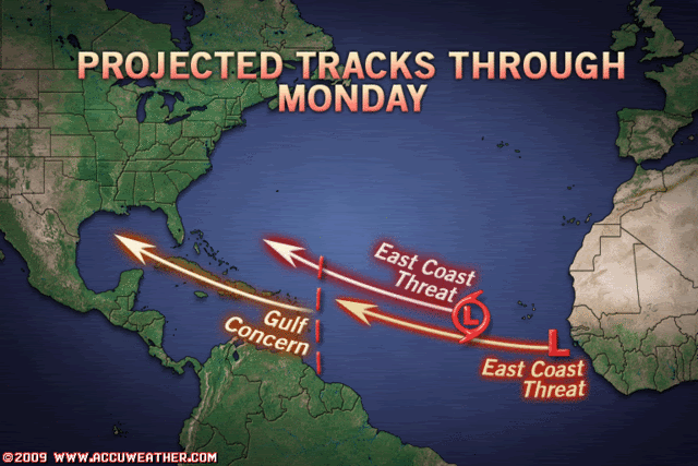
Yeah, in my video I did mention that the threat could be anywhere from the Gulf Coast to out to sea off the East U.S. Coast. Way too early to tell. But it certainly is a "possible East Coast threat".
Gulf coast to out to sea?? Yup, that just about covers it ....amazing...