its feels odd to have a landfalling tropical system and the air be so cool!
fwbbreeze
Moderator: S2k Moderators


Ivanhater wrote:[img]Buoy at 28.8N and 86W.....
Wind Direction (WDIR): E ( 100 deg true )
5-day plot - Wind Speed Wind Speed (WSPD): 36.9 kts5-day plot - Wind Gust Wind Gust (GST): 46.6 kts
5-day plot - Wave Height Wave Height (WVHT): 18.0 ft
5-day plot - Dominant Wave Period Dominant Wave Period (DPD): 11 sec
5-day plot - Average Period Average Period (APD): 7.2 sec
5-day plot - Atmospheric Pressure Atmospheric Pressure (PRES): 29.90 in
5-day plot - Pressure Tendency Pressure Tendency (PTDY): -0.11 in ( Falling Rapidly )
5-day plot - Air Temperature Air Temperature (ATMP): 70.7 °F
5-day plot - Water Temperature Water Temperature (WTMP): 77.7 °F
5-day plot - Dew Point Dew Point (DEWP): 70.0 °F
[/img]
smw1981 wrote:Ivanhater wrote:[img]Buoy at 28.8N and 86W.....
Wind Direction (WDIR): E ( 100 deg true )
5-day plot - Wind Speed Wind Speed (WSPD): 36.9 kts5-day plot - Wind Gust Wind Gust (GST): 46.6 kts
5-day plot - Wave Height Wave Height (WVHT): 18.0 ft
5-day plot - Dominant Wave Period Dominant Wave Period (DPD): 11 sec
5-day plot - Average Period Average Period (APD): 7.2 sec
5-day plot - Atmospheric Pressure Atmospheric Pressure (PRES): 29.90 in
5-day plot - Pressure Tendency Pressure Tendency (PTDY): -0.11 in ( Falling Rapidly )
5-day plot - Air Temperature Air Temperature (ATMP): 70.7 °F
5-day plot - Water Temperature Water Temperature (WTMP): 77.7 °F
5-day plot - Dew Point Dew Point (DEWP): 70.0 °F
[/img]
Sooo...what does all that mean? lol
Also, what school do you go to? I am getting my masters at UWF right now...

jhpigott wrote:are the other models still showing the same kind of solution as the 12Z CMC?
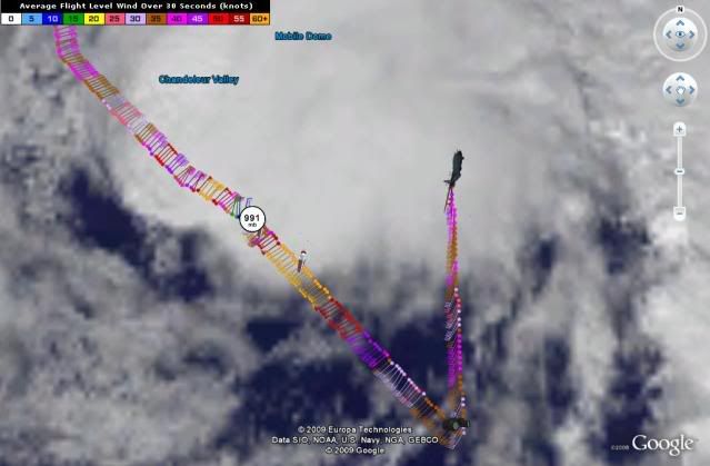
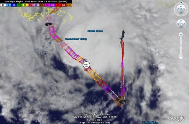
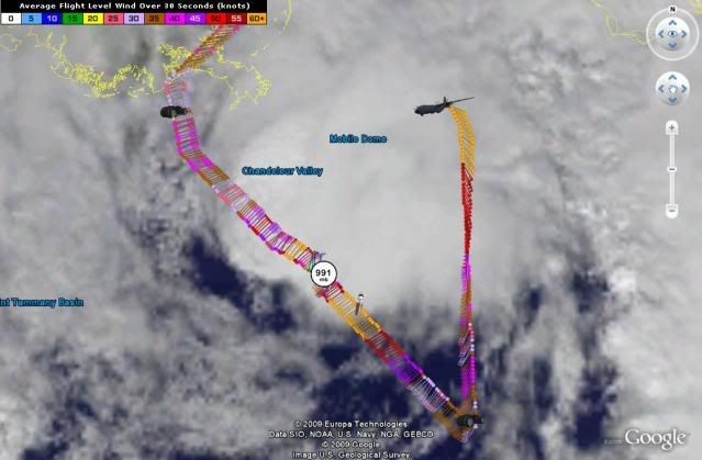
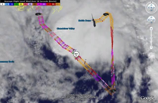
HURAKAN wrote:
Latest
Stormcenter wrote:It still looks like Ida is headed NNW.
I thought she was suppose to move due
north by now.
http://www.ssd.noaa.gov/goes/flt/t2/loop-vis.html
Users browsing this forum: No registered users and 53 guests