http://rammb.cira.colostate.edu/product ... 020615.GIF
the NHC ignored.. this is a Tropical Storm.

Moderator: S2k Moderators


DanieleItalyRm wrote:Fantastic loop Hurakan..
http://rammb.cira.colostate.edu/product ... 020615.GIF
the NHC ignored.. this is a Tropical Storm.


cycloneye wrote:SSD Dvorak says its a Subtropical Storm.
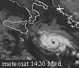
02/1200 UTC 42.7N 23.8W ST3.0 92L -- Atlantic
http://www.ssd.noaa.gov/PS/TROP/tdpositions.html
Chacor wrote:The 50 kt wind reading from Quikscat was heavily marred by rain, and likely was unreliable. NCEP/ATCF says 35 kt and Meteo France says no gale. It also doesn't currently have well-organised deep convection. Only a small band of -50C cloud tops in the NE quadrant. Look at the IR, not the visible.

Chacor wrote:Luis, subtropical classifications are not made using the Dvorak method. It's the Hebert-Poteat method.


Chacor wrote:It's in an area of the pass that is marred by rain (the black barbs), hence why I said it's unreliable.
cycloneye wrote:12 UTC Best track
45 kts,995 mbs
AL, 92, 2009060212, , BEST, 0, 428N, 237W, 45, 995, LO, 34
Users browsing this forum: No registered users and 30 guests

