I agree, the best convergence is ahead of the convection. That is likely where the wave axis is
the convection is merely due to favorable UL divergence
ATL: TROPICAL DEPRESSION DANNY (05L)
Moderator: S2k Moderators
-
'CaneFreak

- Category 5

- Posts: 1487
- Joined: Mon Jun 05, 2006 10:50 am
- Location: New Bern, NC
Re:
Derek Ortt wrote:I agree, the best convergence is ahead of the convection. That is likely where the wave axis is
the convection is merely due to favorable UL divergence
agreed...have you been able to find any kind of center of late? Any center at this point would be Mid-Level of course...
0 likes
-
'CaneFreak
- Category 5
- Posts: 1487
- Joined: Mon Jun 05, 2006 10:50 am
- Location: New Bern, NC
Re: ATL: Invest 92L
Sanibel wrote:No doubter from center burst behavior IMO.
center burst behavior? Where?
0 likes

-
'CaneFreak
- Category 5
- Posts: 1487
- Joined: Mon Jun 05, 2006 10:50 am
- Location: New Bern, NC
Re: ATL: Invest 92L
Sanibel wrote:18-56
I would agree with you but there is no low level convergence there...the best convergence is much further to the west...no low level convergence = no LLC development
0 likes
-
Dean4Storms
- S2K Supporter

- Posts: 6358
- Age: 63
- Joined: Sun Aug 31, 2003 1:01 pm
- Location: Miramar Bch. FL
Re: ATL: Invest 92L
Very true, did not think about the forward speed of 20mph plus a shear coming at it near 25mph, the combination is nearly impossible for TC formation in the near term. Key to this will be the ULL filling or backing SW out of the picture once it nears the SE Bahamas in 2 days.
0 likes
Re: ATL: Invest 92L
Maybe the ULL sheared the surface reflection to that position?
This is forming.
This is forming.
The posts in this forum are NOT official forecast and should not be used as such. They are just the opinion of the poster and may or may not be backed by sound meteorological data. They are NOT endorsed by any professional institution or storm2k.org. For official information, please refer to the NHC and NWS products.
0 likes
-
Dean4Storms
- S2K Supporter
- Posts: 6358
- Age: 63
- Joined: Sun Aug 31, 2003 1:01 pm
- Location: Miramar Bch. FL
-
'CaneFreak
- Category 5
- Posts: 1487
- Joined: Mon Jun 05, 2006 10:50 am
- Location: New Bern, NC
Re: ATL: Invest 92L
Dean4Storms wrote:Very true, did not think about the forward speed of 20mph plus a shear coming at it near 25mph, the combination is nearly impossible for TC formation in the near term. Key to this will be the ULL filling or backing SW out of the picture once it nears the SE Bahamas in 2 days.
Yep...give it 48-60 hours and then it will develop...it will have a honking UL High over it and 29 C water....yee haw...it will be off to the races...and not to mention the Gulf Stream to work with...
0 likes
-
StormClouds63
- Category 2

- Posts: 583
- Age: 62
- Joined: Tue May 13, 2008 11:56 am
- Location: Southwest Louisiana
Re: ATL: Invest 92L - Computer Models
If it does develop, Danny goes fishing for EC's sake. Again, the best hope is for a repeat of the 2006 pattern in the Atlantic basin.
0 likes
-
'CaneFreak
- Category 5
- Posts: 1487
- Joined: Mon Jun 05, 2006 10:50 am
- Location: New Bern, NC
Re: ATL: Invest 92L
Sanibel wrote:Maybe the ULL sheared the surface reflection to that position?
This is forming.
The posts in this forum are NOT official forecast and should not be used as such. They are just the opinion of the poster and may or may not be backed by sound meteorological data. They are NOT endorsed by any professional institution or storm2k.org. For official information, please refer to the NHC and NWS products.
0 likes
-
Dean4Storms
- S2K Supporter
- Posts: 6358
- Age: 63
- Joined: Sun Aug 31, 2003 1:01 pm
- Location: Miramar Bch. FL
-
HURRICANELONNY
- Category 5
- Posts: 1392
- Joined: Wed May 07, 2003 6:48 am
- Location: HOLLYWOOD.FL
Re: ATL: Invest 92L - Computer Models
Computer models without anything to initialize. Is garbage. Until a depression forms (LLC). The models are useless. 
0 likes
-
dixiebreeze

- S2K Supporter
- Posts: 5140
- Joined: Wed Sep 03, 2003 5:07 pm
- Location: crystal river, fla.
Re: ATL: Invest 92L
NOUS42 KNHC 241445
WEATHER RECONNAISSANCE FLIGHTS
CARCAH, NATIONAL HURRICANE CENTER, MIAMI, FL.
1045 AM EDT MON 24 AUGUST 2009
SUBJECT: TROPICAL CYCLONE PLAN OF THE DAY (TCPOD)
VALID 25/1100Z TO 26/1100Z AUGUST 2009
TCPOD NUMBER.....09-088
I. ATLANTIC REQUIREMENTS
1. SUSPECT AREA (NORTH OF PUERTO RICO)
FLIGHT ONE - TEAL 70
A. 25/2100Z
B. AFXXX 01AAA INVEST
C. 25/1900Z
D. 22.0N 67.0W
E. 25/2000Z TO 26/0001Z
F. SFC TO 10,000 FT
FLIGHT TWO - TEAL 71
A. 26/0600Z
B. AFXXX 0205A CYCLONE
C. 26/0400Z
D. 23.0N 71.0W
E. 26/0530Z TO 26/1000Z
F. SFC TO 10,000 FT
2. OUTLOOK FOR SUCCEEDING DAY: BEGIN 6-HRLY FIXES
AT 26/1800Z IF SYSTEM DEVELOPS.
II. PACIFIC REQUIREMENTS
1. NEGATIVE RECONNAISSANCE REQUIREMENTS.
2. SUCCEEDING DAY OUTLOOK.....NEGATIVE.
JWP
0 likes
-
'CaneFreak
- Category 5
- Posts: 1487
- Joined: Mon Jun 05, 2006 10:50 am
- Location: New Bern, NC
Re:
Dean4Storms wrote:I agree with Sanibel, the area of 18/56 is looking suspicious and the shear is actually fairly light down there. I also see no outflow boundaries from that area of repeated deep convection.
Check the latest visible loop...that convection is not moving at all....its bursting over the same area...its bursting due to the ULL divergence...
0 likes
-
Nederlander
- S2K Supporter
- Posts: 1259
- Joined: Sat Jul 19, 2008 4:28 pm
- Location: Conroe, TX
Re: ATL: Invest 92L
Sanibel wrote:
This is forming.
Doesn't really look that impressive to me IMO. If I've heard it said once, I've heard it a thousand times. Convection does not equal TC formation.....
0 likes
-
HURAKAN

- Professional-Met

- Posts: 46084
- Age: 39
- Joined: Thu May 20, 2004 4:34 pm
- Location: Key West, FL
- Contact:
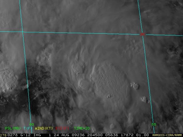
Loop: http://rammb.cira.colostate.edu/ramsdis ... is_floater
Great loop exactly over the area in question
0 likes
-
Derek Ortt
Re: Re:
'CaneFreak wrote:Derek Ortt wrote:I agree, the best convergence is ahead of the convection. That is likely where the wave axis is
the convection is merely due to favorable UL divergence
agreed...have you been able to find any kind of center of late? Any center at this point would be Mid-Level of course...
nope... no center. Only WEAK wave axis
0 likes

I agree with Derek, the main region to watch is probably a little ahead of the convection which blowing up thanks to ULL interaction.
This really hasn't much chance in the short term however post 48hrs I'd imagine it is going to get into better conditions, will watch that ULL closely, I think it'll continue westwards whilst this system will get lifted out somewhat, eventually allowing better conditions, but its going to be a long old task IMO. 48hrs and I think the chances of developing really increase a lot.
This really hasn't much chance in the short term however post 48hrs I'd imagine it is going to get into better conditions, will watch that ULL closely, I think it'll continue westwards whilst this system will get lifted out somewhat, eventually allowing better conditions, but its going to be a long old task IMO. 48hrs and I think the chances of developing really increase a lot.
Last edited by KWT on Mon Aug 24, 2009 4:27 pm, edited 1 time in total.
0 likes
Who is online
Users browsing this forum: No registered users and 19 guests