
000
URNT15 KNHC 261927
AF307 0205A DANNY HDOB 26 20090826
191800 2632N 07139W 9589 00450 0095 +221 +204 065037 038 035 000 00
191830 2632N 07141W 9586 00454 0096 +221 +205 064038 039 035 000 00
191900 2631N 07144W 9584 00458 0097 +219 +209 061037 039 036 000 00
191930 2631N 07146W 9584 00456 0097 +218 +210 061038 039 035 000 03
192000 2631N 07148W 9584 00455 0097 +218 +210 061037 037 035 000 00
192030 2631N 07151W 9585 00455 0098 +218 +212 061036 037 034 000 00
192100 2630N 07153W 9586 00455 0098 +219 +211 061036 036 034 000 03
192130 2630N 07156W 9581 00457 0098 +219 +213 057034 035 035 000 03
192200 2630N 07158W 9591 00452 0098 +220 +213 055033 034 032 000 00
192230 2630N 07200W 9584 00457 0098 +220 +211 058035 036 032 000 03
192300 2629N 07203W 9584 00459 0098 +219 +212 061035 036 026 001 03
192330 2629N 07205W 9584 00456 0099 +216 +211 063038 038 030 000 03
192400 2629N 07208W 9588 00455 0099 +216 +208 063038 039 029 001 00
192430 2629N 07210W 9585 00456 0100 +214 +214 063033 035 033 000 00
192500 2628N 07213W 9586 00455 0100 +215 +213 058030 031 031 002 00
192530 2628N 07215W 9584 00459 0102 +213 +213 054029 032 034 001 00
192600 2628N 07217W 9590 00453 0101 +216 +215 056029 031 030 000 00
192630 2628N 07220W 9586 00456 0101 +216 +211 063031 032 027 000 03
192700 2627N 07222W 9587 00456 0101 +215 +209 063033 035 028 000 03
192730 2627N 07225W 9587 00456 0103 +215 +210 060031 032 029 000 03
$$
ATL: TROPICAL DEPRESSION DANNY (05L)
Moderator: S2k Moderators


-
tolakram
- Admin

- Posts: 20180
- Age: 62
- Joined: Sun Aug 27, 2006 8:23 pm
- Location: Florence, KY (name is Mark)
Re: ATL: TROPICAL STORM DANNY
http://rammb.cira.colostate.edu/ramsdis ... _floater_1
Pretty vigorous lower level flow into that blob of convection to the east of the LLC.
Pretty vigorous lower level flow into that blob of convection to the east of the LLC.
0 likes
000
URNT15 KNHC 261937
AF307 0205A DANNY HDOB 27 20090826
192800 2627N 07227W 9586 00458 0103 +216 +205 059031 032 031 000 03
192830 2627N 07229W 9588 00455 0103 +207 +206 058029 031 999 999 03
192900 2625N 07231W 9588 00455 0102 +213 +209 057026 027 999 999 03
192930 2623N 07230W 9584 00460 0101 +216 +208 063025 026 025 001 03
193000 2622N 07228W 9581 00461 0100 +217 +207 060025 027 021 004 03
193030 2621N 07227W 9583 00458 0099 +217 +206 062028 029 999 999 03
193100 2620N 07225W 9586 00455 0097 +219 +205 061027 028 023 003 03
193130 2618N 07224W 9589 00450 0096 +219 +205 059028 029 999 999 03
193200 2617N 07222W 9583 00455 0095 +220 +204 061028 029 024 002 03
193230 2616N 07221W 9581 00457 0094 +221 +204 061029 029 025 002 03
193300 2614N 07219W 9583 00454 0092 +224 +200 063027 028 025 002 03
193330 2613N 07218W 9598 00439 0090 +232 +196 068029 029 024 002 03
193400 2612N 07217W 9599 00434 0087 +229 +201 067030 031 020 003 03
193430 2611N 07215W 9586 00445 0085 +231 +198 066029 030 022 003 03
193500 2610N 07214W 9592 00440 0086 +225 +203 064031 031 999 999 03
193530 2609N 07213W 9590 00442 0087 +219 +210 066031 032 999 999 03
193600 2608N 07212W 9598 00435 0087 +222 +211 065027 029 018 005 03
193630 2607N 07211W 9585 00446 0087 +221 +210 063027 028 018 003 03
193700 2606N 07210W 9594 00438 0086 +226 +206 057027 028 999 999 03
193730 2605N 07208W 9588 00443 0086 +219 +214 053024 025 020 003 03
$$
;
0 likes
-
OuterBanker
- S2K Supporter

- Posts: 1761
- Joined: Wed Feb 26, 2003 10:53 am
- Location: Nags Head, NC
- Contact:
Re: ATL: TROPICAL STORM DANNY
Not giving up on Danny yet. Don't see any reason for a more west movement, in fact it looks like it's following the tpc route. One thing I have noticed is that the west side is starting to show some convection, and it also seems to be trying to line itself up. Danny has a lot of warm water ahead of it, especially north of 30N. I don't see any more than maybe strong ts strength here. But it could be trouble for the metropolitan centers in New England with just a slight west jog.
0 likes

-
ConvergenceZone
.gif)
- Category 5

- Posts: 5241
- Joined: Fri Jul 29, 2005 1:40 am
- Location: Northern California
Danny boy is looking like a mess. I don't see how this is going to make hurricane strength, let alone strong tropical storm strength. Heck, I don't even know if it's going to survive at this point....So where it's going to go may not even be an issue afterall.
Last edited by ConvergenceZone on Wed Aug 26, 2009 2:48 pm, edited 1 time in total.
0 likes
-
OuterBanker
- S2K Supporter
- Posts: 1761
- Joined: Wed Feb 26, 2003 10:53 am
- Location: Nags Head, NC
- Contact:
Re: ATL: TROPICAL STORM DANNY
Although naked, the south quadrant inflow is starting to take that "cornucopia horn" shape that sometimes signifies storms that intensify. Still mostly west.
0 likes
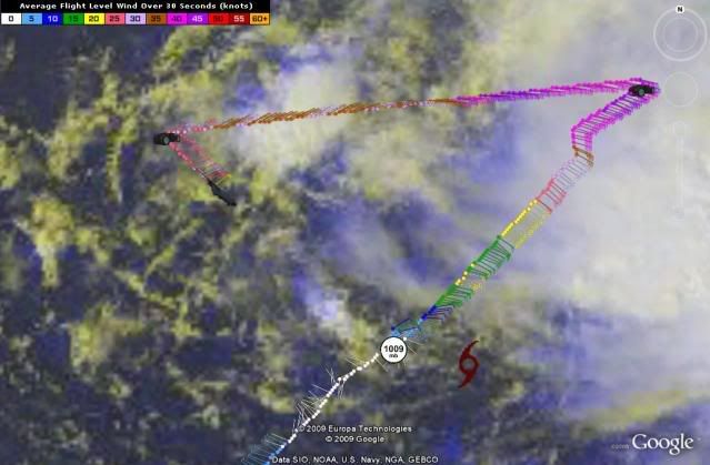
Atlantic USAF High-Density Observations
--------------------------------------------------------------------------------
000
URNT15 KNHC 261947
AF307 0205A DANNY HDOB 28 20090826
193800 2604N 07207W 9589 00442 0086 +218 +218 044021 022 022 005 03
193830 2603N 07206W 9591 00438 0084 +220 +220 049021 022 999 999 03
193900 2602N 07205W 9583 00444 0082 +222 +218 054021 022 015 004 03
193930 2600N 07203W 9575 00453 0084 +223 +210 057022 022 022 002 03
194000 2559N 07202W 9586 00442 0083 +231 +193 066023 023 022 002 03
194030 2558N 07200W 9586 00441 0082 +232 +197 066024 024 020 003 03
194100 2556N 07159W 9588 00441 0082 +231 +199 065024 024 026 000 00
194130 2555N 07158W 9586 00442 0082 +228 +206 064022 023 027 000 03
194200 2554N 07156W 9582 00448 0083 +227 +209 063020 020 026 000 03
194230 2553N 07155W 9587 00441 0082 +227 +212 060019 019 026 000 03
194300 2551N 07153W 9586 00443 0083 +225 +212 059019 019 024 000 03
194330 2550N 07152W 9586 00442 0082 +226 +216 053017 018 025 000 03
194400 2549N 07150W 9584 00445 0082 +225 +219 050016 016 022 000 00
194430 2547N 07149W 9584 00443 0081 +225 +218 047014 015 022 000 03
194500 2546N 07147W 9586 00439 0080 +226 +216 050014 014 020 000 03
194530 2545N 07146W 9585 00442 0080 +225 +219 050013 014 021 000 00
194600 2543N 07144W 9586 00440 0080 +225 +217 047013 013 018 000 00
194630 2542N 07143W 9585 00441 0080 +223 +220 043011 012 023 000 00
194700 2541N 07141W 9586 00439 0080 +225 +219 055010 010 020 000 03
194730 2539N 07140W 9585 00441 0080 +225 +216 053010 011 018 000 03
$$
;
0 likes
CARIBBEAN SEA
NWS TPC/NATIONAL HURRICANE CENTER MIAMI FL
1130 AM EDT WED AUG 26 2009
OFFSHORE WATERS FORECAST FOR THE SW AND TROPICAL N ATLC FROM 07N
TO 22N BETWEEN 55W AND 65W
SEAS GIVEN AS SIGNIFICANT WAVE HEIGHT...WHICH IS THE AVERAGE
HEIGHT OF THE HIGHEST 1/3 OF THE WAVES. INDIVIDUAL WAVES MAY BE
MORE THAN TWICE THE SIGNIFICANT WAVE HEIGHT.
AMZ080-262130-
SW N ATLANTIC S OF 31N W OF 65W INCLUDING BAHAMAS
1130 AM EDT WED AUG 26 2009
...TROPICAL STORM WARNING N OF 24N E OF 77W...
0 likes

Re: ATL: TROPICAL STORM DANNY
Do you all think that it will come right up the NC coast and hit OBX? 
0 likes
Atlantic USAF High-Density Observations
--------------------------------------------------------------------------------
000
URNT15 KNHC 261957
AF307 0205A DANNY HDOB 29 20090826
194800 2538N 07138W 9584 00442 0080 +225 +217 054010 010 019 000 03
194830 2536N 07137W 9586 00440 0079 +229 +213 058009 009 017 000 00
194900 2535N 07135W 9585 00439 0077 +225 +221 053009 009 012 000 00
194930 2534N 07134W 9593 00432 0088 +228 +218 054008 008 007 000 03
195000 2533N 07132W 9602 00450 0099 +229 +219 052009 009 010 000 03
195030 2532N 07131W 9589 00431 0073 +228 +218 055007 008 009 000 03
195100 2530N 07130W 9593 00429 0073 +228 +216 053008 008 008 000 00
195130 2529N 07129W 9592 00429 0073 +226 +219 052007 008 006 000 03
195200 2528N 07128W 9589 00433 0073 +226 +218 050007 008 009 000 03
195230 2527N 07126W 9592 00429 0073 +225 +219 050007 008 004 001 00
195300 2526N 07125W 9592 00430 0073 +225 +218 049007 007 009 000 03
195330 2525N 07124W 9589 00431 0073 +225 +219 046007 007 006 000 00
195400 2524N 07123W 9590 00430 0072 +227 +218 042006 007 010 000 00
195430 2523N 07121W 9593 00427 0076 +228 +218 033007 007 012 000 03
195500 2522N 07120W 9590 00429 0074 +226 +220 028006 007 006 000 03
195530 2521N 07119W 9591 00429 0073 +225 +222 035006 006 008 000 03
195600 2520N 07117W 9592 00427 0083 +227 +220 044006 006 009 000 03
195630 2519N 07116W 9589 00428 0073 +227 +222 035005 006 007 000 00
195700 2518N 07115W 9592 00456 0080 +230 +219 053004 004 005 001 03
195730 2517N 07113W 9585 00432 0069 +228 +221 055004 005 007 000 03
$$
0 likes
-
Air Force Met
- Military Met

- Posts: 4372
- Age: 57
- Joined: Tue Jul 08, 2003 9:30 am
- Location: Roan Mountain, TN
Re:
ConvergenceZone wrote:Danny boy is looking like a mess. I don't see how this is going to make hurricane strength, let alone strong tropical storm strength. Heck, I don't even know if it's going to survive at this point....So where it's going to go may not even be an issue afterall.
Nothing like now casting...
Just a reminder: There are so many times in the past where a storm looked bad...exposed...naked (a lot worse than Danny)...only to get its act together quickly. I can't even count how many times that has happened. Danny is going to survive....and all you have to do is look at a little history to see how this can easily become a hurricane. All the center needs to do is tuck/reform under the convection...and I think it is doing that now (allbeit slowly).
Might need to bookmark this post for later...
0 likes
Who is online
Users browsing this forum: No registered users and 137 guests