


Latest
Moderator: S2k Moderators


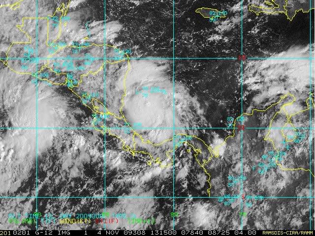
wxman57 wrote:Note that the 12Z center estimate is well SE of the convection. However, surface obs indicate that the LLC is well NW of the 12Z estimate.
wxman57 wrote:Note that the 12Z center estimate is well SE of the convection. However, surface obs indicate that the LLC is well NW of the 12Z estimate.


cycloneye wrote:wxman57 wrote:Note that the 12Z center estimate is well SE of the convection. However, surface obs indicate that the LLC is well NW of the 12Z estimate.
Recon will have the real answer about the structure of the system.
boca wrote:It looks like we have a TD on the sat presentation but we have to wait for recon.This is the steering level.If this does develop into a TS the steering flow would take it west into CA.
http://cimss.ssec.wisc.edu/tropic2/real ... oom=&time=


boca wrote:It looks like we have a TD on the sat presentation but we have to wait for recon.This is the steering level.If this does develop into a TS the steering flow would take it west into CA.
http://cimss.ssec.wisc.edu/tropic2/real ... oom=&time=
Users browsing this forum: No registered users and 65 guests


