TIMOR SEA : TROPICAL CYCLONE LAURENCE (06S)

Moderator: S2k Moderators

Message
Author
User avatar
HURAKAN
Professional-Met
Professional-Met
Posts: 46086
Age: 37
Joined: Thu May 20, 2004 4:34 pm
Location: Key West, FL
Contact:

#101 Postby HURAKAN » Tue Dec 15, 2009 9:16 pm

Image

Thelma's track and time of existence is very similar to Laurance.
0 likes   

User avatar
HURAKAN
Professional-Met
Professional-Met
Posts: 46086
Age: 37
Joined: Thu May 20, 2004 4:34 pm
Location: Key West, FL
Contact:

#102 Postby HURAKAN » Tue Dec 15, 2009 10:37 pm

Image

Still offshore
0 likes   

User avatar
HURAKAN
Professional-Met
Professional-Met
Posts: 46086
Age: 37
Joined: Thu May 20, 2004 4:34 pm
Location: Key West, FL
Contact:

#103 Postby HURAKAN » Tue Dec 15, 2009 11:20 pm

TROPICAL CYCLONE ADVICE NUMBER 40
Issued at 12:00 pm WST on Wednesday, 16 December 2009
BY THE BUREAU OF METEOROLOGY
TROPICAL CYCLONE WARNING CENTRE PERTH

A Cyclone WARNING is current for coastal areas from Kuri Bay to Beagle Bay and
adjacent inland parts.

A Cyclone WATCH has been declared for Beagle Bay to Bidyadanga and extending
inland towards Fitzroy Crossing.

At 11:00 am WST Severe Tropical Cyclone Laurence, Category 5 was estimated to be
55 kilometres southwest of Kuri Bay and
170 kilometres north northeast of Derby and
moving south southwest at 11 kilometres per hour.

Severe Tropical Cyclone Laurence is a small but very intense tropical cyclone
having VERY DESTRUCTIVE WINDS with gusts to 285 kilometres per hour close to the
cyclone centre. VERY DESTRUCTIVE wind gusts are possible on the coast south of
Kuri Bay during this afternoon and evening.

GALES with gusts to 100 kilometres per hour may extend further southwest along
the coast, reaching Cockatoo and Koolan Islands during this afternoon and
evening. Should the centre pass close by VERY DESTRUCTIVE winds are possible
during the afternoon and evening. GALES, and possibly DESTRUCTIVE winds may
extend to Derby and Beagle Bay early Thursday morning.

HEAVY RAIN is expected to continue over the north and west Kimberley. Daily
rainfall totals in excess of 100mm are possible near the coast with totals
decreasing further inland.

FESA-State Emergency Service advises of the following community alerts:
RED ALERT: People in or near the communities of Koolan Island and Cockatoo
Island need to go to shelter immediately.
YELLOW ALERT: People in or near the communities of Cape Leveque, One Arm Point,
Djarindjin, Lombadina and Derby should be taking action.
ALL CLEAR WITH CAUTION: People in or near Mitchell Plateau and Kuri Bay wind and
storm surge dangers have passed but you need to take care to avoid the dangers
caused by damage.

Details of Severe Tropical Cyclone Laurence at 11:00 am WST:
.Centre located near...... 15.9 degrees South 124.2 degrees East
.Location accuracy........ within 35 kilometres
.Recent movement.......... towards the south southwest at 11 kilometres per hour
.Wind gusts near centre... 285 kilometres per hour
.Severity category........ 5
.Central pressure......... 934 hectoPascals

The next advice will be issued by 3:00 pm WST Wednesday 16 December.Cyclone
advices and State Emergency Service Community Alerts are available by
dialling 1300 659 210


A map showing the track of the cyclone is available at:
http://www.bom.gov.au/weather/cyclone


Image
0 likes   

Sanibel
Category 5
Category 5
Posts: 10348
Joined: Mon Aug 30, 2004 11:06 pm
Location: Offshore SW Florida

Re: TIMOR SEA : SEVERE TROPICAL CYCLONE LAURENCE (06S)

#104 Postby Sanibel » Tue Dec 15, 2009 11:33 pm

180mph gusts! Dangerous cyclone mates!
0 likes   

HurricaneBill
Category 5
Category 5
Posts: 3420
Joined: Sun Apr 11, 2004 5:51 pm
Location: East Longmeadow, MA, USA

#105 Postby HurricaneBill » Tue Dec 15, 2009 11:58 pm

Looks like Laurence's eye passed right over Champagny Island. (The island right above Laurence's December 16th, 8AM position.)
0 likes   

User avatar
HURAKAN
Professional-Met
Professional-Met
Posts: 46086
Age: 37
Joined: Thu May 20, 2004 4:34 pm
Location: Key West, FL
Contact:

#106 Postby HURAKAN » Wed Dec 16, 2009 12:07 am

Image

Saved for posterity.
0 likes   

User avatar
HURAKAN
Professional-Met
Professional-Met
Posts: 46086
Age: 37
Joined: Thu May 20, 2004 4:34 pm
Location: Key West, FL
Contact:

#107 Postby HURAKAN » Wed Dec 16, 2009 12:38 am

TROPICAL CYCLONE TECHNICAL BULLETIN: AUSTRALIA - WESTERN REGION
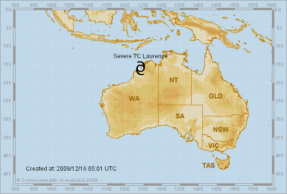
Issued by PERTH TROPICAL CYCLONE WARNING CENTRE
at: 0051 UTC 16/12/2009
Name: Severe Tropical Cyclone Laurence
Identifier: 01U
Data At: 0000 UTC
Latitude: 15.4S
Longitude: 124.2E
Location Accuracy: within 15 nm [30 km]
Movement Towards: southwest [224 deg]
Speed of Movement: 5 knots [9 km/h]
Maximum 10-Minute Wind: 110 knots [205 km/h]
Maximum 3-Second Wind Gust: 155 knots [285 km/h]
Central Pressure: 933 hPa
Radius of 34-knot winds NE quadrant: 40 nm [75 km]
Radius of 34-knot winds SE quadrant: 40 nm [75 km]
Radius of 34-knot winds SW quadrant: 40 nm [75 km]
Radius of 34-knot winds NW quadrant: 40 nm [75 km]
Radius of 48-knot winds NE quadrant: 20 nm [35 km]
Radius of 48-knot winds SE quadrant: 20 nm [35 km]
Radius of 48-knot winds SW quadrant: 20 nm [35 km]
Radius of 48-knot winds NW quadrant: 20 nm [35 km]
Radius of 64-knot winds: 15 nm [30 km]
Radius of Maximum Winds: 10 nm [20 km]
Dvorak Intensity Code: D6.5/6.5/D2.0/24HRS
Pressure of outermost isobar: 1004 hPa
Radius of outermost closed isobar: 60 nm [110 km]
Storm Depth: Deep
FORECAST DATA
Date/Time : Location : Loc. Accuracy: Max Wind : Central Pressure
[UTC] : degrees : nm [km]: knots[km/h]: hPa
+12: 16/1200: 16.2S 123.7E: 045 [085]: 105 [195]: 938
+24: 17/0000: 16.7S 123.7E: 080 [150]: 075 [140]: 967
+36: 17/1200: 17.2S 123.5E: 095 [175]: 060 [110]: 979
+48: 18/0000: 17.7S 122.9E: 110 [205]: 040 [075]: 993
+60: 18/1200: 17.9S 122.1E: 180 [335]: 040 [075]: 993
+72: 19/0000: 18.0S 121.3E: 230 [425]: 050 [095]: 985
REMARKS:
Severe Tropical Cyclone Laurence is a small and very intense system. A well
defined eye has been evident on microwave and IR imagery. EIR analysis was
consistently giving a DT of 6.5 and FT is assigned on this basis with no
constraints broken following reanalysis of previous imagery. The latest image
shows some filling of the eye with the warmest eye temp grey shade being white,
which will imply a weakening trend if it continues.

It has remained sufficiently off the coast and is in a very favourable low shear
environment. Guidance indicates the shear environment will remain generally
favourable over the next 48-72 hours despite some fluctuation. Only interaction
with land is likely to weaken the system, hence the forecast intensity is
dependent on the track. The track is likely to become more southerly during
today under the influence of a highly meridional mid level pattern with a
stationary trough to the west and an anticyclone to the east.

A more westerly track is possible during Friday and in the longer term the
system may move offshore and redevelop.

Copyright Commonwealth of Australia
==
The next bulletin for this system will be issued by: 16/0700 UTC by Perth TCWC.
0 likes   

User avatar
Craiga74
Tropical Low
Tropical Low
Posts: 42
Age: 49
Joined: Thu Feb 21, 2008 8:59 am
Location: Port Hedland, Australia
Contact:

Re: TIMOR SEA : SEVERE TROPICAL CYCLONE LAURENCE (06S)

#108 Postby Craiga74 » Wed Dec 16, 2009 12:50 am

HurricaneBill wrote:This is getting close to Category 5 (Australian scale).

Isn't there a link between El Nino and intense TCs making landfall on western Australia?


Yes there is...the last El Nino year we had was the same year that Cat 5 Cyclone George crossed about 35km's north of here
0 likes   

User avatar
HURAKAN
Professional-Met
Professional-Met
Posts: 46086
Age: 37
Joined: Thu May 20, 2004 4:34 pm
Location: Key West, FL
Contact:

#109 Postby HURAKAN » Wed Dec 16, 2009 8:14 am

TROPICAL CYCLONE ADVICE NUMBER 43
Issued at 9:00 pm WST on Wednesday, 16 December 2009
BY THE BUREAU OF METEOROLOGY
TROPICAL CYCLONE WARNING CENTRE PERTH

A Cyclone WARNING is current for coastal areas from Kuri Bay to Beagle Bay,
including Derby and adjacent inland parts.

A Cyclone WATCH is current for areas from Beagle Bay to Bidyadanga including
Broome, and extending inland towards Fitzroy Crossing.

At 8:00 pm WST Severe Tropical Cyclone Laurence, Category 3 was estimated to be
60 kilometres southeast of Cockatoo Island and
100 kilometres north northeast of Derby and
moving south southwest at 8 kilometres per hour.

Severe Tropical Cyclone Laurence has crossed the Kimberley coast southeast of
Cockatoo Island being a small but very intense tropical cyclone and having VERY
DESTRUCTIVE WINDS with gusts to 220 kilometres per hour close to the cyclone
centre. VERY DESTRUCTIVE wind gusts are occurring on the Kimberley coast east of
Cockatoo Island. Laurence is expected to weaken as it moves inland overnight.

GALES and DESTRUCTIVE winds are likely to extend further inland overnight.
Should the centre pass close by DESTRUCTIVE winds are possible in Derby during
Thursday morning.

HEAVY RAIN is expected to continue over the north and west Kimberley. Daily
rainfall totals in excess of 100mm are possible near the coast with totals
decreasing further inland.

FESA-State Emergency Service advises of the following community alerts:
RED ALERT: People in or near the communities of Koolan Island, Cockatoo Island
and Derby need to go to shelter immediately.
YELLOW ALERT: People in or near the communities of Cape Leveque, One Arm Point,
Djarindjin and Lombadina should be taking action.
ALL CLEAR WITH CAUTION: People in or near Mitchell Plateau and Kuri Bay are
advised that the wind danger has passed but you need to take care to avoid the
dangers caused by any damage.

Details of Severe Tropical Cyclone Laurence at 8:00 pm WST:
.Centre located near...... 16.5 degrees South 124.0 degrees East
.Location accuracy........ within 35 kilometres
.Recent movement.......... towards the south southwest at 8 kilometres per hour
.Wind gusts near centre... 220 kilometres per hour
.Severity category........ 3
.Central pressure......... 957 hectoPascals

The next advice will be issued by 12:00 am WST [midnight] Thursday 17
December.Cyclone advices and State Emergency Service Community Alerts are
available by
dialling 1300 659 210


A map showing the track of the cyclone is available at:
http://www.bom.gov.au/weather/cyclone


Image
0 likes   

User avatar
HURAKAN
Professional-Met
Professional-Met
Posts: 46086
Age: 37
Joined: Thu May 20, 2004 4:34 pm
Location: Key West, FL
Contact:

#110 Postby HURAKAN » Wed Dec 16, 2009 8:24 am

Image

Inland
0 likes   

User avatar
HURAKAN
Professional-Met
Professional-Met
Posts: 46086
Age: 37
Joined: Thu May 20, 2004 4:34 pm
Location: Key West, FL
Contact:

#111 Postby HURAKAN » Wed Dec 16, 2009 8:25 am

Image

WTXS33 PGTW 160900
MSGID/GENADMIN/NAVMARFCSTCEN PEARL HARBOR HI/JTWC//
SUBJ/TROPICAL CYCLONE 06S (LAURENCE) WARNING NR 007//
RMKS/
1. TROPICAL CYCLONE 06S (LAURENCE) WARNING NR 007
01 ACTIVE TROPICAL CYCLONE IN SOUTHIO
MAX SUSTAINED WINDS BASED ON ONE-MINUTE AVERAGE
WIND RADII VALID OVER OPEN WATER ONLY
---
WARNING POSITION:
160600Z --- NEAR 16.3S 124.2E
MOVEMENT PAST SIX HOURS - 185 DEGREES AT 08 KTS
POSITION ACCURATE TO WITHIN 040 NM
POSITION BASED ON CENTER LOCATED BY SATELLITE
PRESENT WIND DISTRIBUTION:
MAX SUSTAINED WINDS - 090 KT, GUSTS 110 KT
WIND RADII VALID OVER OPEN WATER ONLY
RADIUS OF 064 KT WINDS - 030 NM NORTHEAST QUADRANT
025 NM SOUTHEAST QUADRANT
020 NM SOUTHWEST QUADRANT
030 NM NORTHWEST QUADRANT
RADIUS OF 050 KT WINDS - 045 NM NORTHEAST QUADRANT
045 NM SOUTHEAST QUADRANT
035 NM SOUTHWEST QUADRANT
055 NM NORTHWEST QUADRANT
RADIUS OF 034 KT WINDS - 080 NM NORTHEAST QUADRANT
075 NM SOUTHEAST QUADRANT
070 NM SOUTHWEST QUADRANT
085 NM NORTHWEST QUADRANT
REPEAT POSIT: 16.3S 124.2E
---
FORECASTS:
12 HRS, VALID AT:
161800Z --- 17.1S 124.2E
MAX SUSTAINED WINDS - 065 KT, GUSTS 080 KT
WIND RADII VALID OVER OPEN WATER ONLY
DISSIPATING AS A SIGNIFICANT TROPICAL CYCLONE OVER LAND
VECTOR TO 24 HR POSIT: 180 DEG/ 03 KTS
---
24 HRS, VALID AT:
170600Z --- 17.7S 124.2E
MAX SUSTAINED WINDS - 045 KT, GUSTS 055 KT
WIND RADII VALID OVER OPEN WATER ONLY
DISSIPATING AS A SIGNIFICANT TROPICAL CYCLONE OVER LAND
VECTOR TO 36 HR POSIT: 200 DEG/ 03 KTS
---
36 HRS, VALID AT:
171800Z --- 18.2S 124.0E
MAX SUSTAINED WINDS - 030 KT, GUSTS 040 KT
WIND RADII VALID OVER OPEN WATER ONLY
DISSIPATED AS A SIGNIFICANT TROPICAL CYCLONE OVER LAND
VECTOR TO 48 HR POSIT: 225 DEG/ 03 KTS
---
EXTENDED OUTLOOK:
48 HRS, VALID AT:
180600Z --- 18.7S 123.5E
MAX SUSTAINED WINDS - 020 KT, GUSTS 030 KT
WIND RADII VALID OVER OPEN WATER ONLY
DISSIPATED AS A SIGNIFICANT TROPICAL CYCLONE OVER LAND
---
REMARKS:
160900Z POSITION NEAR 16.5S 124.2E.
TROPICAL CYCLONE (TC) 06S (LAURENCE), LOCATED APPROXIMATELY 440 NM
NORTHEAST OF PORT HEDLAND, AUSTRALIA, HAS TRACKED SOUTHWARD AT 08
KNOTS OVER THE LAST SIX HOURS. LAURENCE HAS TURNED SHARPLY SOUTH
AND IS NOW LOCATED OVER LAND. THE CYCLONE WILL CONTINUE TO TRACK
DEEPER INLAND ALONG THE WESTERN PERIPHERY OF A MID TO UPPER LEVEL,
NORTH-SOUTH AMPLIFIED STEERING RIDGE TO THE EAST FOR THE NEXT DAY.
AS THE CYCLONE WEAKENS AND SHALLOWS OVER LAND IT WILL BECOME
INCREASINGLY SUBJECT TO THE STEERING INFLUENCE OF THE LOW LEVEL
RIDGE TO THE SOUTHWEST. THIS RIDGE WILL TEND TO TRACK THE THEN
REMNANT CIRCULATION TOWARDS THE WEST. GIVEN THE CURRENT FORECAST
TRACK IT IS UNLIKELY THAT THE CIRCULATION WILL SURVIVE A 3-PLUS DAY
TRANSIT OVER LAND, AND ENTER BACK INTO THE INDIAN OCEAN AS A WARN-
ABLE SYSTEM. ALL BUT JGSM AND TCLAPS INDICATE DISSIPATION OVER LAND
PRIOR TO RE-ENTERING THE INDIAN OCEAN. NEXT WARNINGS AT 162100Z AND
170900Z.//
0 likes   

User avatar
HURAKAN
Professional-Met
Professional-Met
Posts: 46086
Age: 37
Joined: Thu May 20, 2004 4:34 pm
Location: Key West, FL
Contact:

#112 Postby HURAKAN » Wed Dec 16, 2009 10:32 am

Image

Latest
0 likes   

User avatar
HURAKAN
Professional-Met
Professional-Met
Posts: 46086
Age: 37
Joined: Thu May 20, 2004 4:34 pm
Location: Key West, FL
Contact:

#113 Postby HURAKAN » Wed Dec 16, 2009 10:48 am

16/1430 UTC 16.6S 124.0E OVERLAND LAURENCE -- Southeast Indian
16/0830 UTC 16.4S 124.0E OVERLAND LAURENCE -- Southeast Indian


Almost no movement in 6 hours
0 likes   

User avatar
HURAKAN
Professional-Met
Professional-Met
Posts: 46086
Age: 37
Joined: Thu May 20, 2004 4:34 pm
Location: Key West, FL
Contact:

#114 Postby HURAKAN » Wed Dec 16, 2009 12:29 pm

TROPICAL CYCLONE ADVICE NUMBER 44
Issued at 11:55 pm WST on Wednesday, 16 December 2009
BY THE BUREAU OF METEOROLOGY
TROPICAL CYCLONE WARNING CENTRE PERTH

A Cyclone WARNING is current for coastal areas from Kuri Bay to Beagle Bay,
including Derby and adjacent inland parts.

A Cyclone WATCH is current for areas from Beagle Bay to Bidyadanga including
Broome, and extending inland towards Fitzroy Crossing.

At 11:00 pm WST Severe Tropical Cyclone Laurence, Category 3 was estimated to be
60 kilometres southeast of Cockatoo Island and
100 kilometres north northeast of Derby and
moving south at 6 kilometres per hour.

Severe Tropical Cyclone Laurence has crossed the Kimberley coast southeast of
Cockatoo Island having VERY DESTRUCTIVE WINDS with gusts to 195 kilometres per
hour close to the cyclone centre. VERY DESTRUCTIVE wind gusts are occurring on
the Kimberley coast east of Cockatoo Island. Laurence is expected to weaken as
it moves inland Thursday morning.

GALES and DESTRUCTIVE winds are likely to extend further inland during Thursday.
Should the centre pass close by DESTRUCTIVE winds with winds to 130 kilometres
per hour are possible in Derby later on Thursday morning.

HEAVY RAIN is expected to continue over the north and west Kimberley. Daily
rainfall totals in excess of 100mm are possible near the coast with totals
decreasing further inland.

FESA-State Emergency Service advises of the following community alerts:
RED ALERT: People in or near the communities of Koolan Island, Cockatoo Island
and Derby need to go to shelter immediately.
YELLOW ALERT: People in or near the communities of Cape Leveque, One Arm Point,
Djarindjin and Lombadina should be taking action.
ALL CLEAR WITH CAUTION: People in or near Mitchell Plateau and Kuri Bay are
advised that the wind danger has passed but you need to take care to avoid the
dangers caused by any damage.

Details of Severe Tropical Cyclone Laurence at 11:00 pm WST:
.Centre located near...... 16.5 degrees South 124.0 degrees East
.Location accuracy........ within 35 kilometres
.Recent movement.......... towards the south at 6 kilometres per hour
.Wind gusts near centre... 195 kilometres per hour
.Severity category........ 3
.Central pressure......... 965 hectoPascals

The next advice will be issued by 3:00 am WST Thursday 17 December.Cyclone
advices and State Emergency Service Community Alerts are available by
dialling 1300 659 210


A map showing the track of the cyclone is available at:
http://www.bom.gov.au/weather/cyclone


Image
0 likes   

CrazyC83
Professional-Met
Professional-Met
Posts: 33393
Joined: Tue Mar 07, 2006 11:57 pm
Location: Deep South, for the first time!

#115 Postby CrazyC83 » Wed Dec 16, 2009 2:23 pm

Looking at intensity trends, my guess is the landfall intensity was 100 kt (1-min).
0 likes   

User avatar
HURAKAN
Professional-Met
Professional-Met
Posts: 46086
Age: 37
Joined: Thu May 20, 2004 4:34 pm
Location: Key West, FL
Contact:

#116 Postby HURAKAN » Wed Dec 16, 2009 2:41 pm

TROPICAL CYCLONE ADVICE NUMBER 45
Issued at 2:45 am WST on Thursday, 17 December 2009
BY THE BUREAU OF METEOROLOGY
TROPICAL CYCLONE WARNING CENTRE PERTH

A Cyclone WARNING is current for coastal areas from Kuri Bay to Beagle Bay,
including Derby and adjacent inland parts.

A Cyclone WATCH is current for areas from Beagle Bay to Bidyadanga including
Broome, and extending inland towards Fitzroy Crossing.

At 2:00 am WST Severe Tropical Cyclone Laurence, Category 3 was estimated to be
75 kilometres southeast of Cockatoo Island and
95 kilometres north northeast of Derby and
moving south at 5 kilometres per hour.

Severe Tropical Cyclone Laurence has crossed the Kimberley coast southeast of
Cockatoo Island. Laurence remains a small but intense system with VERY
DESTRUCTIVE WINDS with gusts to 170 kilometres per hour close to the cyclone
centre though is expected to weaken as continues to move over land this morning.

GALES and DESTRUCTIVE winds are likely to extend further inland during Thursday.
Should the centre pass close by DESTRUCTIVE winds with winds to 130 kilometres
per hour are possible in Derby later this morning.

HEAVY RAIN is expected to continue over the north and west Kimberley. Daily
rainfall totals in excess of 100mm are possible near the coast with totals
decreasing further inland.

FESA-State Emergency Service advises of the following community alerts:
RED ALERT: People in or near the communities of Koolan Island, Cockatoo Island
and Derby need to go to shelter immediately.
YELLOW ALERT: People in or near the communities of Cape Leveque, One Arm Point,
Djarindjin and Lombadina should be taking action.
ALL CLEAR WITH CAUTION: People in or near Mitchell Plateau and Kuri Bay are
advised that the wind danger has passed but you need to take care to avoid the
dangers caused by any damage.

Details of Severe Tropical Cyclone Laurence at 2:00 am WST:
.Centre located near...... 16.6 degrees South 124.1 degrees East
.Location accuracy........ within 35 kilometres
.Recent movement.......... towards the south at 5 kilometres per hour
.Wind gusts near centre... 165 kilometres per hour
.Severity category........ 3
.Central pressure......... 974 hectoPascals

The next advice will be issued by 6:00 am WST Thursday 17 December.Cyclone
advices and State Emergency Service Community Alerts are available by
dialling 1300 659 210


A map showing the track of the cyclone is available at:
http://www.bom.gov.au/weather/cyclone
0 likes   

User avatar
HURAKAN
Professional-Met
Professional-Met
Posts: 46086
Age: 37
Joined: Thu May 20, 2004 4:34 pm
Location: Key West, FL
Contact:

#117 Postby HURAKAN » Wed Dec 16, 2009 10:01 pm

Image

TROPICAL CYCLONE ADVICE NUMBER 47
Issued at 8:55 am WST on Thursday, 17 December 2009
BY THE BUREAU OF METEOROLOGY
TROPICAL CYCLONE WARNING CENTRE PERTH

A Cyclone WARNING is current for coastal areas from Kuri Bay to Beagle Bay,
including Derby, and adjacent inland parts.

A Cyclone WATCH is current for areas from Beagle Bay to Bidyadanga, including
Broome.

At 8:00 am WST Tropical Cyclone Laurence, Category 2 was estimated to be
90 kilometres northeast of Derby and
105 kilometres southeast of Cockatoo Island and
moving southeast at 5 kilometres per hour.

Tropical Cyclone Laurence crossed the Kimberley coast southeast of Cockatoo
Island late yesterday and has gradually weakened overnight. DESTRUCTIVE WINDS
with gusts to 130 kilometres per hour are possible close to the cyclone centre.

GALES are likely to extend further southwards during today. Should the centre
pass close by DAMAGING winds with gusts to 100 kilometres per hour are possible
in Derby later today.

HEAVY RAIN is expected to continue over the north and west Kimberley. Daily
rainfall totals in excess of 100mm are possible near the northwest coast with
totals decreasing further inland.

Laurence has moved slowly southeastwards overnight but is expected to take a
more southerly track during the day. If the cyclone remains over land, it will
likely weaken below tropical cyclone strength tonight or early on Friday. A more
westward track on Friday could take the system back over the ocean leading to
reintensification on the weekend.

FESA-State Emergency Service advises of the following community alerts:
YELLOW ALERT: People in or near the communities of Derby, Cape Leveque, One Arm
Point, Djarindjin, Lombadina and surrounding smaller communities should be
taking action.
ALL CLEAR WITH CAUTION: People in or near Koolan Island, Cockatoo Island,
Mitchell Plateau and Kuri Bay are advised that the wind danger has passed but
you need to take care to avoid the dangers caused by any damage.

Details of Tropical Cyclone Laurence at 8:00 am WST:
.Centre located near...... 16.8 degrees South 124.3 degrees East
.Location accuracy........ within 35 kilometres
.Recent movement.......... towards the southeast at 5 kilometres per hour
.Wind gusts near centre... 130 kilometres per hour and weakening
.Severity category........ 2
.Central pressure......... 985 hectoPascals

The next advice will be issued by 12:00 pm WST Thursday 17 December.Cyclone
advices and State Emergency Service Community Alerts are available by
dialling 1300 659 210


A map showing the track of the cyclone is available at:
http://www.bom.gov.au/weather/cyclone
0 likes   

User avatar
HURAKAN
Professional-Met
Professional-Met
Posts: 46086
Age: 37
Joined: Thu May 20, 2004 4:34 pm
Location: Key West, FL
Contact:

#118 Postby HURAKAN » Wed Dec 16, 2009 10:03 pm

Image

WTXS33 PGTW 162100
MSGID/GENADMIN/NAVMARFCSTCEN PEARL HARBOR HI/JTWC//
SUBJ/TROPICAL CYCLONE 06S (LAURENCE) WARNING NR 008//
RMKS/
1. TROPICAL CYCLONE 06S (LAURENCE) WARNING NR 008
01 ACTIVE TROPICAL CYCLONE IN SOUTHIO
MAX SUSTAINED WINDS BASED ON ONE-MINUTE AVERAGE
WIND RADII VALID OVER OPEN WATER ONLY
---
WARNING POSITION:
161800Z --- NEAR 16.8S 124.2E
MOVEMENT PAST SIX HOURS - 180 DEGREES AT 02 KTS
POSITION ACCURATE TO WITHIN 060 NM
POSITION BASED ON CENTER LOCATED BY SATELLITE
PRESENT WIND DISTRIBUTION:
MAX SUSTAINED WINDS - 065 KT, GUSTS 080 KT
WIND RADII VALID OVER OPEN WATER ONLY
DISSIPATING AS A SIGNIFICANT TROPICAL CYCLONE OVER LAND
RADIUS OF 064 KT WINDS - 030 NM NORTHEAST QUADRANT
025 NM SOUTHEAST QUADRANT
030 NM SOUTHWEST QUADRANT
030 NM NORTHWEST QUADRANT
RADIUS OF 050 KT WINDS - 045 NM NORTHEAST QUADRANT
040 NM SOUTHEAST QUADRANT
050 NM SOUTHWEST QUADRANT
055 NM NORTHWEST QUADRANT
RADIUS OF 034 KT WINDS - 080 NM NORTHEAST QUADRANT
075 NM SOUTHEAST QUADRANT
095 NM SOUTHWEST QUADRANT
085 NM NORTHWEST QUADRANT
REPEAT POSIT: 16.8S 124.2E
---
FORECASTS:
12 HRS, VALID AT:
170600Z --- 17.3S 124.2E
MAX SUSTAINED WINDS - 050 KT, GUSTS 065 KT
WIND RADII VALID OVER OPEN WATER ONLY
DISSIPATING AS A SIGNIFICANT TROPICAL CYCLONE OVER LAND
VECTOR TO 24 HR POSIT: 205 DEG/ 03 KTS
---
24 HRS, VALID AT:
171800Z --- 17.9S 123.9E
MAX SUSTAINED WINDS - 035 KT, GUSTS 045 KT
WIND RADII VALID OVER OPEN WATER ONLY
DISSIPATING AS A SIGNIFICANT TROPICAL CYCLONE OVER LAND
VECTOR TO 36 HR POSIT: 240 DEG/ 03 KTS
---
36 HRS, VALID AT:
180600Z --- 18.2S 123.3E
MAX SUSTAINED WINDS - 030 KT, GUSTS 040 KT
WIND RADII VALID OVER OPEN WATER ONLY
DISSIPATING AS A SIGNIFICANT TROPICAL CYCLONE OVER LAND
VECTOR TO 48 HR POSIT: 255 DEG/ 03 KTS
---
EXTENDED OUTLOOK:
48 HRS, VALID AT:
181800Z --- 18.4S 122.6E
MAX SUSTAINED WINDS - 020 KT, GUSTS 030 KT
WIND RADII VALID OVER OPEN WATER ONLY
DISSIPATED AS A SIGNIFICANT TROPICAL CYCLONE OVER LAND
---
REMARKS:
162100Z POSITION NEAR 16.9S 124.2E.
TROPICAL CYCLONE (TC) 06S (LAURENCE), LOCATED APPROXIMATELY 130 NM
EAST-NORTHEAST OF BROOME, AUSTRALIA, HAS TRACKED SOUTHWARD AT 02
KNOTS OVER THE LAST SIX HOURS. ANIMATED INFRARED SATELLITE IMAGERY
SHOWS THAT TC 06S HAS TRACKED ONTO LAND AND IS STARTING TO SLOW DOWN.
THE MODEL GUIDANCE INDICATES TC 06S WILL CONTINUE TO TRACK UNDER THE
INFLUENCE OF A MID-LEVEL RIDGE LOCATED OVER THE WESTERN PORTION OF
CENTRAL AUSTRALIA. THE RIDGE IS EXPECTED TO RE-ALIGN OVER THE NEXT
48 HOURS CAUSING THE TRACK TO SHIFT TO A MORE WESTWARD DIRECTION. AS
THE SYSTEM WEAKENS THE STEERING WILL SHIFT TO THE LOWER LEVELS, AND
SURFACE RIDGING ACROSS SOUTHERN AUSTRALIA WILL HELP TO KEEP THE LOW
LEVEL TRACKING TOWARDS THE COAST AGAIN AROUND TAU 48. HOWEVER, LAND
EFFECTS AND INCREASING VERTICAL WIND SHEAR WILL WEAKEN THE SYSTEM
THROUGHOUT THE NEXT 48 HOURS, AND IS NOT EXPECTED TO RE-DEVELOP
AFTER APPROACHING THE COAST. HOWEVER, THERE ARE SOME MODELS SUG-
GESTING THE SYSTEM COULD TRACK BACK OVER WATER AND RE-DEVELOP. BASED
ON THE SYSTEM TRACKING OVER LAND, THIS IS THE FINAL WARNING ON THIS
SYSTEM BY THE JOINT TYPHOON WARNING CENTER (NAVMARFCSTCEN). WITH THE
POSIBILITY OF THE SYSTEM TRACKING BACK OVER WATER, THE SYSTEM WILL
BE CLOSELY MONITORED FOR SIGNS OF REGENERATION.//
NNNN
0 likes   

User avatar
HURAKAN
Professional-Met
Professional-Met
Posts: 46086
Age: 37
Joined: Thu May 20, 2004 4:34 pm
Location: Key West, FL
Contact:

#119 Postby HURAKAN » Wed Dec 16, 2009 11:17 pm

TROPICAL CYCLONE ADVICE NUMBER 48
Issued at 11:50 am WST on Thursday, 17 December 2009
BY THE BUREAU OF METEOROLOGY
TROPICAL CYCLONE WARNING CENTRE PERTH

A Cyclone WARNING is current for coastal areas from Kuri Bay to Beagle Bay,
including Derby, and adjacent inland parts.

A Cyclone WATCH is current for areas from Beagle Bay to Bidyadanga, including
Broome.

At 11:00 am WST Tropical Cyclone Laurence, Category 1 was estimated to be
85 kilometres east northeast of Derby and
110 kilometres southeast of Cockatoo Island and
moving south southeast at 5 kilometres per hour.

Tropical Cyclone Laurence crossed the Kimberley coast southeast of Cockatoo
Island late yesterday and has gradually weakened. GALES with gusts to 120
kilometres per hour are possible close to the cyclone centre. GALES are likely
to extend further southwards during this afternoon.

HEAVY RAIN is expected to continue over the northwest Kimberley. Daily rainfall
totals in excess of 100mm are possible, with totals decreasing further inland.

Laurence has moved slowly southeastwards this morning but is expected to take a
more southerly track during the afternoon. As the cyclone remains over land it
is expected to weaken below tropical cyclone strength tonight or early on
Friday. A more westward track on Friday could take the system back over the
ocean on the weekend, which may lead to reintensification.

FESA-State Emergency Service advises of the following community alerts:
YELLOW ALERT: People in or near the communities of Derby, Cape Leveque, One Arm
Point, Djarindjin, Lombadina and surrounding smaller communities should be
taking action.
ALL CLEAR WITH CAUTION: People in or near Koolan Island and Cockatoo Island are
advised that the wind danger has passed but you need to take care to avoid the
dangers caused by any damage.

Details of Tropical Cyclone Laurence at 11:00 am WST:
.Centre located near...... 16.9 degrees South 124.3 degrees East
.Location accuracy........ within 35 kilometres
.Recent movement.......... towards the south southeast at 5 kilometres per hour
.Wind gusts near centre... 120 kilometres per hour and weakening
.Severity category........ 1
.Central pressure......... 988 hectoPascals

The next advice will be issued by 3:00 pm WST Thursday 17 December.Cyclone
advices and State Emergency Service Community Alerts are available by
dialling 1300 659 210


A map showing the track of the cyclone is available at:
http://www.bom.gov.au/weather/cyclone
0 likes   

User avatar
HURAKAN
Professional-Met
Professional-Met
Posts: 46086
Age: 37
Joined: Thu May 20, 2004 4:34 pm
Location: Key West, FL
Contact:

#120 Postby HURAKAN » Wed Dec 16, 2009 11:28 pm

Image

Latest
0 likes   


Return to “2009”

Who is online

Users browsing this forum: No registered users and 3 guests