TC Bertha
Moderator: S2k Moderators
-
Blown Away

- S2K Supporter

- Posts: 10253
- Joined: Wed May 26, 2004 6:17 am
Re: Tropical Storm Bertha in East Atlantic
This has been a painfully slow storm to watch, we have been spoiled w/ storms moving 17kts across the Atlantic. I'm grateful we have a system to watch in early July.
0 likes
-
deltadog03

- Professional-Met

- Posts: 3580
- Joined: Tue Jul 05, 2005 6:16 pm
- Location: Macon, GA
-
Blown Away
- S2K Supporter
- Posts: 10253
- Joined: Wed May 26, 2004 6:17 am
Re: Tropical Storm Bertha in East Atlantic
The models have been flattening out and trending W all day. It's difficult to see Bertha becoming more than a minimal TS considering the moderate SST's and climatology. I'm having a difficult time seeing Bertha moving near 22kts by tomorow night. I see the track trending more W as the days go by. I see Bertha crossing 20N between 55-65W. I think the key is forward speed, the models expect a very fast moving Bertha in a short period of time. I think Bertha will move slower than the models expect and miss the weakness.
0 likes
-
CookevilleWeatherGuy
- Tropical Wave

- Posts: 1
- Joined: Thu Jul 03, 2008 9:00 pm
- Location: Cookeville, TN
- Contact:
Re: Tropical Storm Bertha in East Atlantic
Blown_away wrote:The models have been flattening out and trending W all day. It's difficult to see Bertha becoming more than a minimal TS considering the moderate SST's and climatology. I'm having a difficult time seeing Bertha moving near 22kts by tomorow night. I see the track trending more W as the days go by. I see Bertha crossing 20N between 55-65W. I think the key is forward speed, the models expect a very fast moving Bertha in a short period of time. I think Bertha will move slower than the models expect and miss the weakness.
Very good analysis and I certainly agree with you.
0 likes
-
JonathanBelles
- Professional-Met
- Posts: 11430
- Age: 35
- Joined: Sat Dec 24, 2005 9:00 pm
- Location: School: Florida State University (Tallahassee, FL) Home: St. Petersburg, Florida
- Contact:

-
cycloneye

- Admin

- Posts: 149311
- Age: 69
- Joined: Thu Oct 10, 2002 10:54 am
- Location: San Juan, Puerto Rico
Re: Tropical Storm Bertha in East Atlantic
0 likes
-
Gustywind

- Category 5

- Posts: 12334
- Joined: Mon Sep 03, 2007 7:29 am
- Location: Baie-Mahault, GUADELOUPE
Re: Tropical Storm Bertha in East Atlantic
cycloneye wrote::uarrow: It would be in the cone soon if the west shifts continue.
Note too much

0 likes
-
MiamiensisWx
Re: Tropical Storm Bertha in East Atlantic
The following post is NOT an official prognosis.
Personally, it appears to be doubtful that the five day cone will eventually overlap Bermuda. As Bertha deepens, the NW turn beyond ~72 hours becomes more pronounced, as evidenced by the NHC's forecast track. Note the gradual "steepening" trend of the cone's incline beyond 72 hours. Regardless of Bertha's intensity trends, the situation is a double edged sword against the TC (and any potential land threats such as Bermuda) over the long term. If Bertha is deeper over the next ~24-48 hours, it will be more susceptible to an eventual sharp turn as it interacts with the upper low, which will be transitioning to a weak mid-latitude trough at H7-H5. In other words, Bertha would be more influenced by the mid to upper levels. It will also face the strong divergence (shear) as a result. However, if Bertha is weaker through the next ~24-48 hours, it would trend further west and remain along the southern flank of the NHC's cone for a longer period. That would still not change the fact that it will encounter strong shear from the upper low in the central Atlantic, which could easily cause a weaker Bertha (or a stronger one!) to dissipate over water. Overall, it's a lose/lose situation for Bertha and a win/win for those on land masses, some of whom prefer to avoid it.
In the end, I would not express too much concern over the westward shift of the model "cluster" and cone within the short to medium term. Any shifts (west OR east!) would likely not significantly alter the final outcome.
0 likes
-
JonathanBelles
- Professional-Met
- Posts: 11430
- Age: 35
- Joined: Sat Dec 24, 2005 9:00 pm
- Location: School: Florida State University (Tallahassee, FL) Home: St. Petersburg, Florida
- Contact:
-
cheezyWXguy

- Category 5
- Posts: 6282
- Joined: Mon Feb 13, 2006 12:29 am
- Location: Dallas, TX
Re: Tropical Storm Bertha in East Atlantic
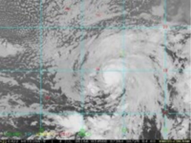
I think its just you...If your talking about how it seems to be slowly drifting NW, I believe that there is the illusion of it moving north because of its ragged convection, forming more on the northern side than the southern side, as it was previously. Im pretty sure its still moving w-wnw, but i could be wrong...i aint no pro! lol
0 likes
-
JonathanBelles
- Professional-Met
- Posts: 11430
- Age: 35
- Joined: Sat Dec 24, 2005 9:00 pm
- Location: School: Florida State University (Tallahassee, FL) Home: St. Petersburg, Florida
- Contact:
Re: Tropical Storm Bertha in East Atlantic
I say the SAL gets it - but I was wrong about this not forming.
0 likes

-
HURAKAN

- Professional-Met
- Posts: 46084
- Age: 39
- Joined: Thu May 20, 2004 4:34 pm
- Location: Key West, FL
- Contact:
Re: Tropical Storm Bertha in East Atlantic
UW - CIMSS
ADVANCED DVORAK TECHNIQUE
ADT-Version 7.2.3
Tropical Cyclone Intensity Algorithm
----- Current Analysis -----
Date : 04 JUL 2008 Time : 041500 UTC
Lat : 13:26:47 N Lon : 27:17:47 W
CI# /Pressure/ Vmax
3.3 / 998.0mb/ 51.0kt
Final T# Adj T# Raw T#
(3hr avg)
3.3 3.3 3.3
Latitude bias adjustment to MSLP : +1.6mb
Center Temp : -19.3C Cloud Region Temp : -32.9C
Scene Type : SHEAR (0.12^ TO DG)
Positioning Method : FORECAST INTERPOLATION
Ocean Basin : ATLANTIC
Dvorak CI > MSLP Conversion Used : ATLANTIC
Tno/CI Rules : Constraint Limits : NO LIMIT
Weakening Flag : OFF
Rapid Dissipation Flag : OFF
0 likes
-
Derek Ortt
-
gatorcane

- S2K Supporter
- Posts: 23708
- Age: 48
- Joined: Sun Mar 13, 2005 3:54 pm
- Location: Boca Raton, FL
the due W path the NHC mentioned is of no surprise also. As I explained earlier in this thread, the Azores High is building strong to the north of Bertha and is building westward in tandem with Bertha's movement...and...a W motion would not be unexpected as is happening now. Look for W movement possible through the next 1-2 days or so at least with hints of WNW.
0 likes
Who is online
Users browsing this forum: No registered users and 23 guests