ColdFusion wrote:Not much of a Northly drift in that loop.
Not moving from the looks of there but it is radar.
Moderator: S2k Moderators


ColdFusion wrote:Not much of a Northly drift in that loop.


OuterBanker wrote:Well, I can relax now. Just watched a bit of TWC and they are saying that they don't expect it to become a named storm.
Let's see JB or TWC. I'll take TWC tonight, I'll sleep better (got one of those nasty summer colds).

OuterBanker wrote:Well, I can relax now. Just watched a bit of TWC and they are saying that they don't expect it to become a named storm.
Let's see JB or TWC. I'll take TWC tonight, I'll sleep better (got one of those nasty summer colds).


orion wrote:I've got radar loop superimposed on sat image of this area running on my site for those interested...
http://orionweather.net/index.php?content=radar.html
I will update the radar site as needed to follow the system.

OuterBanker wrote:Well, I can relax now. Just watched a bit of TWC and they are saying that they don't expect it to become a named storm.
Let's see JB or TWC. I'll take TWC tonight, I'll sleep better (got one of those nasty summer colds).
HURAKAN wrote:orion wrote:I've got radar loop superimposed on sat image of this area running on my site for those interested...
http://orionweather.net/index.php?content=radar.html
I will update the radar site as needed to follow the system.
Looks great.
bad news/good news
very close to land/Gulf Stream
brunota2003 wrote: I think you have that reversed
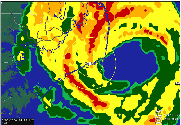
vacanechaser wrote:reminds me of alex in '04....
Jesse V. Bass III
http://www.vastormphoto.com
Hurricane Intercept Research Team
orion wrote:vacanechaser wrote:reminds me of alex in '04....
Jesse V. Bass III
http://www.vastormphoto.com
Hurricane Intercept Research Team
Yeah, you're right, Alex hung around in that same location for a bit then skirted up the outer banks as a cat 2 I think.
OuterBanker wrote:I was being facetious of course. TWC is sad now going for appearance first and weather (it seems) last.
I remember when the weather channel was actually about weather, not ratings.
OuterBanker wrote:Yes, Orion. Cat 2 from TS in 30hrs. Recorded wind gust Ocracoke Island 122. Ocracoke and Hatteras Island in eyewall and hurricane conditions for several hours, but eye itself never crossed land so not considered a land falling hurricane. Also remember it was 04, so Alex was forgotten because of all the other land falling hurricanes.
No one is saying another Alex though.
Users browsing this forum: No registered users and 40 guests

