this reduction factor is about what I expected
Very similar in structure to Isabel at landfall; hence, a similar reduction
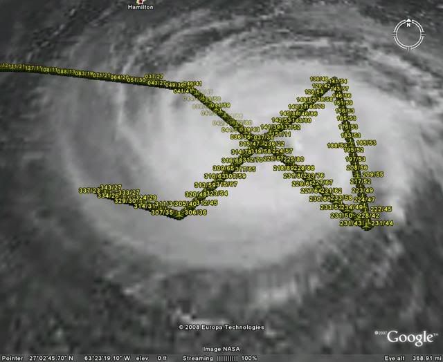
ATL: Tropical Storm Bertha RECON Discussion
Moderator: S2k Moderators


Re: ATL: Hurricane Bertha RECON Discussion
We have a winner for today's recon contest:
viewtopic.php?f=25&t=101778
The contest for tomorrow's mission is already up:
viewtopic.php?f=25&t=101784
viewtopic.php?f=25&t=101778
The contest for tomorrow's mission is already up:
viewtopic.php?f=25&t=101784
Last edited by Thunder44 on Fri Jul 11, 2008 3:05 pm, edited 1 time in total.
0 likes

-
brunota2003

- S2K Supporter

- Posts: 9476
- Age: 35
- Joined: Sat Jul 30, 2005 9:56 pm
- Location: Stanton, KY...formerly Havelock, NC
- Contact:
-
Chris_in_Tampa
- Category 5

- Posts: 5101
- Age: 42
- Joined: Thu Jun 21, 2007 11:06 pm
- Location: Tampa, Florida, USA
- Contact:
Isn't the wind profile a little odd in this storm? Take a look at a dropsonde:
http://www.tropicalatlantic.com/recon/a ... 996-103-69
Why are the winds so high in the middle? I know it is not always a smooth curve, but it looks odder than other storms. Is this storm particularly shallow?
http://www.tropicalatlantic.com/recon/a ... 996-103-69
Why are the winds so high in the middle? I know it is not always a smooth curve, but it looks odder than other storms. Is this storm particularly shallow?
0 likes
Well interestingly the NE quadrant appears to be a little weaker then the SE side with max 10 second winds of only 90kts compared to 99kts in the SE. Now for the next center pass and the pass through the SW quadrant, then its back to base, we shall see whether the Sw quadrant has winds high enough to warrent an upgrade because the NE doesn't.
0 likes

Re:
Chris_in_Tampa wrote:Isn't the wind profile a little odd in this storm? Take a look at a dropsonde:
http://www.tropicalatlantic.com/recon/a ... 996-103-69
Why are the winds so high in the middle? I know it is not always a smooth curve, but it looks odder than other storms. Is this storm particularly shallow?
Chris - that is one AWESOME decoder! Congratulations!
0 likes
-
HURAKAN

- Professional-Met

- Posts: 46084
- Age: 39
- Joined: Thu May 20, 2004 4:34 pm
- Location: Key West, FL
- Contact:
602
URNT12 KNHC 111913
VORTEX DATA MESSAGE AL022008
A. 11/18:47:20Z
B. 28 deg 54 min N
062 deg 04 min W
C. 700 mb 2872 m
D. 69 kt
E. 056 deg 029 nm
F. 145 deg 091 kt
G. 055 deg 034 nm
H. 976 mb
I. 8 C/ 3049 m
J. 13 C/ 3046 m
K. 5 C/ NA
L. CLOSED
M. C55
N. 12345/ 7
O. 0.02 / 1 nm
P. AF309 0102A BERTHA OB 16
MAX FL WIND 99 KT SE QUAD 17:17:20 Z
0 likes
-
Chris_in_Tampa
- Category 5
- Posts: 5101
- Age: 42
- Joined: Thu Jun 21, 2007 11:06 pm
- Location: Tampa, Florida, USA
- Contact:
Re: Re:
gotoman38 wrote:Chris_in_Tampa wrote:Isn't the wind profile a little odd in this storm? Take a look at a dropsonde:
http://www.tropicalatlantic.com/recon/a ... 996-103-69
Why are the winds so high in the middle? I know it is not always a smooth curve, but it looks odder than other storms. Is this storm particularly shallow?
Chris - that is one AWESOME decoder! Congratulations!
Thanks.
0 likes
-
brunota2003
- S2K Supporter
- Posts: 9476
- Age: 35
- Joined: Sat Jul 30, 2005 9:56 pm
- Location: Stanton, KY...formerly Havelock, NC
- Contact:
-
txwatcher91
- Category 5
- Posts: 1498
- Joined: Tue Aug 02, 2005 2:29 pm
Re:
txwatcher91 wrote:So what were the strongest winds found at the surface? I was away today so couldn't check.
SMFR picked up low to mid 70s (kt), FL winds peaked mid to upper 90s. NHC compromised and went with 80.
0 likes
-
brunota2003
- S2K Supporter
- Posts: 9476
- Age: 35
- Joined: Sat Jul 30, 2005 9:56 pm
- Location: Stanton, KY...formerly Havelock, NC
- Contact:
Re: Re:
RL3AO wrote:txwatcher91 wrote:So what were the strongest winds found at the surface? I was away today so couldn't check.
SMFR picked up low to mid 70s (kt), FL winds peaked mid to upper 90s. NHC compromised and went with 80.
NHC also mentioned the SMFR was rain contaminated, that is another reason for going with 80.
0 likes
Who is online
Users browsing this forum: No registered users and 41 guests