stevetampa33614 wrote:I hope this things get ashore soon. People did not Prepare for a strong Cat 2 weak Cat 3
100mph is a minimal cat 2. Did they revise the SS scaleor something?
Moderator: S2k Moderators


stevetampa33614 wrote:I hope this things get ashore soon. People did not Prepare for a strong Cat 2 weak Cat 3


ZCZC MIATCEAT4 ALL
TTAA00 KNHC DDHHMM
HURRICANE DOLLY TROPICAL CYCLONE POSITION ESTIMATE
NWS TPC/NATIONAL HURRICANE CENTER MIAMI FL AL042008
1100 AM CDT WED JUL 23 2008
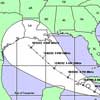
AT 11 AM CDT THE CENTER OF HURRICANE DOLLY WAS ESTIMATED NEAR
LATITUDE 26.2 NORTH...LONGITUDE 97.0 WEST OR ABOUT 35 MILES...60
KM...NORTHEAST OF BROWNSVILLE TEXAS.
$$
FORECASTER AVILA
Category 5 wrote:stevetampa33614 wrote:I hope this things get ashore soon. People did not Prepare for a strong Cat 2 weak Cat 3
100mph is a minimal cat 2. Did they revise the SS scaleor something?


dwg71 wrote:Houston Metroplex and Galveston are not getting near the rain that we need. The little amount around 430am helped, but just a bandaid on a hatchet wound. There seems to be capping in place not allowing showers to come ashore.

Sanibel wrote:TWC says data confirms weakening.
Inner eyewall still offshore.
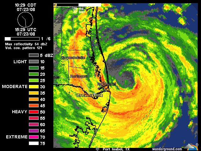

swimaster20 wrote:Sanibel wrote:TWC says data confirms weakening.
Inner eyewall still offshore.
Although I agree it looks like Dolly has peaked, TWC said the pressure was up to 966, but the latest recon I saw (10:35) said that the pressure was 962.

Ed Mahmoud wrote:ZCZC MIATCEAT4 ALL
TTAA00 KNHC DDHHMM
HURRICANE DOLLY TROPICAL CYCLONE POSITION ESTIMATE
NWS TPC/NATIONAL HURRICANE CENTER MIAMI FL AL042008
1100 AM CDT WED JUL 23 2008
AT 11 AM CDT THE CENTER OF HURRICANE DOLLY WAS ESTIMATED NEAR
LATITUDE 26.2 NORTH...LONGITUDE 97.0 WEST OR ABOUT 35 MILES...60
KM...NORTHEAST OF BROWNSVILLE TEXAS.
$$
FORECASTER AVILA
stevetampa33614 wrote:cpdaman wrote:stevetampa33614 wrote:I hope this things get ashore soon. People did not Prepare for a strong Cat 2 weak Cat 3
people should always prepare for one category more than forecast because you never no
Jim Cantore said alot of people on S. Padre didnt even board up and the police had to chase them away from the beaches.
lrak wrote:Ed Mahmoud wrote:ZCZC MIATCEAT4 ALL
TTAA00 KNHC DDHHMM
HURRICANE DOLLY TROPICAL CYCLONE POSITION ESTIMATE
NWS TPC/NATIONAL HURRICANE CENTER MIAMI FL AL042008
1100 AM CDT WED JUL 23 2008
AT 11 AM CDT THE CENTER OF HURRICANE DOLLY WAS ESTIMATED NEAR
LATITUDE 26.2 NORTH...LONGITUDE 97.0 WEST OR ABOUT 35 MILES...60
KM...NORTHEAST OF BROWNSVILLE TEXAS.
$$
FORECASTER AVILA
WTH happen, this was suppose to go in this morning. And Brownsville was its target, has something new developed, do I need to get my butt home and start boarding up?
I saw "this should be making landfall soon" at 5am this morning...what time frame means "soon?"
Users browsing this forum: No registered users and 8 guests


