ATL: Tropical Depression Edouard
Moderator: S2k Moderators
-
hurricanefloyd5

- Category 5

- Posts: 1659
- Age: 45
- Joined: Sun May 02, 2004 10:53 am
- Location: Spartanburg
- Contact:
Re: ATL: Invest 91L- Gulf of Mexico
I sure hope your right aric but I think the real question is TD or TS status??
0 likes

Re:
Aric Dunn wrote:I imagine there lack of interest with investigating the west side of the system is due to the fact that closed low is quite evident, so they are just searching for the highest winds to upgrade too.
They are doing an alpha pattern. They will go NE to SW, then up the west side.
0 likes
-
Honeyko
Re: ATL: Invest 91L- Gulf of Mexico
MiamiensisWx wrote:Can we refrain from non-meteorological chat? It's becoming more difficult for me to dredge through a topic.
Seconded. I'd also like to add that VIS zoom shots are king in the daytime. People shouldn't be posting links to wide-out IR loops -- they're a complete waste of time when this baby is available, and updated every 10-15 minutes.
==//==
Now about that 37kts wind; what part of the storm was that found in? (I.e., it it was in an 850mb inflow jet, that obviously means a lot more than if it was gust-outflow related.)
Last edited by Honeyko on Sun Aug 03, 2008 1:52 pm, edited 1 time in total.
0 likes


-
Aric Dunn
- Category 5
- Posts: 21238
- Age: 43
- Joined: Sun Sep 19, 2004 9:58 pm
- Location: Ready for the Chase.
- Contact:
Re: Re:
RL3AO wrote:Aric Dunn wrote:I imagine there lack of interest with investigating the west side of the system is due to the fact that closed low is quite evident, so they are just searching for the highest winds to upgrade too.
They are doing an alpha pattern. They will go NE to SW, then up the west side.
agreed thats the whole point.. You normally see a Alpha pattern when you have a center fix. otherwise the alpha pattern is pointless, so the shear fact that are doing it is a pretty good giveaway considering the fact that with what eventually became dolly they were doing little circles trying to close off a low.
0 likes


well given there is a circulation fairly evident the Alpha pattern probably is the best one to use in this invest. As NDG said recon should confirm a LLC as it heads towards the SW quadrant.
Hurakan that does look like a TC to me, could easily be a 35kts TS as well.
Hurakan that does look like a TC to me, could easily be a 35kts TS as well.
Last edited by KWT on Sun Aug 03, 2008 2:01 pm, edited 1 time in total.
0 likes
-
MiamiensisWx
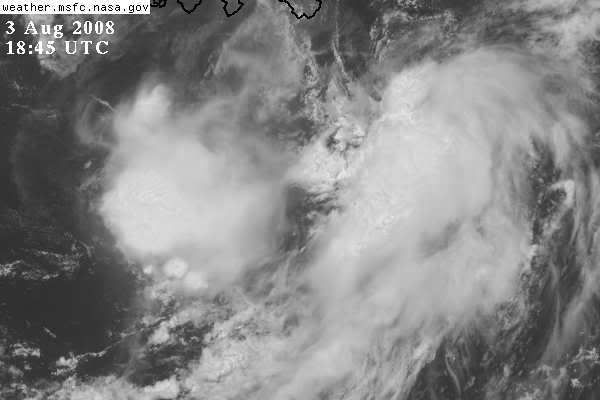
New convection is developing over the southern portion of the LLC. Note the developing thunderstorms on GOES IR:
http://www.ssd.noaa.gov/goes/flt/t2/loop-avn.html
Some of the stronger thunderstorms may mix the more intense winds to the surface, so we could (conceivably) have a marginal TS Edouard.
LLC is clearly moving WSW per visible loops.
http://www.ssd.noaa.gov/goes/flt/t2/loop-avn.html
Some of the stronger thunderstorms may mix the more intense winds to the surface, so we could (conceivably) have a marginal TS Edouard.
LLC is clearly moving WSW per visible loops.
Last edited by MiamiensisWx on Sun Aug 03, 2008 2:03 pm, edited 1 time in total.
0 likes
-
Aric Dunn
- Category 5
- Posts: 21238
- Age: 43
- Joined: Sun Sep 19, 2004 9:58 pm
- Location: Ready for the Chase.
- Contact:
Re:
MiamiensisWx wrote:New convection is developing over the southern portion of the LLC. Note the developing thunderstorms on GOES IR:
http://www.ssd.noaa.gov/goes/flt/t2/loop-avn.html
Some of the stronger thunderstorms may mix the more intense winds to the surface, so we could (conceivably) have a marginal TS Edouard.
very disorganized .. and the convection is pretty minimal no real deep convection to speak of
0 likes
-
SouthFloridawx

- S2K Supporter

- Posts: 8346
- Age: 47
- Joined: Tue Jul 26, 2005 1:16 am
- Location: Sarasota, FL
- Contact:
Re:
MiamiensisWx wrote:New convection is developing over the southern portion of the LLC. Note the developing thunderstorms on GOES IR:
http://www.ssd.noaa.gov/goes/flt/t2/loop-avn.html
Some of the stronger thunderstorms may mix the more intense winds to the surface, so we could (conceivably) have a marginal TS Edouard.
I noticed the developing storms as well.
http://www.ssd.noaa.gov/goes/flt/t2/loop-rgb.html
You can see them by what looks like some filling in going on.
0 likes
-
hwego7
The NHC is in a very tough predicament. If there is a closed LLC, do they even have to upgrade? And if so, do they want to go with TD or TS. Recon is showing evidence that this is a TS if if there is a LLC. However, it just doesn't look "pretty". There is no organized deep convection directly over the possible LLC. For this reason, the NHC might compromise and just go with TD until deeper convection fires directly over the center.
It's a tough decision for them and this is why they are the best. They get to make the call.
It's a tough decision for them and this is why they are the best. They get to make the call.
Last edited by hwego7 on Sun Aug 03, 2008 2:05 pm, edited 1 time in total.
0 likes
-
Honeyko
Re:
The sooner the better, because, IMO there needs to be a TS warning put up for the Mississippi delta region right now.NDG wrote:Reconn should confirm a closed LLC once it enters the SW quadrant which should be heading in that direction in the next pass.
http://www.ghcc.msfc.nasa.gov/GOES/goeseastconus.html -- Zoom mag "high", quality to 100%, loop 20 frames. Later this evening, any cells whipping around the top of that circulation are going to deliver some hard slaps.
Last edited by Honeyko on Sun Aug 03, 2008 2:09 pm, edited 2 times in total.
0 likes
It may look that way Aric but I've learnt that these lop-sided systems are often stronger then they look, would surprise me at all if this does have some TS winds in that new convective burst near the LLC over the last hour.
If TS winds are found, they will upgrade no matter how ugly a system looks, we've seen hurricanes with a not too different presentation this one in the past, so don't just judge on what they look like!
MiamiensisWx, yep if there is one advantage to having a slightly exposed circulation its that its easier to track these systems.
0 likes
-
galvestontx13
- Tropical Low

- Posts: 28
- Joined: Wed Sep 12, 2007 2:47 pm
Re: ATL: Invest 91L- Gulf of Mexico
Honeyko wrote:MiamiensisWx wrote:Can we refrain from non-meteorological chat? It's becoming more difficult for me to dredge through a topic.
Seconded. I'd also like to add that VIS zoom shots are king in the daytime. People shouldn't be posting links to wide-out IR loops -- they're a complete waste of time when this baby is available, and updated every 10-15 minutes.
That's your opinion. But you're wrong.
0 likes

IMO, I expect at least depression to be declared due to the proximity to the coast, model support and to get folks eyes focused and prepared for securing property and potential evacuations.
If this does develop in to TS, this would be the first time since Katrina that a named storm was this close with likely warnings posted. I know we had Humberto last year, but that was further west and with little notice.
If this does develop in to TS, this would be the first time since Katrina that a named storm was this close with likely warnings posted. I know we had Humberto last year, but that was further west and with little notice.
0 likes

-
vbhoutex
- Storm2k Executive

- Posts: 29146
- Age: 74
- Joined: Wed Oct 09, 2002 11:31 pm
- Location: Cypress, TX
- Contact:
Re: ATL: Invest 91L- Gulf of Mexico
galvestontx13 wrote:Honeyko wrote:MiamiensisWx wrote:Can we refrain from non-meteorological chat? It's becoming more difficult for me to dredge through a topic.
Seconded. I'd also like to add that VIS zoom shots are king in the daytime. People shouldn't be posting links to wide-out IR loops -- they're a complete waste of time when this baby is available, and updated every 10-15 minutes.
That's your opinion. But you're wrong.
One more comment such as this and it will be vacation time!!! If you can't be respectful don't post!!!
THIS IS A WARNING FOR ALL CONCERNED!!!WE WILL NOT ALLOW ANYMORE POSTING SUCH AS THIS AND DELETIONS AND SUSPENSIONS WILL BEGIN IMMEDIATELY IF IT CONTINUES!
0 likes
Who is online
Users browsing this forum: No registered users and 9 guests