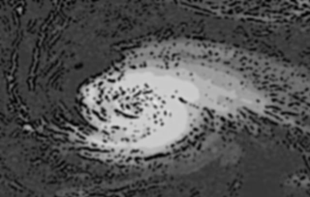
TC Bertha
Moderator: S2k Moderators
Re: Hurricane Bertha in Western Atlantic
water should be a wee bit warmer (less upwelled) should she be able to keep moving NW
which IMO could lead to re-intensification back to hurricane strength
http://www.aoml.noaa.gov/phod/dataphod1 ... 4atsst.png
steve lyons was saying how her upper levels had been blown off to the SE as she moves NW so perhaps there is a bit of mid/ upper shear now, (n shear)
which IMO could lead to re-intensification back to hurricane strength
http://www.aoml.noaa.gov/phod/dataphod1 ... 4atsst.png
steve lyons was saying how her upper levels had been blown off to the SE as she moves NW so perhaps there is a bit of mid/ upper shear now, (n shear)
Last edited by cpdaman on Sun Jul 13, 2008 11:05 am, edited 1 time in total.
0 likes
i don't think anyone should give up on bertha yet (not saying anyone has, but most have been lulled to sleep by her stationary and weakening trends)
she has surprised before
although there appears to be a pocket of mid level northerly shear to her N and W in the CIMSS shear maps
recon shows center is near 29.9 62.8 (988mb)
she has surprised before
although there appears to be a pocket of mid level northerly shear to her N and W in the CIMSS shear maps
recon shows center is near 29.9 62.8 (988mb)
0 likes
Looks like a 50-55kts tropical storm right now, NHC strength seems to be about right. Bertha still needs to be watched but there does seem to be some shear now and the inner core issue really messed this system up.
Still 200 pages for Bertha is impressive, indeed its probably the longest thread for a recurving hurricane I reckon!
Still 200 pages for Bertha is impressive, indeed its probably the longest thread for a recurving hurricane I reckon!
0 likes
-
93superstorm
- Tropical Depression

- Posts: 79
- Joined: Mon Jul 07, 2008 11:41 am
Re: Tropical Storm Bertha in Western Atlantic
Starting to refire in her NE Side and trying to wrap back around. Kinda looks it'll graze Bermuda:


0 likes
- cycloneye
- Admin

- Posts: 149277
- Age: 69
- Joined: Thu Oct 10, 2002 10:54 am
- Location: San Juan, Puerto Rico
Re: Tropical Storm Bertha in Western Atlantic
More sense of humor by Lixon Avila 
WTNT32 KNHC 131735
TCPAT2
BULLETIN
TROPICAL STORM BERTHA INTERMEDIATE ADVISORY NUMBER 42A
NWS TPC/NATIONAL HURRICANE CENTER MIAMI FL AL022008
200 PM AST SUN JUL 13 2008
...BERTHA HESITATES AGAIN...REFUSES TO MOVE...
WTNT32 KNHC 131735
TCPAT2
BULLETIN
TROPICAL STORM BERTHA INTERMEDIATE ADVISORY NUMBER 42A
NWS TPC/NATIONAL HURRICANE CENTER MIAMI FL AL022008
200 PM AST SUN JUL 13 2008
...BERTHA HESITATES AGAIN...REFUSES TO MOVE...
0 likes
-
JonathanBelles
- Professional-Met

- Posts: 11430
- Age: 35
- Joined: Sat Dec 24, 2005 9:00 pm
- Location: School: Florida State University (Tallahassee, FL) Home: St. Petersburg, Florida
- Contact:
-
Ad Novoxium
- Category 1

- Posts: 348
- Age: 35
- Joined: Sat May 03, 2008 2:12 am
Re: Tropical Storm Bertha in Western Atlantic
93superstorm wrote:Starting to refire in her NE Side and trying to wrap back around. Kinda looks it'll graze Bermuda:
That looks uncannily like a mushroom.
0 likes
Re: Tropical Storm Bertha in Western Atlantic
Bertha looks so weird. There is a large eye and no convection to the west, while all the convection is to the east.
http://www.wunderground.com/tropical/tr ... ml#a_topad
http://www.wunderground.com/tropical/tr ... ml#a_topad
0 likes
- DESTRUCTION5
- Category 5

- Posts: 4430
- Age: 44
- Joined: Wed Sep 03, 2003 11:25 am
- Location: Stuart, FL
Who is online
Users browsing this forum: No registered users and 20 guests


