Category 5 wrote:Ed Mahmoud wrote:Anyway, if HPC analyzing an occluded front settles the matter, why doesn't NHC just cancel the mission now. What point is there flying around on a system they won't upgrade?
I give up


Moderator: S2k Moderators

Category 5 wrote:Ed Mahmoud wrote:Anyway, if HPC analyzing an occluded front settles the matter, why doesn't NHC just cancel the mission now. What point is there flying around on a system they won't upgrade?
I give up


Okay enough pictures of Jean-luc Picard.


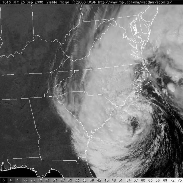
wxman57 wrote:Here's a crude surface analysis of the Mid Atlantic Coast. Looks like an occluded low. Should such lows be called tropical storms or subtropical storms - I would say no. I don't have to make those decisions, though. The NHC's primary role is to protect the general public. With a winter-type storm like this, they think the public are adequately served by posting gale warnings along the coast. Calling it "Kyle" at this point may only add to public confusion. It actually looked a lot more tropical 24 hours ago than it does now. At least there was strong convection over the center then.
Such low centers won't carry their winds inland like tropical systems, and there won't be an associated storm surge (just above-normal tides due to onshore flow). So maybe coastal gale warnings are all that's needed for this system.
Frank2 wrote:Actually, the real storm is the controversy over whether 94L is a no-name cyclone!
Quack-quack...
Thanks for the surface ob map - that looks just like the one I used to plot at the NHC - by pen and ink (back in the St. Joan of Arc days)...
LOL
wxman57 wrote:Here's a crude surface analysis of the Mid Atlantic Coast. Looks like an occluded low. Should such lows be called tropical storms or subtropical storms - I would say no. I don't have to make those decisions, though. The NHC's primary role is to protect the general public. With a winter-type storm like this, they think the public are adequately served by posting gale warnings along the coast. Calling it "Kyle" at this point may only add to public confusion. It actually looked a lot more tropical 24 hours ago than it does now. At least there was strong convection over the center then.
Such low centers won't carry their winds inland like tropical systems, and there won't be an associated storm surge (just above-normal tides due to onshore flow). So maybe coastal gale warnings are all that's needed for this system.

Ed Mahmoud wrote:Soon to be Kyle has less temperature differential to the core than extratropical no-name 94L...
cycloneye wrote:hurricanefloyd5 wrote:we Have Kyle now
Wrong thread.
Users browsing this forum: No registered users and 111 guests