ATL: Tropical Depression Dolly

Moderator: S2k Moderators

Message
Author
User avatar
NDG
S2K Supporter
S2K Supporter
Posts: 15448
Joined: Sun Jul 09, 2006 10:14 pm
Location: Orlando, FL

Re: ATL: INVEST 94L in Central Caribbean

#2321 Postby NDG » Fri Jul 18, 2008 5:21 am

Matt-hurricanewatcher wrote:http://manati.orbit.nesdis.noaa.gov/storm_at_image21/latest_at_1.html

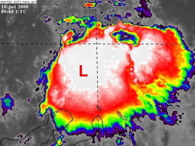
The LLC appears to be over land near 12 north/70 west. So no development.

Intil it moves back over water no reason to get excited.


Why are you going by old scan? Too funny!!
Just look at the radar loop from Curacao, the LLC is near 14N & 70.8W
0 likes   

User avatar
KWT
Category 5
Category 5
Posts: 31415
Joined: Tue Aug 17, 2004 11:02 am
Location: UK!!!

#2322 Postby KWT » Fri Jul 18, 2008 5:24 am

Ah yeah I made the same mistake as Matt in that I didn't see that bottom part. Anyway yep radar does show a circulation a good deal further north and right in the deep convection.
0 likes   

User avatar
Thunder44
Category 5
Category 5
Posts: 5922
Age: 44
Joined: Mon Jun 09, 2003 7:53 pm
Location: New York City

Re:

#2323 Postby Thunder44 » Fri Jul 18, 2008 5:27 am

KWT wrote:Ah yeah I made the same mistake as Matt in that I didn't see that bottom part. Anyway yep radar does show a circulation a good deal further north and right in the deep convection.


Where is the link to the radar? From the ob out of Aruba, it appears to be near that area:

6am: SW wind at 5mph at pressure at 1008mb

http://weather.noaa.gov/weather/current/TNCA.html
0 likes   

User avatar
KWT
Category 5
Category 5
Posts: 31415
Joined: Tue Aug 17, 2004 11:02 am
Location: UK!!!

#2324 Postby KWT » Fri Jul 18, 2008 5:30 am

http://www.weather.an/product_images/high/ppi.html

Hmmm actually not sure this has an obvious low pressure center, still looks like a broad low to me.
0 likes   

User avatar
NDG
S2K Supporter
S2K Supporter
Posts: 15448
Joined: Sun Jul 09, 2006 10:14 pm
Location: Orlando, FL

Re: ATL: INVEST 94L in Central Caribbean

#2325 Postby NDG » Fri Jul 18, 2008 5:33 am

Code: Select all

Personal Forecast Disclaimer:
The posts in this forum are NOT official forecast and should not be used as such. They are just the opinion of the poster and may or may not be backed by sound meteorological data. They are NOT endorsed by any professional institution or storm2k.org. For official information, please refer to the NHC and NWS products.


By looking at the Curacao radar, I aproximately place the low pressure center near 14N & 70.8W, IMO this is a TD this morning, if not Cristobal.

Image
0 likes   

Matt-hurricanewatcher

Re:

#2326 Postby Matt-hurricanewatcher » Fri Jul 18, 2008 5:33 am

KWT wrote:http://www.weather.an/product_images/high/ppi.html

Hmmm actually not sure this has an obvious low pressure center, still looks like a broad low to me.


I agree, 94L is playing its games with us. It has already burned us many times before, I'm not going to fall for it. I'm going to say no depression today, but maybe by Sunday.
0 likes   

User avatar
Thunder44
Category 5
Category 5
Posts: 5922
Age: 44
Joined: Mon Jun 09, 2003 7:53 pm
Location: New York City

Re:

#2327 Postby Thunder44 » Fri Jul 18, 2008 5:34 am

KWT wrote:http://www.weather.an/product_images/high/ppi.html

Hmmm actually not sure this has an obvious low pressure center, still looks like a broad low to me.


I got the loop going, but I'm not seeing any images yet.
0 likes   

User avatar
HURAKAN
Professional-Met
Professional-Met
Posts: 46086
Age: 38
Joined: Thu May 20, 2004 4:34 pm
Location: Key West, FL
Contact:

#2328 Postby HURAKAN » Fri Jul 18, 2008 5:36 am

Station 42059 - Eastern Caribbean
http://www.ndbc.noaa.gov/station_page.php?station=42059

Continuous Winds
0950 ESE ( 117 deg ) 22.7 kts
0940 ESE ( 113 deg ) 22.5 kts
0930 ESE ( 109 deg ) 23.5 kts
0920 ESE ( 104 deg ) 20.4 kts
0910 ESE ( 110 deg ) 13.2 kts
0900 ESE ( 113 deg ) 11.7 kts

Supplemental Measurements Highest 1 minute Wind Speed
Time (GMT) WSPD WDIR
0934 29.3 kts ESE ( 116 deg true )
0 likes   

User avatar
NDG
S2K Supporter
S2K Supporter
Posts: 15448
Joined: Sun Jul 09, 2006 10:14 pm
Location: Orlando, FL

#2329 Postby NDG » Fri Jul 18, 2008 5:38 am

Whether it the low pressure remains broad or not, which you have to keep in mind that the center is now approximately 200+ miles away from the radar site so is not catching as much low level vorticity, one thing for sure it is starting to get some nice inflow of southerly moisture as indicated by the radar.
0 likes   

User avatar
KWT
Category 5
Category 5
Posts: 31415
Joined: Tue Aug 17, 2004 11:02 am
Location: UK!!!

#2330 Postby KWT » Fri Jul 18, 2008 5:45 am

Saying that though Matt this is the best its looked in a while IMO and its held this look for longer then before as well, I wish recon could be in there now to have a good look.

NDg, thats a real good point and one I didn't think about.
0 likes   

User avatar
ronjon
Category 5
Category 5
Posts: 4825
Joined: Fri Aug 19, 2005 5:17 pm
Location: Hernando Beach, FL

Re: ATL: INVEST 94L in Central Caribbean

#2331 Postby ronjon » Fri Jul 18, 2008 5:47 am

This morning now looks as if 94L will finally become a tropical cyclone. 96L has moved inland decreasing any potential outflow interference and the ULL looks like it may aid to ventilate the system. Intense convection popping and concentrated. I think 94L now has the potential to be a serious threat for the GOM. Models have been pretty unanimous in showing development with a long term threat anywhere from the mexican coast, Tx, La, or even as far east as coastal MS, AL. I don't usually over hype things but this looks very bad if it gets into the GOM as a cyclone.

https://my.sfwmd.gov/portal/page?_pageid=2854,19644915,2854_19644936:2854_19645022:2854_19645029&_dad=portal&_schema=PORTAL
0 likes   

User avatar
KWT
Category 5
Category 5
Posts: 31415
Joined: Tue Aug 17, 2004 11:02 am
Location: UK!!!

#2332 Postby KWT » Fri Jul 18, 2008 5:49 am

Well alot of the better models has this tracking into N.Mexico Ronjon I think thats more likely to occur unless this does become a hurricane like the GFDL forecasted last night.

We will have to wait and see what happens, it does look like its getting close now to being a TD but NHC won't upgrade with recon going in fairly soon.
0 likes   

User avatar
NDG
S2K Supporter
S2K Supporter
Posts: 15448
Joined: Sun Jul 09, 2006 10:14 pm
Location: Orlando, FL

#2333 Postby NDG » Fri Jul 18, 2008 5:50 am

Actually, it is actually closer to 180 miles from the radar site, that is like viewing a low pressure center located near Sarasota FL from the Miami Radar, so we are not going to see a well defined surface circulation, but I mostly came with my estimated location for the low pressure center based on where it was located last night and continuity.
0 likes   

User avatar
NDG
S2K Supporter
S2K Supporter
Posts: 15448
Joined: Sun Jul 09, 2006 10:14 pm
Location: Orlando, FL

Re:

#2334 Postby NDG » Fri Jul 18, 2008 5:53 am

KWT wrote:Well alot of the better models has this tracking into N.Mexico Ronjon I think thats more likely to occur unless this does become a hurricane like the GFDL forecasted last night.

We will have to wait and see what happens, it does look like its getting close now to being a TD but NHC won't upgrade with recon going in fairly soon.


I see the very thing happen as it did with Bertha, if this system strengthens more than expected a more northward track is very likely, since ML ridging to its north will be weak, unlike '07.
0 likes   

Matt-hurricanewatcher

Re: ATL: INVEST 94L in Central Caribbean

#2335 Postby Matt-hurricanewatcher » Fri Jul 18, 2008 5:54 am

ronjon wrote:This morning now looks as if 94L will finally become a tropical cyclone. 96L has moved inland decreasing any potential outflow interference and the ULL looks like it may aid to ventilate the system. Intense convection popping and concentrated. I think 94L now has the potential to be a serious threat for the GOM. Models have been pretty unanimous in showing development with a long term threat anywhere from the mexican coast, Tx, La, or even as far east as coastal MS, AL. I don't usually over hype things but this looks very bad if it gets into the GOM as a cyclone.

https://my.sfwmd.gov/portal/page?_pageid=2854,19644915,2854_19644936:2854_19645022:2854_19645029&_dad=portal&_schema=PORTAL


It is possible once into the Gulf. But we have to be careful this invest has a history of getting us up in arms then bitting us. But I will say it has a 60 percent chance of become a depression or a storm throughout the next 48-72 hours.

Derek Ortt says that this doe's not have any chance of developing. He said something funny about its chances. He is a pro with great knowledge when it comes to tropical cyclones.

->quote and thoughts from Derek, "This has about as much chance of developing within the next 48 hours as a bearded lady has of winning Miss America"
0 likes   

User avatar
NDG
S2K Supporter
S2K Supporter
Posts: 15448
Joined: Sun Jul 09, 2006 10:14 pm
Location: Orlando, FL

#2336 Postby NDG » Fri Jul 18, 2008 6:02 am

I am glad Derek was quoted saying that, :lol:

But anyway, right about where I estimated the center to be:
Image
0 likes   

User avatar
HURAKAN
Professional-Met
Professional-Met
Posts: 46086
Age: 38
Joined: Thu May 20, 2004 4:34 pm
Location: Key West, FL
Contact:

#2337 Postby HURAKAN » Fri Jul 18, 2008 6:02 am

Oranjestad, Aruba, has been reporting SW winds over the past two hours.

http://www.wunderground.com/history/air ... atename=NA
0 likes   

User avatar
KWT
Category 5
Category 5
Posts: 31415
Joined: Tue Aug 17, 2004 11:02 am
Location: UK!!!

#2338 Postby KWT » Fri Jul 18, 2008 6:02 am

Yeah NDG thats true but I just can't se eit getting strong enough to tap into the deeper steering at least till its quite a bit closer to land.
Matt, yeah I saw that post, its interesting but really its anyone guess what will happen!
0 likes   

User avatar
NDG
S2K Supporter
S2K Supporter
Posts: 15448
Joined: Sun Jul 09, 2006 10:14 pm
Location: Orlando, FL

#2339 Postby NDG » Fri Jul 18, 2008 6:03 am

Yeah, southerly inflow is picking up on this system. :uarrow:
0 likes   

category5

Re: ATL: INVEST 94L in Central Caribbean

#2340 Postby category5 » Fri Jul 18, 2008 6:04 am

Matt, the NHC experts would not be giving this a 20-50% chance of development within 48 hours and waste resources by sending recon every day to investigate if they thought it had as much chance to develop as a bearded woman winning miss america. Their the best in the world at what they do and I believe their opinion is greatly valued.
0 likes   


Return to “2008”

Who is online

Users browsing this forum: No registered users and 21 guests